Frederica is a town in Kent County, Delaware, United States. It is part of the Dover, Delaware Metropolitan Statistical Area. The population was 1,073 in 2020. ILC Dover, the company which manufactured the spacesuits for the Apollo and Skylab astronauts of the 1960s and 1970s, along with fabricating the suit component of the Space Shuttle’s Extravehicular Mobility Unit (EMU), is located nearby.
| Name: | Frederica town |
|---|---|
| LSAD Code: | 43 |
| LSAD Description: | town (suffix) |
| State: | Delaware |
| County: | Kent County |
| Elevation: | 16 ft (5 m) |
| Total Area: | 1.74 sq mi (4.51 km²) |
| Land Area: | 1.74 sq mi (4.51 km²) |
| Water Area: | 0.00 sq mi (0.00 km²) |
| Total Population: | 1,073 |
| Population Density: | 616.31/sq mi (237.95/km²) |
| ZIP code: | 19946 |
| Area code: | 302 |
| FIPS code: | 1028440 |
| GNISfeature ID: | 213981 |
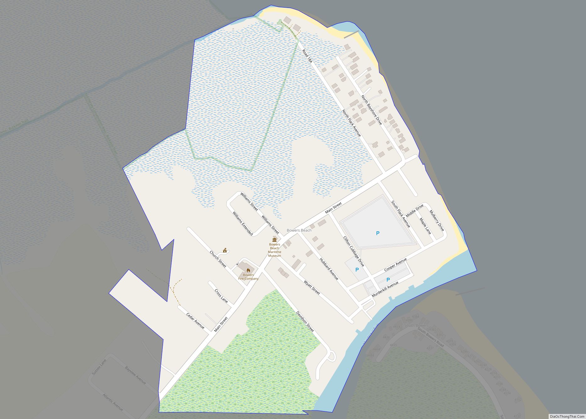
Online Interactive Map
Click on ![]() to view map in "full screen" mode.
to view map in "full screen" mode.
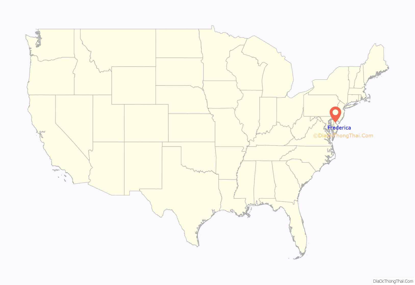
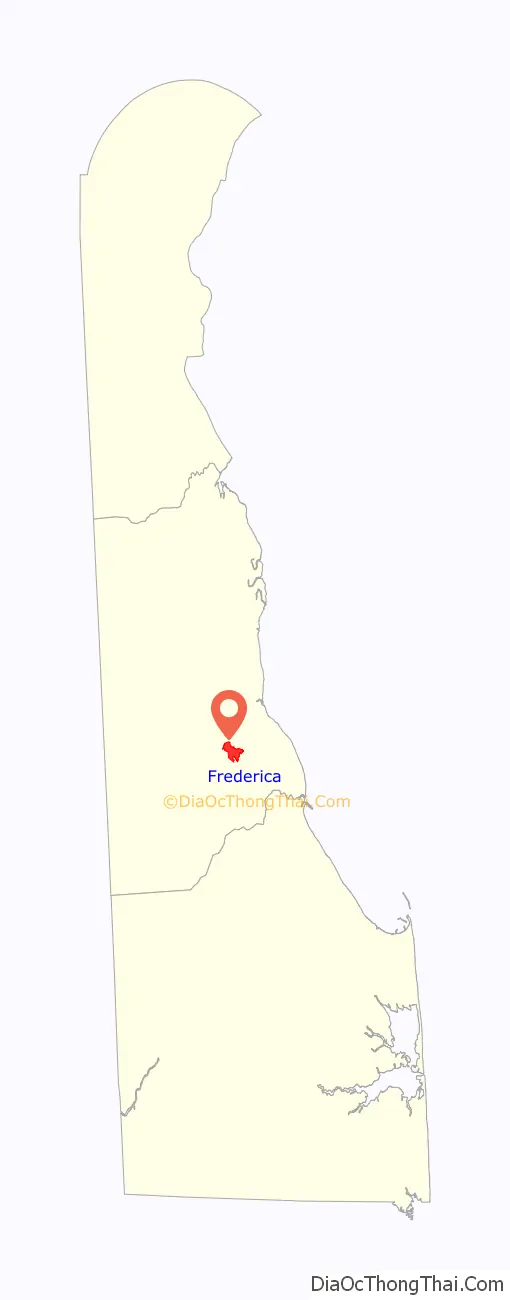
Frederica location map. Where is Frederica town?
History
The present-day town of Frederica was part of a land grant to Boneny Bishop by William Penn in 1681. The location at a bend along the Murderkill River was originally known as Indian Point and later became known as Johnny Cake Landing. The waterfront was surveyed in 1758 and the area where most shipping activity occurred became known as Goforth’s Landing.
The remainder of the town was surveyed and laid out by Jonathan Emerson in 1772. In 1796, the community was renamed from Johnny Cake Landing to Frederica Landing at the request of one of Emerson’s daughters, as she believed the name Johnny Cake Landing was a rather unceremonious, informal name and inappropriate for a settlement close to Barratt’s Chapel, a major landmark for Methodism. (See Johnnycake.) The Town of Frederica was incorporated by the state in 1826. The incorporation act for Frederica was repealed in 1855, only for the town to be reincorporated in 1865.
Frederica was built along the Murderkill River at a point it was still navigable, 6 miles (9.7 km) from the Delaware Bay. The town was surrounded by wetlands, leading to the nickname “Frogtown” for the large number of frogs that live in the wetlands. Frederica developed as a shipping and shipbuilding center due to its location along the navigable Murderkill River; shipping and shipbuilding would dominate the town’s economy for several decades. The town was linked by water to other Kent County towns along with the city of Philadelphia, and its fortunes depended on its water connections to these places as roads were often impassable at the time. Important cargo shipped along the Murderkill River in Frederica’s early history included bacon, beef, corn, wheat flour, cedar shingles, cheese, butter, tar, pitch and hardwood boards.
In 1857, the Delaware Railroad was constructed across the state, leading to a decline in Frederica’s status as a major shipping center. The railroad brought improved transportation across Kent County, diverting the shipment of goods away from the river ports. The shipping interests in Frederica fought against the construction of the Delaware Railroad near the town, which stopped the growth of the town and increased the isolation of Frederica from other towns. The Delaware Railroad was built well to the west of Frederica through Dover and Felton. The town later attempted to get a railroad connection by chartering a railroad line that would run from Dover to Milford via Frederica as well as pushing for a 7-mile (11 km) branch of the Delaware Railroad from Felton to Frederica; both efforts were unsuccessful.
The last shipyard in Frederica closed around 1890, but other industries would become prominent in Frederica. By 1887, the town had three canneries, with other businesses such as fertilizer manufacturing, a hat factory, two brush factories, a cooper, a butcher, a hotel, a clothing house, and ten general stores. A steamship operated by the Frederica and Philadelphia Navigation Company linked Frederica with Philadelphia until the onset of the Great Depression. In the 1920s, improvements to U.S. Route 113 that included a causeway into Frederica cut the town off from the Delaware Bay. Improved roads in the 20th century would provide better connections with Harrington, Dover, and Wilmington, reducing the need for the steamship to Philadelphia. Maritime activity in Frederica declined, the port quieted down, and the canneries and many businesses in the town closed. U.S. Route 113 was rerouted to bypass Frederica to the east along what is now Delaware Route 1. Today, Frederica is a quiet town that has not experienced much change unlike many places in the United States.
The Barratt Hall, Barratt’s Chapel, Bonwell House, Frederica Historic District, and Mordington are listed on the National Register of Historic Places.
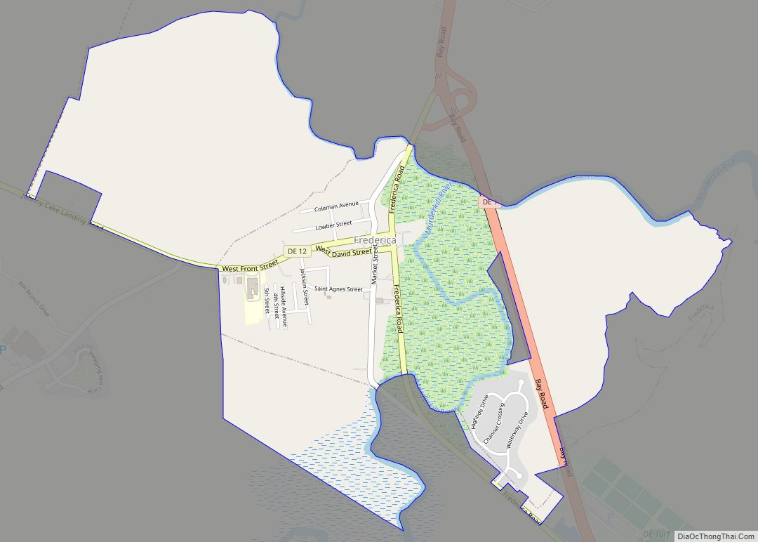
Frederica Road Map

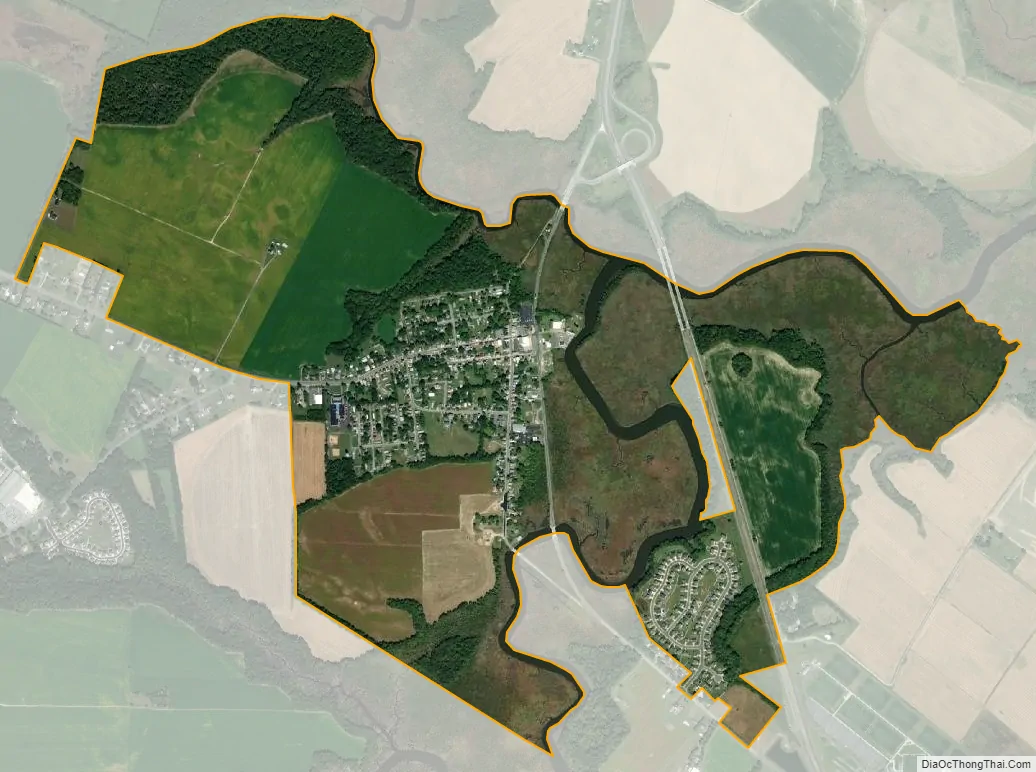
Frederica city Satellite Map
Geography
Frederica is located at 39°00′32″N 75°27′57″W / 39.00889°N 75.46583°W / 39.00889; -75.46583 (39.0090017, –75.4657542).
According to the United States Census Bureau, the town has a total area of 0.8 square miles (2.1 km), all land.
Due to the marsh surrounding Murderkill River to the south of town, residents often have to deal with a very strong odor on hot summer days. Also, several of the roads heading to the south and north out of town to DE 1 are frequently flooded during very high tides and heavy rains.
Climate
The climate in this area is characterized by hot, humid summers and generally mild to cool winters. According to the Köppen Climate Classification system, Frederica has a humid subtropical climate, abbreviated “Cfa” on climate maps.
See also
Map of Delaware State and its subdivision: Map of other states:- Alabama
- Alaska
- Arizona
- Arkansas
- California
- Colorado
- Connecticut
- Delaware
- District of Columbia
- Florida
- Georgia
- Hawaii
- Idaho
- Illinois
- Indiana
- Iowa
- Kansas
- Kentucky
- Louisiana
- Maine
- Maryland
- Massachusetts
- Michigan
- Minnesota
- Mississippi
- Missouri
- Montana
- Nebraska
- Nevada
- New Hampshire
- New Jersey
- New Mexico
- New York
- North Carolina
- North Dakota
- Ohio
- Oklahoma
- Oregon
- Pennsylvania
- Rhode Island
- South Carolina
- South Dakota
- Tennessee
- Texas
- Utah
- Vermont
- Virginia
- Washington
- West Virginia
- Wisconsin
- Wyoming