Long Neck is a census-designated place (CDP) in Sussex County, Delaware, United States. The population was 1,980 at the 2010 census. Long Neck was the only census-designated place in Sussex County until Lincoln was added in the 2020 United States census. It is part of the Salisbury, Maryland-Delaware Metropolitan Statistical Area.
| Name: | Long Neck CDP |
|---|---|
| LSAD Code: | 57 |
| LSAD Description: | CDP (suffix) |
| State: | Delaware |
| County: | Sussex County |
| Elevation: | 13 ft (4 m) |
| Total Area: | 3.13 sq mi (8.12 km²) |
| Land Area: | 2.76 sq mi (7.15 km²) |
| Water Area: | 0.38 sq mi (0.97 km²) |
| Total Population: | 3,017 |
| Population Density: | 1,093.51/sq mi (422.21/km²) |
| ZIP code: | 19966 |
| Area code: | 302 |
| FIPS code: | 1043245 |
| GNISfeature ID: | 1867106 |
Online Interactive Map
Click on ![]() to view map in "full screen" mode.
to view map in "full screen" mode.
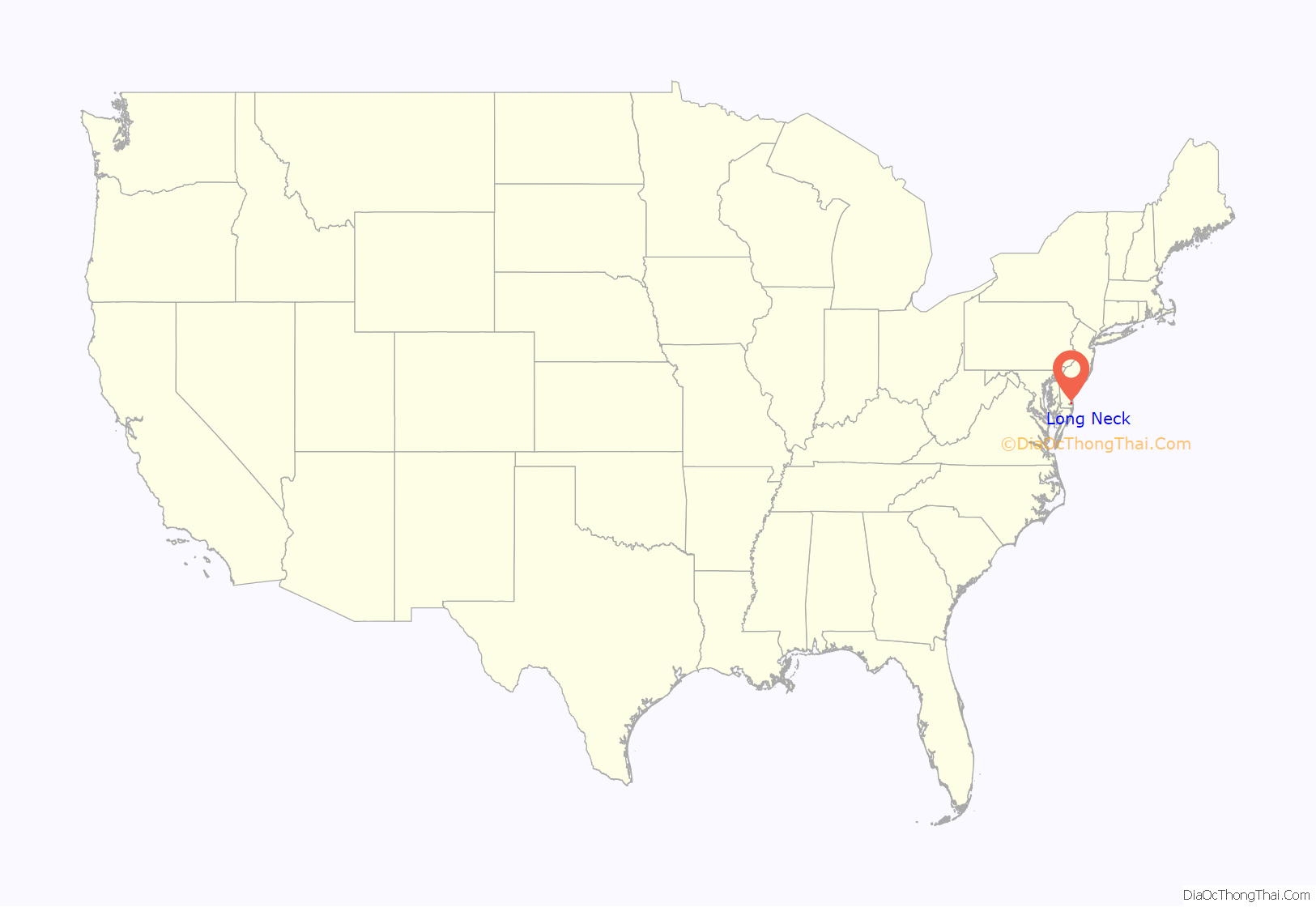
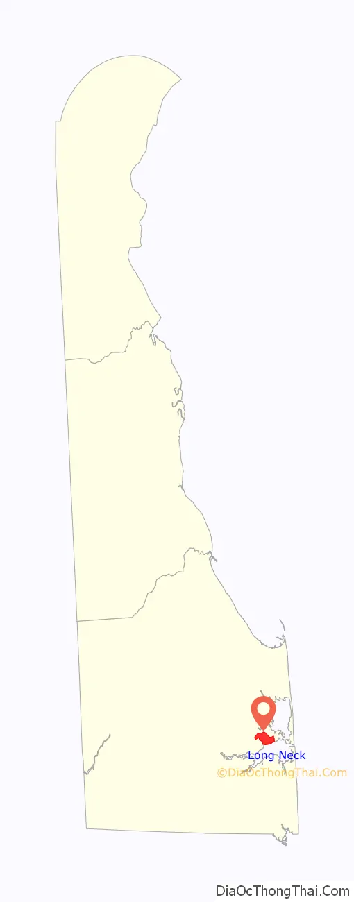
Long Neck location map. Where is Long Neck CDP?
History
This is taken from deed record, page 247, Georgetown Court House, Delaware titled as;
“William Burton Patent for Long Neck”
“Whereas, there is a certaine parcel of land situated on the West side of Delaware Bay the which hath been certified by the Court at the Horekill and laide out for William Burton the saide Land being called the Long Neck lying on the South side of Rehoboth Bay and on the North side of the Greate River beginning at a point of woods and running West up the Greate River one thousand perches to a White Oak at the head of a small creek called Indian Cabin Creek and from thence North three hundred and fifty perches to a White Oak standing by a creek side called Middle Creek with a line of marked trees and from thence bounder upon the aforesaid Bay to the first bounded point Southeast one thousand perches containing One Thousand Acres of Land.”
“Know Ye That by Virtue of His Majesty Lord’s Patent and the Commission and authority unto me given by His Royal Highness, I have given and granted by these presents, Doe hereby give and grant unto the said William Burton his heirs and assigns the aforesaid recited piece of Land and Premises with their and every of their appurtenances; To Have and To Hold the saide piece of land and premises unto the saide William Burton his heirs and assigns unto the proper use and behoofe of him the said William Burton his heirs and assigns forever he making present improvements thereon and continuing in obedience and conforming himself according to the Laws of this Government and yielding and paying therefor yearly and every yeare unto His Royal Highness as a quite Rent Ten bushels of good winter wheat unto such officers as shall be there Impowered to receive the same.”
For most of the second half of the 20th century, the area of Long Neck was sparsely populated, except for several mobile home communities that served mostly as summer vacation properties for permanent residents of the Washington, DC, Baltimore, Maryland, Wilmington, Delaware, and Philadelphia, Pennsylvania metropolitan areas. However, in the late 1990s, more permanent, year-round communities began being built, such as the neighborhood surrounding the golf course at Baywood Greens, and The Peninsula, which is being developed by Jack Nicklaus. Long Neck is now seeing unprecedented growth in permanent residents.
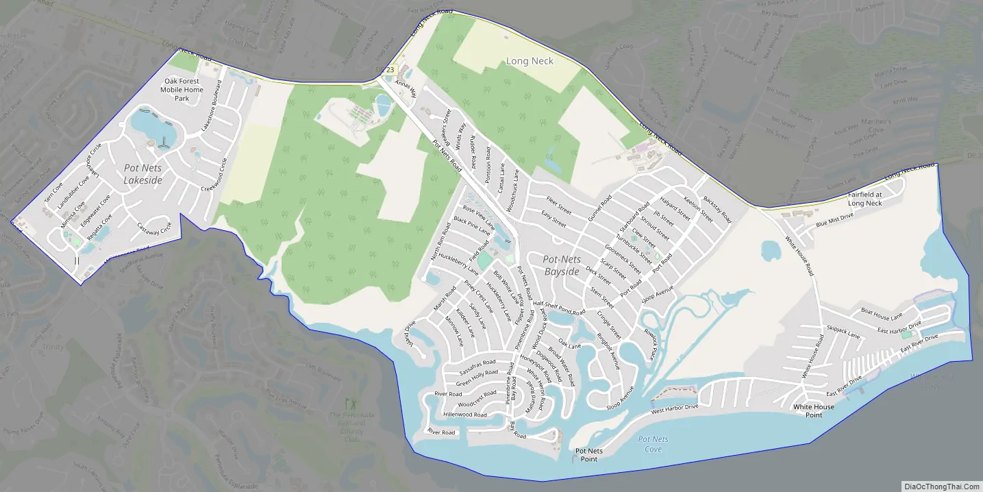
Long Neck Road Map
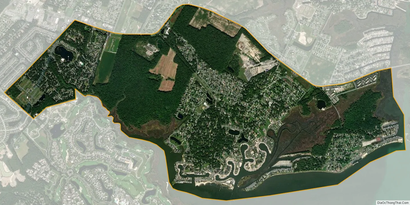
Long Neck city Satellite Map
Geography
Long Neck is located at 38°37′12″N 75°09′03″W / 38.6201125°N 75.1507399°W / 38.6201125; -75.1507399 (38.6201125, -75.1507399).
According to the United States Census Bureau, the CDP has a total area of 2.6 square miles (6.7 km), of which 0.68% is water.
See also
Map of Delaware State and its subdivision: Map of other states:- Alabama
- Alaska
- Arizona
- Arkansas
- California
- Colorado
- Connecticut
- Delaware
- District of Columbia
- Florida
- Georgia
- Hawaii
- Idaho
- Illinois
- Indiana
- Iowa
- Kansas
- Kentucky
- Louisiana
- Maine
- Maryland
- Massachusetts
- Michigan
- Minnesota
- Mississippi
- Missouri
- Montana
- Nebraska
- Nevada
- New Hampshire
- New Jersey
- New Mexico
- New York
- North Carolina
- North Dakota
- Ohio
- Oklahoma
- Oregon
- Pennsylvania
- Rhode Island
- South Carolina
- South Dakota
- Tennessee
- Texas
- Utah
- Vermont
- Virginia
- Washington
- West Virginia
- Wisconsin
- Wyoming


