Jefferson County is a county on the northern border of the U.S. state of New York. As of the 2020 census, the population was 116,721. Its county seat is Watertown. The county is named after Thomas Jefferson, third President of the United States of America. It is adjacent to Lake Ontario, southeast from the Canada–US border of Ontario.
Jefferson County comprises the Watertown-Fort Drum, NY Metropolitan Statistical Area. In 2014, it elected Colleen M. O’Neill as the first woman county sheriff in the state. She had served with the New York State Police for 32 years. The popularity of the area as a summer tourist destination results in a dramatic increase of population during that season.
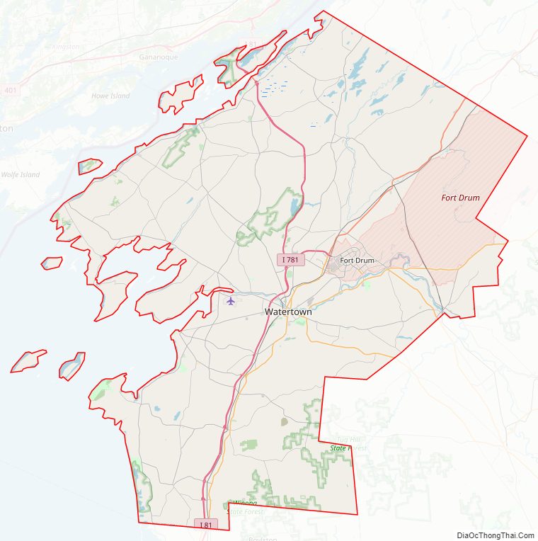
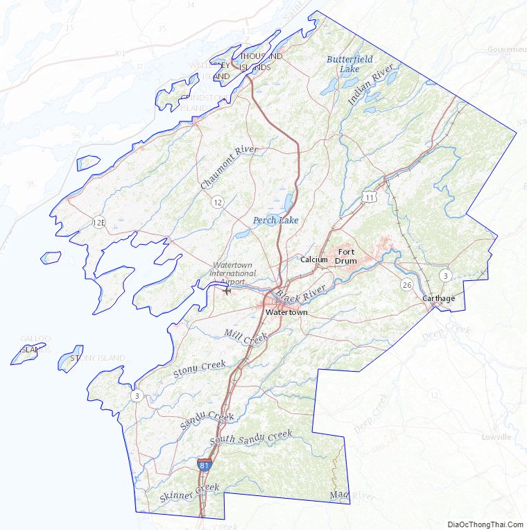
The United States Army’s 10th Mountain Division is based at Fort Drum. The base had a total population of nearly 13,000 according to the 2010 census.
| Name: | Jefferson County |
|---|---|
| FIPS code: | 36-045 |
| State: | New York |
| Founded: | 1805 |
| Named for: | Thomas Jefferson |
| Seat: | Watertown |
| Largest town: | Le Ray |
| Total Area: | 1,857 sq mi (4,810 km²) |
| Land Area: | 1,269 sq mi (3,290 km²) |
| Total Population: | 116,721 |
| Population Density: | 92/sq mi (36/km²) |
| Time zone: | UTC−5 (Eastern) |
| Summer Time Zone (DST): | UTC−4 (EDT) |
| Website: | www.co.jefferson.ny.us |
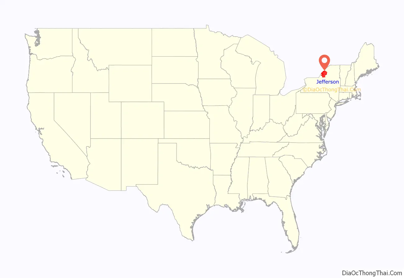
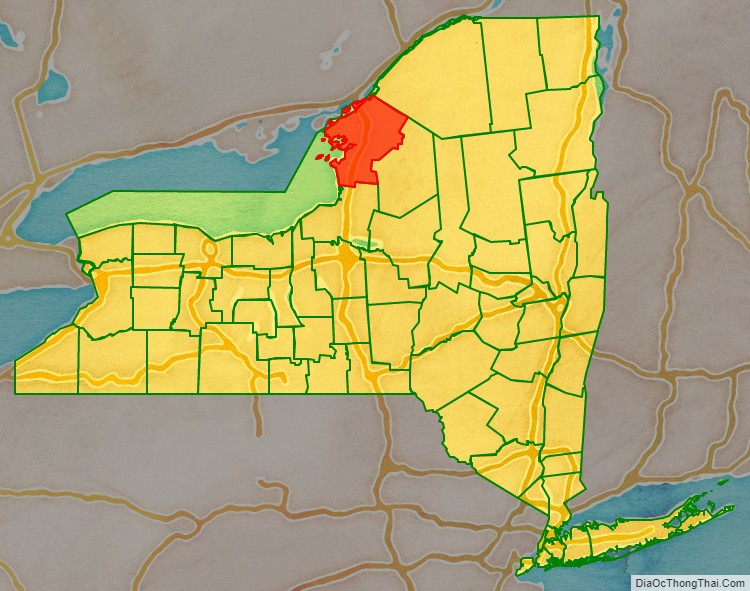
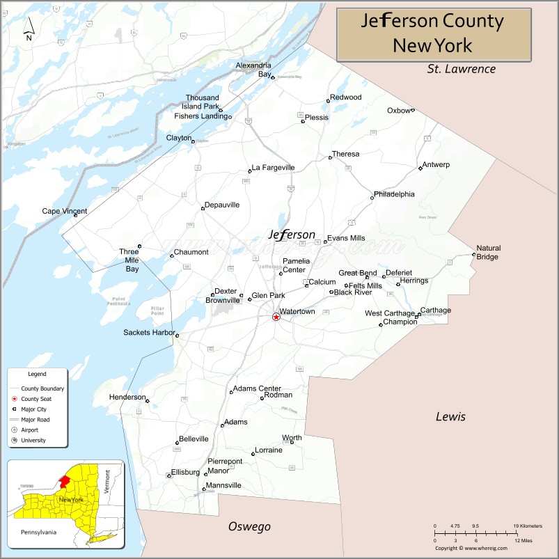
Jefferson County location map. Where is Jefferson County?
History
When counties were established in the Province of New York in 1683, the present Jefferson County was part of Albany County. This was an enormous county, including the northern part of New York State as well as all of the present State of Vermont and, in theory, extending westward to the Pacific Ocean. This county was reduced in size on July 3, 1766, by the creation of Cumberland County, and further on March 16, 1770, by the creation of Gloucester County, both containing territory now in Vermont.
On March 12, 1772, what was left of Albany County was split into three parts, one remaining under the name Albany County. One of the other pieces, Tryon County, contained the western portion (and thus, since no western boundary was specified, theoretically still extended west to the Pacific). The eastern boundary of Tryon County was approximately 5 miles (8.0 km) west of the present city of Schenectady, and the county included the western part of the Adirondack Mountains and the area west of the West Branch of the Delaware River. The area then designated as Tryon County now includes 37 counties of New York State. The county was named for William Tryon, colonial governor of New York.
In the years subsequent to 1776, most of the Loyalists in Tryon County fled to Canada. In 1784, following the peace treaty that ended the American Revolutionary War, the name of Tryon County was changed to Montgomery County to honor the general, Richard Montgomery, who had captured several places in Canada and died attempting to capture the city of Quebec, replacing the name of the hated British governor.
In 1789, the size of Montgomery County was reduced by the creation of Ontario County from Montgomery. The area split off from Montgomery County was much larger than the present county, as it was later divided to form the present Allegany, Cattaraugus, Chautauqua, Erie, Genesee, Livingston, Monroe, Niagara, Orleans, Steuben, Wyoming, Yates, and parts of Schuyler and Wayne counties.
Jefferson County is part of Macomb’s Purchase of 1791.
In 1791, Herkimer County was one of three counties split off from Montgomery (the other two being Otsego, and Tioga County). This was much larger than the present county, however, and was reduced by a number of subsequent splits. The first one of these, in 1794, produced Onondaga County. This county was larger than the current Onondaga County, including the present Cayuga and Cortland Counties, and part of Oswego County.
Oneida County (as well as a part of Chenango County), was split off from Herkimer County in 1798.
Jefferson County was split off from Oneida County in 1805. In 1817, Carleton Island, captured from the British in the War of 1812, was annexed to the county. During the late eighteenth and nineteenth centuries, the county was largely developed for agriculture.
By the early 20th centuries, Watertown was a city with the highest per capita number of millionaires in the United States. Local industrialists had made early fortunes from industries driven by water power. Mills were established along the falls of the Black River from the first half of the nineteenth century.
In 2019, Jefferson County and much of the rest of the North Country was identified as one of the most politically tolerant communities in America, according to an analysis by PredictWise.
Jefferson County Road Map
Geography
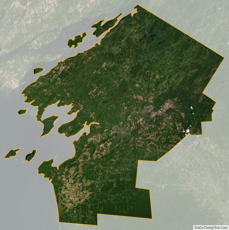
According to the U.S. Census Bureau, the county has an area of 1,857 square miles (4,810 km), of which 1,269 square miles (3,290 km) is land and 589 square miles (1,530 km) (32%) is water. It is the fourth-largest county in New York by area.
Jefferson County is in New York State’s northern lobe, adjacent to the area where the Saint Lawrence River exits Lake Ontario. It is northeast of Syracuse, and northwest of Utica. The county is at the international border with Canada.
The Black River, which empties into Lake Ontario, is an important waterway in the county. Part of the Tug Hill Plateau is in the southern part of the county. The county contains part of the Thousand Islands in the St. Lawrence River, including such large islands as Carleton Island, Grindstone Island, and Wellesley Island.
Adjacent counties
- St. Lawrence County – northeast
- Lewis County – southeast
- Oswego County – southwest
- Leeds and Grenville United Counties, Ontario – north
- Frontenac County, Ontario – northwest
Major highways
- Interstate 81
- Interstate 781
- U.S. Route 11
- New York State Route 3
- New York State Route 3A
- New York State Route 12
- New York State Route 12E
- New York State Route 12F
- New York State Route 26
- New York State Route 37
- New York State Route 180
Jefferson County Topographic Map
Jefferson County Satellite Map
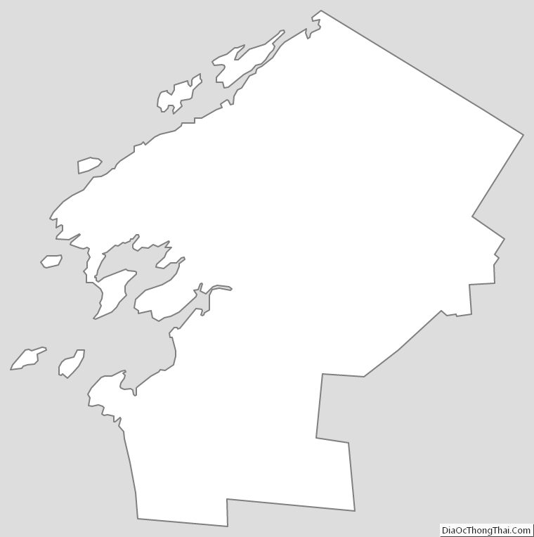
Jefferson County Outline Map