Watertown is a city in, and the county seat of, Jefferson County, New York, United States. It is approximately 25 miles (40 km) south of the Thousand Islands, along the Black River about 5 miles (8 km) east of where it flows into Lake Ontario. The city is bordered by the town of Watertown to the south, east, and west, and is served by the Watertown International Airport and the Watertown Daily Times newspaper. In the middle of Watertown lies the Public Square Historic District, which was built in 1805 and listed on the National Register of Historic Places (NRHP) in 1984. Watertown is located 13 miles (21 kilometers) southwest of the U.S. Army base at Fort Drum; it is the service and shopping destination for personnel there and their families. As of the 2020 United States Census, the city has 24,685 residents, making it the largest city in the North Country.
The area was first surveyed in 1796, and was settled in March 1800 due to the abundant hydropower the Black River provided. The city was designated as the county seat of Jefferson County when it was split off from Oneida County in 1805. Watertown was incorporated as a village in 1816, and became a city in 1869. By then, it was booming as an industrial center for Upstate New York. By the early 20th century the city was said to have more millionaires per capita than any other city in the nation. During the mid 1960s, Chicago attracted many of the younger residents from the area along with their businesses, leading to the demolition of many historic buildings and a steady decline in population. By 2000, the city had lost over 7,000 residents.
The city serves as the commercial and financial center for the North Country. Located 30 miles (48 km) from the Canadian border, shopping by Canadian visitors is important to Watertown’s economy. The city also receives numerous tourists and summer residents. Watertown, South Dakota, was named in the city’s honor.
| Name: | Watertown city |
|---|---|
| LSAD Code: | 25 |
| LSAD Description: | city (suffix) |
| State: | New York |
| County: | Jefferson County |
| Elevation: | 466 ft (142 m) |
| Total Area: | 9.39 sq mi (24.31 km²) |
| Land Area: | 9.03 sq mi (23.39 km²) |
| Water Area: | 0.35 sq mi (0.92 km²) |
| Total Population: | 24,685 |
| Population Density: | 2,733.06/sq mi (1,055.21/km²) |
| Area code: | 315 |
| FIPS code: | 3678608 |
| GNISfeature ID: | 0968914 |
| Website: | www.watertown-ny.gov |
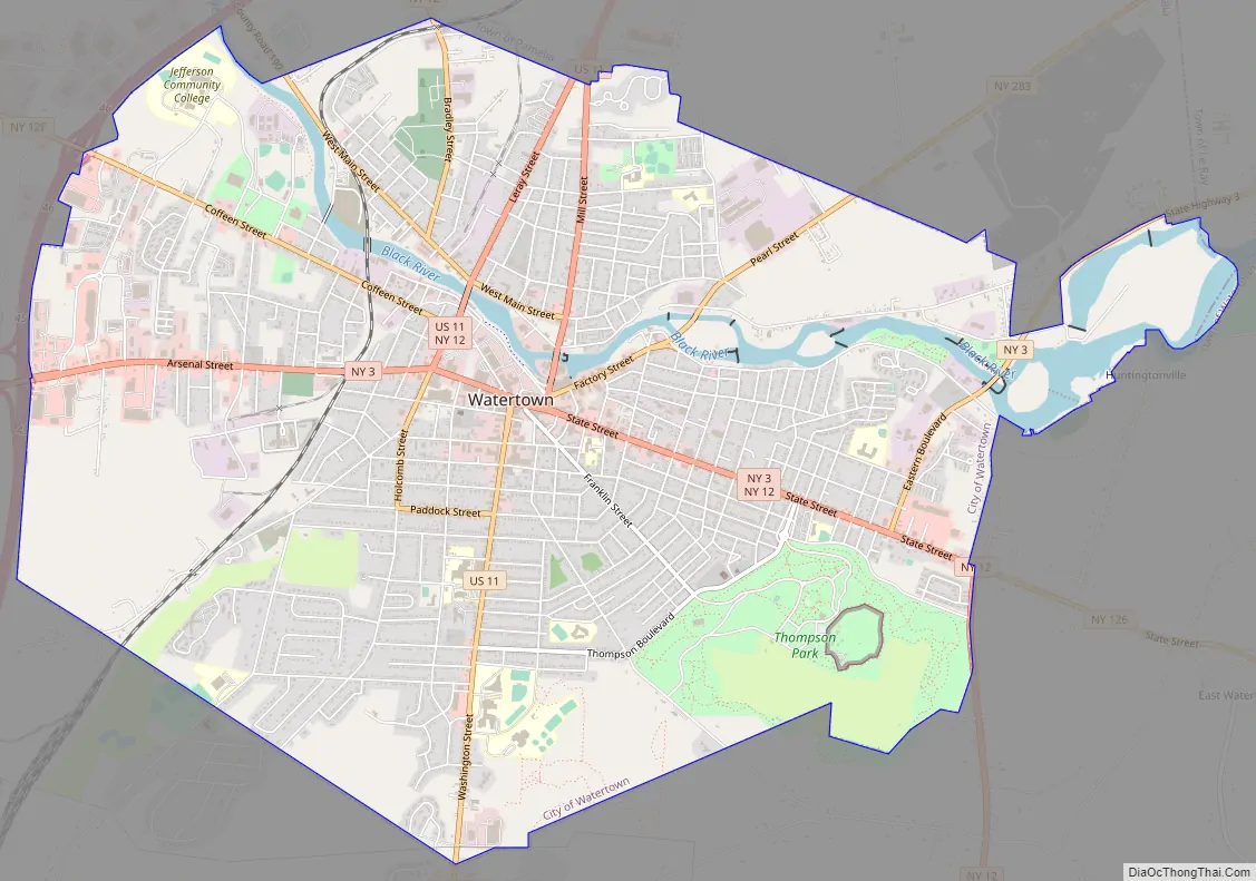
Online Interactive Map
Click on ![]() to view map in "full screen" mode.
to view map in "full screen" mode.
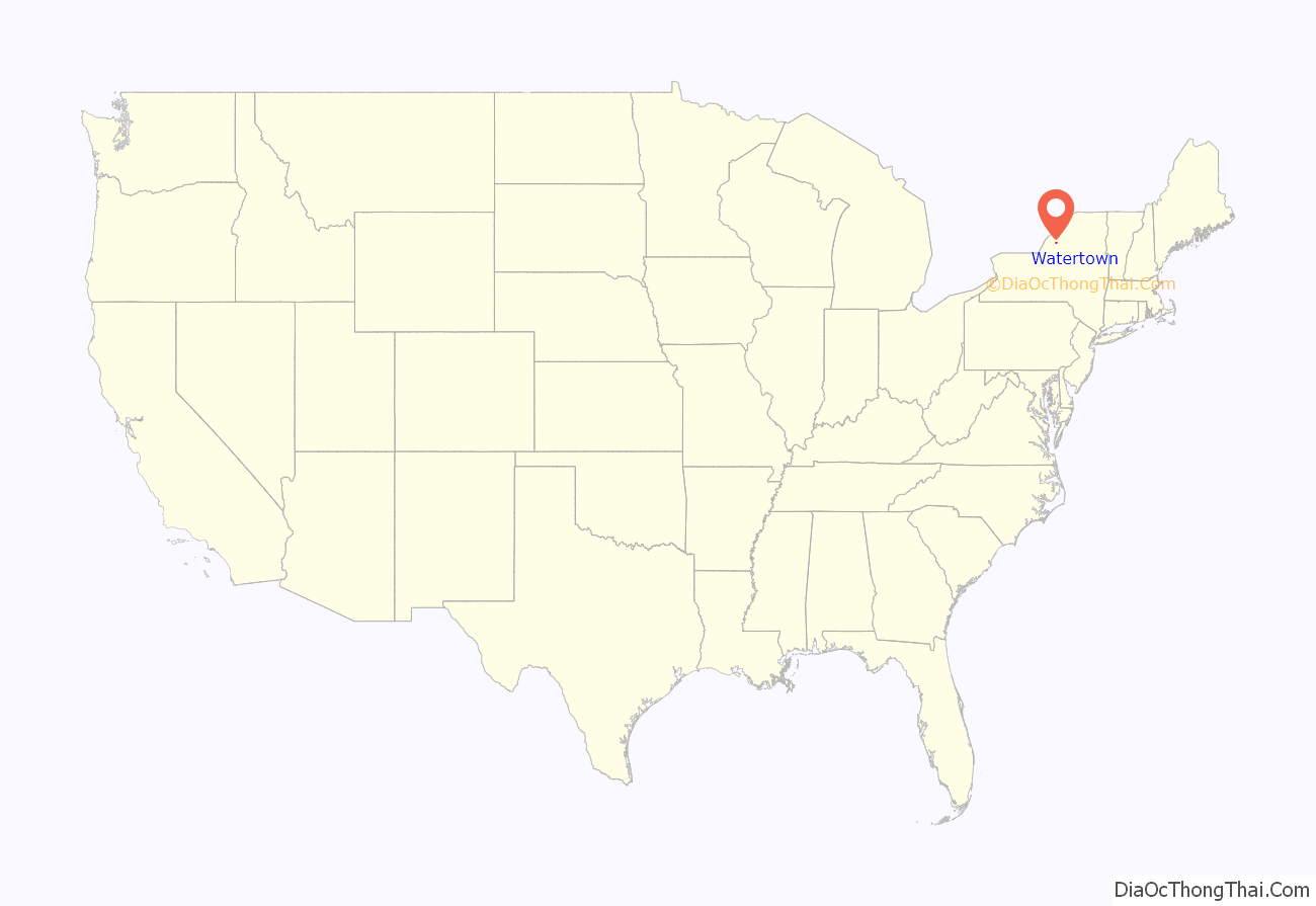
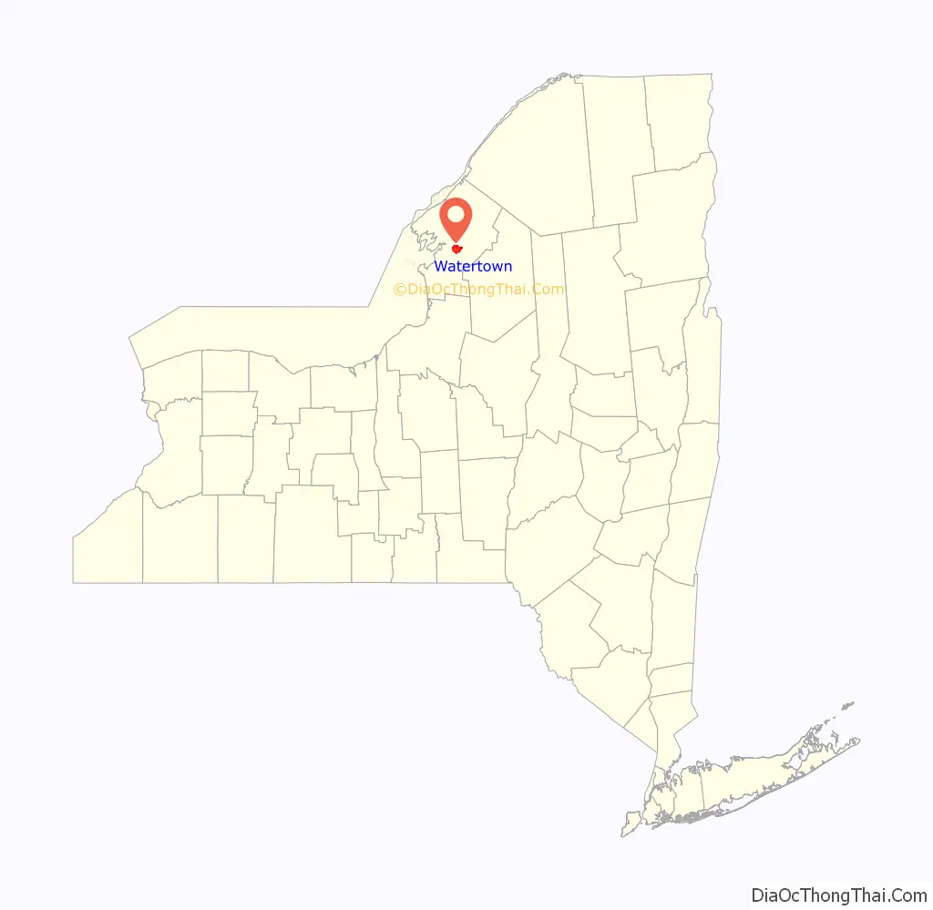
Watertown location map. Where is Watertown city?
History
Etymology
Watertown got its name from straddling the Black River. It is unknown which settler chose it, but it is commonly believed to have been a consensus choice in order to attract mills. By 1850, mills manufacturing different products, powered by the Black river, were being built throughout Watertown.
Precolonial and colonial eras
In 1791, New York City resident Alexander Macomb purchased the land of Jefferson, Lewis, St. Lawrence and Oswego county. He sent out multiple surveyors to sell the land to passing settlers. The area of Watertown was first surveyed in 1796 by Benjamin Wright, who was employed by Macomb to survey the northern and central portions of New York State. Wright made the following statement about the land after returning:
In 1798, pioneers Hart Massey, Henry Coffeen, and Zachariah Butterfield built cabins in what is now the Public Square area as part of a large migration into New York from New England after the Revolutionary War. The land was very uneven territory and was leveled out in one of the first landfill projects in the United States. The area was taken from the nearby town of Mexico in 1800.
Coffeen then moved his family into Watertown. He and the other pioneers chose the area due to the Black River, which flowed west into Lake Ontario about 5 mi (8.0 km) away. Their vision was for an industrial center that would draw power from the river. In 1805, settlers cleared the center of town to create Public Square. During the 19th century, several significant buildings were built around it. The area has been designated as a historic district, listed on the NRHP. Watertown was designated as the seat of Jefferson County after it was split from Oneida County. At that time, Watertown was one of the least populated places in the county.
Watertown was incorporated as a village in 1816. In 1869, it reincorporated as a city.
Due to its proximity to Lake Ontario, Watertown became a popular location for transporting supplies into Canada, which helped its economy. As industry and businesses flourished, successful residents built substantial retail buildings, churches, and private residences close to the square. After the Embargo Act of 1807 was passed which prohibited trade with Britain and France, which at the time included Canada. The economy suffered as a result and eventually led to smuggling materials into Canada, leading to the War of 1812. During the Civil War, the 35th New York Infantry Regiment began in Watertown.
The Paddock Arcade, built in 1850 according to European and US models, is the oldest continuously operating enclosed mall in the United States. It is also listed on the National Register, as are several mansions and churches, such as the Emma Flower Taylor Mansion and the Trinity Episcopal Church. The drops in the Black at Watertown’s location—40 feet (12 m) in the center of town, and 120 feet (37 m) over 2.5 miles (4.0 km)—provided abundant water power for early industry.
By the mid-19th century, entrepreneurs had built paper mills and major industries, including one to manufacture the first portable steam engine in 1847. In the late 1840s Watertown saw an influx in population from Irish migration into the area during the famine. In 1849 a fire began in the public square that destroyed most of the surrounding buildings. In 1851, the city was joined to Albany, Syracuse, and Rochester as well as other major cities of the state with the Rome, Watertown and Ogdensburg Railroad. Other mills were added to the business base, generating revenue to support the city’s early public works projects, such as the water system and illuminating gas works in 1853, and a telephone system in 1879.
Watertown claims that Rodman native Frank W. Woolworth conceived the idea of his eponymous mercantile chain while working here in 1878. Woolworth, then employed as a clerk in Moore’s Store, set up a successful clearance display of low-priced items. This led to his idea of a store specializing in fixed-price, cut-rate merchandise. Woolworth left Watertown and opened his first store in 1879 in Utica. Among the many manufacturing businesses was the Davis Sewing Machine Company, which originated in Watertown. It was the predecessor to George P. Huffman’s Huffy Corporation, now a maker of bicycles and other sporting goods.
In the late 1890s, many new factories and industries were established, increasing the population by over 17,000 in the span of 30 years. The city gained a reputation for gambling and prostitution. Watertown also developed an educated professional class of doctors and lawyers. The economic center of the country kept moving west following the development of the frontier and a shift of population into the Midwest. In 1920, the city adopted a city manager-style of government.
After the Wall Street Crash of 1929, many stores shut down and laid off a considerable amount of their workforce, leading to economic hardships until World War II, when Watertown’s industries switched from consumer products to war materiel, revitalizing the economy.
Contemporary history
Little Trees were developed in Watertown in 1951; the Car-Freshner Corporation headquarters and manufacturing plant is located in the city. In the 1960s and 1970s, Watertown began a large de-industrialization which destroyed many historic buildings, such as the Hotel Woodruff and old courthouse. Watertown suffered economic and population declines. As Chicago boomed, it attracted many of the younger people from upstate New York for its business and professional opportunities. By the 1980s, unemployment in the area was up 20 percent.
In the 21st century, the city serves as a hub for a large rural area. In 2006, the city began a $7.4 million project that restored multiple buildings as well as fixing roads and walkways. The city completed this project in 2008, although more fixes are planned. In early 2019, Watertown was named “The Least Politically Prejudiced Place in America” by Amanda Ripley.
Watertown Road Map
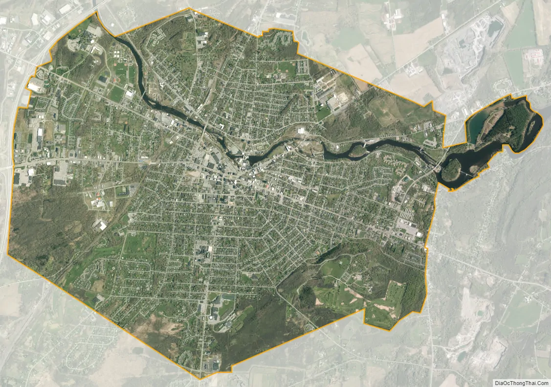
Watertown city Satellite Map
Geography
Watertown is around 60 miles (97 kilometers) northwest of Syracuse, 20 miles (32 kilometers) south of the Thousand Islands and 328 miles (530 kilometers) northwest of New York City. According to the United States Census Bureau, the city has a total area of 9.3 square miles (24 km), of which 9.0 square miles (23 km) are land and 0.3 square miles (0.78 km) (3.45 percent) is water. Before the area was settled, all the land was rough and forested. Elevation was also a problem. The Black River, flowing westward through the city toward Lake Ontario, is a world-renowned kayaking destination. Competition-level kayaking events, such as the Blackwater Challenge, have been held on the river.
Climate
Watertown has a humid continental climate or hemiboreal climate(Köppen: Dfb), with cold, snowy winters and an atypical autumn maximum precipitation regime, this being far more common in areas on the west coasts of landmasses. Unless otherwise noted, all figures cited below are from the GHCN station located closer to downtown.
Winters can be very cold: temperatures remain at or below the freezing mark on an average of 54 days annually, and fall to 0 °F (−18 °C) or below on an average 20 nights. Moreover, Watertown is located in plant hardiness zone 4b, which means that the temperature is likely to drop below −20 °F (−29 °C) at least once a year. Summers are mild to warm, and temperatures of 90 °F (32 °C) or above on average occur on only 3.1 days annually. Record temperatures range from a low of −39 °F (−39 °C) on December 29, 1933, up to highs of 99 °F (37 °C) on July 20 and 27, 1894, although those at the airport have dropped as low as −43 °F (−42 °C) on January 16, 1994.
Precipitation averages 44.36 inches (1,127 mm), and is distributed fairly uniformly throughout the year, with slightly more during autumn and slightly less during spring and late winter. Since Watertown is situated near the eastern edge of Lake Ontario, it receives much lake-effect snow, averaging 116.4 inches (296 cm) of snowfall in the winter.
See also
Map of New York State and its subdivision:- Albany
- Allegany
- Bronx
- Broome
- Cattaraugus
- Cayuga
- Chautauqua
- Chemung
- Chenango
- Clinton
- Columbia
- Cortland
- Delaware
- Dutchess
- Erie
- Essex
- Franklin
- Fulton
- Genesee
- Greene
- Hamilton
- Herkimer
- Jefferson
- Kings
- Lake Ontario
- Lewis
- Livingston
- Madison
- Monroe
- Montgomery
- Nassau
- New York
- Niagara
- Oneida
- Onondaga
- Ontario
- Orange
- Orleans
- Oswego
- Otsego
- Putnam
- Queens
- Rensselaer
- Richmond
- Rockland
- Saint Lawrence
- Saratoga
- Schenectady
- Schoharie
- Schuyler
- Seneca
- Steuben
- Suffolk
- Sullivan
- Tioga
- Tompkins
- Ulster
- Warren
- Washington
- Wayne
- Westchester
- Wyoming
- Yates
- Alabama
- Alaska
- Arizona
- Arkansas
- California
- Colorado
- Connecticut
- Delaware
- District of Columbia
- Florida
- Georgia
- Hawaii
- Idaho
- Illinois
- Indiana
- Iowa
- Kansas
- Kentucky
- Louisiana
- Maine
- Maryland
- Massachusetts
- Michigan
- Minnesota
- Mississippi
- Missouri
- Montana
- Nebraska
- Nevada
- New Hampshire
- New Jersey
- New Mexico
- New York
- North Carolina
- North Dakota
- Ohio
- Oklahoma
- Oregon
- Pennsylvania
- Rhode Island
- South Carolina
- South Dakota
- Tennessee
- Texas
- Utah
- Vermont
- Virginia
- Washington
- West Virginia
- Wisconsin
- Wyoming


