Oswego County is a county in the U.S. state of New York. As of the 2020 census, the population was 117,525. The county seat is Oswego. The county name is from a Mohawk-language word meaning “the pouring out place”, referring to the point at which the Oswego River feeds into Lake Ontario at the northern edge of the county in the city of Oswego.
Oswego County is part of the Syracuse, NY Metropolitan Statistical Area.
| Name: | Oswego County |
|---|---|
| FIPS code: | 36-075 |
| State: | New York |
| Founded: | 1816 |
| Seat: | Oswego |
| Largest city: | Oswego |
| Total Area: | 1,312 sq mi (3,400 km²) |
| Land Area: | 952 sq mi (2,470 km²) |
| Total Population: | 117,525 |
| Population Density: | 123.5/sq mi (47.7/km²) |
| Time zone: | UTC−5 (Eastern) |
| Summer Time Zone (DST): | UTC−4 (EDT) |
| Website: | www.oswegocounty.com |
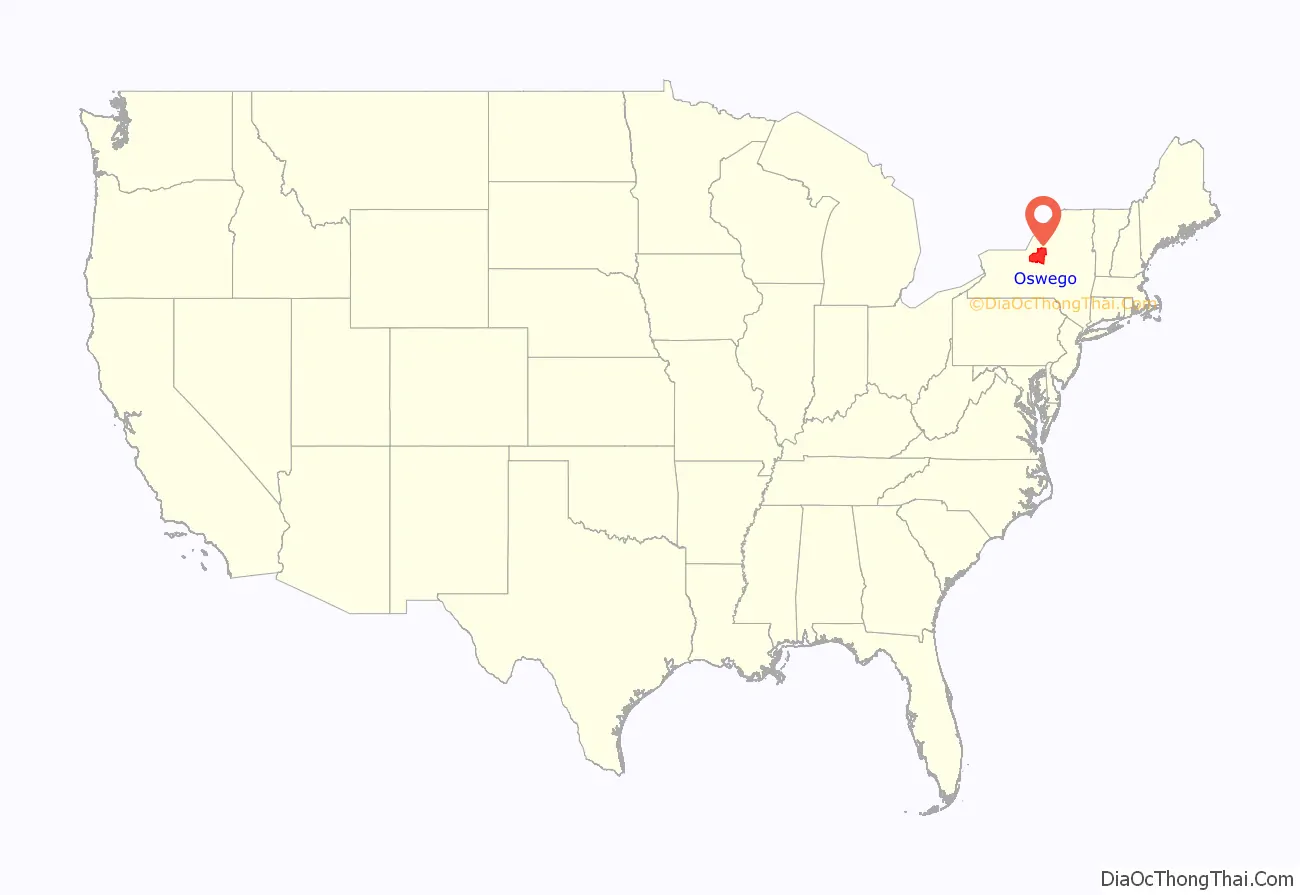
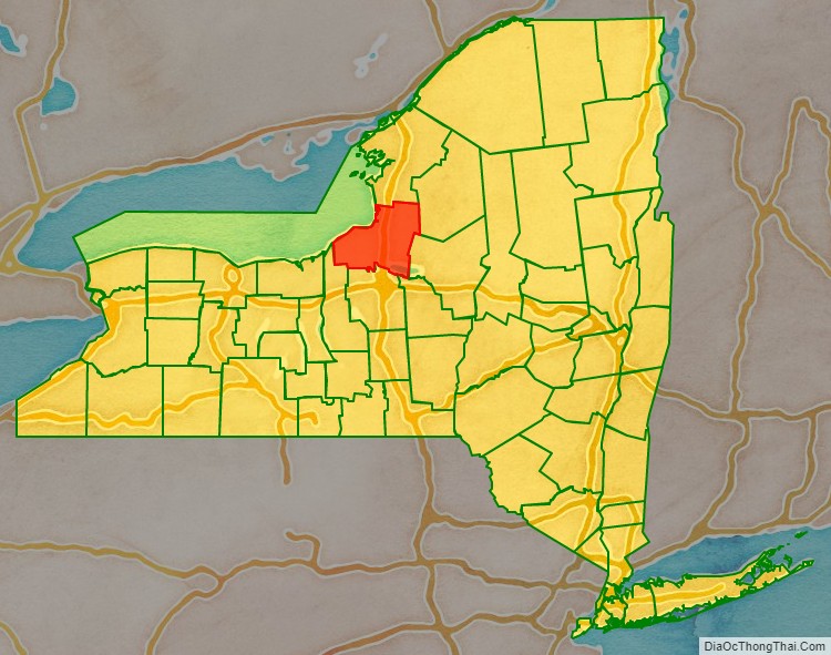
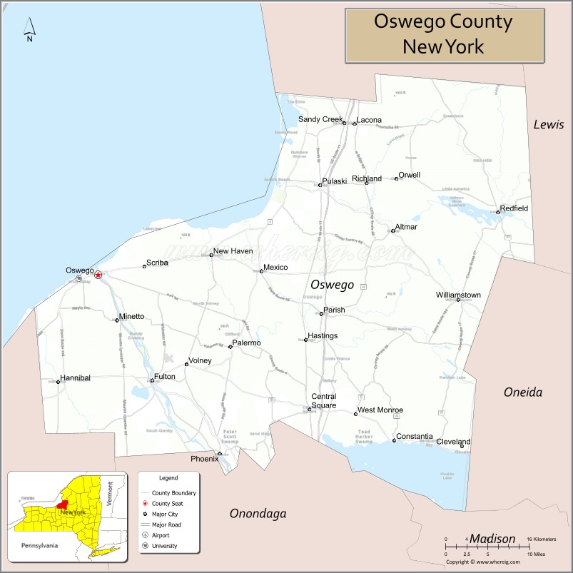
Oswego County location map. Where is Oswego County?
History
When counties were established in the British colony of New York in 1683, the present Oswego County was part of Albany County. This was an enormous county, including the northern part of what is now New York state as well as all of the present state of Vermont and, in theory, extending westward to the Pacific Ocean. This county was reduced in size on July 3, 1766, by the creation of Cumberland County in the British colony, and further on March 16, 1770, by the creation of Gloucester County, both containing territory now in Vermont.
On March 12, 1772, what was left of Albany County was split into three parts, one remaining under the name Albany County. One of the other pieces, Tryon County, contained the western portion (and thus, since no western boundary was specified, theoretically still extended west to the Pacific). The eastern boundary of Tryon County was approximately five miles (8.0 km) west of the present city of Schenectady, and the county included the western part of the Adirondack Mountains and the area west of the West Branch of the Delaware River. The area then designated as Tryon County now includes 37 counties of New York State. The county was named for William Tryon, colonial governor of New York.
In the years prior to 1776, most of the Loyalists in Tryon County fled to Canada. In 1784, following the peace treaty that ended the American Revolutionary War, the name of Tryon County was changed to Montgomery County to honor the general, Richard Montgomery, who had captured several places in Canada and died attempting to capture the city of Quebec, replacing the name of the hated British governor.
In 1789, the size of Montgomery County was reduced by the splitting off of Ontario County from Montgomery. The actual area split off from Montgomery County was much larger than the present county, also including the present Allegany, Cattaraugus, Chautauqua, Erie, Genesee, Livingston, Monroe, Niagara, Orleans, Steuben, Wyoming, Yates, and part of Schuyler and Wayne counties.
Oswego County was partly in Macomb’s Purchase of 1791.
In 1791, Herkimer County was one of three counties split off from Montgomery (the other two being Otsego, and Tioga County). This was much larger than the present county, however, and was reduced by a number of subsequent splits.
In 1794, Onondaga County was created from a part of Herkimer County. This county was larger than the current Onondaga County, including the present Cayuga, Cortland, and part of Oswego counties.
In 1798, Oneida County was created from a part of Herkimer County. This county was larger than the current Oneida County, including the present Jefferson, Lewis, and part of Oswego counties.
In 1805, Oneida County was reduced in size by the splitting off of Jefferson and Lewis counties.
In 1816, Oswego County was created as New York State’s 48th county from parts of Oneida and Onondaga counties.
In 1841, businessmen in Oswego attempted to divide Oswego County into two counties. They failed to persuade the State to do so, however. Occasionally, the topic still comes up today by dividing the county into an east part and a west part, with the east portion being renamed “Salmon County”.
At various times, beginning in 1847 and as late as 1975, attempts were made to move the county seat to the Village of Mexico. However, none of these attempts succeeded.
On April 20, 2002, at around 6:50 am, many residents of Oswego County were shaken awake by a magnitude 5.2 earthquake centered near Plattsburgh, New York. Minor damage to a Fire Hall in Altmar was the only report of damage. No injuries were sustained.
During 1–12 February 2007, a major lake effect snowfall dumped over ten feet of snow in many places in Oswego County, resulting in several roof collapses, some communities being cut off, and some people being snowed-in in their homes. A state of emergency was declared for the county, and the National Guard was sent in to help clear the snow.
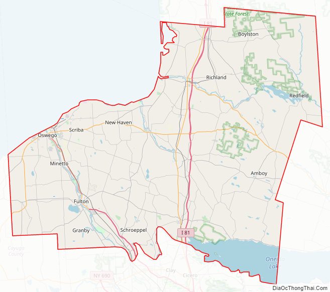
Oswego County Road Map
Geography
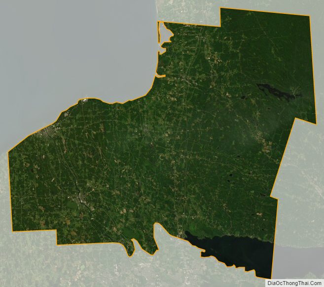
According to the U.S. Census Bureau, the county has a total area of 1,312 square miles (3,400 km), of which 952 square miles (2,470 km) is land and 360 square miles (930 km), comprising 27%, is water.
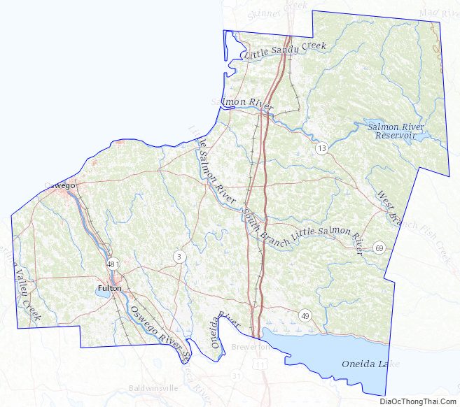
Oswego County is in northwestern New York State, just north of Syracuse and northwest of Utica, on the eastern shore of Lake Ontario. Part of the Tug Hill Plateau is in the eastern part of the county and, at 1,550 feet (470 m), is the highest point. The Salmon River Falls, a 110-foot (34 m) waterfall, is a popular sightseeing destination in the northeastern portion of the county.
There are two harbors in the county: Oswego Harbor at the mouth of the Oswego River and Port Ontario on the Salmon River. The first major port of call on the Great Lakes is the Port of Oswego Authority dock.
Adjacent counties
- Jefferson County – north
- Lewis County – northeast
- Oneida County – east
- Madison County – southeast
- Onondaga County – south
- Cayuga County – southwest
Major highways
- Interstate 81
- U.S. Route 11
- New York State Route 3
- New York State Route 13
- New York State Route 48
- New York State Route 49
- New York State Route 69
- New York State Route 104
- New York State Route 104B
- New York State Route 481 (Veterans Memorial Highway)
Oswego County Topographic Map
Oswego County Satellite Map
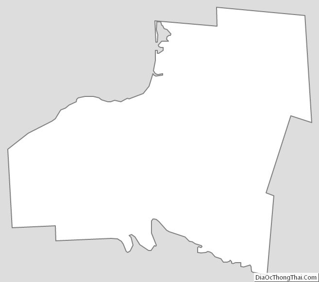
Oswego County Outline Map