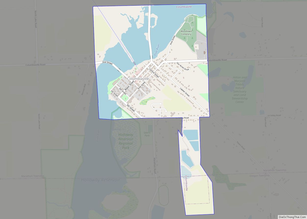
Columbiaville is a village in Lapeer County in the U.S. state of Michigan. The population was 787 at the 2010 census. The village is within Marathon Township on the Flint River.
| Name: | Columbiaville village |
|---|---|
| LSAD Code: | 47 |
| LSAD Description: | village (suffix) |
| State: | Michigan |
| County: | Lapeer County |
| Elevation: | 771 ft (235 m) |
| Total Area: | 1.18 sq mi (3.05 km²) |
| Land Area: | 0.88 sq mi (2.28 km²) |
| Water Area: | 0.30 sq mi (0.77 km²) |
| Total Population: | 702 |
| Population Density: | 795.92/sq mi (307.24/km²) |
| ZIP code: | 48421 |
| Area code: | 810 |
| FIPS code: | 2617460 |
| GNISfeature ID: | 0623646 |
Online Interactive Map
Click on ![]() to view map in "full screen" mode.
to view map in "full screen" mode.
Columbiaville location map. Where is Columbiaville village?


History
The first settler on the site of the village was Levi D. Cutting, a carpenter and cabinet maker by trade, who arrived with his family in 1847. His home in Columbiaville is still standing at the south corner of Water and Lapeer Streets. In 1848, George and Henry Niver built a saw mill on the banks of the Flint River and the place became known as “Niverville”. William Peter, a neighbor of the Nivers from their previous residence in Columbia County, New York came to work in the Niver’s sawmill. By 1852, he opened his own business, starting with a store. He eventually came into possession of the entire property of Columbiaville.
A post office was established in April 1857 with the name “Columbiaville”. The Nivers originally suggested the name “Columbia” after their home county in New York, but at the time there was already another post office in Michigan with that name.
The village continued to grow with the inclusion of a large Steam Grist and Flouring Mill, built by William Peter. The Detroit and Bay City Railroad chose to route through Columbiaville and was opened to the public in 1872. The first depot was a wooden structure located on the east side of the track at Pine Street. In 1893 the brick depot was erected by William Peter, with the provision in the deed that all passenger trains were to stop in Columbiaville. The railroad provided great means of transportation and opportunity for the village. In 1892 the Peters along with Toledo workmen, built the William Peter Mansion. They moved into the sixteen room Mansion in 1896. Mrs. Peter stated that the location of the home was chosen for convenience of being right downtown in the center of activity. Peter soon after became ill and died on October 23, 1899, at age 75. He is buried at Woodlawn Cemetery. The first automobile traveled into the village in 1903, and was not initially well accepted by all residents who were in fear of witch craft. The first gas station in the village was established in the early 1900s by Standard Oil Company. Early automobile dealers were Roy Osborne, who built a large garage and dealership display on Water Street in 1920. Thomas Ward established Willey’s Overland Garage in the 1920s.
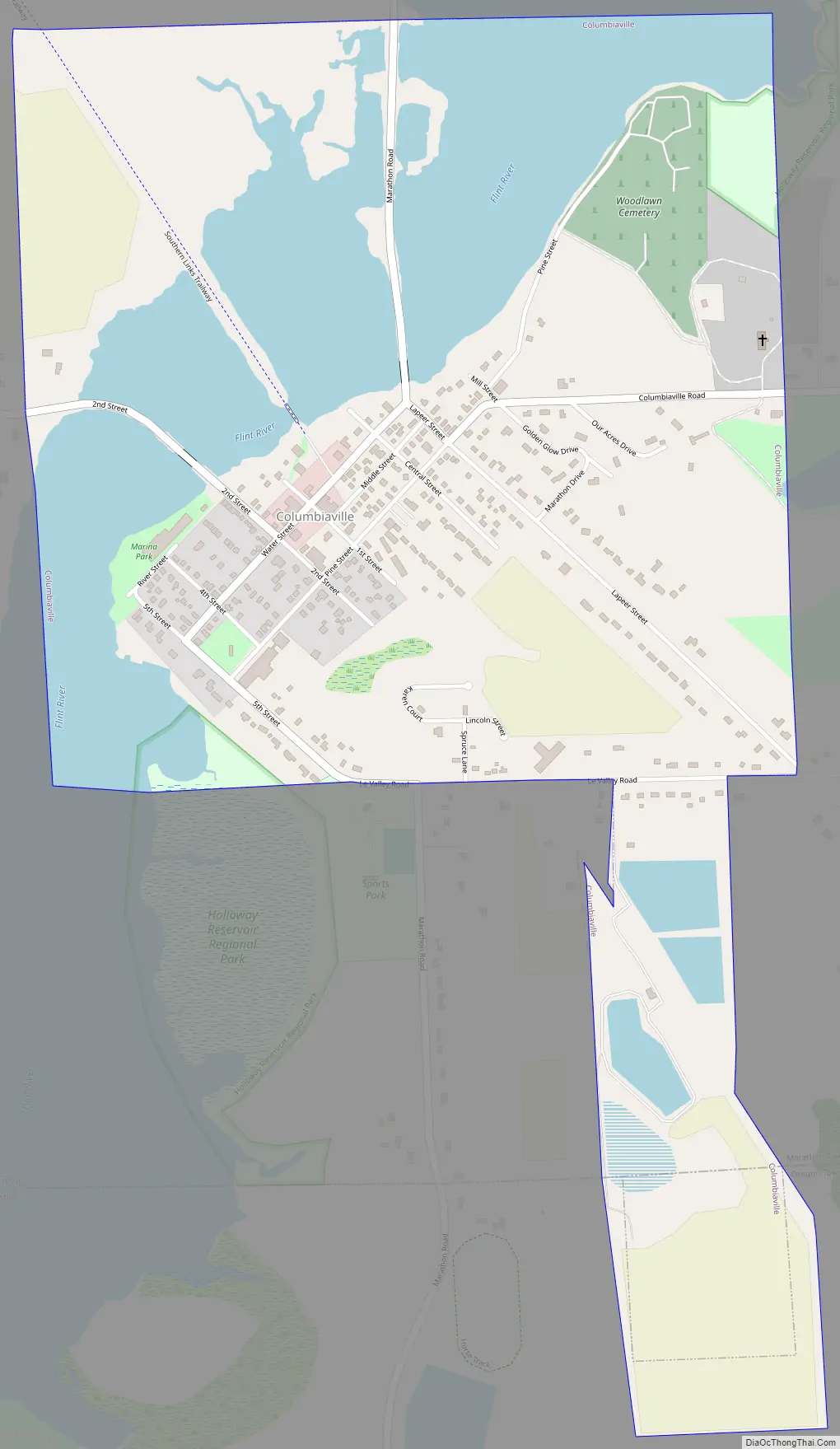
Columbiaville Road Map
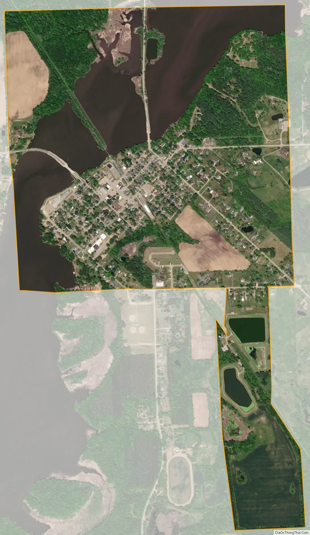
Columbiaville city Satellite Map
Geography
According to the United States Census Bureau, the village has a total area of 1.15 square miles (2.98 km), of which 0.85 square miles (2.20 km) is land and 0.30 square miles (0.78 km) is water.
See also
Map of Michigan State and its subdivision:- Alcona
- Alger
- Allegan
- Alpena
- Antrim
- Arenac
- Baraga
- Barry
- Bay
- Benzie
- Berrien
- Branch
- Calhoun
- Cass
- Charlevoix
- Cheboygan
- Chippewa
- Clare
- Clinton
- Crawford
- Delta
- Dickinson
- Eaton
- Emmet
- Genesee
- Gladwin
- Gogebic
- Grand Traverse
- Gratiot
- Hillsdale
- Houghton
- Huron
- Ingham
- Ionia
- Iosco
- Iron
- Isabella
- Jackson
- Kalamazoo
- Kalkaska
- Kent
- Keweenaw
- Lake
- Lake Hurron
- Lake Michigan
- Lake St. Clair
- Lake Superior
- Lapeer
- Leelanau
- Lenawee
- Livingston
- Luce
- Mackinac
- Macomb
- Manistee
- Marquette
- Mason
- Mecosta
- Menominee
- Midland
- Missaukee
- Monroe
- Montcalm
- Montmorency
- Muskegon
- Newaygo
- Oakland
- Oceana
- Ogemaw
- Ontonagon
- Osceola
- Oscoda
- Otsego
- Ottawa
- Presque Isle
- Roscommon
- Saginaw
- Saint Clair
- Saint Joseph
- Sanilac
- Schoolcraft
- Shiawassee
- Tuscola
- Van Buren
- Washtenaw
- Wayne
- Wexford
- Alabama
- Alaska
- Arizona
- Arkansas
- California
- Colorado
- Connecticut
- Delaware
- District of Columbia
- Florida
- Georgia
- Hawaii
- Idaho
- Illinois
- Indiana
- Iowa
- Kansas
- Kentucky
- Louisiana
- Maine
- Maryland
- Massachusetts
- Michigan
- Minnesota
- Mississippi
- Missouri
- Montana
- Nebraska
- Nevada
- New Hampshire
- New Jersey
- New Mexico
- New York
- North Carolina
- North Dakota
- Ohio
- Oklahoma
- Oregon
- Pennsylvania
- Rhode Island
- South Carolina
- South Dakota
- Tennessee
- Texas
- Utah
- Vermont
- Virginia
- Washington
- West Virginia
- Wisconsin
- Wyoming