Dryden is a village in Lapeer County in the U.S. state of Michigan. The population was 951 at the 2010 census. The village is located within Dryden Township.
| Name: | Dryden village |
|---|---|
| LSAD Code: | 47 |
| LSAD Description: | village (suffix) |
| State: | Michigan |
| County: | Lapeer County |
| Elevation: | 935 ft (285 m) |
| Total Area: | 1.10 sq mi (2.85 km²) |
| Land Area: | 1.10 sq mi (2.85 km²) |
| Water Area: | 0.00 sq mi (0.00 km²) |
| Total Population: | 1,023 |
| Population Density: | 928.31/sq mi (358.53/km²) |
| ZIP code: | 48428 |
| Area code: | 810 |
| FIPS code: | 2623140 |
| GNISfeature ID: | 0624906 |
Online Interactive Map
Click on ![]() to view map in "full screen" mode.
to view map in "full screen" mode.
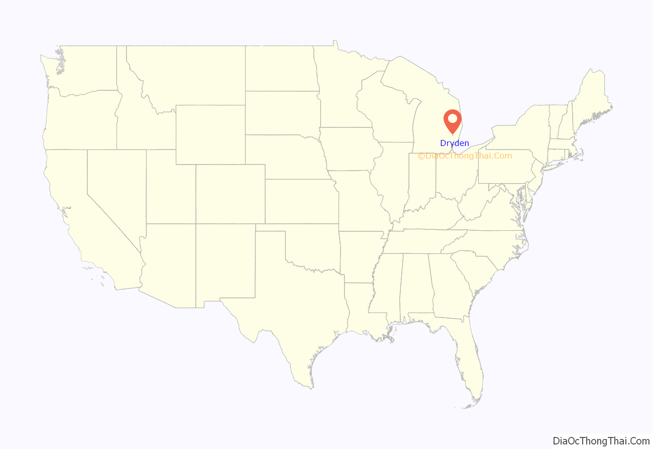
Dryden location map. Where is Dryden village?
History
The Village of Dryden was settled in 1836 and was called Amboy. It was located 1 mile North of its present-day located at Dryden and Mill Roads. In 1837, then known as Lomond, held its first town meeting since settling the previous year. A store was built here as early as 1840 by Mr. Johnathan Sweet who owned most of the land. It was known as Lamb’s Corners in homage to the man who bought the land from Mr. Sweet, John M. Lamb, starting in 1846 and the named stayed for several years. The name Dryden for its village was eventually picked and it was to pay honor to the poet, John Dryden. The 1840s was the decade in which many businesses were first established in the village. It was incorporated as a village in 1887.
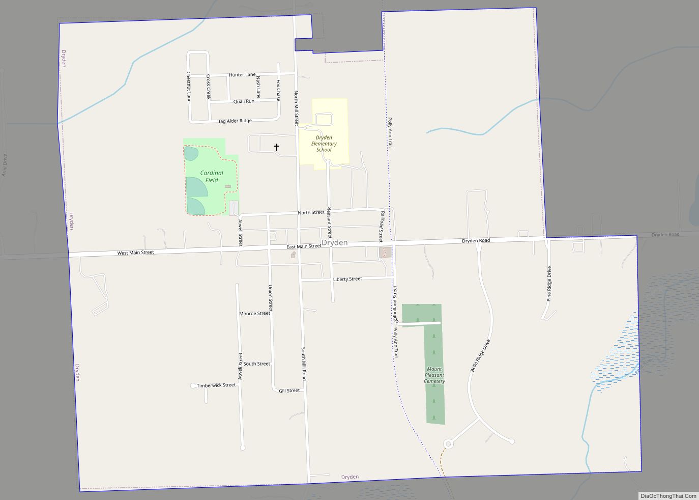
Dryden Road Map
Dryden city Satellite Map
Geography
According to the United States Census Bureau, the village has a total area of 1.10 square miles (2.85 km), all land.
See also
Map of Michigan State and its subdivision:- Alcona
- Alger
- Allegan
- Alpena
- Antrim
- Arenac
- Baraga
- Barry
- Bay
- Benzie
- Berrien
- Branch
- Calhoun
- Cass
- Charlevoix
- Cheboygan
- Chippewa
- Clare
- Clinton
- Crawford
- Delta
- Dickinson
- Eaton
- Emmet
- Genesee
- Gladwin
- Gogebic
- Grand Traverse
- Gratiot
- Hillsdale
- Houghton
- Huron
- Ingham
- Ionia
- Iosco
- Iron
- Isabella
- Jackson
- Kalamazoo
- Kalkaska
- Kent
- Keweenaw
- Lake
- Lake Hurron
- Lake Michigan
- Lake St. Clair
- Lake Superior
- Lapeer
- Leelanau
- Lenawee
- Livingston
- Luce
- Mackinac
- Macomb
- Manistee
- Marquette
- Mason
- Mecosta
- Menominee
- Midland
- Missaukee
- Monroe
- Montcalm
- Montmorency
- Muskegon
- Newaygo
- Oakland
- Oceana
- Ogemaw
- Ontonagon
- Osceola
- Oscoda
- Otsego
- Ottawa
- Presque Isle
- Roscommon
- Saginaw
- Saint Clair
- Saint Joseph
- Sanilac
- Schoolcraft
- Shiawassee
- Tuscola
- Van Buren
- Washtenaw
- Wayne
- Wexford
- Alabama
- Alaska
- Arizona
- Arkansas
- California
- Colorado
- Connecticut
- Delaware
- District of Columbia
- Florida
- Georgia
- Hawaii
- Idaho
- Illinois
- Indiana
- Iowa
- Kansas
- Kentucky
- Louisiana
- Maine
- Maryland
- Massachusetts
- Michigan
- Minnesota
- Mississippi
- Missouri
- Montana
- Nebraska
- Nevada
- New Hampshire
- New Jersey
- New Mexico
- New York
- North Carolina
- North Dakota
- Ohio
- Oklahoma
- Oregon
- Pennsylvania
- Rhode Island
- South Carolina
- South Dakota
- Tennessee
- Texas
- Utah
- Vermont
- Virginia
- Washington
- West Virginia
- Wisconsin
- Wyoming
