Lapeer (/ləpir/ lə-PEER) is a city in the U.S. state of Michigan and is the county seat of Lapeer County. As of the 2020 census, the city population was 9,023. Most of the city was incorporated from land that was formerly in Lapeer Township, though portions were also annexed from Mayfield Township and Elba Township. Lapeer is in southern Michigan, east of Flint, on the Flint River.
| Name: | Lapeer city |
|---|---|
| LSAD Code: | 25 |
| LSAD Description: | city (suffix) |
| State: | Michigan |
| County: | Lapeer County |
| Elevation: | 856 ft (261 m) |
| Total Area: | 7.51 sq mi (19.46 km²) |
| Land Area: | 7.34 sq mi (19.02 km²) |
| Water Area: | 0.17 sq mi (0.44 km²) |
| Total Population: | 9,023 |
| Population Density: | 1,200/sq mi (460/km²) |
| ZIP code: | 48446 |
| Area code: | 810 |
| FIPS code: | 2646040 |
| GNISfeature ID: | 0630146 |
| Website: | ci.Lapeer.mi.us |
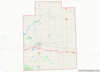
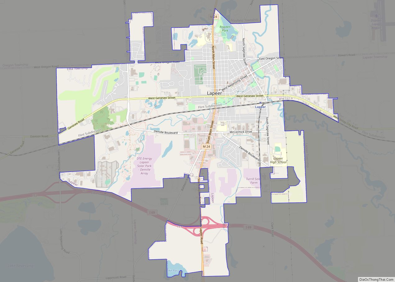
Online Interactive Map
Click on ![]() to view map in "full screen" mode.
to view map in "full screen" mode.
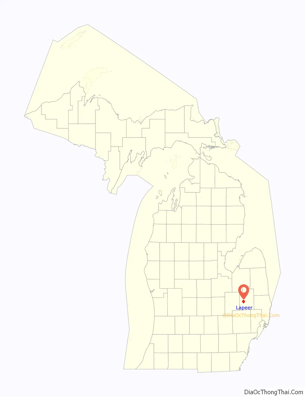
Lapeer location map. Where is Lapeer city?

History
By an ordinance of the Congress of the United States passed on July 13, 1787, the area lying northwest of the Ohio River, though still occupied by the British, was organized as the Northwest Territory. Lapeer County was once part of the Northwest Territory. In January 1820, the county of Oakland was formed, which served the area now known as Lapeer, until the County of Lapeer was formed in 1837, when Michigan became a state. The first elections were for county officers, with 520 persons voting in 1837.
Folklore claims Lapeer was derived from the naming of the south branch of the Flint River, which flows northwestward in Lapeer County. French and Indian traders frequently passed over this section of the county and through the river, ultimately naming the city for the stone that lay at the river bottom. In French, stone is called “la pierre”; the English pronunciation of these words gives Lapeer. The river was named Flint, synonymous with stone. (See List of Michigan county name etymologies.)
It is also believed that the first settlers who came from New York State may have brought the name Lapeer from a similarly named city in their home state. A third supposition is that French missionaries named the city Le Pere, meaning The Father.
The first settlers in Lapeer were a group of men named Alvin N. Hart, Oliver B. Hart, and J.B. Morse. The most prominent of the three, Alvin N. Hart, was born in Cornwall, Connecticut, on February 11, 1804. He came to Lapeer in 1831 and platted the Village of Lapeer, November 8, 1833. The plat was registered in Pontiac on December 14, 1833, in the County of Oakland; four years before Michigan became a state and Lapeer became a county. Alvin N. Hart became a State Senator in 1843, representing Lapeer, Oakland, Genesee, Shiawassee, Tuscola, Saginaw Counties and the entire Upper Peninsula. He was instrumental in having the State Capitol relocated from Detroit to Lansing. Hart died on August 22, 1874, and is buried in Lapeer.
The second group of settlers were Enoch J. White and his family. He was born in South Hadley, Massachusetts in 1814. He came to Lapeer in 1833. Of pioneer stock, Alvin N. Hart and Enoch J. White both had the initiative to start new communities. Mr. Hart formed Lapeer and Mr. White formed what was then known as Whitesville, which now consists of the western portion of Lapeer. A tamarack swamp once separated these two settlements.
Other distinguished natives include John T. Rich, former governor of the state of Michigan; Louis C. Cramton, special assistant to the U.S. Secretary of the Interior in 1931 and 1932. He led studies of the area around the Colorado River that led to the establishment of the first National Recreation Area, Lake Mead National Recreation Area; Charles Potter, whose son became a U.S. Senator; William Reed, Big Ten Football Commissioner; and Marguerite deAngeli, internationally known writer of children’s books.
At one time, there were two courthouses. The White family erected one at the present site of the Old Lapeer High School at Main and Genesee Streets, while the Hart family erected one at Nepessing and Court Streets. The Board of Supervisors purchased the Hart courthouse for $3,000, which is now the oldest continuously running courthouse in the state of Michigan and one of the oldest 10 courthouses in the United States. White’s courthouse later became the first school in Lapeer called Lapeer Academy.
Over time, it became evident that the business district would be near the Courthouse, so the city’s founders moved the Opera House piece-by-piece to its present location at the southeast corner of Court and Nepessing Streets in 1879. The building is now known as the White Block.
Lapeer’s first church was the Congregational Church; organized in 1833, the same year Lapeer was platted. The Methodist Episcopal Church opened its doors a year later, followed by the Baptist Church in 1858, the Immaculate Conception Catholic Church in 1866, the Universalist Church in 1873, the Methodist Protestant Church in 1877 and the Grace Episcopal Church in 1882.
Lumbering was the sole industry in the early days of Lapeer. The flourishing lumber business attracted the New York Central Railroad and Grand Trunk Railroad. Lapeer later became the intersection to two state trunk lines: M-21 and M-24. Adequate supplies of water, fuel and electricity, and many various forms of recreational facilities, provided the foundation for our growing community. Our industries today supply our state’s high-tech automotive industry with gray iron casting, molded plastics, plastic fabrics, electrical harnesses and stamping.
On October 26, 2010, Lapeer became a founding member of the Karegnondi Water Authority.
On August 15, 2012, the fourth-largest Powerball jackpot was won from a ticket sold at a Sunoco station in Lapeer. The jackpot had an annuity value of $337 million.
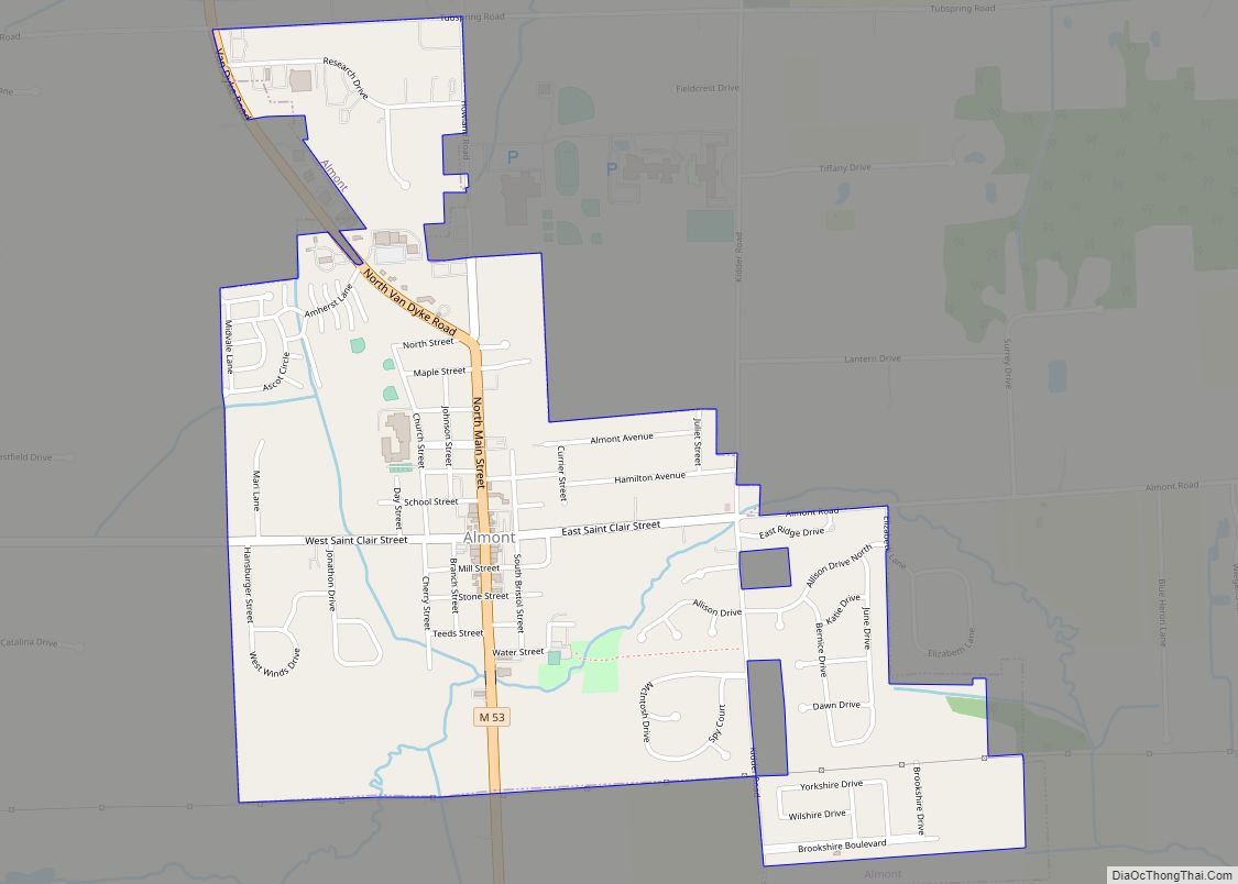
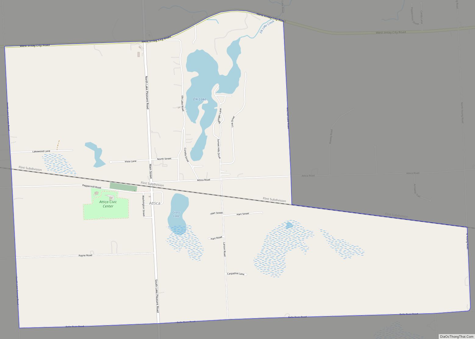
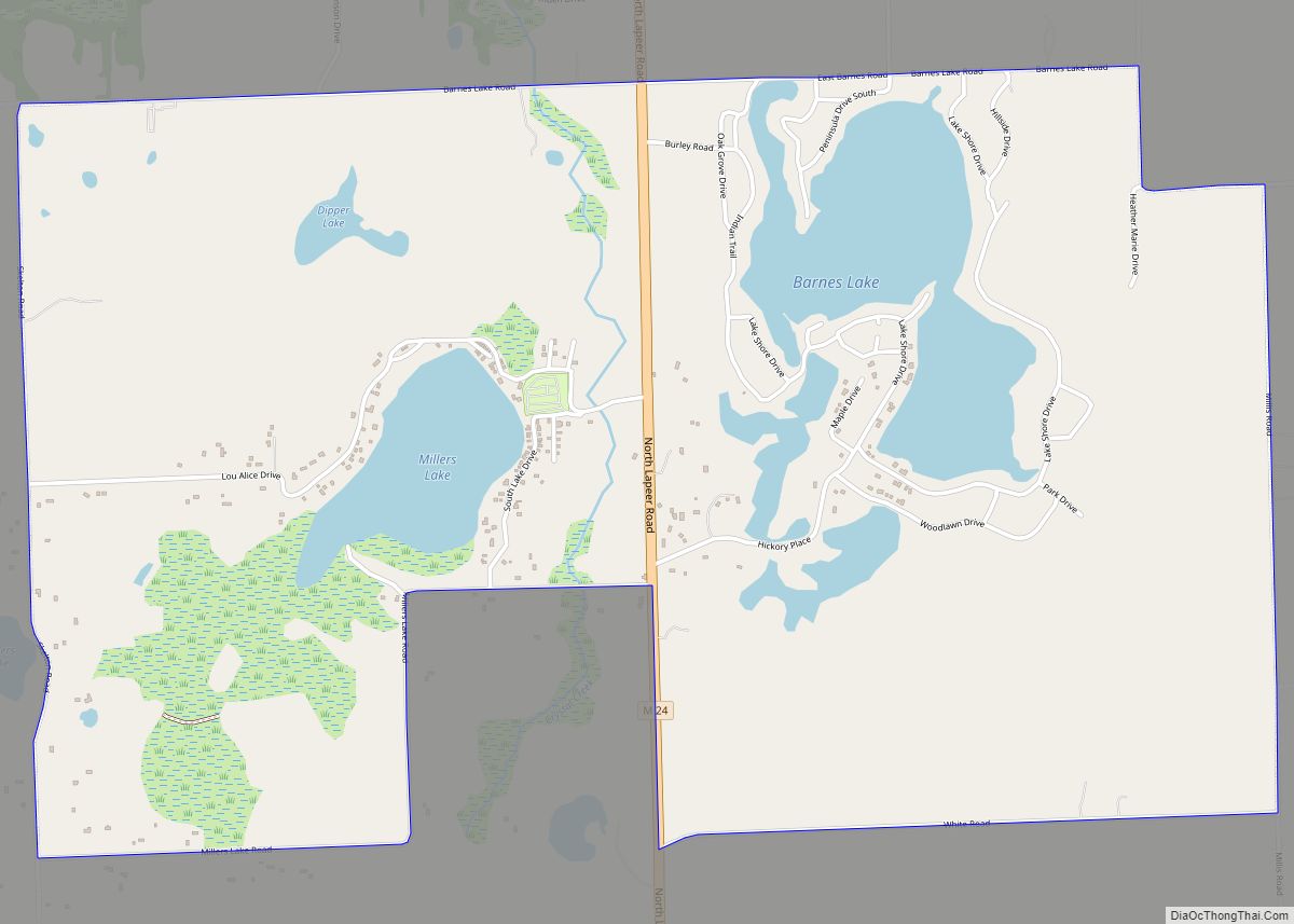
Lapeer Road Map
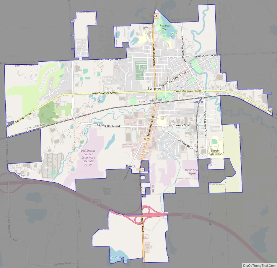
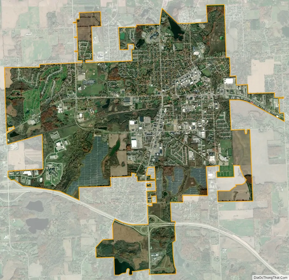
Lapeer city Satellite Map
Geography
According to the United States Census Bureau, the city has a total area of 7.38 square miles (19.11 km), of which 7.13 square miles (18.47 km) is land and 0.25 square miles (0.65 km) is water. It is considered to be part of the Thumb of Michigan, which in turn is a subregion of the Flint/Tri-Cities.
Climate
See also
Map of Michigan State and its subdivision:- Alcona
- Alger
- Allegan
- Alpena
- Antrim
- Arenac
- Baraga
- Barry
- Bay
- Benzie
- Berrien
- Branch
- Calhoun
- Cass
- Charlevoix
- Cheboygan
- Chippewa
- Clare
- Clinton
- Crawford
- Delta
- Dickinson
- Eaton
- Emmet
- Genesee
- Gladwin
- Gogebic
- Grand Traverse
- Gratiot
- Hillsdale
- Houghton
- Huron
- Ingham
- Ionia
- Iosco
- Iron
- Isabella
- Jackson
- Kalamazoo
- Kalkaska
- Kent
- Keweenaw
- Lake
- Lake Hurron
- Lake Michigan
- Lake St. Clair
- Lake Superior
- Lapeer
- Leelanau
- Lenawee
- Livingston
- Luce
- Mackinac
- Macomb
- Manistee
- Marquette
- Mason
- Mecosta
- Menominee
- Midland
- Missaukee
- Monroe
- Montcalm
- Montmorency
- Muskegon
- Newaygo
- Oakland
- Oceana
- Ogemaw
- Ontonagon
- Osceola
- Oscoda
- Otsego
- Ottawa
- Presque Isle
- Roscommon
- Saginaw
- Saint Clair
- Saint Joseph
- Sanilac
- Schoolcraft
- Shiawassee
- Tuscola
- Van Buren
- Washtenaw
- Wayne
- Wexford
- Alabama
- Alaska
- Arizona
- Arkansas
- California
- Colorado
- Connecticut
- Delaware
- District of Columbia
- Florida
- Georgia
- Hawaii
- Idaho
- Illinois
- Indiana
- Iowa
- Kansas
- Kentucky
- Louisiana
- Maine
- Maryland
- Massachusetts
- Michigan
- Minnesota
- Mississippi
- Missouri
- Montana
- Nebraska
- Nevada
- New Hampshire
- New Jersey
- New Mexico
- New York
- North Carolina
- North Dakota
- Ohio
- Oklahoma
- Oregon
- Pennsylvania
- Rhode Island
- South Carolina
- South Dakota
- Tennessee
- Texas
- Utah
- Vermont
- Virginia
- Washington
- West Virginia
- Wisconsin
- Wyoming