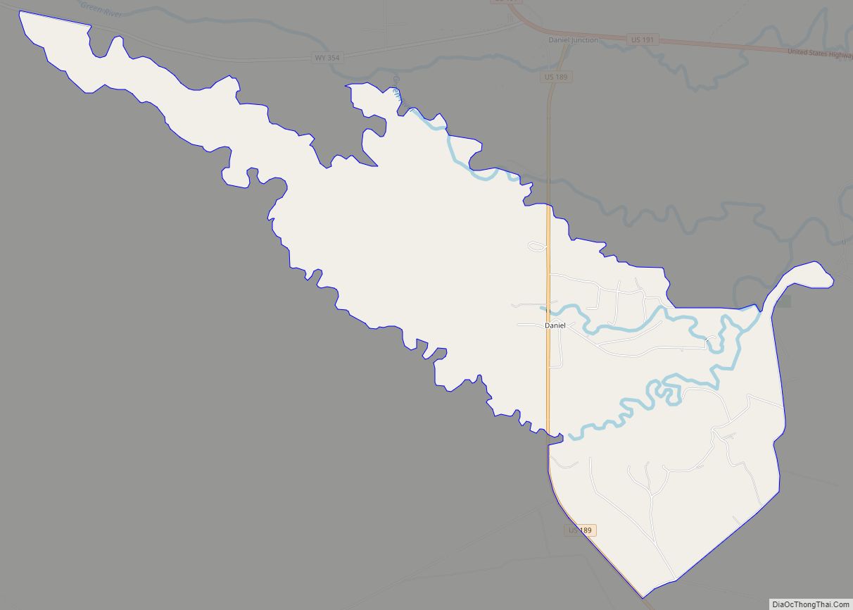
Daniel is a census-designated place in Sublette County, Wyoming, United States. The population was 150 at the 2010 census.
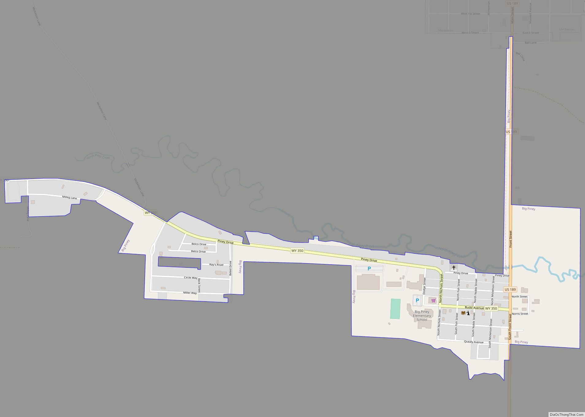
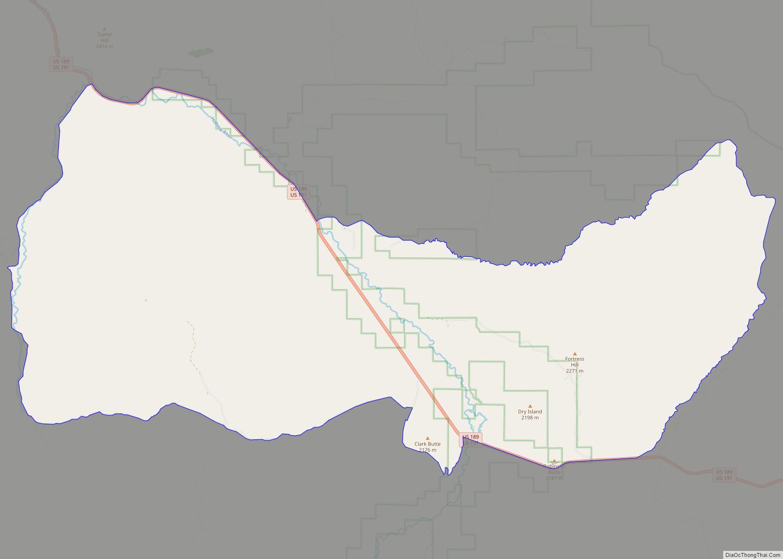
The town lies on U.S. Route 189, in the Green River valley as the water flows out of the Gros Ventre Range to Daniel’s north and the Wind River Mountains to the town’s east. Horse Creek, a Green River tributary that joins just west of Daniel, has its headwaters west in the Salt River Range. Thus bordered on three sides by nearby mountains, Daniel lies in the very northern, highest part of the large basin that defines much of southern Wyoming. Wyoming Highway 354 is a west-east road that intersects US Highways 189 and 191 north of town.
| Name: | Daniel CDP |
|---|---|
| LSAD Code: | 57 |
| LSAD Description: | CDP (suffix) |
| State: | Wyoming |
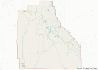
| County: | Sublette County |
| Elevation: | 7,195 ft (2,193 m) |
| Total Area: | 5.1 sq mi (13 km²) |
| Land Area: | 5.1 sq mi (13 km²) |
| Water Area: | 0.0 sq mi (0 km²) |
| Total Population: | 150 |
| Population Density: | 29/sq mi (11/km²) |
| ZIP code: | 83115 |
| Area code: | 307 |
| FIPS code: | 5618950 |
| GNISfeature ID: | 1587343 |
Online Interactive Map
Click on ![]() to view map in "full screen" mode.
to view map in "full screen" mode.
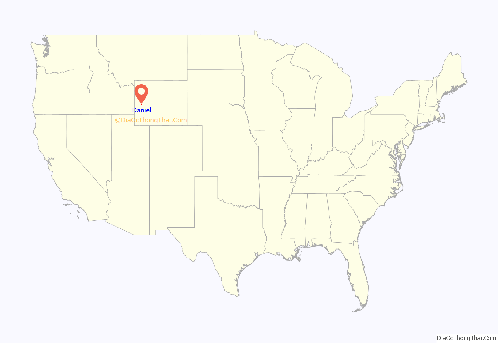
Daniel location map. Where is Daniel CDP?

History
On July 5, 1840, Father Pierre-Jean De Smet offered the first Holy Mass (an important Christian worship ceremony) in Wyoming. A monument to the event stands on its site one mile east of Daniel.
The Rocky Mountain Rendezvous, a gathering of fur trappers and traders, was held in Daniel six times from 1833 to 1840.
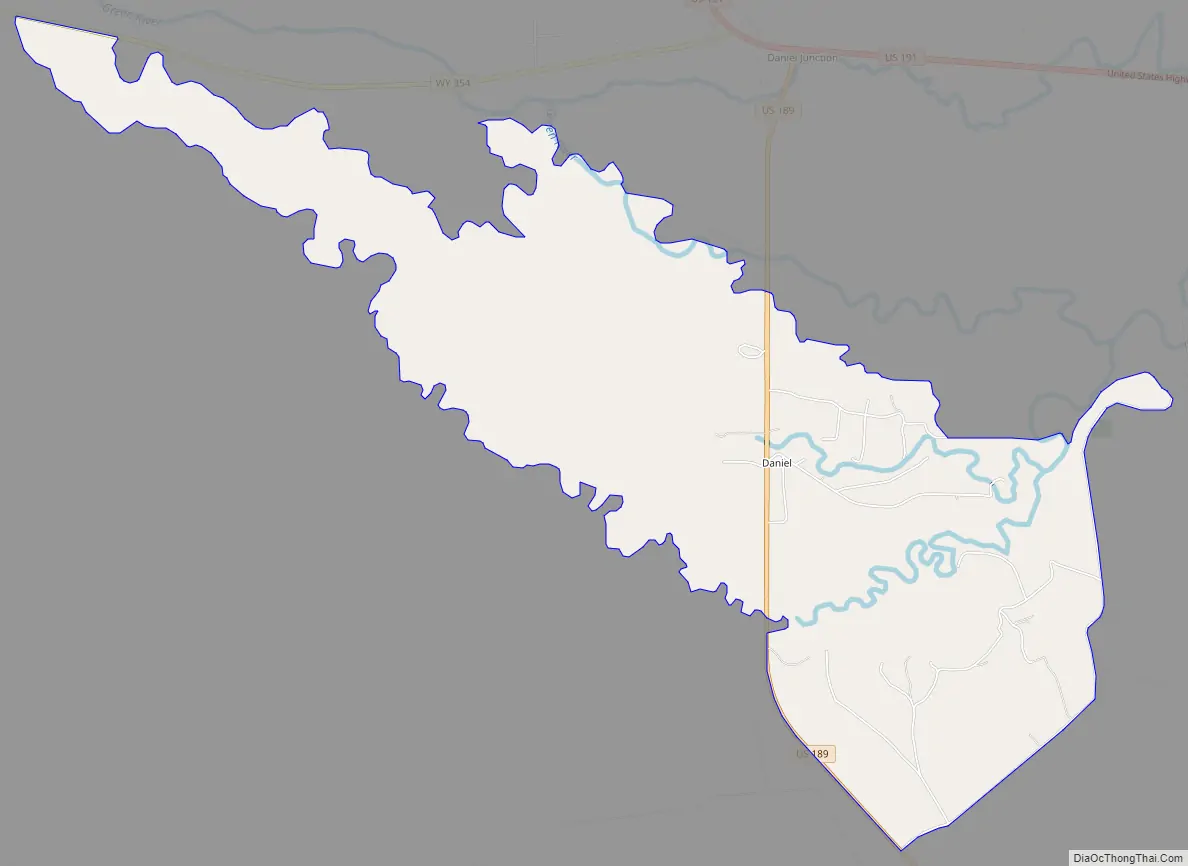
Daniel Road Map
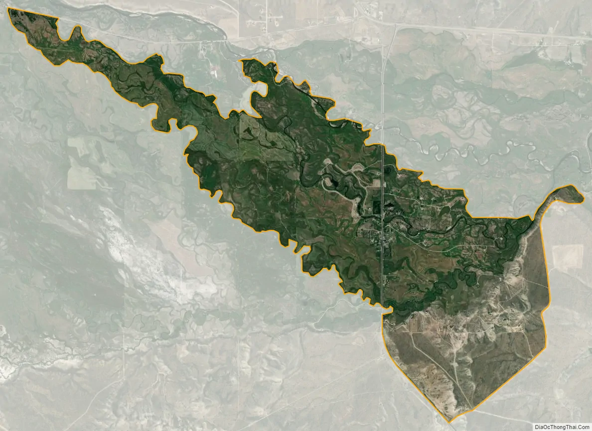
Daniel city Satellite Map
Geography
Daniel is located at 42°51′55″N 110°4′15″W / 42.86528°N 110.07083°W / 42.86528; -110.07083 (42.865172, −110.070921).
According to the United States Census Bureau, the CDP has a total area of 5.1 square miles (13.2 km), all land.
See also
Map of Wyoming State and its subdivision: Map of other states:- Alabama
- Alaska
- Arizona
- Arkansas
- California
- Colorado
- Connecticut
- Delaware
- District of Columbia
- Florida
- Georgia
- Hawaii
- Idaho
- Illinois
- Indiana
- Iowa
- Kansas
- Kentucky
- Louisiana
- Maine
- Maryland
- Massachusetts
- Michigan
- Minnesota
- Mississippi
- Missouri
- Montana
- Nebraska
- Nevada
- New Hampshire
- New Jersey
- New Mexico
- New York
- North Carolina
- North Dakota
- Ohio
- Oklahoma
- Oregon
- Pennsylvania
- Rhode Island
- South Carolina
- South Dakota
- Tennessee
- Texas
- Utah
- Vermont
- Virginia
- Washington
- West Virginia
- Wisconsin
- Wyoming