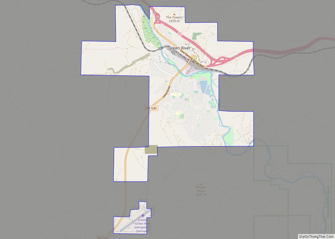
Green River is a city in and the county seat of Sweetwater County, Wyoming, United States, in the southwestern part of the state. The population was 12,515 at the 2010 census.
| Name: | Green River city |
|---|---|
| LSAD Code: | 25 |
| LSAD Description: | city (suffix) |
| State: | Wyoming |
| County: | Sweetwater County |
| Elevation: | 6,115 ft (1,864 m) |
| Total Area: | 14.11 sq mi (36.54 km²) |
| Land Area: | 13.81 sq mi (35.76 km²) |
| Water Area: | 0.30 sq mi (0.78 km²) |
| Total Population: | 12,515 |
| Population Density: | 851.61/sq mi (328.81/km²) |
| ZIP code: | 82935, 82938 |
| Area code: | 307 |
| FIPS code: | 5633740 |
| GNISfeature ID: | 1589126 |
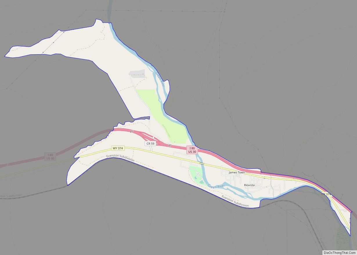
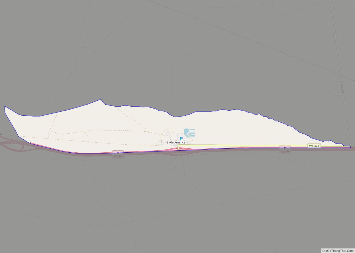
Online Interactive Map
Click on ![]() to view map in "full screen" mode.
to view map in "full screen" mode.
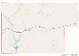
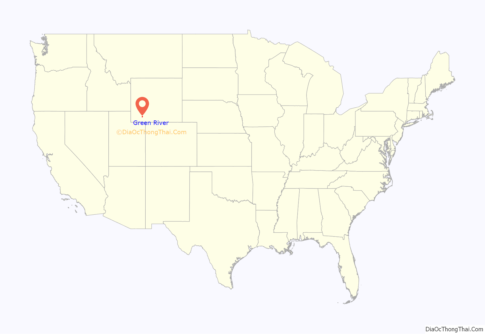
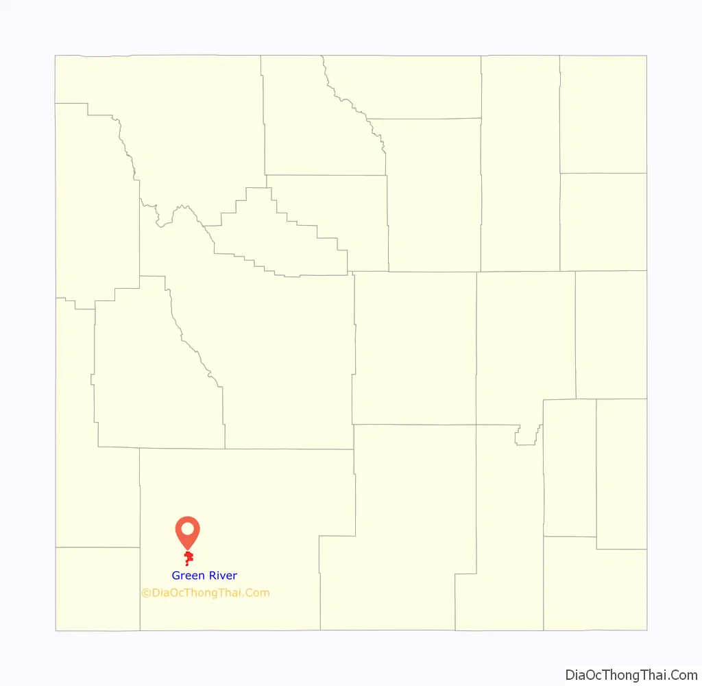
Green River location map. Where is Green River city?
History
The townsite of Green River, Dakota Territory was platted by the Union Pacific Railroad in 1867. Although the Territory of Wyoming was created on July 25, 1868, the Town of Green River was incorporated on August 21,1868 under the laws of the previous Territory of Dakota since the laws of the Wyoming Territory had yet to be written. The Town of Green River was re-incorporated on June 10, 1891 under the laws of the State of Wyoming to remove any ambiguity.
The Union Pacific Railroad reached Green River on October 1, 1868 and was supposed to be the site of a division point for the railroad. Railroad officials were surprised to find that a town of 2000 residents and permanent adobe buildings had been established there, likely requiring costly negotiations for railroad land. They moved the division point 12 miles (19 km) west, creating the town of Bryan, on the Blacks Fork of the Green River. Just when Green River was on the verge of becoming a ghost town, Blacks Fork dried up during a drought and the railroad was forced to move the division point back to Green River to ensure adequate water for its steam locomotives. Bryan became the ghost town.
On May 24, 1869, John Wesley Powell launched the Powell Geographic Expedition from Green River.
On November 16, 1931, the Town of Green River passed the Green River Ordinance that prohibited door-to-door selling. Other towns across the country would adopt the ordinance.
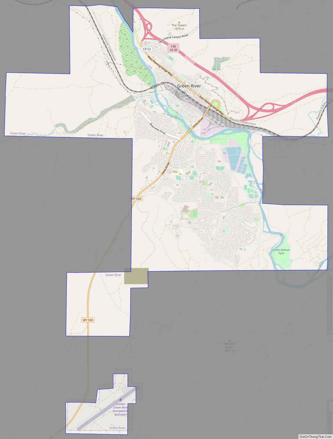
Green River Road Map
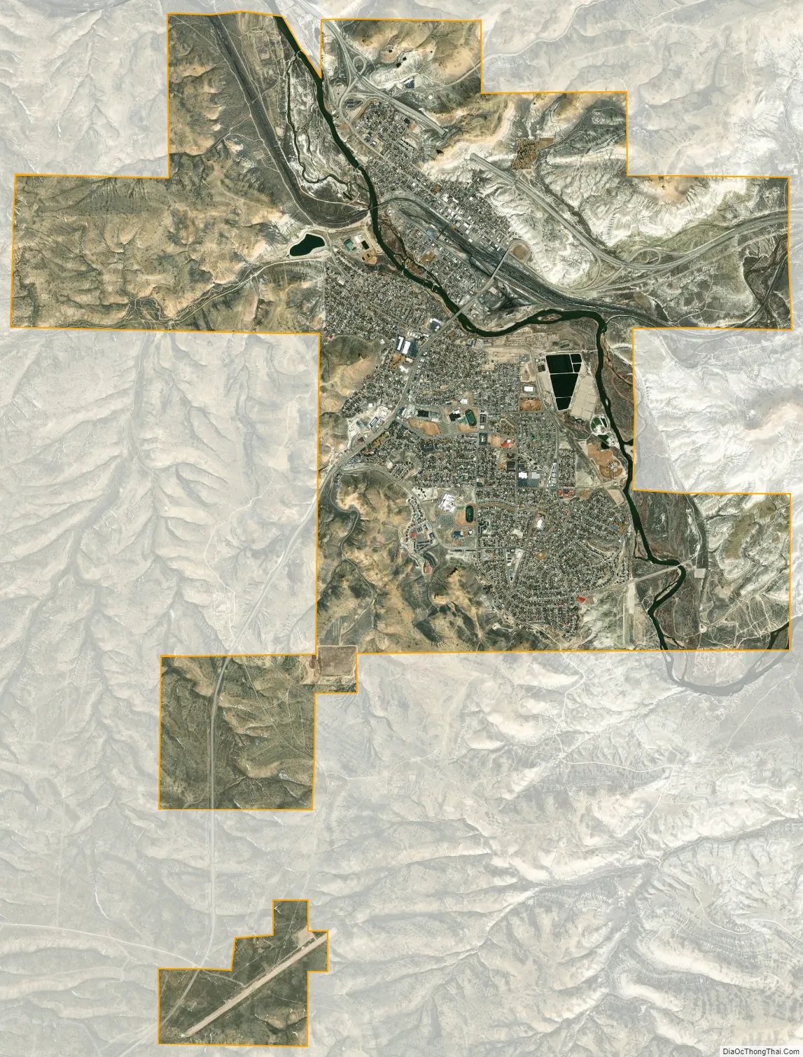
Green River city Satellite Map
Geography
According to the United States Census Bureau, the city has a total area of 14.02 square miles (36.31 km), of which 13.73 square miles (35.56 km) is land and 0.29 square miles (0.75 km) is water.
Climate
According to the Köppen Climate Classification system, Green River has a cold semi-arid climate, abbreviated “BSk” on climate maps. The hottest temperature recorded in Green River was 104 °F (40 °C) on July 8, 1954, while the coldest temperature recorded was −42 °F (−41 °C) on December 31, 1978.
See also
Map of Wyoming State and its subdivision: Map of other states:- Alabama
- Alaska
- Arizona
- Arkansas
- California
- Colorado
- Connecticut
- Delaware
- District of Columbia
- Florida
- Georgia
- Hawaii
- Idaho
- Illinois
- Indiana
- Iowa
- Kansas
- Kentucky
- Louisiana
- Maine
- Maryland
- Massachusetts
- Michigan
- Minnesota
- Mississippi
- Missouri
- Montana
- Nebraska
- Nevada
- New Hampshire
- New Jersey
- New Mexico
- New York
- North Carolina
- North Dakota
- Ohio
- Oklahoma
- Oregon
- Pennsylvania
- Rhode Island
- South Carolina
- South Dakota
- Tennessee
- Texas
- Utah
- Vermont
- Virginia
- Washington
- West Virginia
- Wisconsin
- Wyoming