Wheatland is a town in and the county seat of Platte County in southeastern Wyoming, United States. The population was 3,627 at the 2010 census.
| Name: | Wheatland town |
|---|---|
| LSAD Code: | 43 |
| LSAD Description: | town (suffix) |
| State: | Wyoming |
| County: | Platte County |
| Elevation: | 4,751 ft (1,448 m) |
| Total Area: | 4.10 sq mi (10.61 km²) |
| Land Area: | 4.10 sq mi (10.61 km²) |
| Water Area: | 0.00 sq mi (0.00 km²) |
| Total Population: | 3,627 |
| Population Density: | 844.80/sq mi (326.16/km²) |
| ZIP code: | 82201 |
| Area code: | 307 |
| FIPS code: | 5683040 |
| GNISfeature ID: | 1609173 |
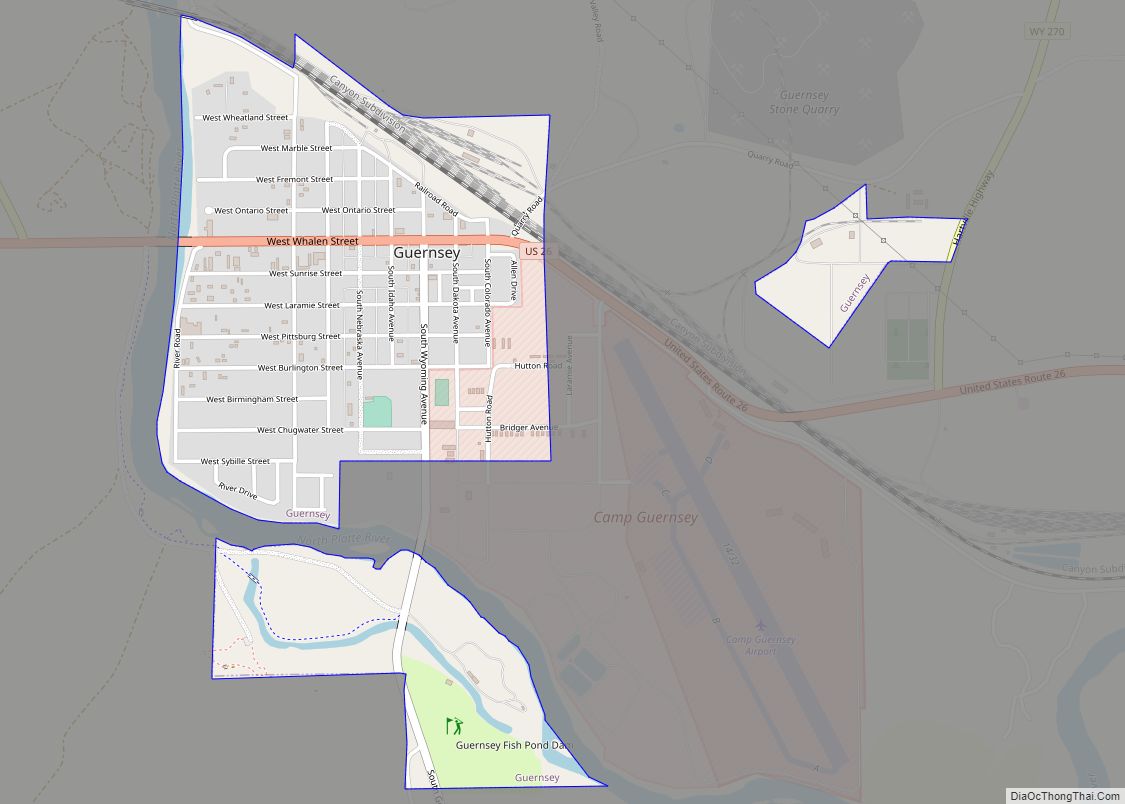
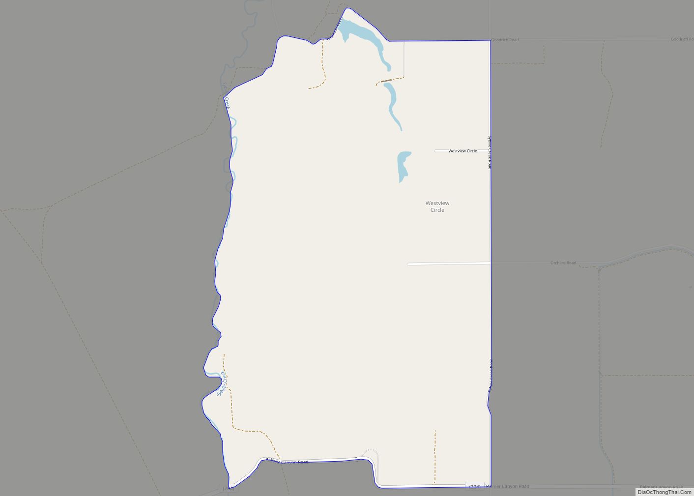
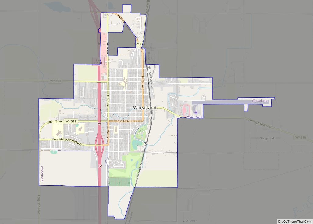
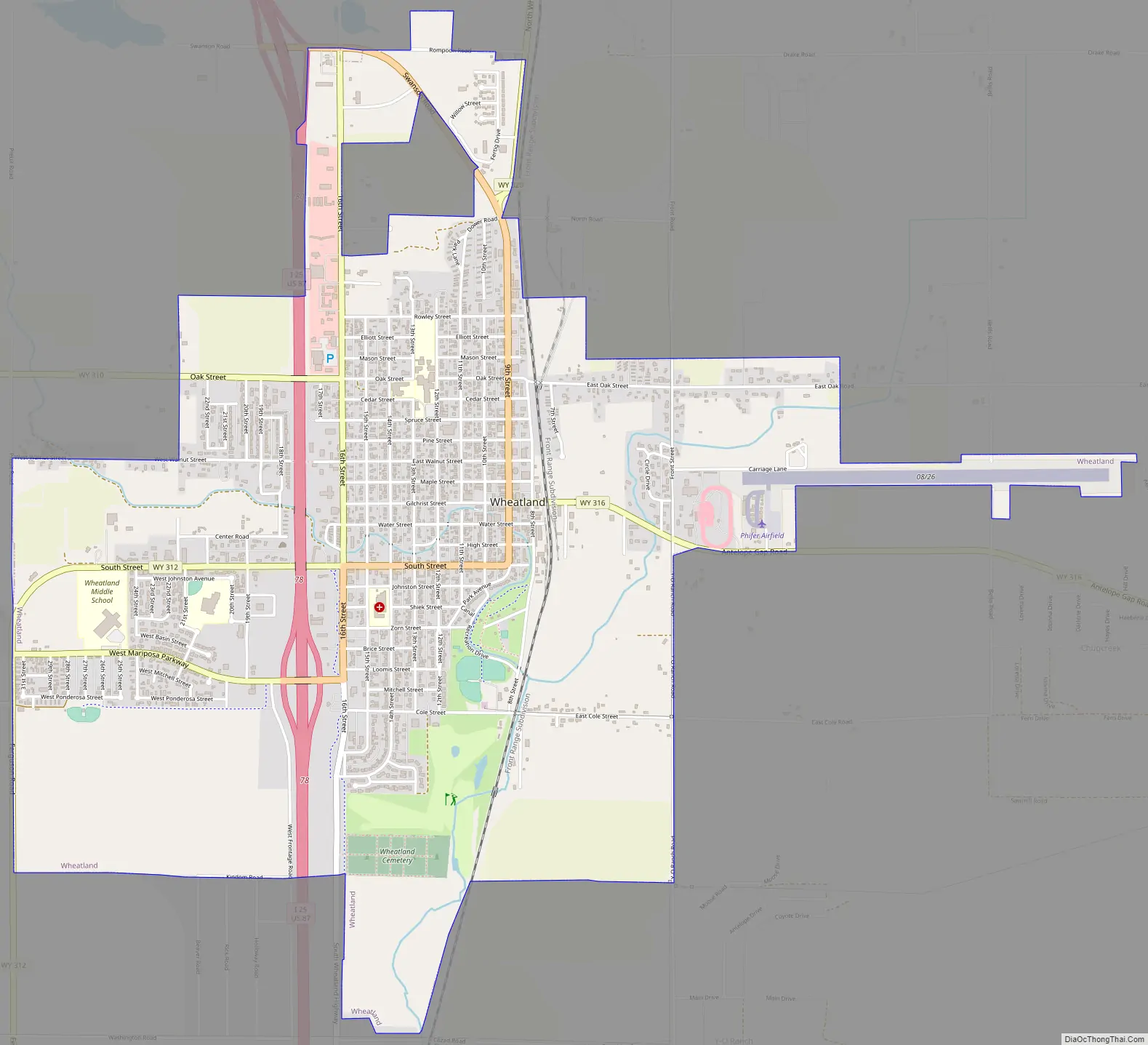
Online Interactive Map
Click on ![]() to view map in "full screen" mode.
to view map in "full screen" mode.
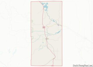
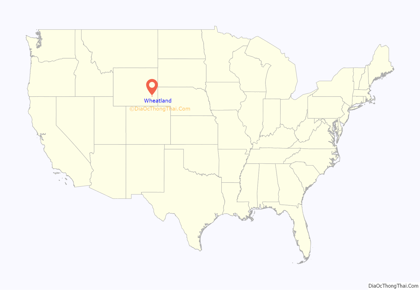
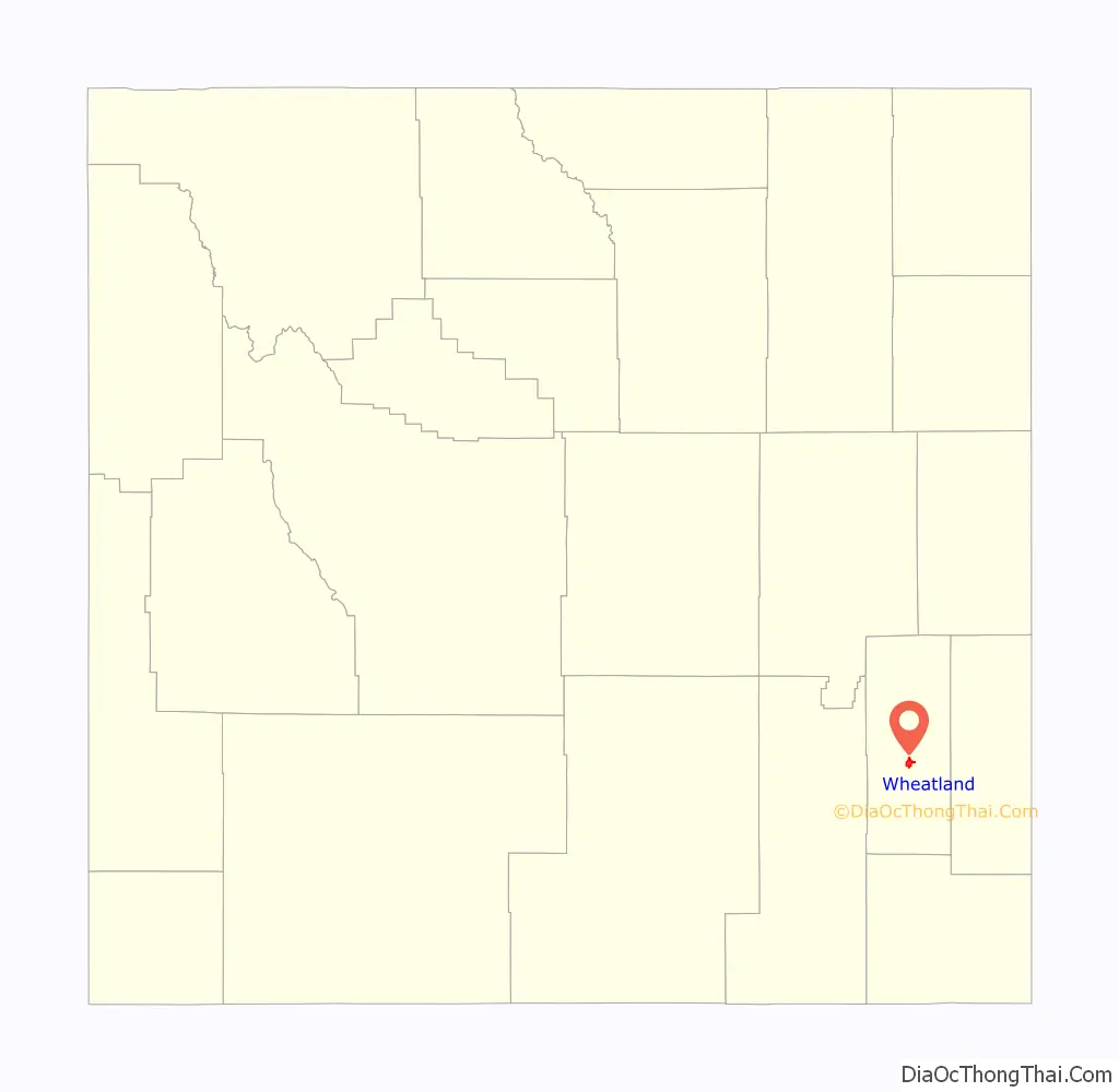
Wheatland location map. Where is Wheatland town?
History
Before the late 19th century, the area around the future site of Wheatland was a flat, arid landscape with desert-like vegetation. In 1883 local rancher and judge Joseph M. Carey, along with Horace Plunkett, John Hoyt, Morton Post, Francis E. Warren, William Irvine, and Andrew Gilchrist, established the Wyoming Development Company. The company hoped to irrigate in the Wheatland Flats and profit from new development.
By the fall of 1883 an irrigation system was constructed on the Wheatland flats including a 2,380 foot long tunnel to divert water for irrigation into Bluegrass Creek and the first two of the system’s canals. The Cheyenne and Northern Railway line reached the Wheatland flats in July, 1887, eventually extending to the Wyoming Central Railway at Wendover. The line was eventually sold to the Colorado and Southern Railway, controlled by the Chicago, Burlington, and Quincy Railroad, and operated at Wheatland station. Lots in the town of Wheatland were auctioned in 1894. By 1915 many farms were established in the irrigation district and the population of the flats was 5,277.
In 1911 Platte County was created from a portion of Albany County, and Wheatland was selected as the county seat. The Platte County Courthouse was built in Wheatland in 1917.
The Wheatland Irrigation District is still the largest privately owned irrigation system in the country.
Wheatland Road Map
Wheatland city Satellite Map

Geography
Wheatland is located at 42°3′14″N 104°57′34″W / 42.05389°N 104.95944°W / 42.05389; -104.95944 (42.053917, –104.959460). According to the United States Census Bureau, the town has a total area of 4.10 square miles (10.62 km), all land.
See also
Map of Wyoming State and its subdivision: Map of other states:- Alabama
- Alaska
- Arizona
- Arkansas
- California
- Colorado
- Connecticut
- Delaware
- District of Columbia
- Florida
- Georgia
- Hawaii
- Idaho
- Illinois
- Indiana
- Iowa
- Kansas
- Kentucky
- Louisiana
- Maine
- Maryland
- Massachusetts
- Michigan
- Minnesota
- Mississippi
- Missouri
- Montana
- Nebraska
- Nevada
- New Hampshire
- New Jersey
- New Mexico
- New York
- North Carolina
- North Dakota
- Ohio
- Oklahoma
- Oregon
- Pennsylvania
- Rhode Island
- South Carolina
- South Dakota
- Tennessee
- Texas
- Utah
- Vermont
- Virginia
- Washington
- West Virginia
- Wisconsin
- Wyoming