Big Horn County is a county in the U.S. state of Wyoming. As of the 2020 United States Census, the population was 11,521. The county seat is Basin. Its north boundary abuts the south boundary of Montana.
| Name: | Big Horn County |
|---|---|
| FIPS code: | 56-003 |
| State: | Wyoming |
| Founded: | March 12, 1890 (authorized) 1897 (organized) |
| Named for: | Bighorn Mountains |
| Seat: | Basin |
| Largest town: | Lovell |
| Total Area: | 3,159 sq mi (8,180 km²) |
| Land Area: | 3,137 sq mi (8,120 km²) |
| Total Population: | 11,521 |
| Population Density: | 3.6/sq mi (1.4/km²) |
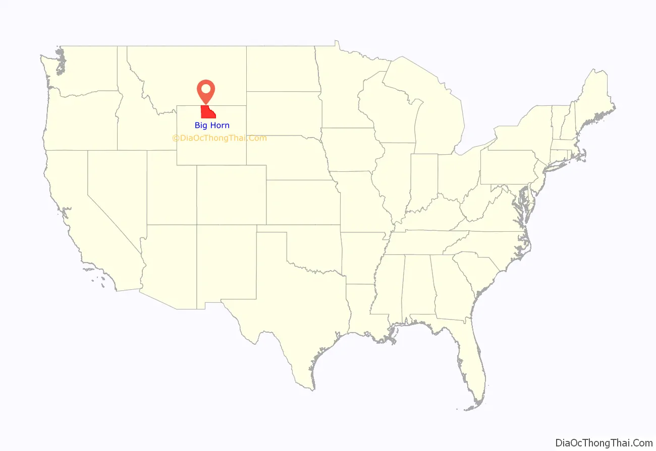
Big Horn County location map. Where is Big Horn County?
History
Big Horn County was created by the legislature of Wyoming Territory in March 1890, and was organized in 1897; its area was annexed from Fremont, Johnson, and Sheridan counties. Big Horn County was named for the Big Horn Mountains which form its eastern boundary. Originally, the county included the entire Big Horn Basin, but in 1909 Park County, WY was created from a portion of Big Horn County, and in 1911 Hot Springs and Washakie counties were created from portions of Big Horn, leaving the county with its present borders. There were large amounts of first generation immigrants from England and Germany living in Big Horn County when World War I broke out in Europe.
The two groups went out of their way to maintain cordial relations with one another, and the county did not see the sorts of anti-German sentiment that was common throughout much of the country. While the English residents were outspokenly pro-British, and many of their Wyoming-born sons went to Canada and joined the Canadian Armed Forces in order to serve in the war on England’s side, they nonetheless made sure that their German co-workers and neighbors were not harassed or discriminated against. In late 1917 one English rancher referred to the effort as making sure that his German neighbor was always “treated like a gentleman.” Another English rancher said that two of his ranch hands were from Germany and he “would hate to see the foolishness of national hatreds inflicted on men as decent as they are.” English residents of Big Horn County went out of their way to make sure that German-born residents did not feel unwelcome. German immigrants and their Wyoming-born children were not “anti-British” though they favored America remaining neutral in the conflict. Before the war the most commonly read works of fiction among German-born residents of Big Horn County were German language translations of British adventure stories including The Four Feathers by A. E. W. Mason as well as Sherlock Holmes stories and The Light That Failed by Rudyard Kipling. Consensus among Big Horn County residents of all backgrounds after the war was that the war had ultimately been a tragedy and a “horrible waste of human life.”
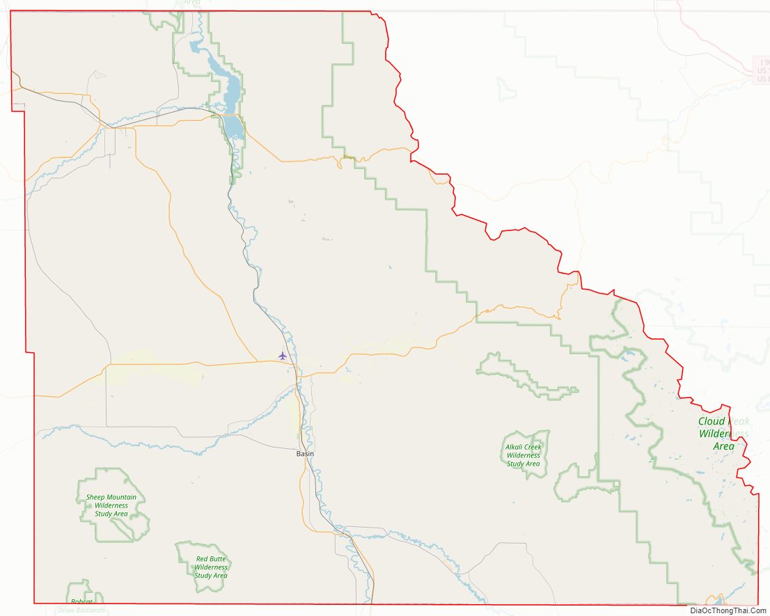
Big Horn County Road Map
Geography
According to the US Census Bureau, the county has a total area of 3,159 square miles (8,180 km), of which 3,137 square miles (8,120 km) is land and 22 square miles (57 km) (0.7%) is water.
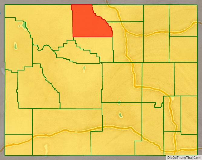
Adjacent counties
- Park County – west
- Carbon County, Montana – northwest
- Big Horn County, Montana – northeast
- Sheridan County – east
- Johnson County – southeast
- Washakie County – south
Big Horn County in Wyoming and Montana are one of ten pairs of counties and parishes in the United States with the same name to border each other across state lines. The others are Sabine (Texas and Louisiana), Union (Arkansas and Louisiana), Bristol (Massachusetts and Rhode Island), Kent (Maryland and Delaware), Escambia (Alabama and Florida), Pike (Illinois and Missouri), Teton (Idaho and Wyoming), Park (Montana and Wyoming), and San Juan (New Mexico and Utah – albeit through a single point, the four corners).
Major highways
- U.S. Highway 14
- U.S. Highway 14A
- U.S. Highway 16
- U.S. Highway 20
- U.S. Highway 310
- Wyoming Highway 30
- Wyoming Highway 31
- Wyoming Highway 32
- Wyoming Highway 114
- Wyoming Highway 37
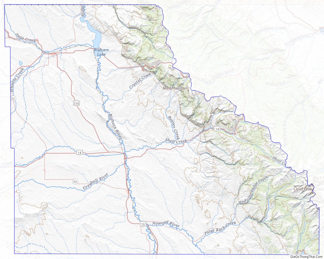
National protected areas
- Bighorn Canyon National Recreation Area (part)
- Bighorn National Forest (part)
Big Horn County Topographic Map
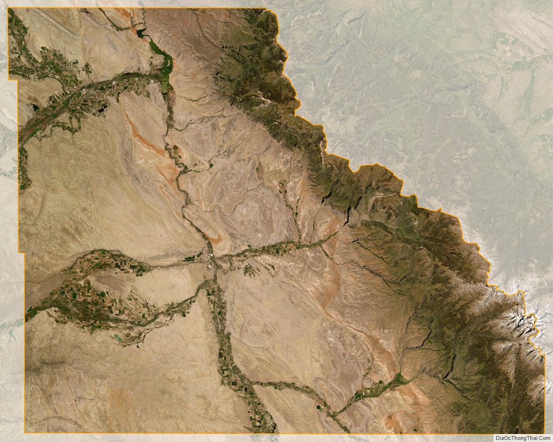
Big Horn County Satellite Map
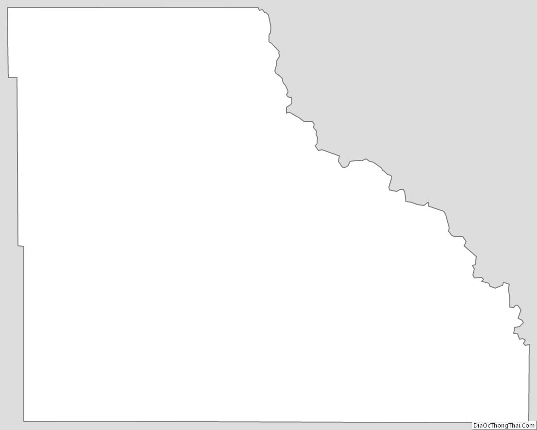
Big Horn County Outline Map
See also
Map of Wyoming State and its subdivision: Map of other states:- Alabama
- Alaska
- Arizona
- Arkansas
- California
- Colorado
- Connecticut
- Delaware
- District of Columbia
- Florida
- Georgia
- Hawaii
- Idaho
- Illinois
- Indiana
- Iowa
- Kansas
- Kentucky
- Louisiana
- Maine
- Maryland
- Massachusetts
- Michigan
- Minnesota
- Mississippi
- Missouri
- Montana
- Nebraska
- Nevada
- New Hampshire
- New Jersey
- New Mexico
- New York
- North Carolina
- North Dakota
- Ohio
- Oklahoma
- Oregon
- Pennsylvania
- Rhode Island
- South Carolina
- South Dakota
- Tennessee
- Texas
- Utah
- Vermont
- Virginia
- Washington
- West Virginia
- Wisconsin
- Wyoming