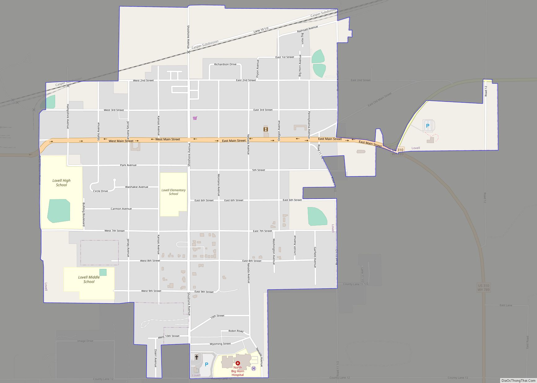
Lovell is the largest town in Big Horn County, Wyoming, United States. The population was 2,360 at the 2010 census.
| Name: | Lovell town |
|---|---|
| LSAD Code: | 43 |
| LSAD Description: | town (suffix) |
| State: | Wyoming |
| County: | Big Horn County |
| Elevation: | 3,832 ft (1,168 m) |
| Total Area: | 1.10 sq mi (2.85 km²) |
| Land Area: | 1.10 sq mi (2.85 km²) |
| Water Area: | 0.00 sq mi (0.00 km²) |
| Total Population: | 2,360 |
| Population Density: | 2,147.01/sq mi (829.09/km²) |
| ZIP code: | 82431 |
| Area code: | 307 |
| FIPS code: | 5647950 |
| GNISfeature ID: | 1591067 |
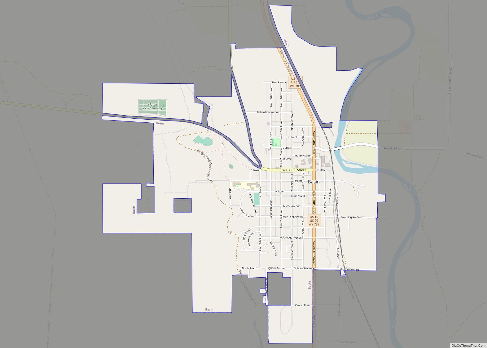
Online Interactive Map
Click on ![]() to view map in "full screen" mode.
to view map in "full screen" mode.
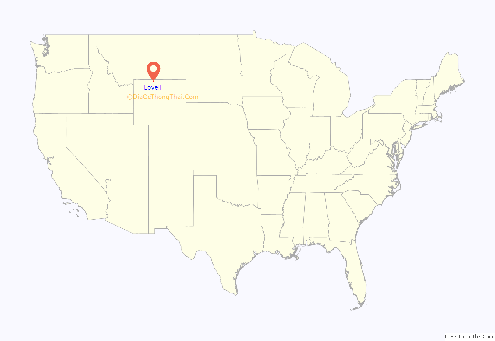
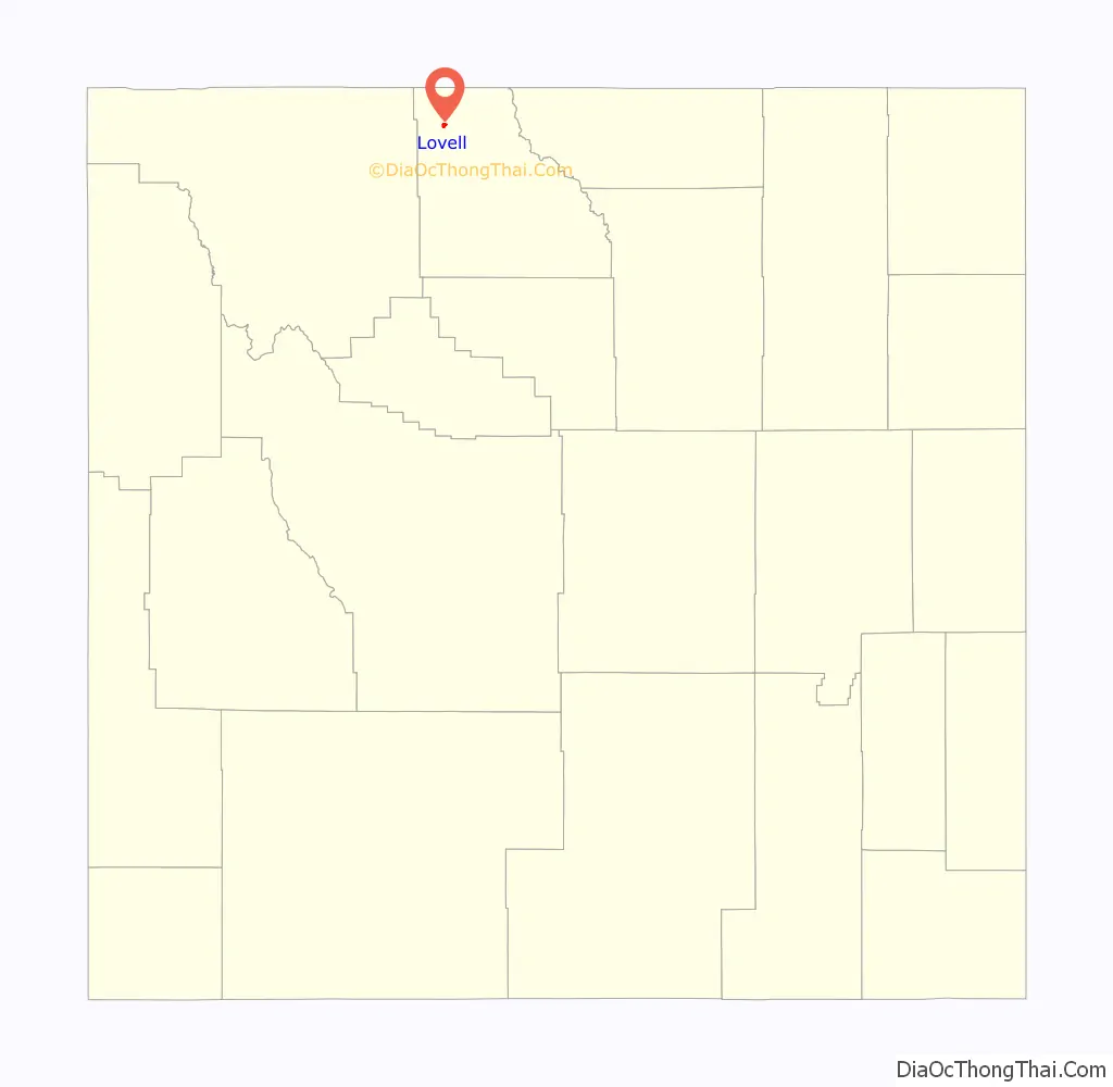
Lovell location map. Where is Lovell town?
History
Lovell was named for Henry Lovell, a local rancher.
Built in 1925, the EJZ Bridge over Shoshone River is listed on the National Register of Historic Places.
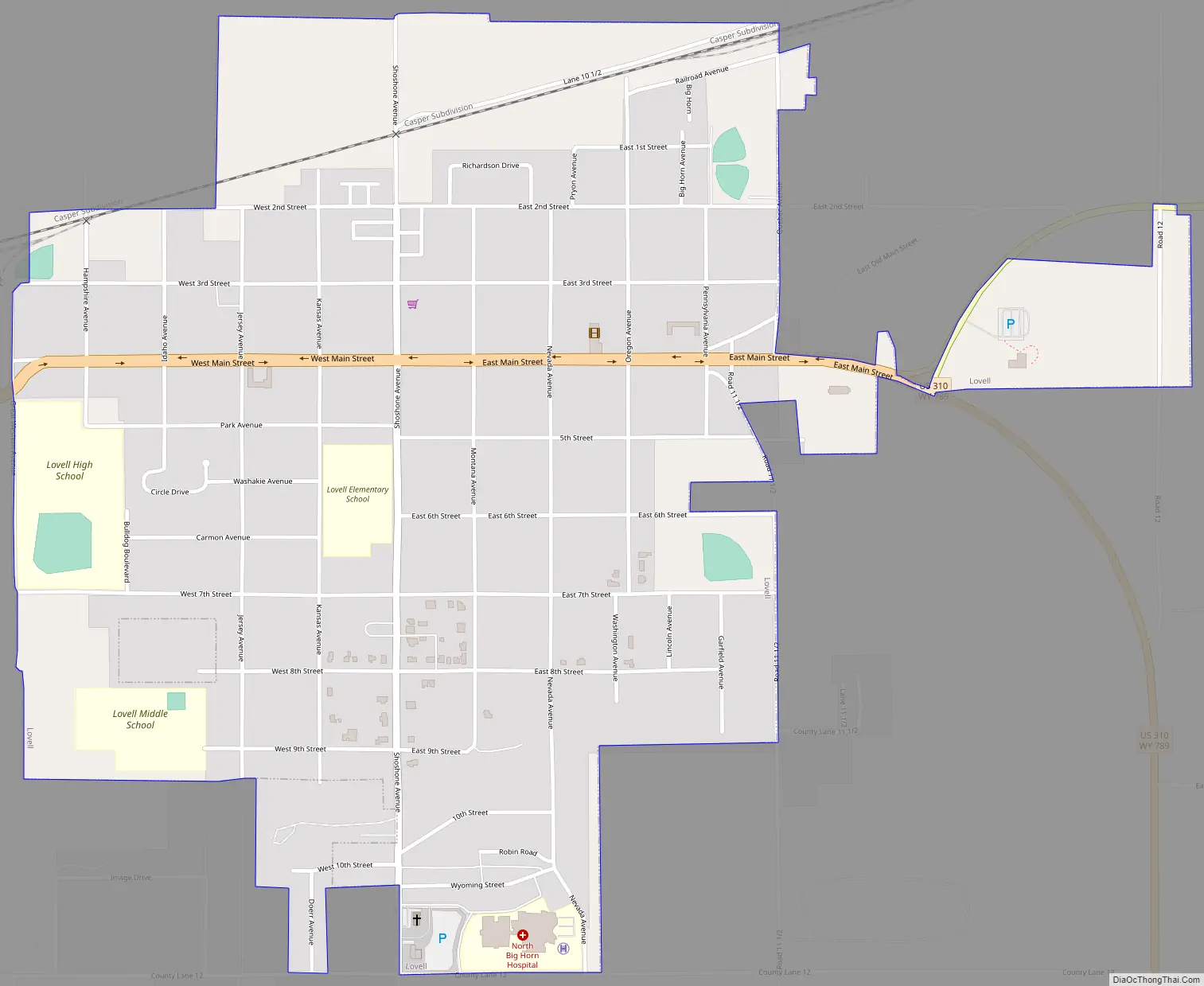
Lovell Road Map
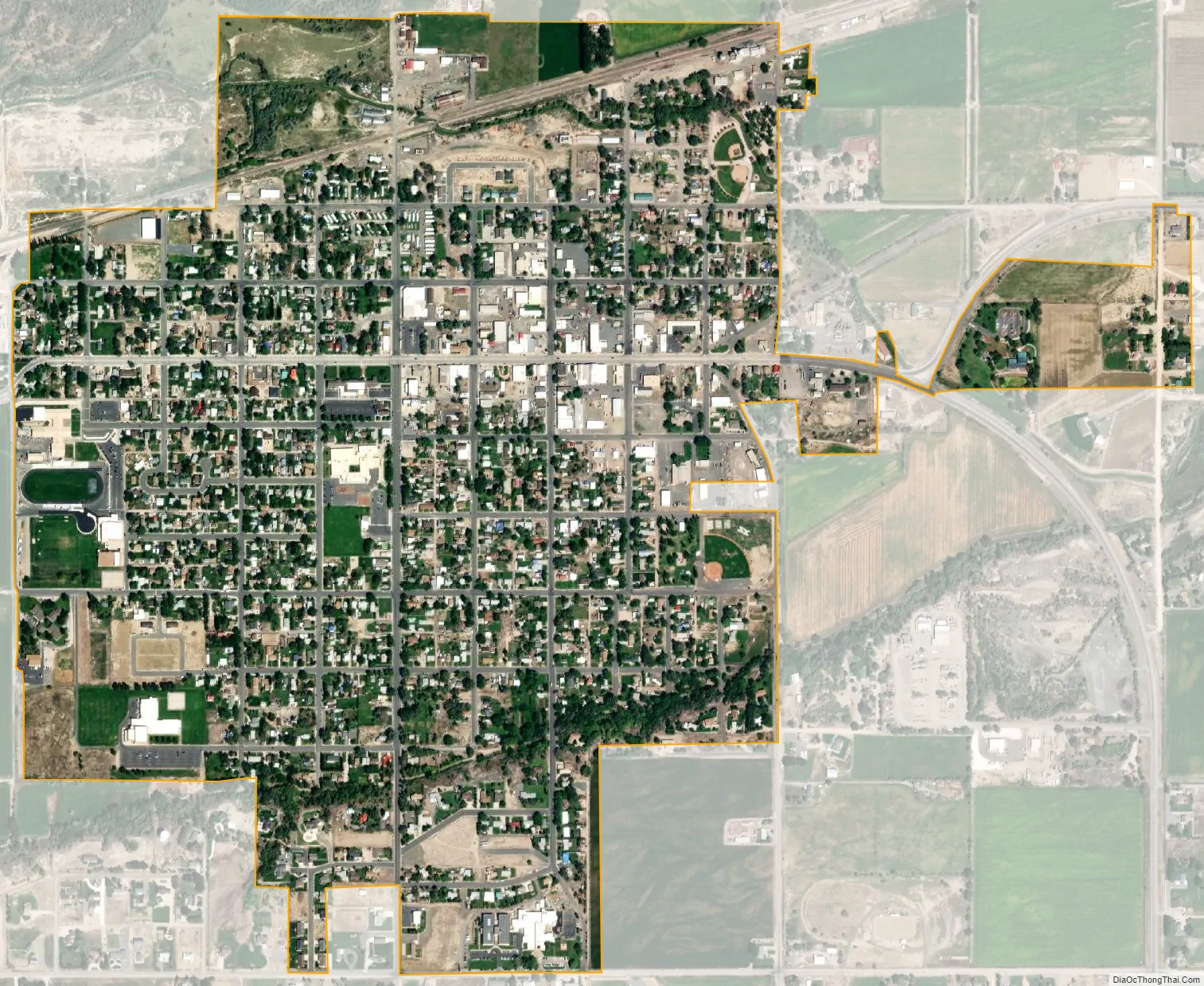
Lovell city Satellite Map
Geography
Lovell is located at 44°50′12″N 108°23′32″W / 44.83667°N 108.39222°W / 44.83667; -108.39222 (44.836787, -108.392180).
According to the United States Census Bureau, the town has a total area of 1.10 square miles (2.85 km), all land.
Climate
According to the Köppen Climate Classification system, Lovell has a cold desert climate, abbreviated BWk on climate maps, although it borders a cold semi-arid climate (BSk). The hottest temperature recorded in Lovell was 111 °F (43.9 °C) on June 29, 1919, while the coldest temperature recorded was −48 °F (−44.4 °C) on February 5, 1899.
See also
Map of Wyoming State and its subdivision: Map of other states:- Alabama
- Alaska
- Arizona
- Arkansas
- California
- Colorado
- Connecticut
- Delaware
- District of Columbia
- Florida
- Georgia
- Hawaii
- Idaho
- Illinois
- Indiana
- Iowa
- Kansas
- Kentucky
- Louisiana
- Maine
- Maryland
- Massachusetts
- Michigan
- Minnesota
- Mississippi
- Missouri
- Montana
- Nebraska
- Nevada
- New Hampshire
- New Jersey
- New Mexico
- New York
- North Carolina
- North Dakota
- Ohio
- Oklahoma
- Oregon
- Pennsylvania
- Rhode Island
- South Carolina
- South Dakota
- Tennessee
- Texas
- Utah
- Vermont
- Virginia
- Washington
- West Virginia
- Wisconsin
- Wyoming