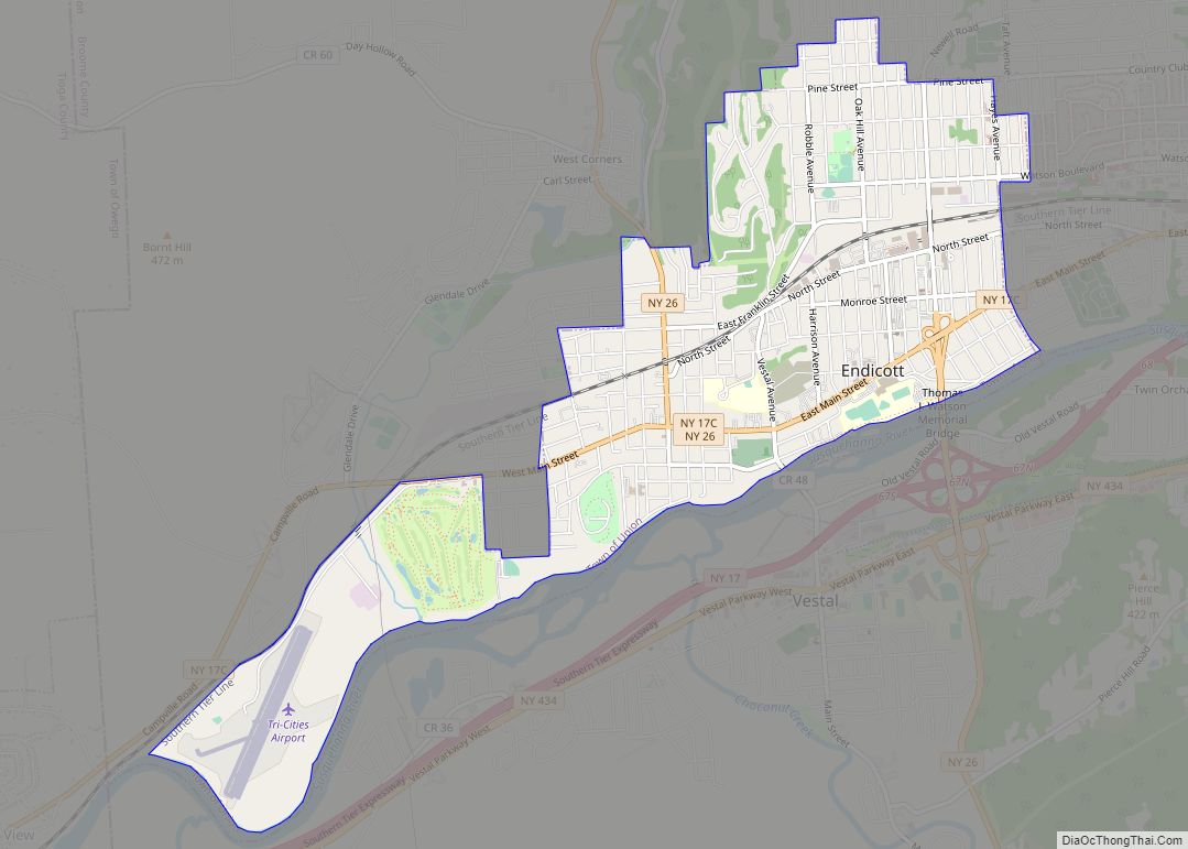
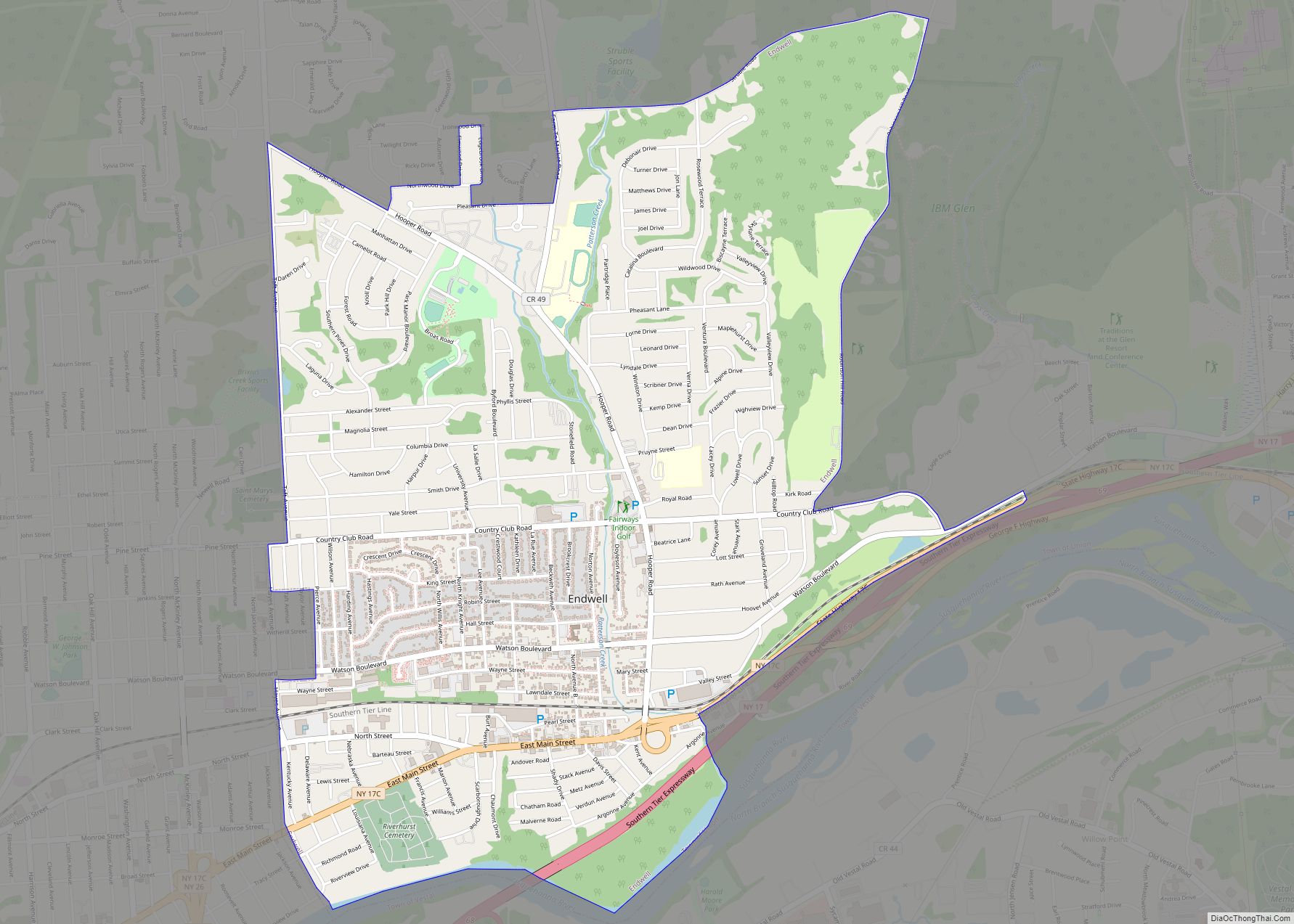
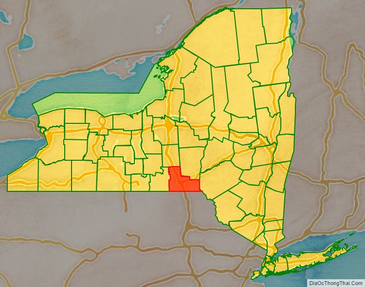
Broome County is a county in the U.S. state of New York. As of the 2020 United States census, the county had a population of 198,683. Its county seat is Binghamton. The county was named for John Broome, the state’s lieutenant governor when Broome County was created.
The county is part of the Binghamton, NY Metropolitan Statistical Area. It is home to Binghamton University, one of four university centers in the State University of New York (SUNY) system.
| Name: | Broome County |
|---|---|
| FIPS code: | 36-007 |
| State: | New York |
| Founded: | 1806 |
| Named for: | John Broome |
| Seat: | Binghamton |
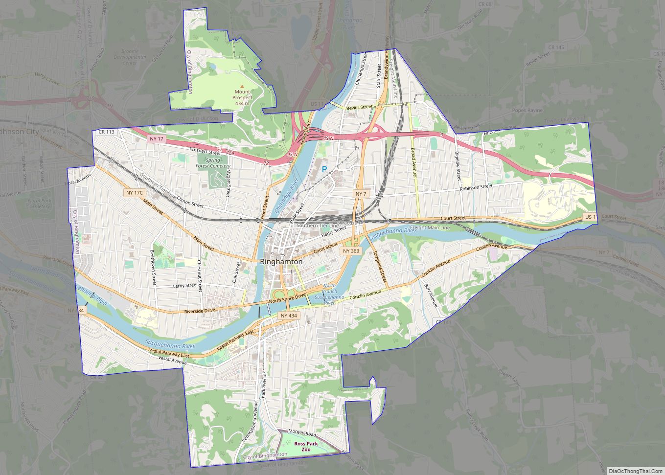
| Largest city: | Binghamton |
| Total Area: | 715.52 sq mi (1,853.2 km²) |
| Land Area: | 705.77 sq mi (1,827.9 km²) |
| Total Population: | 198,683 |
| Population Density: | 281.6/sq mi (108.7/km²) |
| Time zone: | UTC−5 (Eastern) |
| Summer Time Zone (DST): | UTC−4 (EDT) |
| Website: | www.gobroomecounty.com |
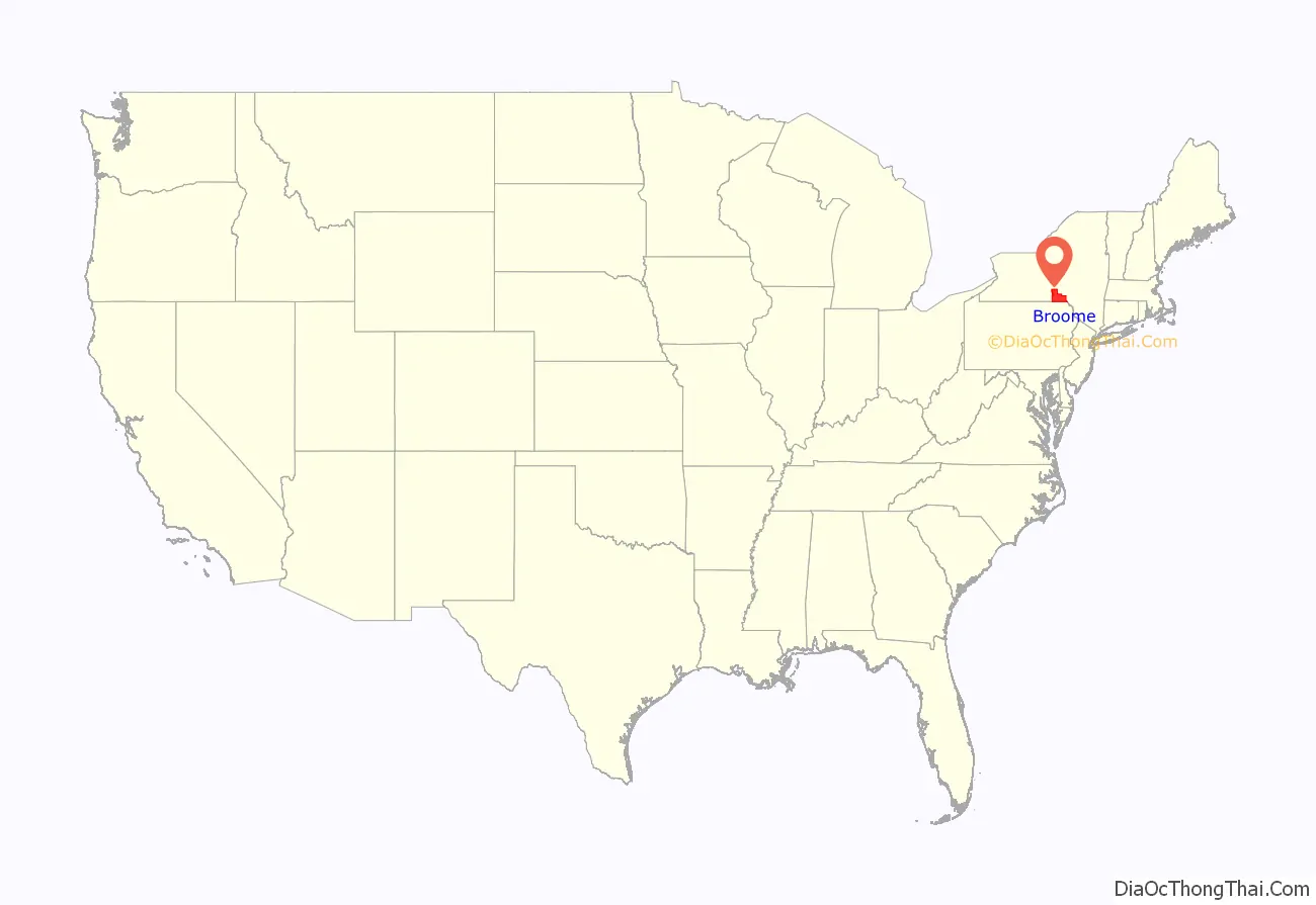
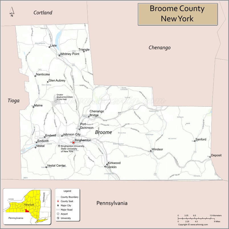
Broome County location map. Where is Broome County?
History
When counties were established in the Province of New York in 1683, the present Broome County was part of the enormous Albany County, including the northern part of New York State as well as all of the present State of Vermont and, in theory, extending westward to the Pacific Ocean. This county was reduced in size on July 3, 1766, by the creation of Cumberland County, and further on March 16, 1770, by the creation of Gloucester County, both containing territory now in Vermont.
On March 12, 1772, what was left of Albany County was split into three parts, one remaining under the name Albany County. One of the other pieces, Tryon County, contained the western portion (and thus, since no western boundary was specified, theoretically still extended west to the Pacific). The eastern boundary of Tryon County was approximately five miles west of the present city of Schenectady, and the county included the western part of the Adirondack Mountains and the area west of the West Branch of the Delaware River. The area then designated as Tryon County now is organized as 37 counties of New York State. The county was named for William Tryon, colonial governor of New York.
In the years prior to 1776, most of the Loyalists in Tryon County fled to Canada. In 1784, following the peace treaty that ended the American Revolutionary War, the name of Tryon County was changed to Montgomery County, for General Richard Montgomery, who had captured several places in Canada and died attempting to capture the city of Quebec, thus replacing the name of the hated British governor.
In 1789, Montgomery County was reduced in size by the splitting off of Ontario County. The actual area split off from Montgomery County was much larger than the present county, also including the present Allegany, Cattaraugus, Chautauqua, Erie, Genesee, Livingston, Monroe, Niagara, Orleans, Steuben, Wyoming, Yates, and part of Schuyler and Wayne Counties.
In 1791, Tioga County split off from Montgomery County, along with Herkimer and Otsego Counties. Tioga County was at this time much larger than the present county and included the present Broome and Chemung Counties and parts of Chenango and Schuyler Counties.
In 1798, Tioga County was reduced in size by the splitting off of Chemung County (which also included part of the present Schuyler County) and by the combination of a portion with a portion of Herkimer County to create Chenango County.
In 1806, the present-day Broome County was split off from Tioga County.
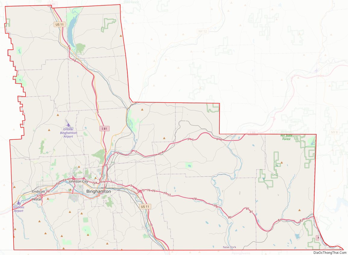
Broome County Road Map
Geography
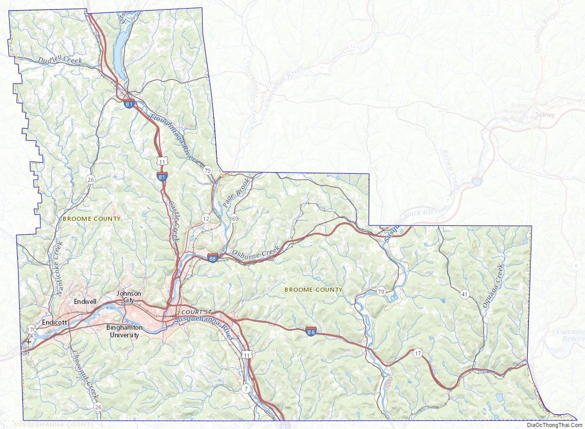
Broome County lies on the southern line of New York. Its southern border abuts the northern boundary of the state of Pennsylvania. The Susquehanna River flows southward through the eastern part of the county, enters Susquehanna County in Pennsylvania, then re-enters Broome and flows northwestward to meet the Chenango River at Binghamton. The combined flow moves west-southwestward into Tioga County to the west. The West Branch Delaware River flows southward along the lower portion of the county’s east border, delineating that portion of the border between Broome and Delaware counties.
The county’s western portion is hilly, with wide valleys that accommodate Binghamton and its suburbs. In the northern portion, Interstate 81 traverses a wide glacial valley. The eastern part of the county is much more rugged, as the land rises to the Catskill Mountains. The terrain generally slopes to the west. The county’s highest point is in the southeast of the county, a U.S. National Geodetic Survey benchmark known as Slawson atop an unnamed hill in the Town of Sanford. It is approximately 2087 feet (636 m) above sea level. An area due east on the Delaware County line in Oquaga Creek State Park also lies within the same elevation contour line. The lowest point is 864 feet (263 m) above sea level, along the Susquehanna River, at the Pennsylvania state line.
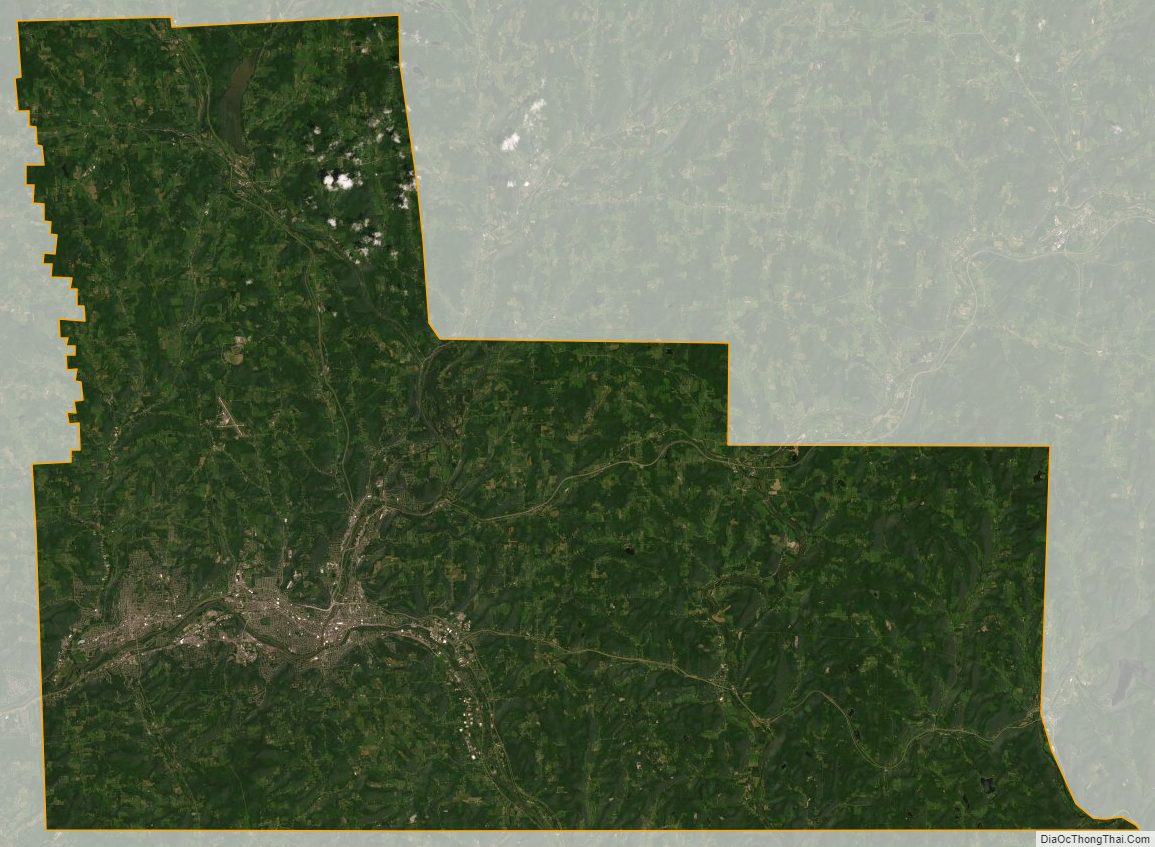
The county has a total area of 716 square miles (1,850 km), of which 706 square miles (1,830 km) is land and 9.7 square miles (25 km) (1.4%) is water.
Adjacent counties
- Chenango County – northeast
- Delaware County – east
- Wayne County, Pennsylvania – southeast
- Susquehanna County, Pennsylvania – south
- Tioga County – west
- Cortland County – northwest
Protected areas
Source:
- Aqua-Terra Wilderness Area
- Beaver Flow State Forest (part)
- Beaver Pond State Forest
- Cascade Valley State Forest
- Cat Hollow State Forest
- Chenango Valley State Park
- Dorchester County Park
- Greenwood County Park (part)
- Hawkins Pond State Forest
- Marsh Pond State Forest
- Nathaniel Cole County Park
- Oquaga Creek State Park (part)
- Skyline Drive State Forest
- Triangle State Forest
- Whitney Point Multiple Use Area (part)
- Whittacker Swamp State Forest
Lakes
Source:
- Agwaterra Pond
- Blueberry Lake
- Chenango Lake
- Deer Lake
- Fly Pond
- Hawkins Pond
- Hust Pond
- Laurel Lake
- Lily Lake
- Nanticoke Lake
- Oquaga Lake
- Otselic River
- Potato Creek
- Sky Lake
- Summit Lake
Major highways
- I-81
- I-86 / NY 17 / Southern Tier Expressway/Quickway
- I-88
- US 11
- NY 7
- NY 7A
- NY 7B
- NY 12
- NY 12A
- NY 17C
- NY 26
- NY 38B
- NY 41
- NY 79
- NY 206
- NY 235
- NY 363
- NY 369
- NY 434
Broome County Topographic Map
Broome County Satellite Map
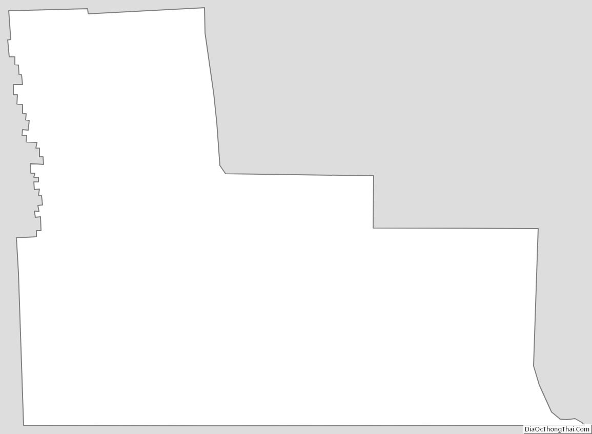
Broome County Outline Map