Seneca County is located in the U.S. state of New York. As of the 2020 census, the population was 33,814. The primary county seat is Waterloo, moved there from the original county seat of Ovid in 1819. It became a two-shire county in 1822, which currently remains in effect and uses both locations as county seats although the majority of Seneca County administrative offices are located in Waterloo. Therefore, most political sources list only Waterloo as the county seat. The county’s name comes from the Seneca Nation of the Haudenosaunee (Iroquois), who occupied part of the region.
Seneca County comprises the Seneca Falls, NY Micropolitan Statistical Area, which is also included in the Rochester–Batavia-Seneca Falls, NY Combined Statistical Area.
| Name: | Seneca County |
|---|---|
| FIPS code: | 36-099 |
| State: | New York |
| Founded: | 1804 |
| Named for: | Seneca people |
| Seat: | Waterloo and Ovid |
| Total Area: | 390 sq mi (1,000 km²) |
| Land Area: | 324 sq mi (840 km²) |
| Total Population: | 33,814 |
| Population Density: | 104.5/sq mi (40.3/km²) |
| Time zone: | UTC−5 (Eastern) |
| Summer Time Zone (DST): | UTC−4 (EDT) |
| Website: | www.co.seneca.ny.us |
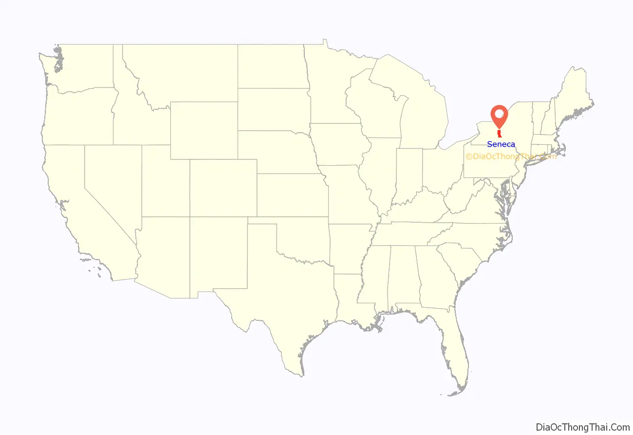
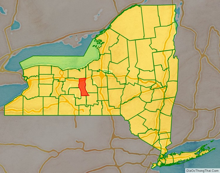
Seneca County location map. Where is Seneca County?
History
The area covered by Seneca County straddles the prehistoric territories of both Seneca and Cayuga Nations of the Haudenosaunee. When counties were established by Europeans in New York in 1683, the present-day Seneca County was part of Albany County. This was an enormous county, including the northern part of New York as well as all of the present state of Vermont and, in theory, extending westward to the Pacific Ocean. This county was reduced in size on July 3, 1766, by the creation of Cumberland County, and further on March 16, 1770, by the creation of Gloucester County, both containing territory now in Vermont.
On March 12, 1772, what was left of Albany County was split into three parts, one remaining under the name Albany County. One of the other pieces, Tryon County, contained the western portion (and thus, since no western boundary was specified, theoretically still extended west to the Pacific). The eastern boundary of Tryon County was approximately five miles west of the present city of Schenectady, and the county included the western part of the Adirondack Mountains and the area west of the West Branch of the Delaware River. The area then designated as Tryon County now includes 37 counties of New York State. The county was named for William Tryon, colonial governor of New York.
In the years prior to 1776, most of the Loyalists in Tryon County fled to Canada. In the fall of 1779 on orders from commander-in-chief General George Washington the Sullivan Expedition conducted a scorched earth campaign against the Iroquois who sided with the Loyalists in the Revolutionary War. Sullivan’s path destroyed Cayuga and Seneca villages along the east shore of Seneca Lake.
In 1784, following the peace treaty that ended the American Revolutionary War, the name of Tryon County was changed to Montgomery County in honor of the general, Richard Montgomery, who had captured several places in Canada and died attempting to capture the city of Quebec, replacing the name of the hated British governor.
In 1789, Montgomery County was reduced in size by the splitting off of Ontario County. The actual area split off from Montgomery County was much larger than the present Ontario County, also including the present Allegany, Cattaraugus, Chautauqua, Erie, Genesee, Livingston, Monroe, Niagara, Orleans, Steuben, Wyoming, Yates, and parts of Schuyler and Wayne counties.
Herkimer County was one of three counties split off from Montgomery County (the others being Otsego and Tioga counties) in 1791.
Onondaga County was formed in 1794 by the splitting of Herkimer County.
Cayuga County was formed in 1799 by the splitting of Onondaga County. This county was, however, much larger than the present Cayuga County. It then included the present Seneca and Tompkins counties and part of Wayne County.
In 1804, Seneca County was formed by the splitting of Cayuga County.
In 1817, Seneca County was reduced in size by combining portions of Seneca and the remainder of Cayuga County to form Tompkins County. Part of this territory, the current towns of Covert and Lodi, were returned to Seneca County in 1819.
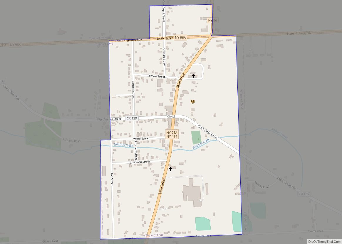
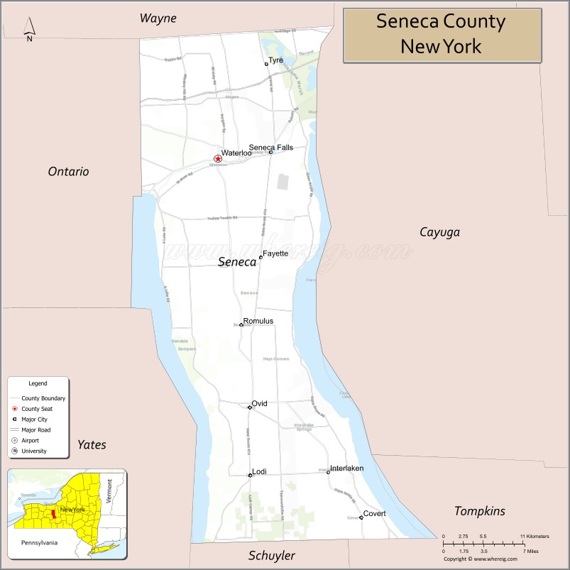
The original county seat of Seneca County was located in Ovid, where a court house was constructed in 1806. After southern portions of the county were removed in 1817 to become part of Tompkins County, the seat was moved to Waterloo as the village was more geographically centered at the time. In 1823, northern portions of the county were removed to form part of Wayne County. This put Waterloo in the same situation as Ovid with being on one end of Seneca County. A compromise was made to use both locations as county seats, becoming a two-shire county. It included the constitution of two county courts and jury districts under Chapter 137 of the New York State Laws of 1822. In 1895, the Seneca County Board of Supervisors voted to abolish the setup of two jury districts. It later voted to remove the two-shire county system in 1921, making Waterloo the only county seat, but was reinstated two years later. At least once a year, the County Board of Supervisors holds its monthly meeting in Ovid to maintain the two-shire status.
In 1823, Seneca County was reduced in size by combining portions of Seneca and Ontario counties to form Wayne County.
Seneca County Road Map
Geography
According to the U.S. Census Bureau, the county has a total area of 390 square miles (1,000 km), of which 324 square miles (840 km) is land and 67 square miles (170 km) (17%) is water.
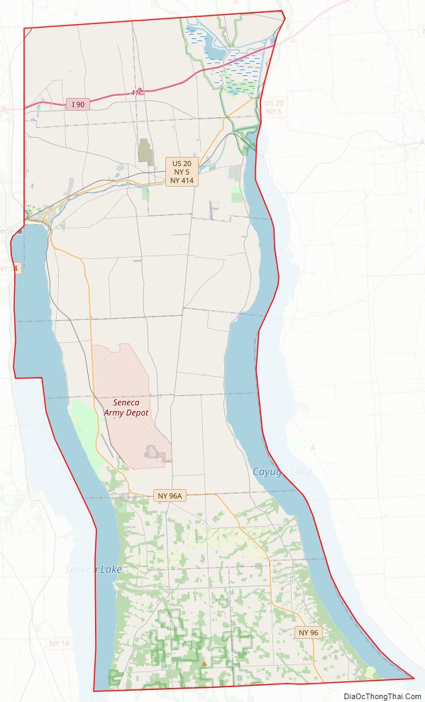
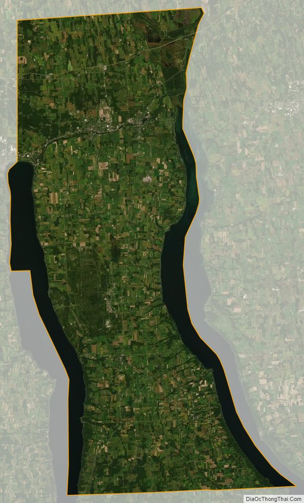
Seneca County is in the western part of New York in the Finger Lakes Region, bounded on the east by Cayuga Lake and on the west by Seneca Lake.
The Finger Lakes National Forest is in the south part of the county.
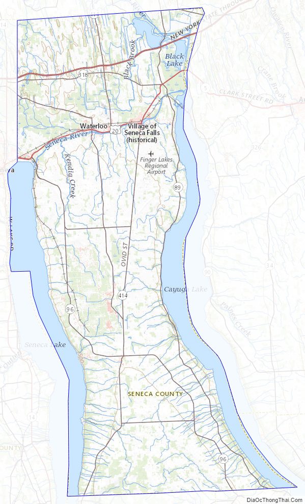
Both the New York State Thruway and the Erie Canal cross the northern part of the county.
The former Seneca Army Depot occupies a portion of land between Cayuga and Seneca Lakes. The former Willard Drug Treatment Center and Five Points Correctional Facility are two New York State prisons located in the county. Sampson State Park is located next to the former Army base.
Adjacent counties
- Wayne County – north
- Cayuga County – east
- Tompkins County – southeast
- Schuyler County – south
- Yates County – southwest
- Ontario County – west
Major highways
- Interstate 90 (New York State Thruway)
- U.S. Route 20
- New York State Route 5
- New York State Route 89
- New York State Route 96
- New York State Route 96A
- New York State Route 414
- New York State Route 336
National protected areas
- Finger Lakes National Forest (part)
- Montezuma National Wildlife Refuge (part)
- Women’s Rights National Historical Park
Seneca County Topographic Map
Seneca County Satellite Map
Seneca County Outline Map