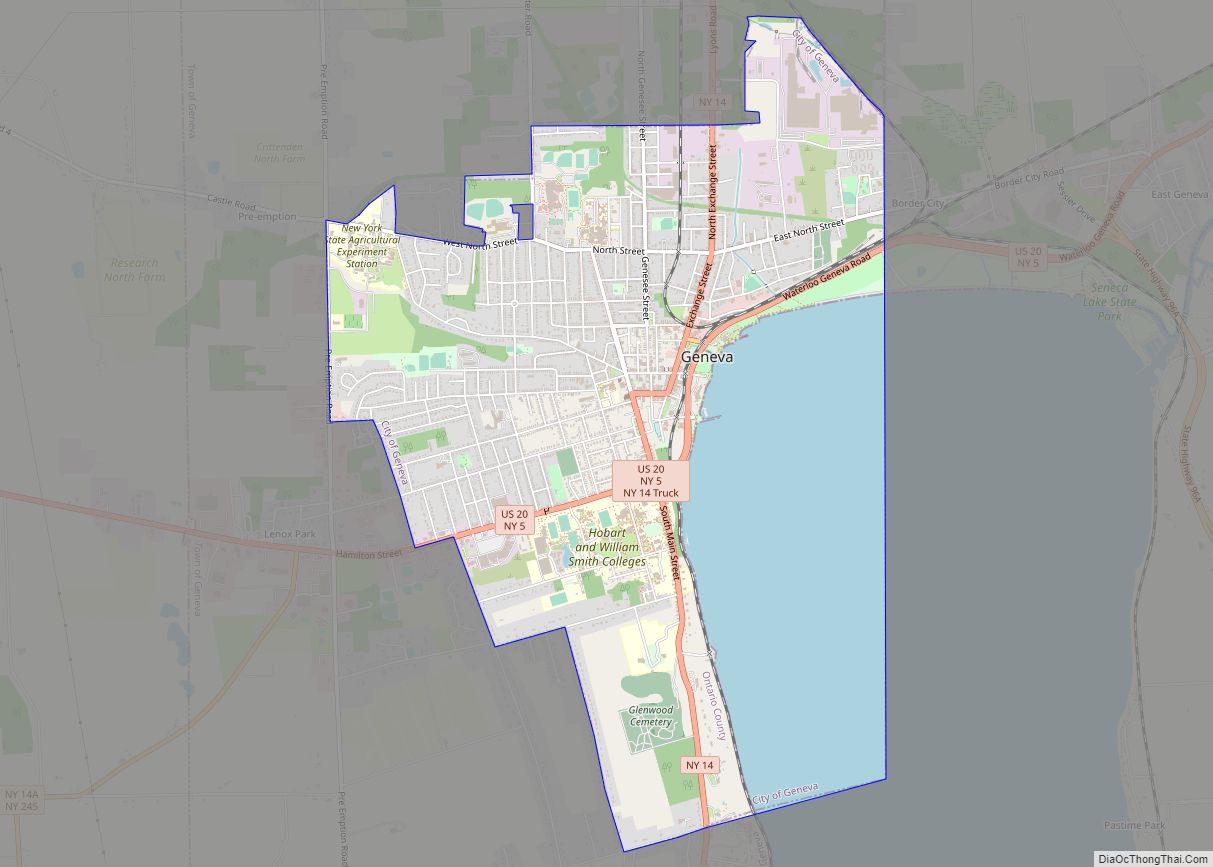
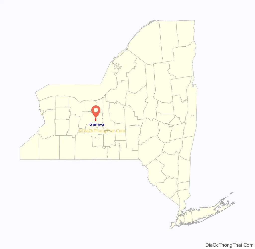
Geneva is a city in Ontario and Seneca counties in the U.S. state of New York. It is at the northern end of Seneca Lake; all land portions of the city are within Ontario County; the water portions are in Seneca County. The population was 13,261 at the 2010 census. The city is supposedly named after the city and canton of Geneva in Switzerland. The main settlement of the Seneca was spelled Zoneshio by early white settlers, and was described as being two miles north of Seneca Lake.
The city borders, and was once part of, the town of Geneva. The city identifies as the “Lake Trout Capital of the World.”
| Name: | Geneva city |
|---|---|
| LSAD Code: | 25 |
| LSAD Description: | city (suffix) |
| State: | New York |
| County: | Ontario County, Seneca County |
| Total Area: | 5.85 sq mi (15.14 km²) |
| Land Area: | 4.21 sq mi (10.91 km²) |
| Water Area: | 1.63 sq mi (4.23 km²) |
| Total Population: | 12,812 |
| Population Density: | 3,040.34/sq mi (1,173.84/km²) |
| ZIP code: | 14456 |
| Area code: | 315 and 585 |
| FIPS code: | 3628640 |
| GNISfeature ID: | 0978993 |
| Website: | http://www.geneva.ny.us |
Online Interactive Map
Click on ![]() to view map in "full screen" mode.
to view map in "full screen" mode.
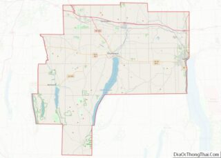
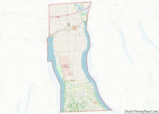
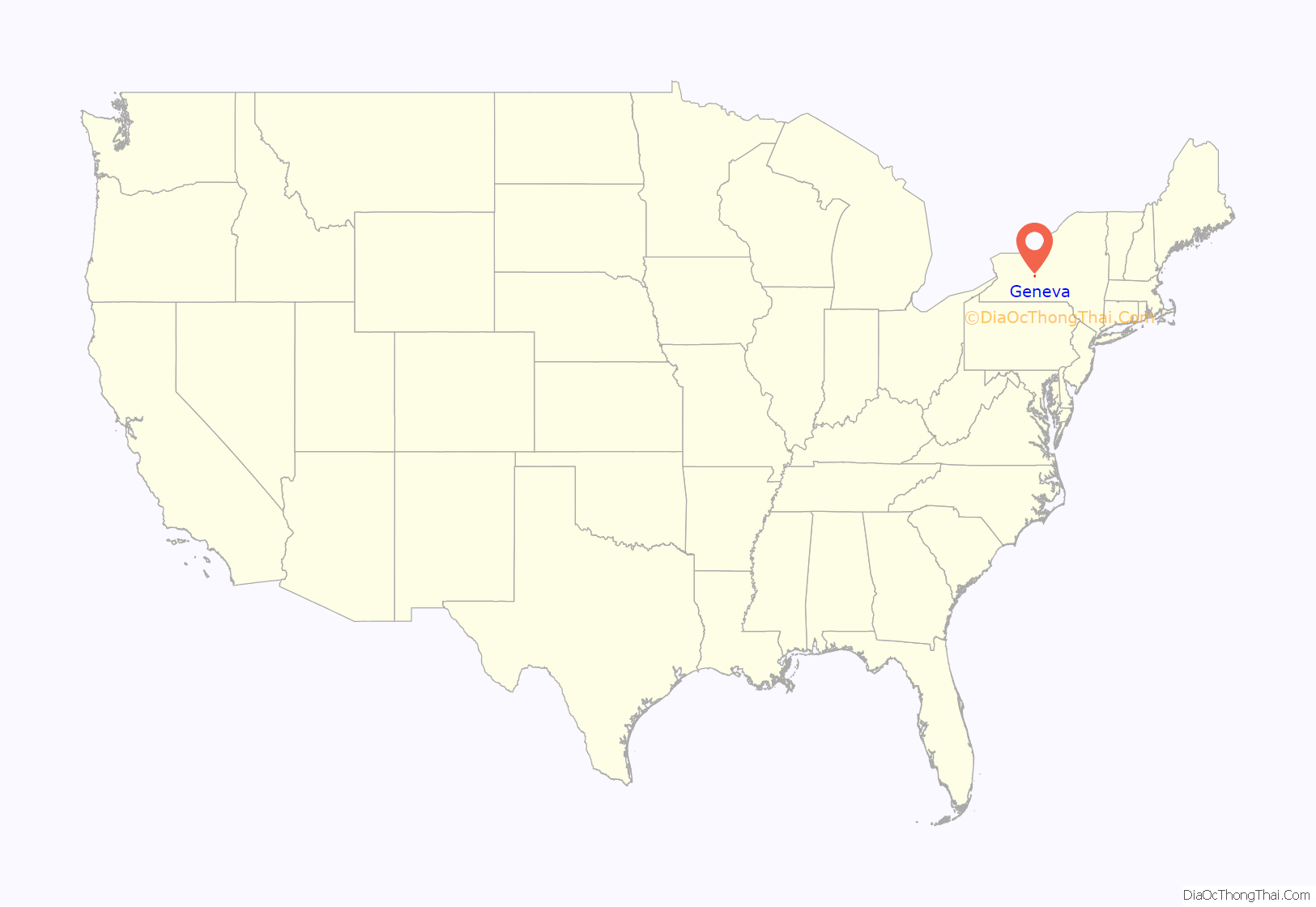
Geneva location map. Where is Geneva city?
History
The area was long occupied by the Seneca tribe, which had established a major village of Kanadaseaga here by 1687. The British helped fortify the village against the French of Canada during the Seven Years’ War (locally known as the French and Indian War); later they added defensive fortifications against the Americans during the Revolutionary War. During the latter warfare, the punitive Sullivan Expedition of 1779 mounted by rebel forces destroyed many of the dwellings, as well as the winter stores of the people, and they abandoned the ruins. Following the war and the forced removal of the Seneca from their native land, European-Americans settled here about 1793. They developed a town encouraged by the Pulteney Association, which owned the land and was selling plots.
At the end of the Revolutionary War, Lt. Col. Seth Reed (né Read), who had fought at Bunker Hill, was one of many pioneers who moved from Massachusetts into Ontario County. By trade with the Seneca, he bought a tract of land eighteen miles in extent. (This was illegal, as only the US government was authorized to make land deals with the Native Americans.) This occurred in 1787, while his wife Hannah stayed in Uxbridge, Massachusetts with their family. “Seth Read moved his wife Hannah and their family to Geneva, Ontario County, New York in the winter of 1790″.
The settlement at Geneva was not yet permanent; the European Americans continued to harass the Seneca on the frontier. In 1795 Read and his family removed to Erie, Pennsylvania, where they became the earliest European-American settlers.
The “Village of Geneva” was incorporated in 1806, formally separating it from the surrounding area of Geneva Town. Later the village became a city through a 1871 charter.
In the 1830s, a government surveyor named John Brink named both Geneva Lake and Lake Geneva in Wisconsin after Geneva, New York. Geneva, Nebraska, founded in 1871, is considered to have been named after the one in New York, rather than directly for the Swiss city.
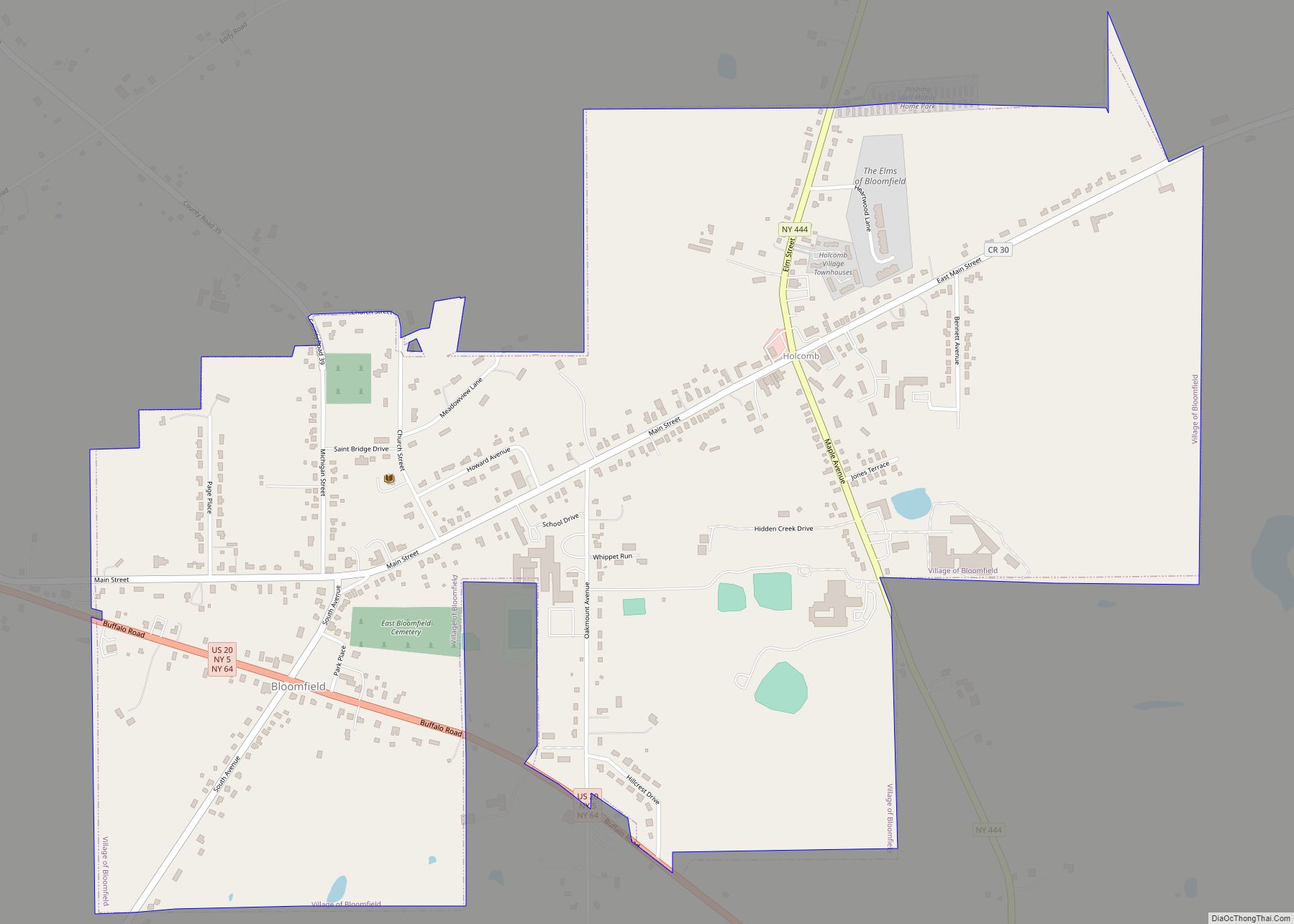
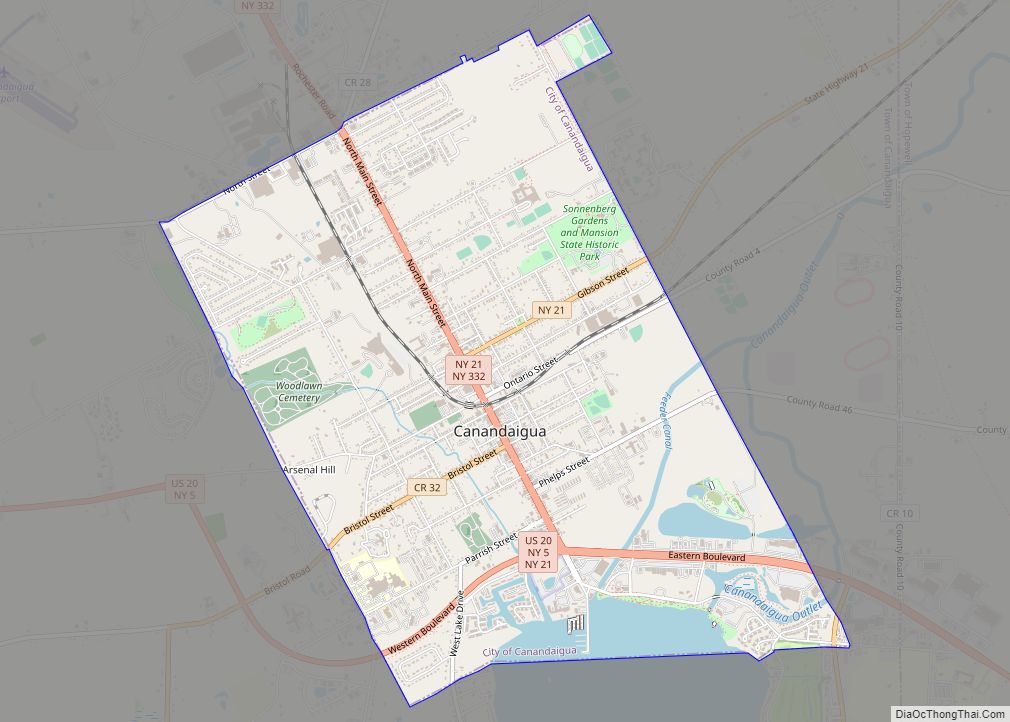
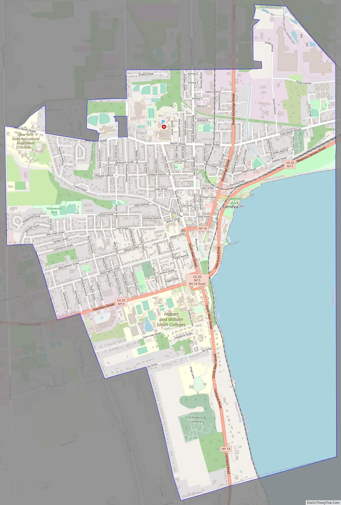
Geneva Road Map
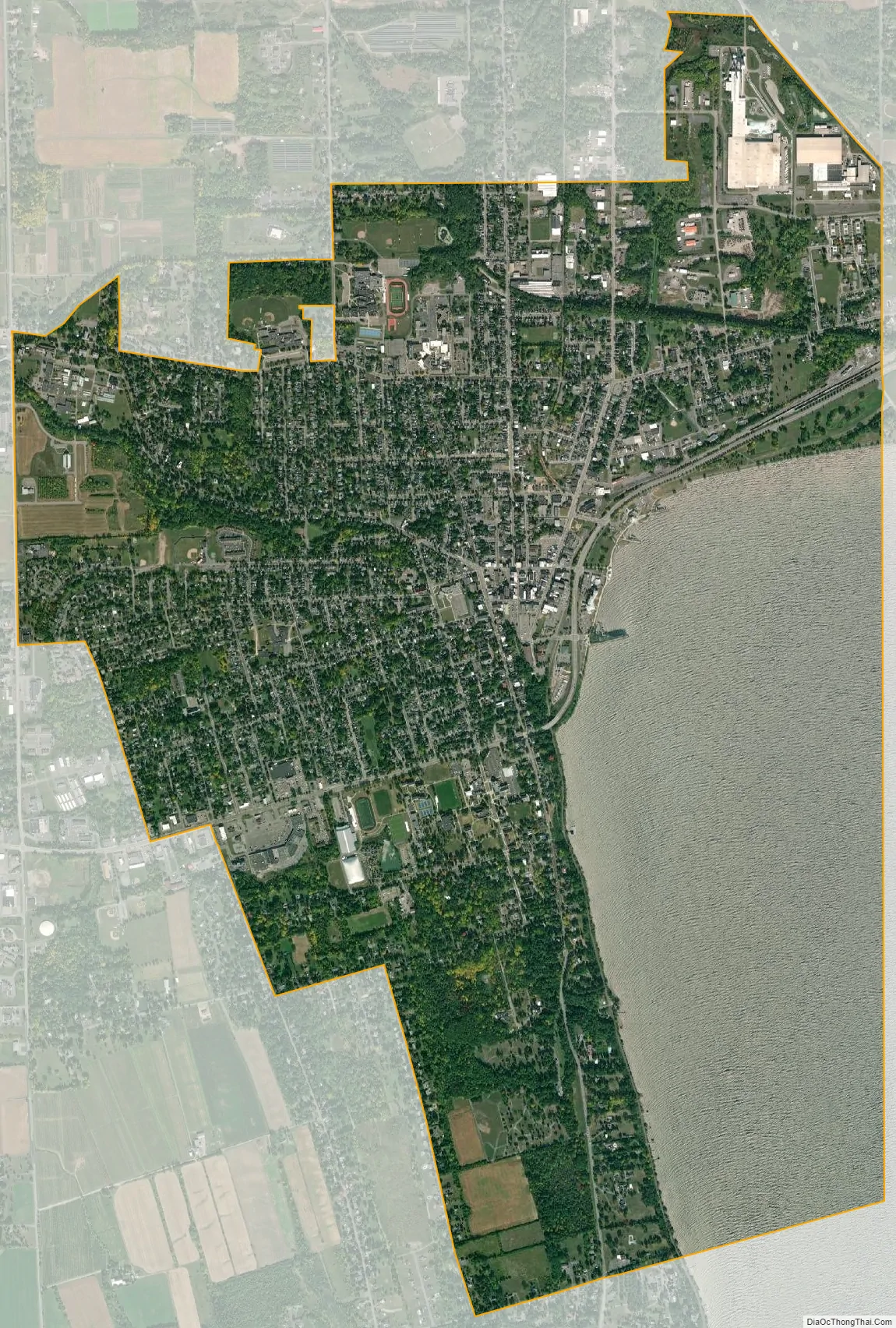
Geneva city Satellite Map
Geography
The town is at the two-mile wide northern outlet of Seneca Lake, a lake that spans 34 miles south to Watkins Glen. Geneva is in the Finger Lakes region, the largest wine-producing area in New York State. The Cayuga-Seneca Canal is part of the watershed of Keuka Lake. It flows north through Geneva, connecting to the Erie Canal, which was completed in 1825, giving access for the region to the Great Lakes and midwestern markets for their produce, as well as to buy natural resource commodities.
According to the United States Census Bureau, the city has a total area of 5.8 square miles (15.2 km). 4.3 square miles (11.0 km) of it is land and 1.6 square miles (4.1 km) of it (27.18%) is water.
Geneva is connected via the east–west US 20, concurrent with NY 5. NY 14 is a north–south highway through the city. It is approximately equidistant from Rochester and Syracuse, each being about 45 miles away.
Climate
According to the Köppen Climate Classification system, Geneva has a warm-summer humid continental climate, abbreviated “Dfb” on climate maps. The hottest temperature recorded in Geneva was 99 °F (37.2 °C) on July 22, 2011, while the coldest temperature recorded was −16 °F (−26.7 °C) on February 18, 1979, and January 22, 2005.
See also
Map of New York State and its subdivision:- Albany
- Allegany
- Bronx
- Broome
- Cattaraugus
- Cayuga
- Chautauqua
- Chemung
- Chenango
- Clinton
- Columbia
- Cortland
- Delaware
- Dutchess
- Erie
- Essex
- Franklin
- Fulton
- Genesee
- Greene
- Hamilton
- Herkimer
- Jefferson
- Kings
- Lake Ontario
- Lewis
- Livingston
- Madison
- Monroe
- Montgomery
- Nassau
- New York
- Niagara
- Oneida
- Onondaga
- Ontario
- Orange
- Orleans
- Oswego
- Otsego
- Putnam
- Queens
- Rensselaer
- Richmond
- Rockland
- Saint Lawrence
- Saratoga
- Schenectady
- Schoharie
- Schuyler
- Seneca
- Steuben
- Suffolk
- Sullivan
- Tioga
- Tompkins
- Ulster
- Warren
- Washington
- Wayne
- Westchester
- Wyoming
- Yates
- Alabama
- Alaska
- Arizona
- Arkansas
- California
- Colorado
- Connecticut
- Delaware
- District of Columbia
- Florida
- Georgia
- Hawaii
- Idaho
- Illinois
- Indiana
- Iowa
- Kansas
- Kentucky
- Louisiana
- Maine
- Maryland
- Massachusetts
- Michigan
- Minnesota
- Mississippi
- Missouri
- Montana
- Nebraska
- Nevada
- New Hampshire
- New Jersey
- New Mexico
- New York
- North Carolina
- North Dakota
- Ohio
- Oklahoma
- Oregon
- Pennsylvania
- Rhode Island
- South Carolina
- South Dakota
- Tennessee
- Texas
- Utah
- Vermont
- Virginia
- Washington
- West Virginia
- Wisconsin
- Wyoming