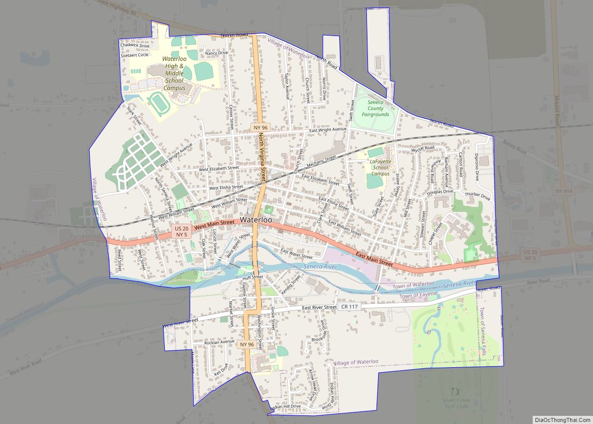
Waterloo is a village and primary county seat of Seneca County, New York, United States. The population was 5,171 at the 2010 census and is now the most populated village in Seneca County. The village is named after Waterloo, Belgium, where Napoleon was defeated. It is the primary county seat of Seneca County, with the other being Ovid as part of a two-shire system established in 1822. Most of the county administrative offices are located in the village. Therefore, many political sources only list Waterloo as the county seat.
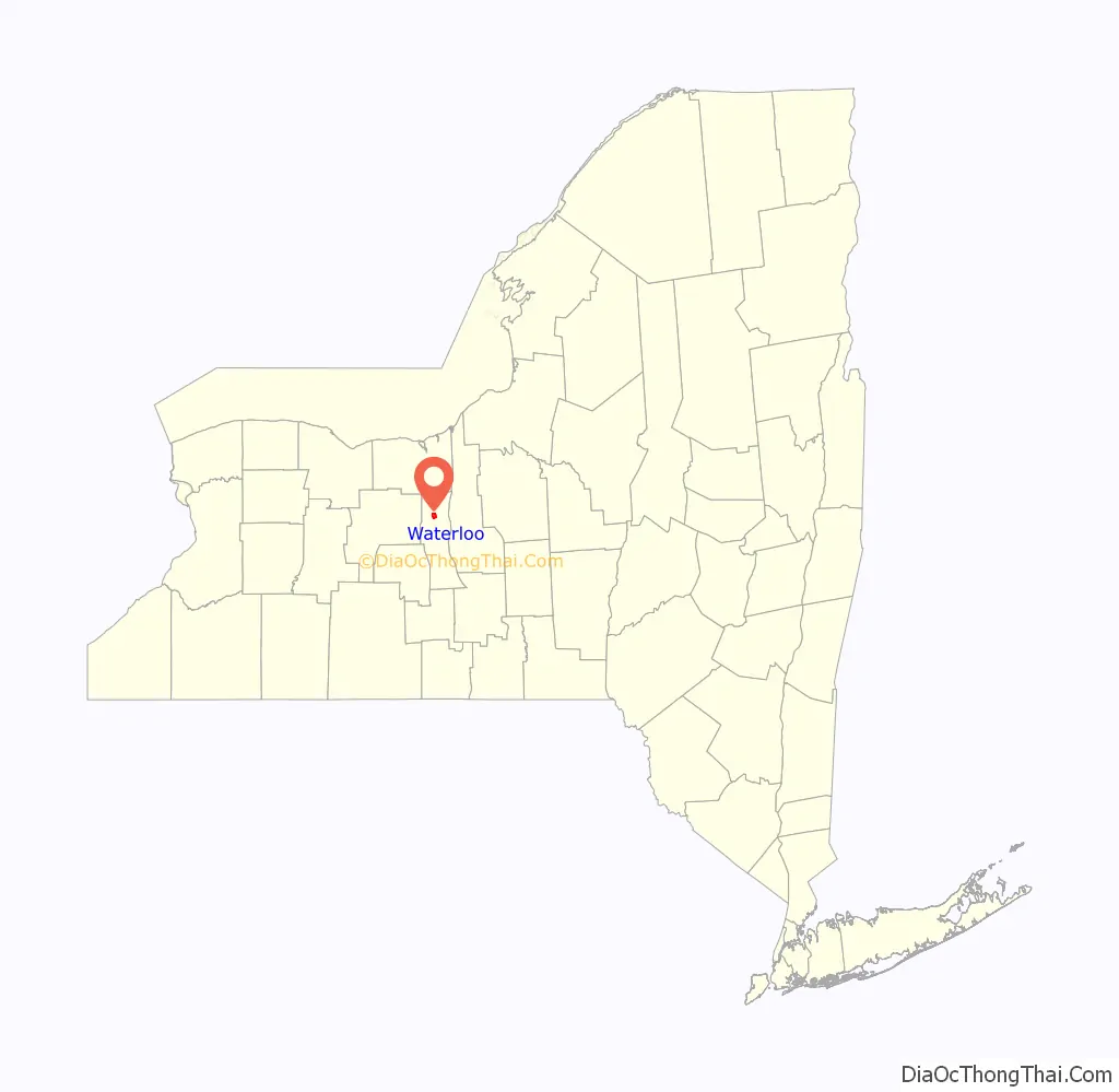
The Village of Waterloo is mostly in the Town of Waterloo, but the part south of the Cayuga-Seneca Canal of the village is in the Town of Fayette and a small area in the southeast of the village is in Town of Seneca Falls. Waterloo is east of Geneva and is located in between the two main Finger Lakes, Seneca Lake and Cayuga Lake.
| Name: | Waterloo village |
|---|---|
| LSAD Code: | 47 |
| LSAD Description: | village (suffix) |
| State: | New York |
| County: | Seneca County |
| Incorporated: | April 9, 1824; 199 years ago (1824-04-09) |
| Elevation: | 453 ft (138 m) |
| Total Area: | 2.20 sq mi (5.71 km²) |
| Land Area: | 2.16 sq mi (5.59 km²) |
| Water Area: | 0.05 sq mi (0.12 km²) |
| Total Population: | 4,810 |
| Population Density: | 2,229.95/sq mi (860.99/km²) |
| ZIP code: | 13165 |
| Area code: | 315 and 680 |
| FIPS code: | 3678553 |
| GNISfeature ID: | 0968900 |
| Website: | http://www.waterloony.com/ |
Online Interactive Map
Click on ![]() to view map in "full screen" mode.
to view map in "full screen" mode.
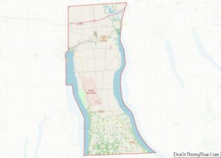
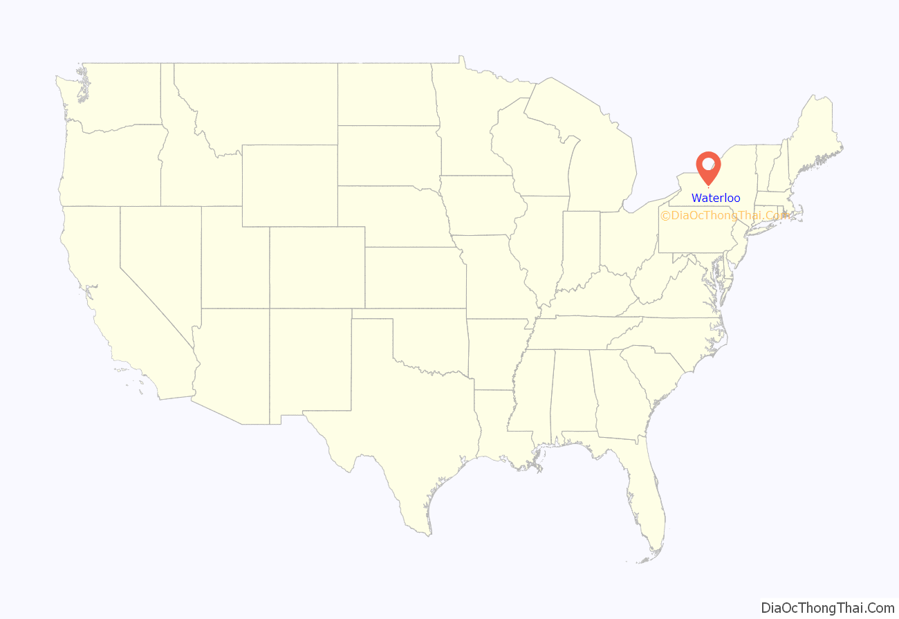
Waterloo location map. Where is Waterloo village?
History
The area was within the realm of the Cayuga nation, one of several bands to form the Iroquois League. The current site of the village was the location of the former Cayuga village “Skoiyase” (or Skoi-Yase), meaning “flowing water”, which was established around 1500. They were visited by Jesuit missionaries in the 17th century. After the Sullivan Expedition of 1779 destroyed Skoiyase, many natives left the area. The land then became part of the Central New York Military Tract, reserved for veterans.
The first new settler, Jabez Gorham, arrived on the site of the village around 1795. The early village was known as “New Hudson”. It was also known as “Scoys”, based on the name of the former Indian village.
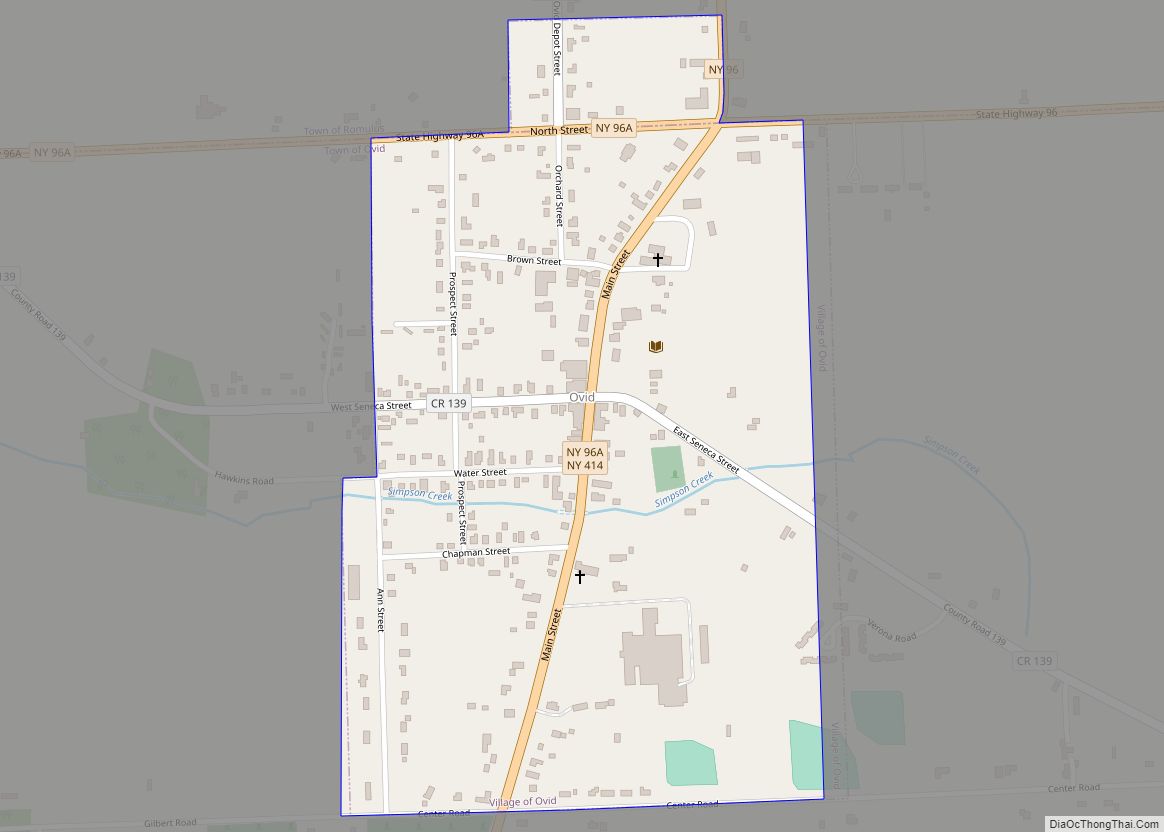
Because the original county seat in Ovid was deemed too close to the south county line after land was lost from Seneca County, Waterloo became the county seat in 1819. A similar fate befell Waterloo, when much of the north of Seneca County was lost, leaving the village close to the northern county line. The outcome was that both villages were made joint county seats, even though some of the lost towns were later returned to the county. Seneca County remains a two-shire county, although nearly all government activity now occurs in Waterloo. In honor of the two-shire history, the County Board of Supervisors will at least once a year hold a meeting in Ovid at the buildings locally called the “Three Bears”.
Planning for the Women’s Rights Convention in 1848 in Seneca Falls took place in Waterloo.
The Village of Waterloo was incorporated in 1824 and again in 1866, the same year it celebrated the first Memorial Day. Waterloo was officially designated as the birthplace of Memorial Day in 1966 by President Lyndon B. Johnson. The Memorial Day Museum is in the village. However, in 2014, Bellware and Gardiner challenged this designation in The Genesis of the Memorial Day Holiday in America. They uncovered evidence that the origin story is a hoax including information ignored by the Centennial Committee backing the proclamation. This includes a report in a New York newspaper that predates by several years any of the sources used by the committee. It describes, in detail, Waterloo’s first Memorial Day and places it in 1868. They also note other inconsistencies between the historical record and the story compiled by the Centennial Committee and the lack of discussion or debate in Congress prior to the resolution recognizing Waterloo as the birthplace of the holiday.
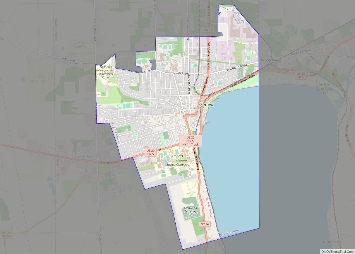
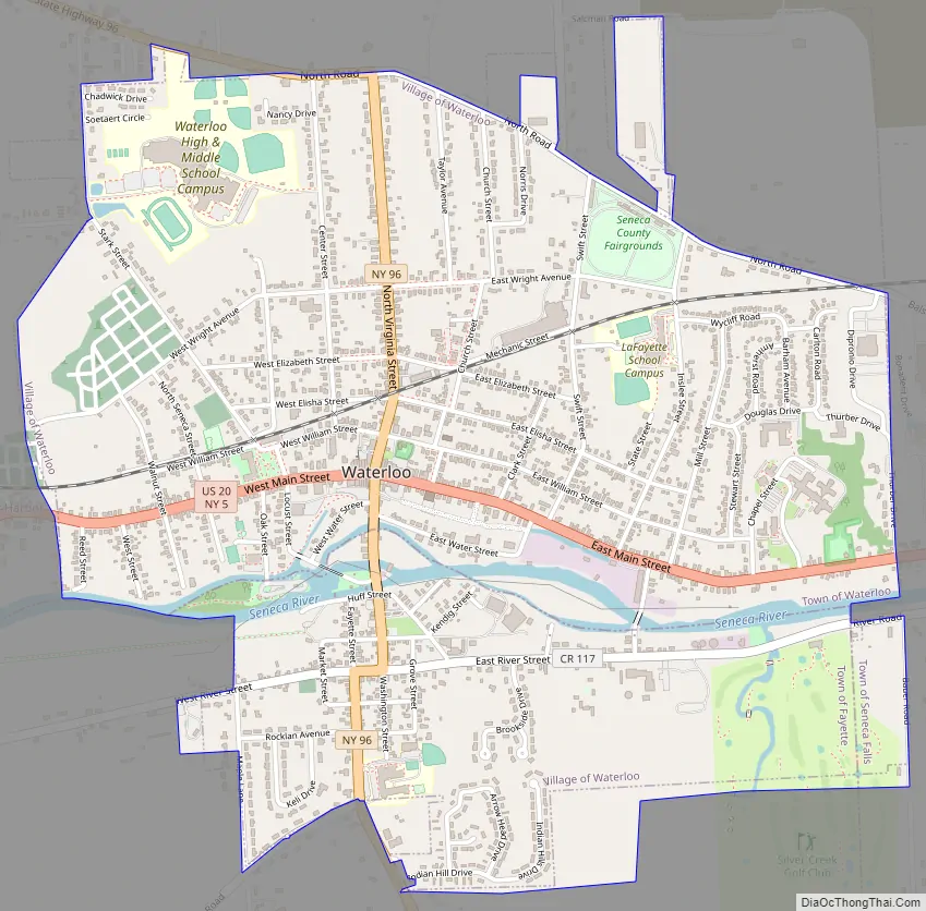
Waterloo Road Map
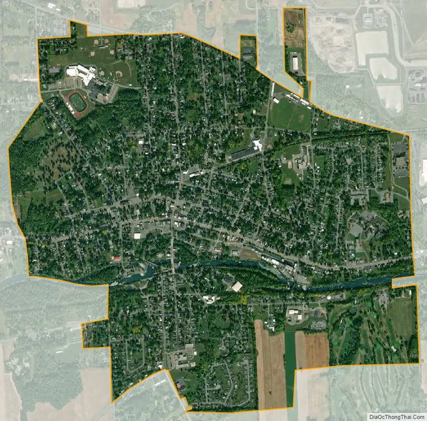
Waterloo city Satellite Map
Geography
Waterloo is located at 42°54′13″N 76°51′34″W / 42.90361°N 76.85944°W / 42.90361; -76.85944 (42.903697, -76.859517).
According to the United States Census Bureau, the village has a total area of 2.2 square miles (5.6 km), of which, 2.1 square miles (5.4 km) of it is land and 0.1 square miles (0.2 km) of it (3.24%) is water.
The Seneca River/Cayuga-Seneca Canal pass through the village, linking the area to the Erie Canal system.
US Route 20, conjoined with New York State Route 5, intersects New York State Route 96 in the village.
The largest active landfill in New York State, Seneca Meadows, is northeast of Waterloo in the town of Seneca Falls.
See also
Map of New York State and its subdivision:- Albany
- Allegany
- Bronx
- Broome
- Cattaraugus
- Cayuga
- Chautauqua
- Chemung
- Chenango
- Clinton
- Columbia
- Cortland
- Delaware
- Dutchess
- Erie
- Essex
- Franklin
- Fulton
- Genesee
- Greene
- Hamilton
- Herkimer
- Jefferson
- Kings
- Lake Ontario
- Lewis
- Livingston
- Madison
- Monroe
- Montgomery
- Nassau
- New York
- Niagara
- Oneida
- Onondaga
- Ontario
- Orange
- Orleans
- Oswego
- Otsego
- Putnam
- Queens
- Rensselaer
- Richmond
- Rockland
- Saint Lawrence
- Saratoga
- Schenectady
- Schoharie
- Schuyler
- Seneca
- Steuben
- Suffolk
- Sullivan
- Tioga
- Tompkins
- Ulster
- Warren
- Washington
- Wayne
- Westchester
- Wyoming
- Yates
- Alabama
- Alaska
- Arizona
- Arkansas
- California
- Colorado
- Connecticut
- Delaware
- District of Columbia
- Florida
- Georgia
- Hawaii
- Idaho
- Illinois
- Indiana
- Iowa
- Kansas
- Kentucky
- Louisiana
- Maine
- Maryland
- Massachusetts
- Michigan
- Minnesota
- Mississippi
- Missouri
- Montana
- Nebraska
- Nevada
- New Hampshire
- New Jersey
- New Mexico
- New York
- North Carolina
- North Dakota
- Ohio
- Oklahoma
- Oregon
- Pennsylvania
- Rhode Island
- South Carolina
- South Dakota
- Tennessee
- Texas
- Utah
- Vermont
- Virginia
- Washington
- West Virginia
- Wisconsin
- Wyoming