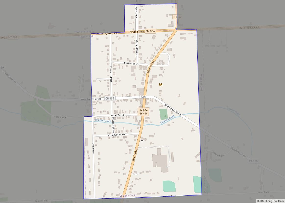
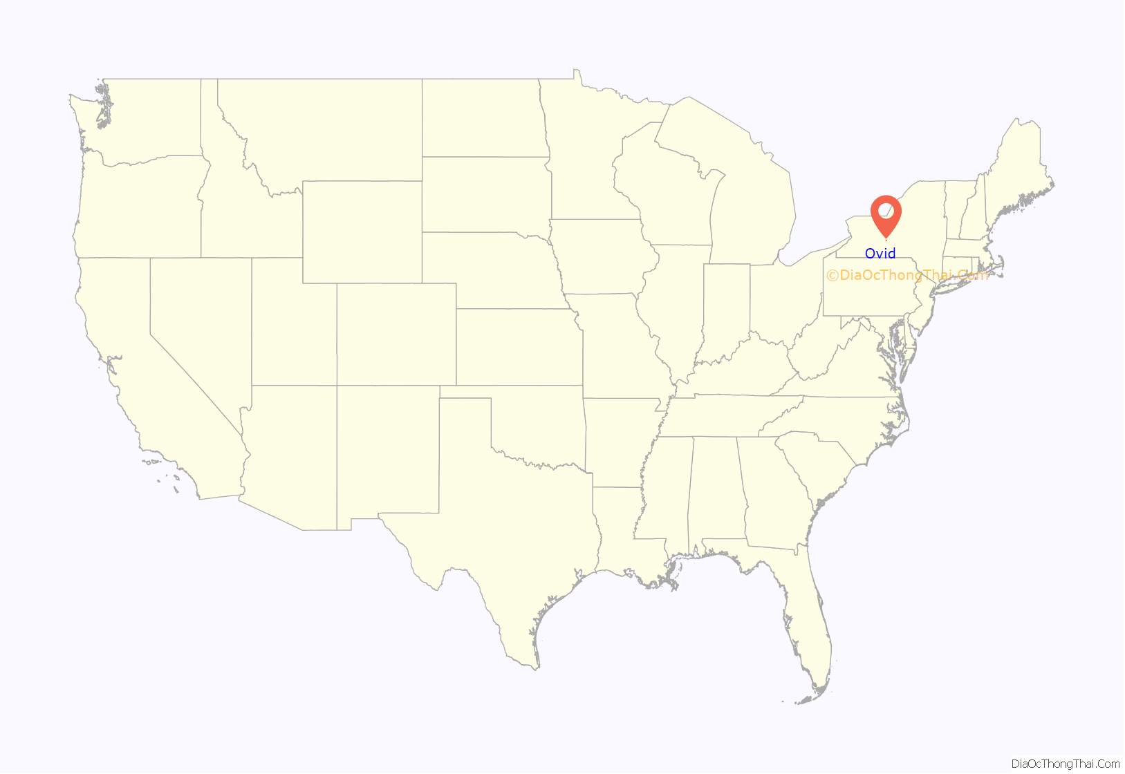
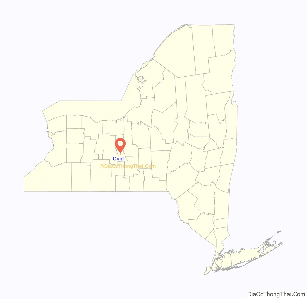
Ovid is a village in Seneca County, New York, United States. The population was 602 at the 2010 census. The town was named by a clerk interested in the classics (see Ovid).
The Village of Ovid is within the Town of Ovid, but a small portion is in the Town of Romulus, and is southeast of Geneva, New York.
| Name: | Ovid village |
|---|---|
| LSAD Code: | 47 |
| LSAD Description: | village (suffix) |
| State: | New York |
| County: | Seneca County |
| Incorporated: | April 17, 1816 (Dissolved in 1849, Re-Incorporated in 1852) |
| Elevation: | 968 ft (295 m) |
| Total Area: | 0.40 sq mi (1.03 km²) |
| Land Area: | 0.40 sq mi (1.03 km²) |
| Water Area: | 0.00 sq mi (0.00 km²) |
| Total Population: | 534 |
| Population Density: | 1,341.71/sq mi (518.62/km²) |
| ZIP code: | 14521 |
| Area code: | 607 |
| FIPS code: | 3655816 |
| GNISfeature ID: | 0959663 |
Online Interactive Map
Click on ![]() to view map in "full screen" mode.
to view map in "full screen" mode.
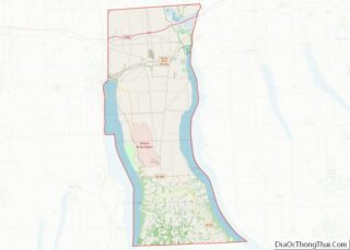
Ovid location map. Where is Ovid village?
History
Ovid and the surrounding area was part the lands controlled by the Iroquois. The Sullivan Expedition of 1779 drove away or killed many of these natives to reduce their raiding in support of the British. After the American Revolution the village was in the Central New York Military Tract, used to compensate soldiers.
Ovid was the first county seat of Seneca County, and a courthouse was erected in 1806. When adjacent towns were created from Ovid and placed in other counties, Ovid was seen as being too far from the county center, and Waterloo became the county seat. Later, Waterloo itself became located on the northern fringe of the county when new towns created there were assigned to new counties. The ultimate solution was to make both Ovid and Waterloo county seats.
The village was incorporated in 1816, but dissolved in 1849, and then re-incorporated in 1852.
The David and Mary Kinne Farmstead, Seneca County Courthouse Complex at Ovid, Edith B. Ford Memorial Library and Aaron Wilson House are listed on the National Register of Historic Places.
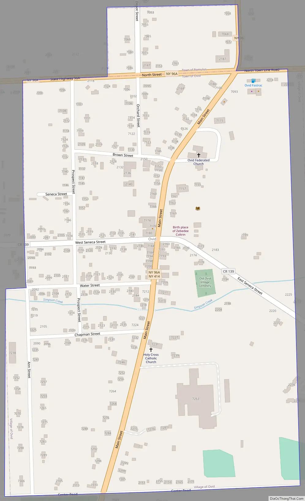
Ovid Road Map
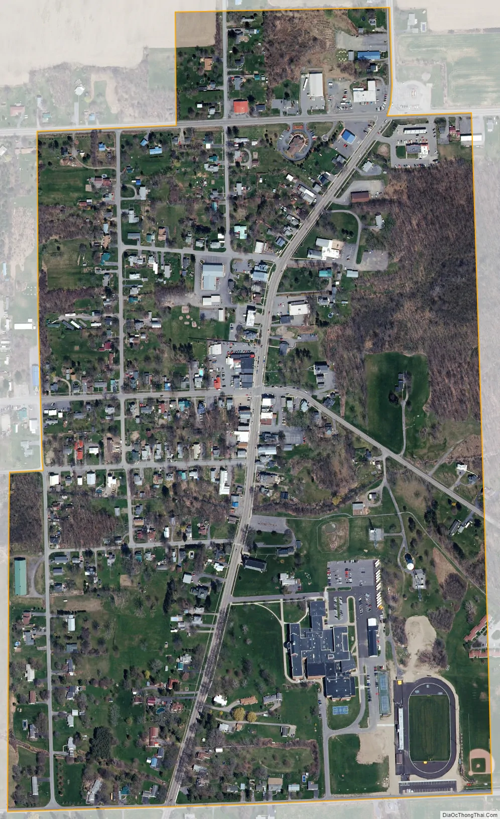
Ovid city Satellite Map
Geography
Ovid is located at 42°40.5′N 76°49.6′W / 42.6750°N 76.8267°W / 42.6750; -76.8267 (42.6775, -76.8243).
According to the United States Census Bureau, the village has a total area of 0.4 square miles (1.1 km), none of which is covered with water.
The village is in the Finger Lakes District, lying between Cayuga Lake and Seneca Lake.
New York State Route 96, New York State Route 96A, and New York State Route 414, along with County Road 139, converge at the village.
Simpson Creek flows through the village to Seneca Lake.
Seneca County Courthouse Complex at Ovid
See also
Map of New York State and its subdivision:- Albany
- Allegany
- Bronx
- Broome
- Cattaraugus
- Cayuga
- Chautauqua
- Chemung
- Chenango
- Clinton
- Columbia
- Cortland
- Delaware
- Dutchess
- Erie
- Essex
- Franklin
- Fulton
- Genesee
- Greene
- Hamilton
- Herkimer
- Jefferson
- Kings
- Lake Ontario
- Lewis
- Livingston
- Madison
- Monroe
- Montgomery
- Nassau
- New York
- Niagara
- Oneida
- Onondaga
- Ontario
- Orange
- Orleans
- Oswego
- Otsego
- Putnam
- Queens
- Rensselaer
- Richmond
- Rockland
- Saint Lawrence
- Saratoga
- Schenectady
- Schoharie
- Schuyler
- Seneca
- Steuben
- Suffolk
- Sullivan
- Tioga
- Tompkins
- Ulster
- Warren
- Washington
- Wayne
- Westchester
- Wyoming
- Yates
- Alabama
- Alaska
- Arizona
- Arkansas
- California
- Colorado
- Connecticut
- Delaware
- District of Columbia
- Florida
- Georgia
- Hawaii
- Idaho
- Illinois
- Indiana
- Iowa
- Kansas
- Kentucky
- Louisiana
- Maine
- Maryland
- Massachusetts
- Michigan
- Minnesota
- Mississippi
- Missouri
- Montana
- Nebraska
- Nevada
- New Hampshire
- New Jersey
- New Mexico
- New York
- North Carolina
- North Dakota
- Ohio
- Oklahoma
- Oregon
- Pennsylvania
- Rhode Island
- South Carolina
- South Dakota
- Tennessee
- Texas
- Utah
- Vermont
- Virginia
- Washington
- West Virginia
- Wisconsin
- Wyoming