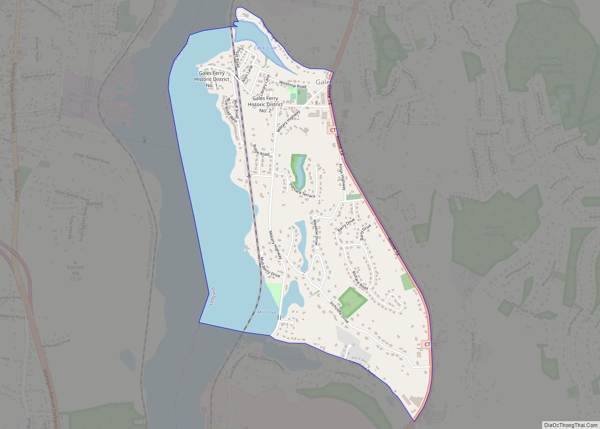
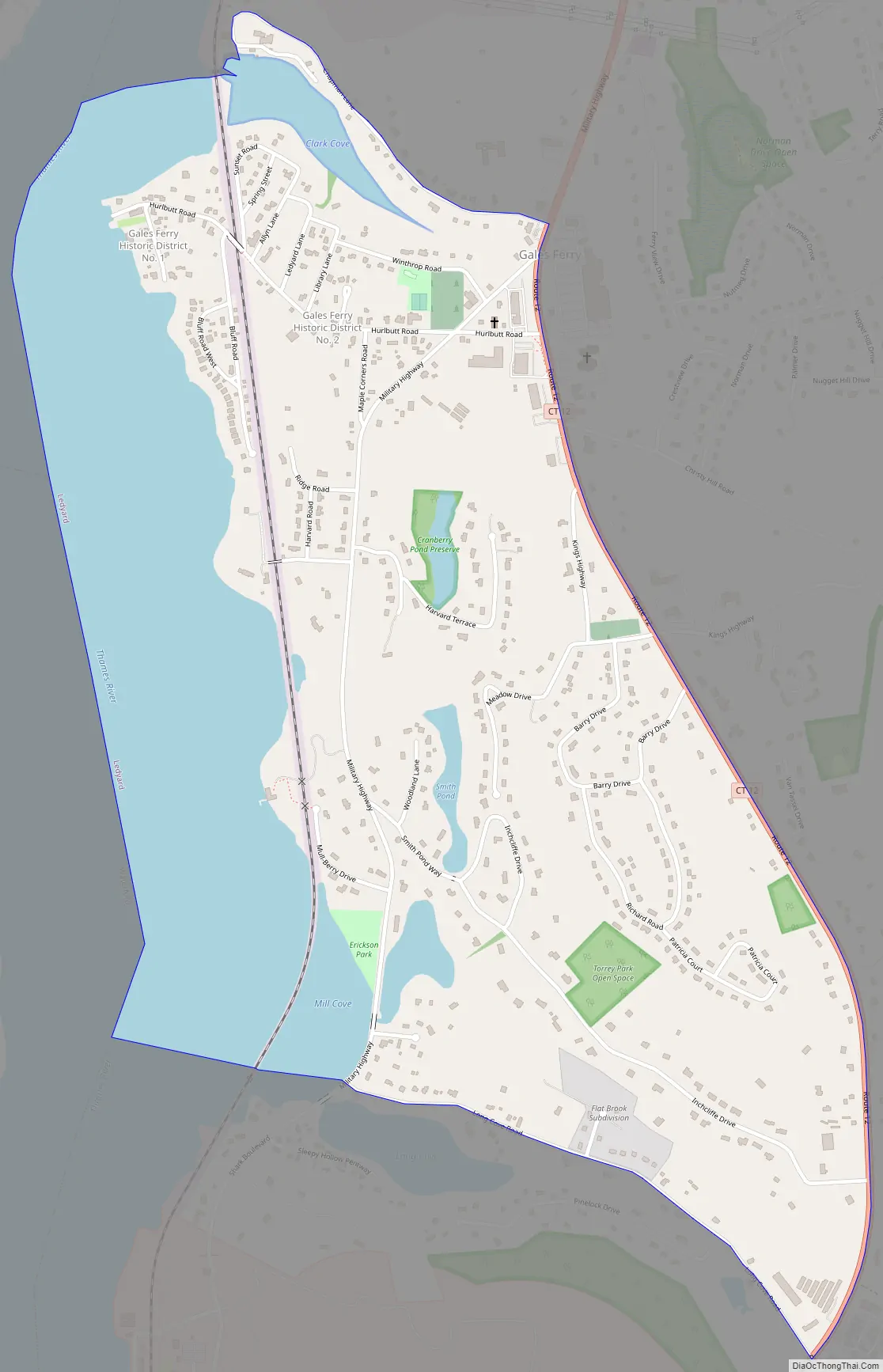
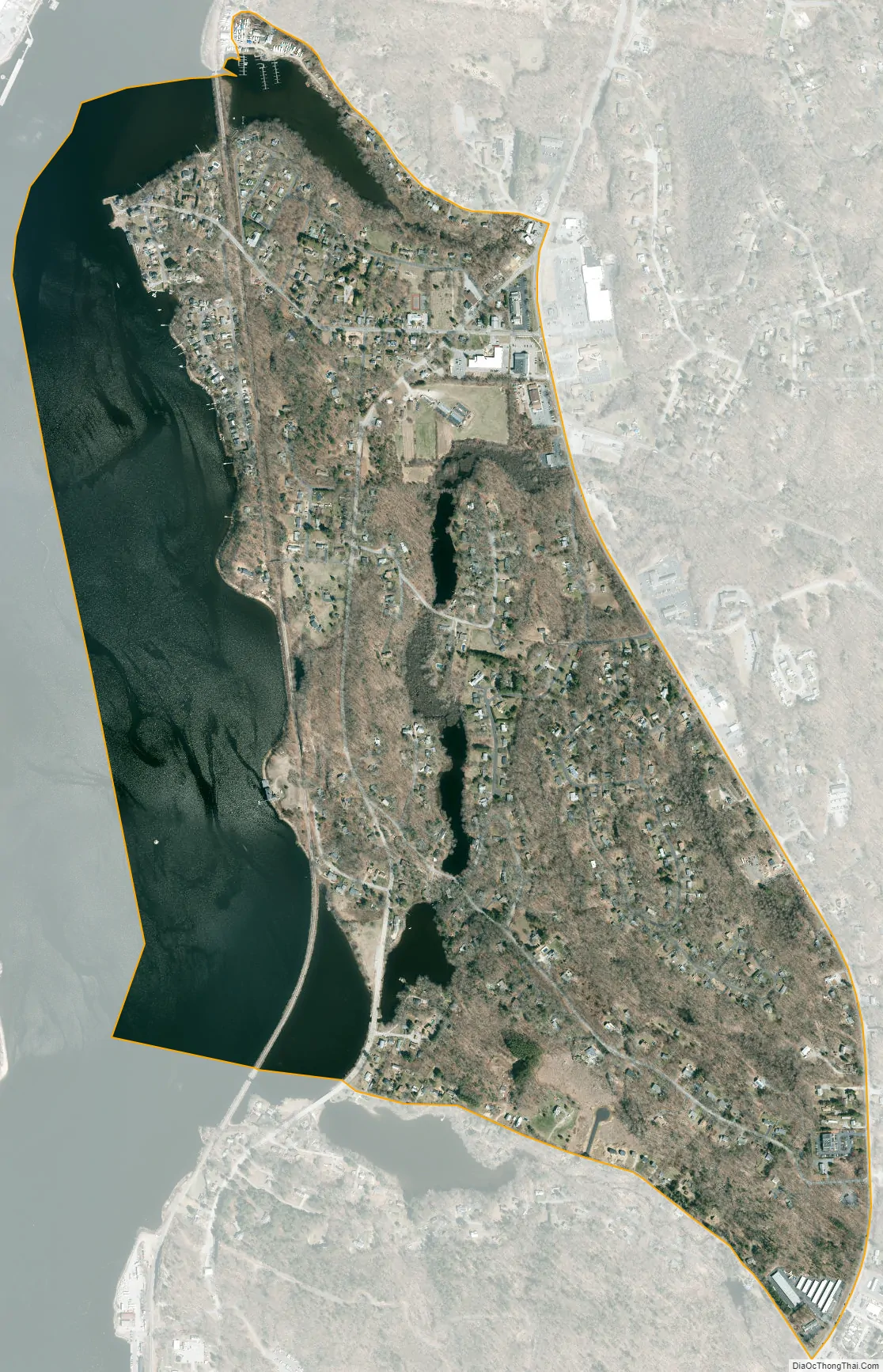
Gales Ferry is a village in the town of Ledyard, Connecticut, United States. It is located along the eastern bank of the Thames River. The village developed as a result of having a ferry to Uncasville located at this site, and from which the village was named. Gales Ferry was listed as a census-designated place for the 2010 Census, with a population of 1,162.
Much of the core of the original settlement at the site of the former ferry has been included in two separate historic districts, each with several farmstead buildings from the late colonial and early national periods (late 18th and early 19th century). The two historic districts are irregularly shaped, and are separated by a railroad cut and some non-contributing buildings.
Several farmsteads that are individually listed on the National Register of Historic Places are located close to Gales Ferry. These are the Nathan Lester House on Vinegar Hill Road, the Perkins-Bill House at 1040 Long Cove Road, and the Capt. Mark Stoddard Farmstead at 24 Vinegar Hill Road.
| Name: | Gales Ferry CDP |
|---|---|
| LSAD Code: | 57 |
| LSAD Description: | CDP (suffix) |
| State: | Connecticut |
| County: | New London County |
| Elevation: | 26 ft (8 m) |
| Total Area: | 1.23 sq mi (3.18 km²) |
| Land Area: | 0.88 sq mi (2.27 km²) |
| Water Area: | 0.35 sq mi (0.91 km²) |
| Total Population: | 1,162 |
| Population Density: | 940/sq mi (370/km²) |
| ZIP code: | 06335 |
| Area code: | 860 |
| FIPS code: | 0930190 |
Online Interactive Map
Click on ![]() to view map in "full screen" mode.
to view map in "full screen" mode.
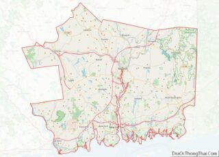
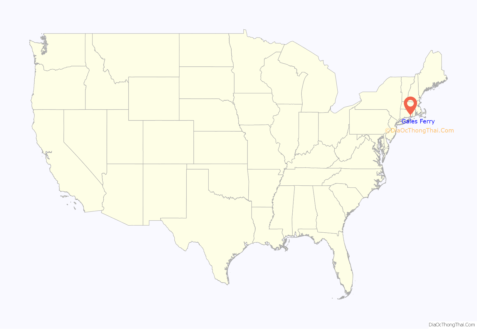
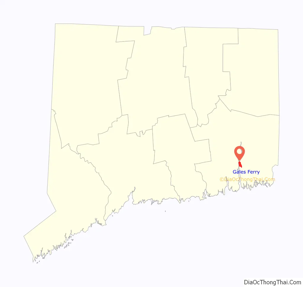
Gales Ferry location map. Where is Gales Ferry CDP?
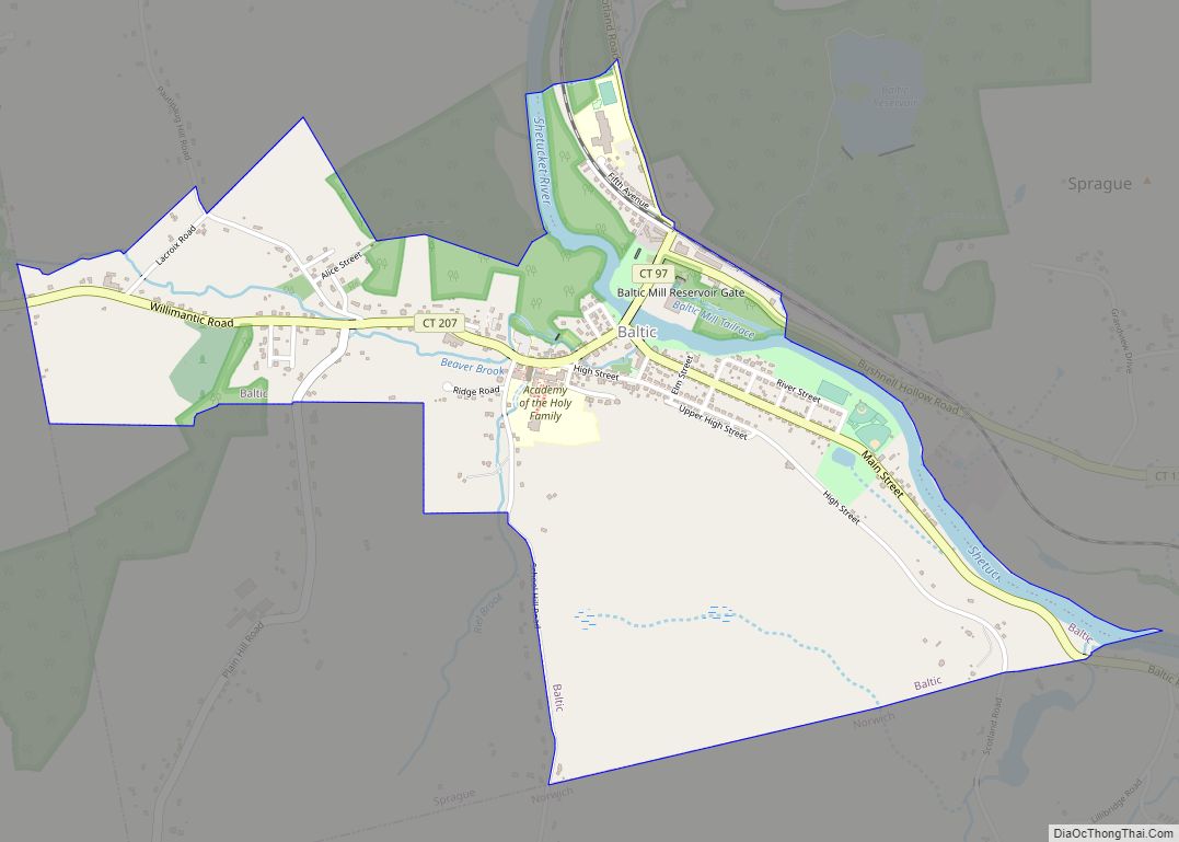
Gales Ferry Road Map
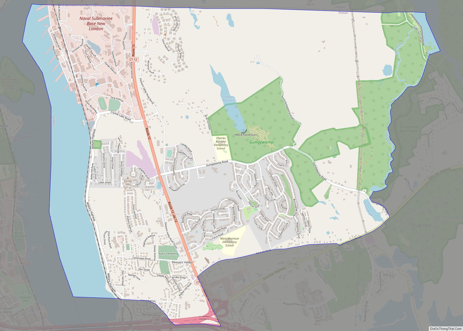
Gales Ferry city Satellite Map
See also
Map of Connecticut State and its subdivision: Map of other states:- Alabama
- Alaska
- Arizona
- Arkansas
- California
- Colorado
- Connecticut
- Delaware
- District of Columbia
- Florida
- Georgia
- Hawaii
- Idaho
- Illinois
- Indiana
- Iowa
- Kansas
- Kentucky
- Louisiana
- Maine
- Maryland
- Massachusetts
- Michigan
- Minnesota
- Mississippi
- Missouri
- Montana
- Nebraska
- Nevada
- New Hampshire
- New Jersey
- New Mexico
- New York
- North Carolina
- North Dakota
- Ohio
- Oklahoma
- Oregon
- Pennsylvania
- Rhode Island
- South Carolina
- South Dakota
- Tennessee
- Texas
- Utah
- Vermont
- Virginia
- Washington
- West Virginia
- Wisconsin
- Wyoming