Dewey Beach is an incorporated coastal town in eastern Sussex County, Delaware, United States. According to the 2010 census, the population of the town is 341, an increase of 13.3% over the previous decade. It is part of the rapidly growing Cape Region and lies within the Salisbury, Maryland-Delaware Metropolitan Statistical Area. In 2011, the NRDC awarded Dewey Beach with a 5-Star rating in water quality. This award was given only to 12 other locations, one being neighboring Rehoboth Beach. Out of the 30 states with coastline, the Delaware Beaches ranked number 1 in water quality in 2011.
| Name: | Dewey Beach town |
|---|---|
| LSAD Code: | 43 |
| LSAD Description: | town (suffix) |
| State: | Delaware |
| County: | Sussex County |
| Incorporated: | 1981 |
| Elevation: | 7 ft (2 m) |
| Total Area: | 0.33 sq mi (0.86 km²) |
| Land Area: | 0.33 sq mi (0.86 km²) |
| Water Area: | 0.00 sq mi (0.00 km²) |
| Total Population: | 353 |
| Population Density: | 1,066.47/sq mi (412.07/km²) |
| ZIP code: | 19971 |
| Area code: | 302 |
| FIPS code: | 1020900 |
| GNISfeature ID: | 213884 |
| Website: | http://www.townofdeweybeach.com/ |
Online Interactive Map
Click on ![]() to view map in "full screen" mode.
to view map in "full screen" mode.
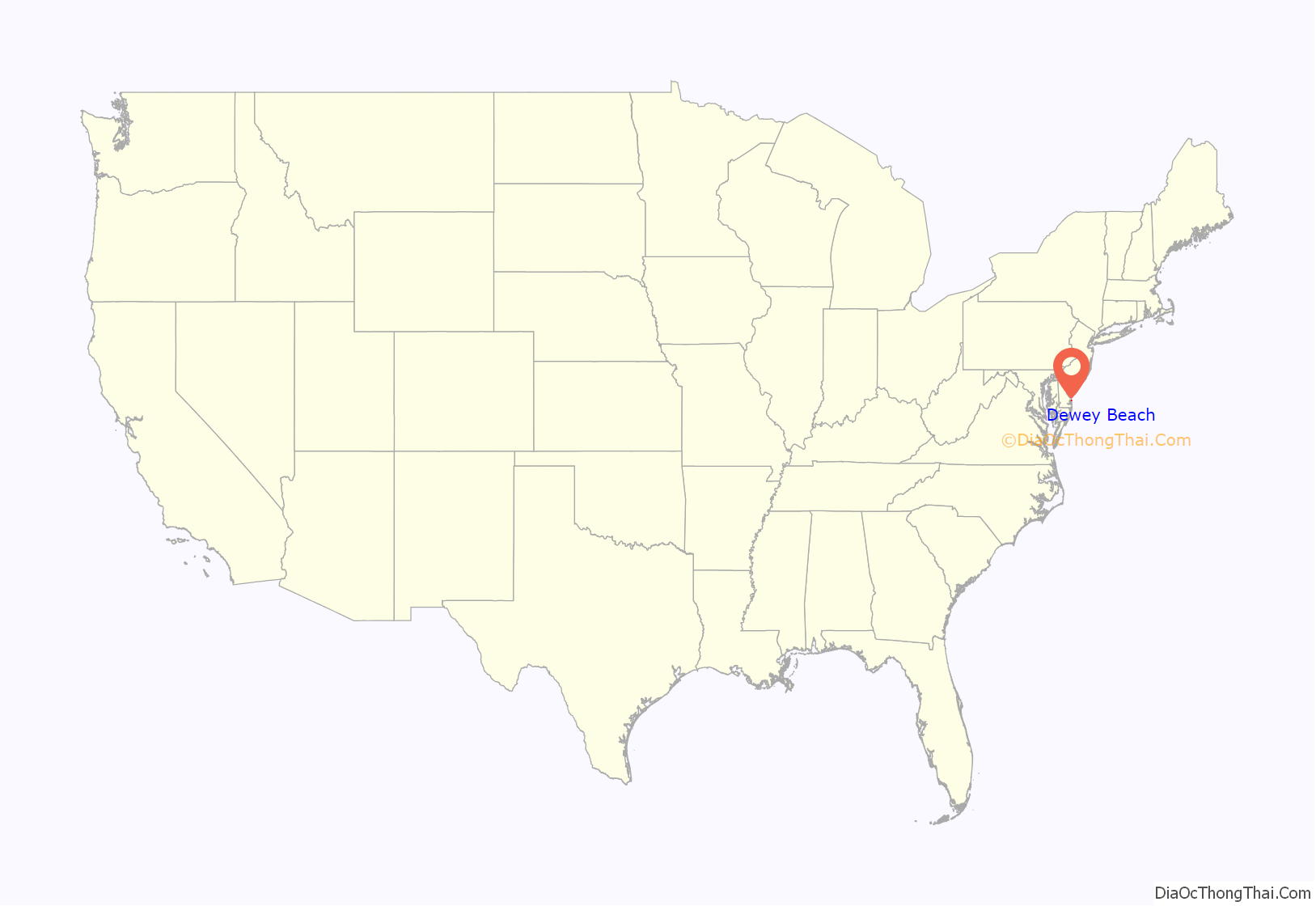
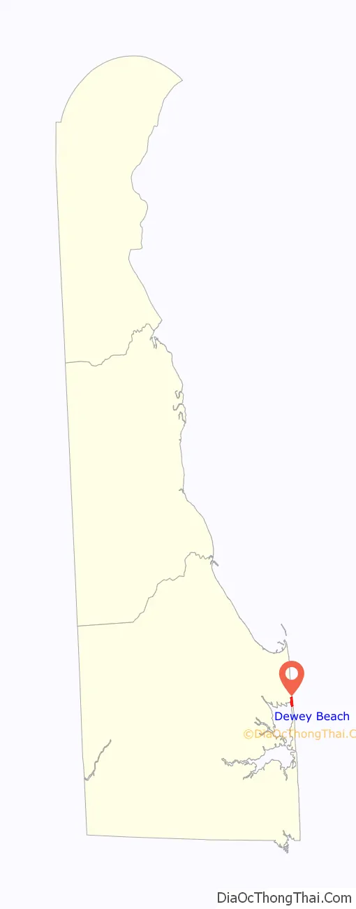
Dewey Beach location map. Where is Dewey Beach town?
History
In 1868, “Rehoboth City” first appeared on a map of Lewes Rehoboth Hundred in Beer’s Atlas of Delaware. It is believed that the name was changed to Dewey Beach following the 1898 Battle of Manilla (Spanish–American War) when Admiral George Dewey became a national hero. Dewey Beach was incorporated in 1981.
The Rehoboth Beach Life-Saving Station (RBLSS), located at the end of Dagsworthy Street, was commissioned in 1878. It became the Rehoboth Beach Coast Guard Station (RBCGS) in 1915. In 1921 citizens objected to the closing of the station, and it was recommissioned in 1926. The station was decommissioned in 1937 and abandoned in 1946. The original structure was moved to Lewes and became a residence. A replica of the station was built in 1988 which stands today.
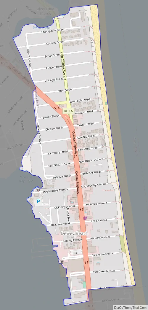
Dewey Beach Road Map
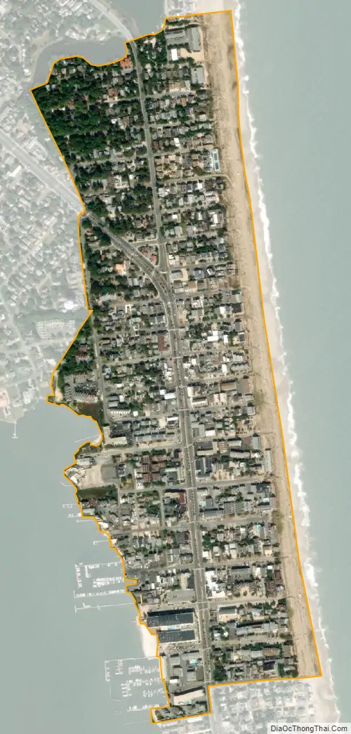
Dewey Beach city Satellite Map
Geography
Dewey Beach is located at 38°41′34″N 75°04′29″W / 38.69278°N 75.07472°W / 38.69278; -75.07472 (38.6928899, –75.0746249).
According to the United States Census Bureau, the town has a total area of 0.3 square miles (0.78 km), all land.
Climate
The climate in this area is characterized by hot, humid summers and generally mild to cool winters. According to the Köppen Climate Classification system, Dewey Beach has a humid subtropical climate, abbreviated “Cfa” on climate maps.
See also
Map of Delaware State and its subdivision: Map of other states:- Alabama
- Alaska
- Arizona
- Arkansas
- California
- Colorado
- Connecticut
- Delaware
- District of Columbia
- Florida
- Georgia
- Hawaii
- Idaho
- Illinois
- Indiana
- Iowa
- Kansas
- Kentucky
- Louisiana
- Maine
- Maryland
- Massachusetts
- Michigan
- Minnesota
- Mississippi
- Missouri
- Montana
- Nebraska
- Nevada
- New Hampshire
- New Jersey
- New Mexico
- New York
- North Carolina
- North Dakota
- Ohio
- Oklahoma
- Oregon
- Pennsylvania
- Rhode Island
- South Carolina
- South Dakota
- Tennessee
- Texas
- Utah
- Vermont
- Virginia
- Washington
- West Virginia
- Wisconsin
- Wyoming


