Newport is a city in and the county seat of Pend Oreille County, Washington, United States. The population was 2,126 at the 2010 census.
| Name: | Newport city |
|---|---|
| LSAD Code: | 25 |
| LSAD Description: | city (suffix) |
| State: | Washington |
| County: | Pend Oreille County |
| Elevation: | 2,142 ft (653 m) |
| Land Area: | 1.47 sq mi (3.80 km²) |
| Water Area: | 0.00 sq mi (0.00 km²) |
| Population Density: | 1,497.96/sq mi (578.48/km²) |
| ZIP code: | 99156 |
| Area code: | 509 |
| FIPS code: | 5348820 |
| GNISfeature ID: | 1512505 |
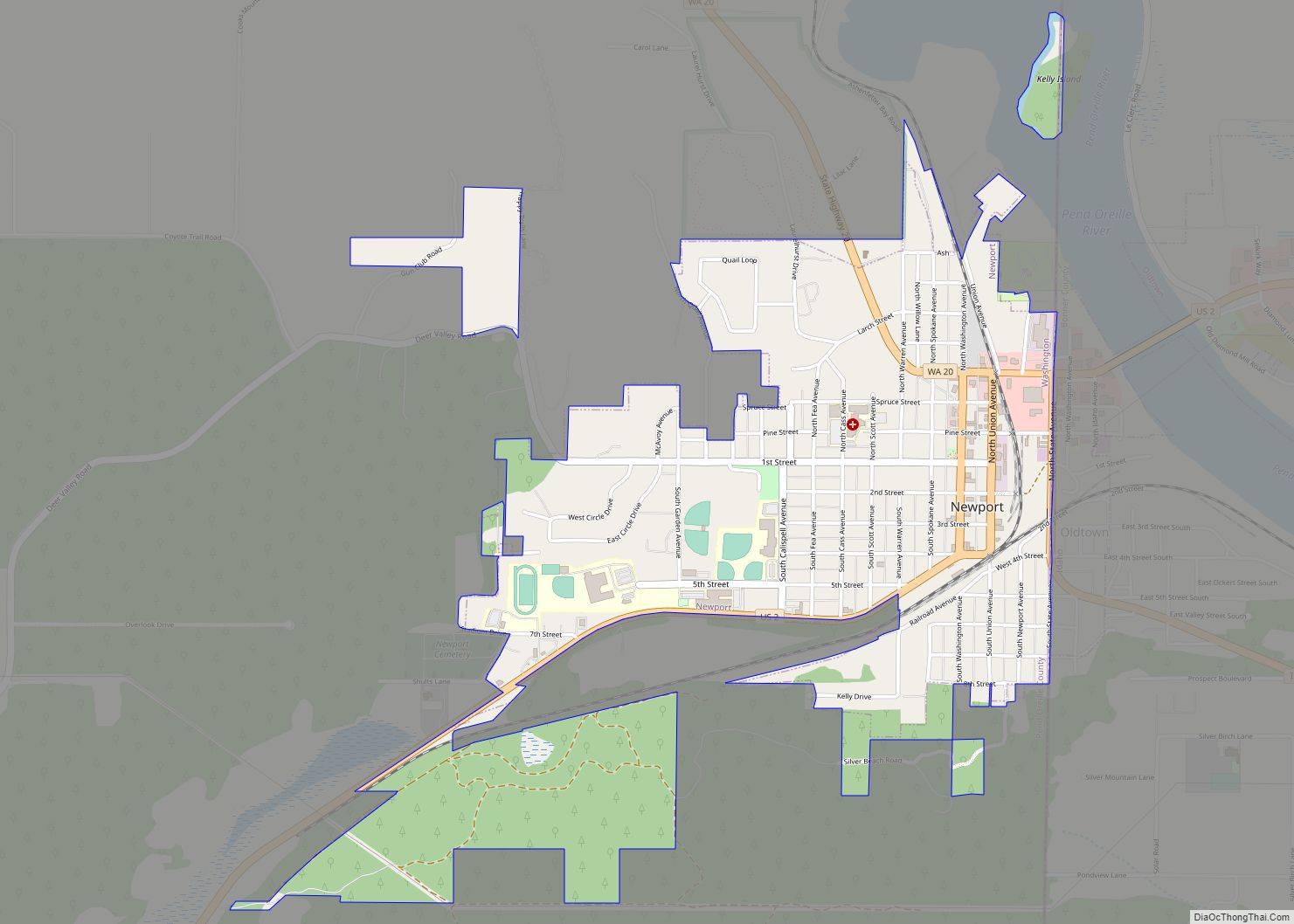
Online Interactive Map
Click on ![]() to view map in "full screen" mode.
to view map in "full screen" mode.
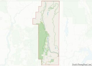
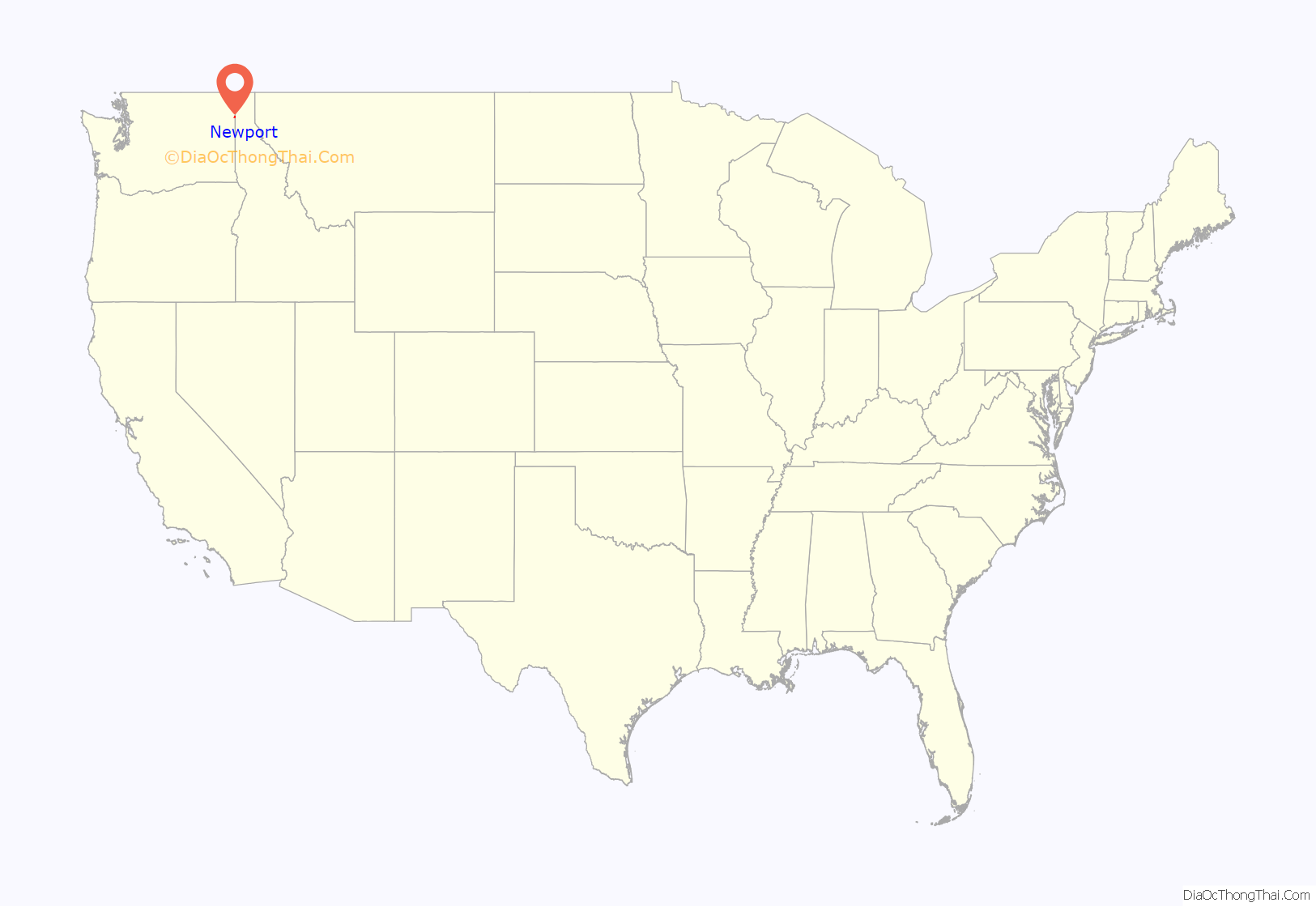
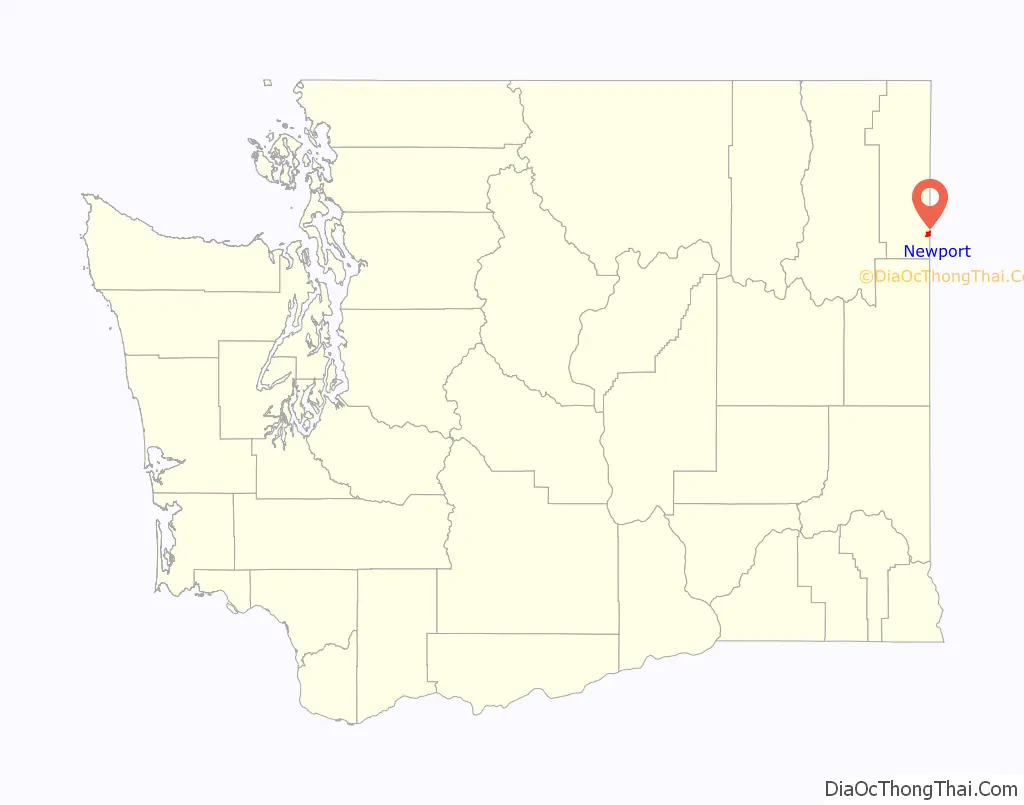
Newport location map. Where is Newport city?
History
Newport was given its name in 1890 because it was selected as a landing site for the first steamboat on the Pend Oreille River. Newport was officially incorporated on April 13, 1903. The first river bridge was built in 1906, and was replaced in 1926, and again in 1988.
On July 14, 2015, an explosion took place at Zodiac Aerospace. Five people were injured, and people were urged to stay at least 2000 feet from the facility.
One of the most important historic buildings is “Kelly’s Bar and Grill” which has been operating since 1894 with only minor breaks, making it the second oldest bar in the state.
Newport began a tourism campaign in 1987 that involved planting hundreds of national, state, and city flags to transform itself into the “City of Flags”. The scheme was abandoned a decade later after issues with theft and maintenance.
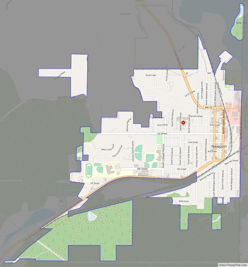
Newport Road Map
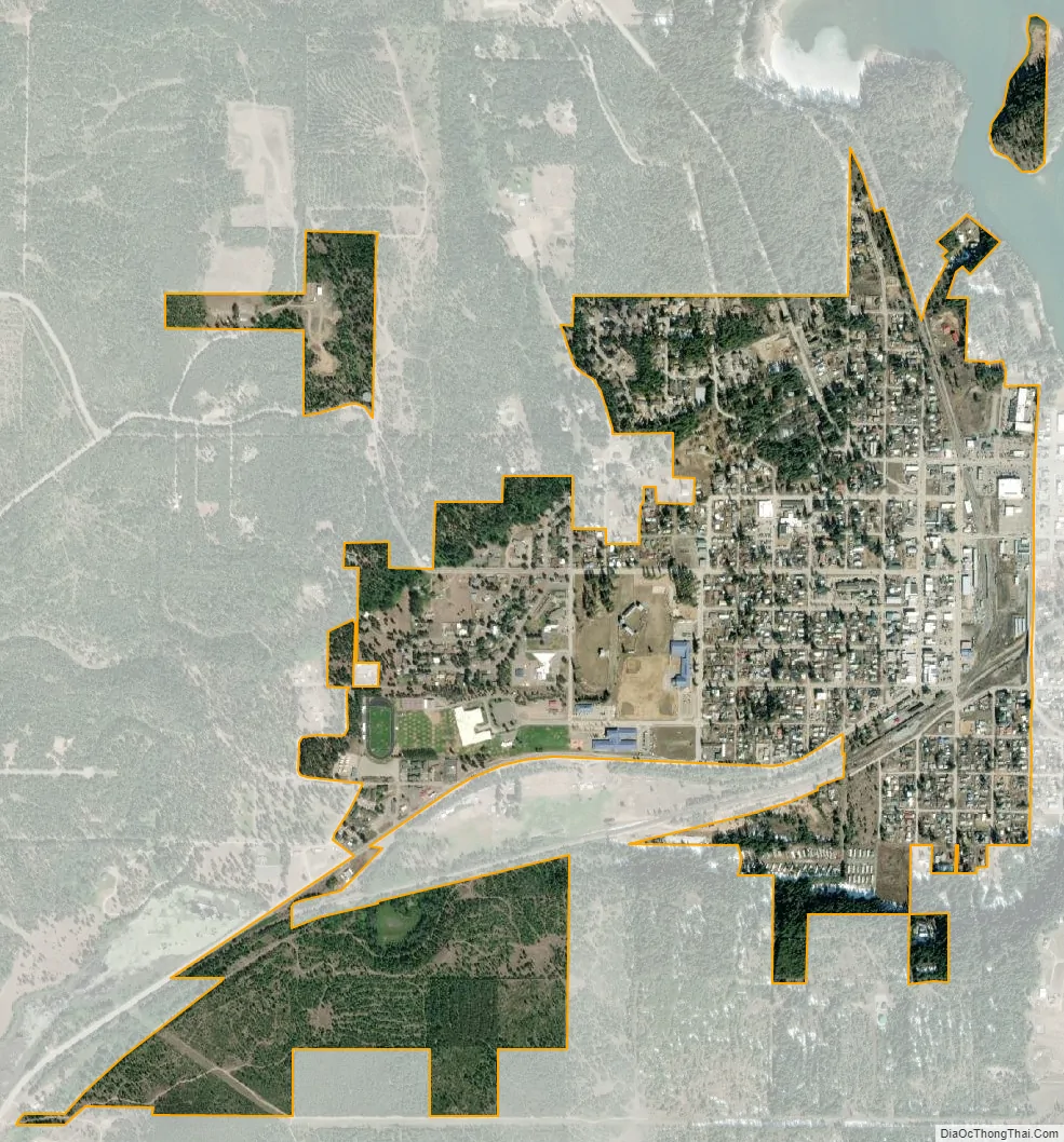
Newport city Satellite Map
Geography
Newport is located at 48°10′50″N 117°2′51″W / 48.18056°N 117.04750°W / 48.18056; -117.04750 (48.180634, -117.047407) at an elevation of 2,160 feet (658.5 m).
According to the United States Census Bureau, the city has a total area of 1.07 square miles (2.77 km), all of it land.
The town of Oldtown, Idaho, is just to the east of Newport, and on the Pend Oreille River. There are no natural or physical barriers between the two towns, and it is strictly a political division, separated by the straight-line state boundary.
About one-half mile north of Newport, the Pend Oreille River enters Washington State and flows north to Canada. The watershed of the Pend Oreille in the Newport-Oldtown area west of the river is extremely limited. This is due to a small depression of no more than 50 feet (15 m), which begins about one-half mile from the river. Unable to flow uphill, the waters (from natural springs, rainfall runoff, etc.) eventually form the Little Spokane River, and flow southwest towards Spokane.
Diamond Lake, WA (elevation 2,345 ft.) is about 7 miles (11 km) to the southwest, and is also part of the Little Spokane River watershed (outflow only) via a creek runoff from the uninhabited far west end of the lake.
See also
Map of Washington State and its subdivision:- Adams
- Asotin
- Benton
- Chelan
- Clallam
- Clark
- Columbia
- Cowlitz
- Douglas
- Ferry
- Franklin
- Garfield
- Grant
- Grays Harbor
- Island
- Jefferson
- King
- Kitsap
- Kittitas
- Klickitat
- Lewis
- Lincoln
- Mason
- Okanogan
- Pacific
- Pend Oreille
- Pierce
- San Juan
- Skagit
- Skamania
- Snohomish
- Spokane
- Stevens
- Thurston
- Wahkiakum
- Walla Walla
- Whatcom
- Whitman
- Yakima
- Alabama
- Alaska
- Arizona
- Arkansas
- California
- Colorado
- Connecticut
- Delaware
- District of Columbia
- Florida
- Georgia
- Hawaii
- Idaho
- Illinois
- Indiana
- Iowa
- Kansas
- Kentucky
- Louisiana
- Maine
- Maryland
- Massachusetts
- Michigan
- Minnesota
- Mississippi
- Missouri
- Montana
- Nebraska
- Nevada
- New Hampshire
- New Jersey
- New Mexico
- New York
- North Carolina
- North Dakota
- Ohio
- Oklahoma
- Oregon
- Pennsylvania
- Rhode Island
- South Carolina
- South Dakota
- Tennessee
- Texas
- Utah
- Vermont
- Virginia
- Washington
- West Virginia
- Wisconsin
- Wyoming