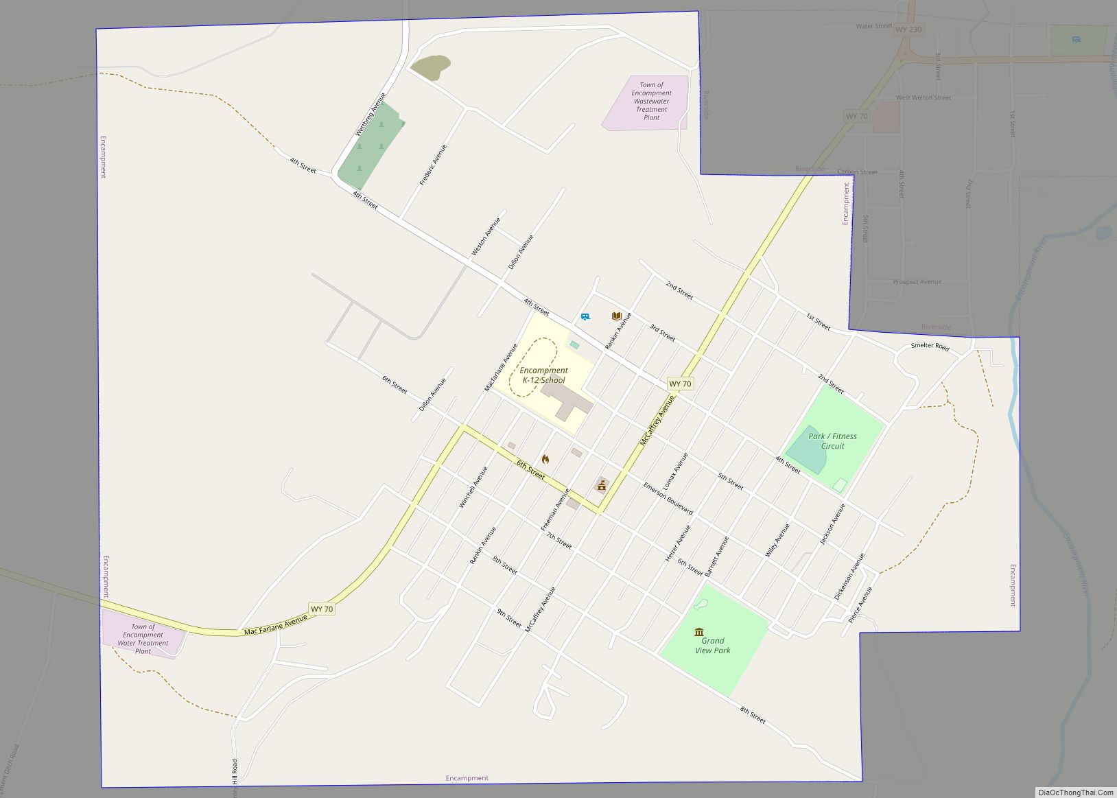
Encampment (also known as Grand Encampment) is a town in southern Carbon County, Wyoming, United States. The population was 450 at the 2010 census.
| Name: | Encampment town |
|---|---|
| LSAD Code: | 43 |
| LSAD Description: | town (suffix) |
| State: | Wyoming |
| County: | Carbon County |
| Elevation: | 7,277 ft (2,218 m) |
| Total Area: | 1.60 sq mi (4.14 km²) |
| Land Area: | 1.60 sq mi (4.14 km²) |
| Water Area: | 0.00 sq mi (0.00 km²) |
| Total Population: | 450 |
| Population Density: | 266.75/sq mi (102.99/km²) |
| Area code: | 307 |
| FIPS code: | 5624750 |
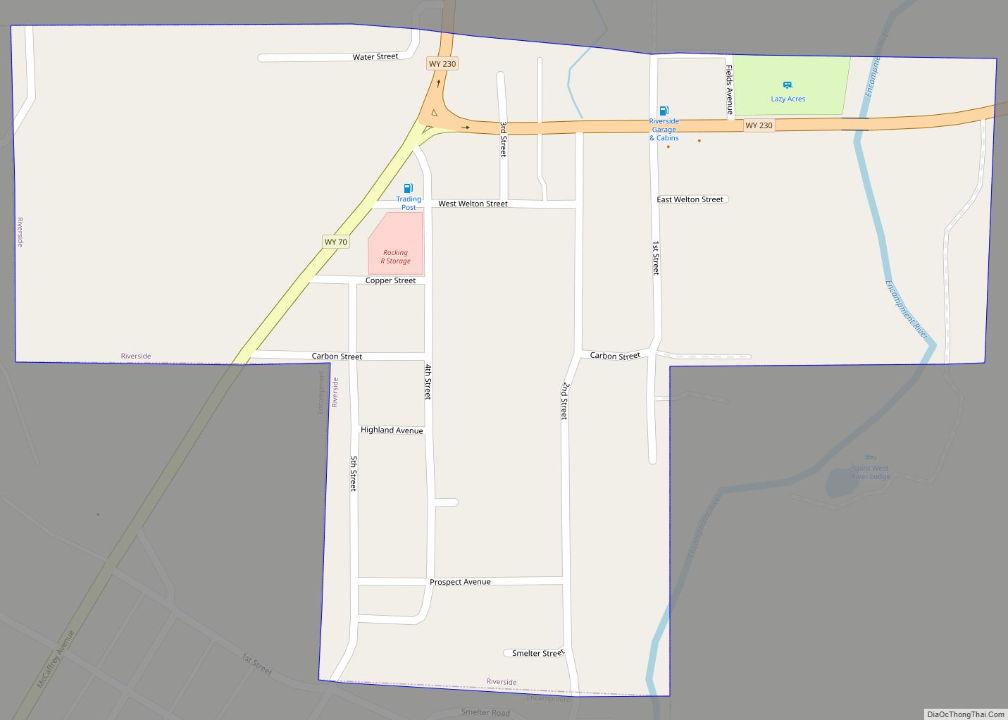
Online Interactive Map
Click on ![]() to view map in "full screen" mode.
to view map in "full screen" mode.
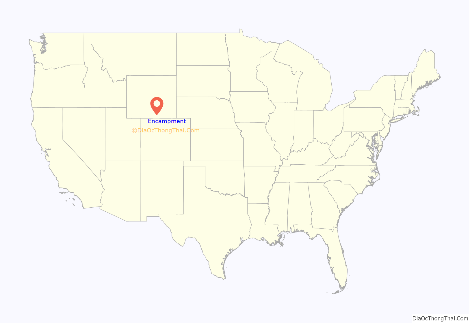
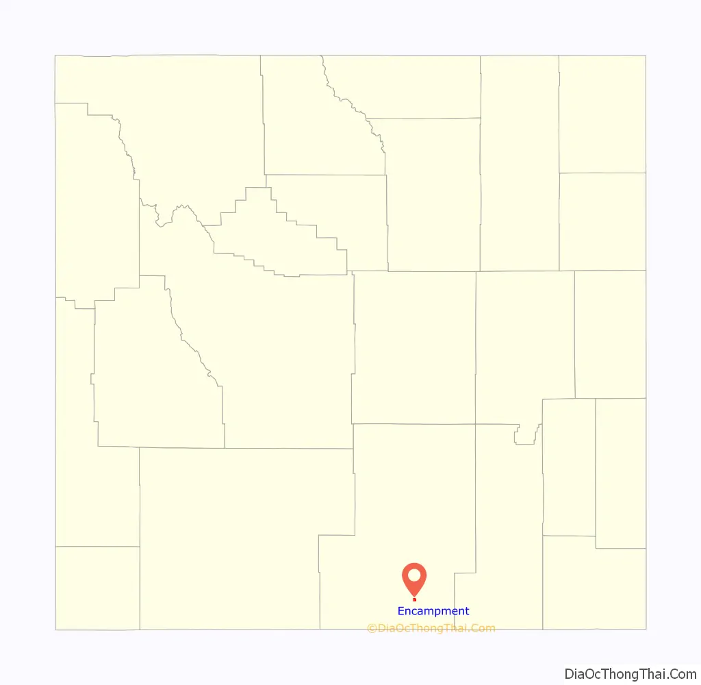
Encampment location map. Where is Encampment town?
History
Known also as ” Grand Encampment”, this town along the Colorado-Wyoming border was, at the turn of the twentieth century, a booming center of copper mining and smelting. At one point a sixteen-mile tramway was built to carry copper ore from the mountains into the town for smelting. This steam powered tramway was, at the time, the longest in the world. A sharp drop in copper prices and disastrous fires drove the mining company into bankruptcy. Mining operations ceased in the early twentieth century. A large sawmill operated in the town between 1950 and 1998.
The Grand Encampment Museum is located in Encampment. It highlights the copper mining, ranching, logging history in the area. It includes over 15 historic buildings and thousands of interesting objects. A research library is located in the main gallery, the Doc Culleton Interpretive Center.
Encampment Road Map
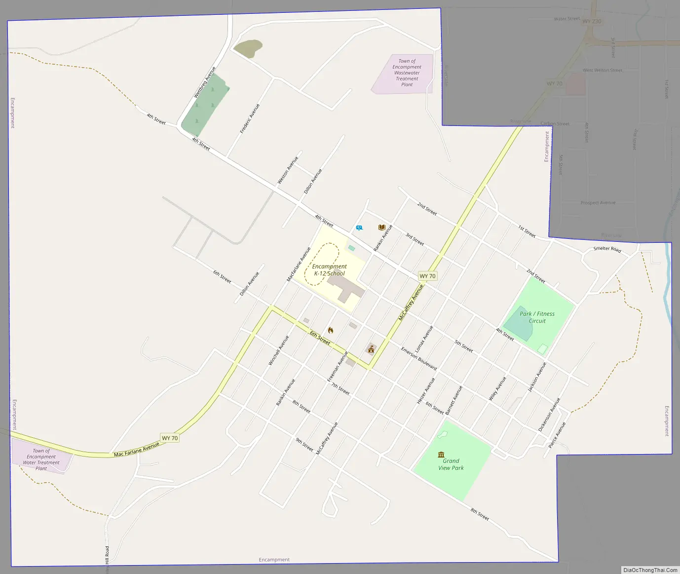
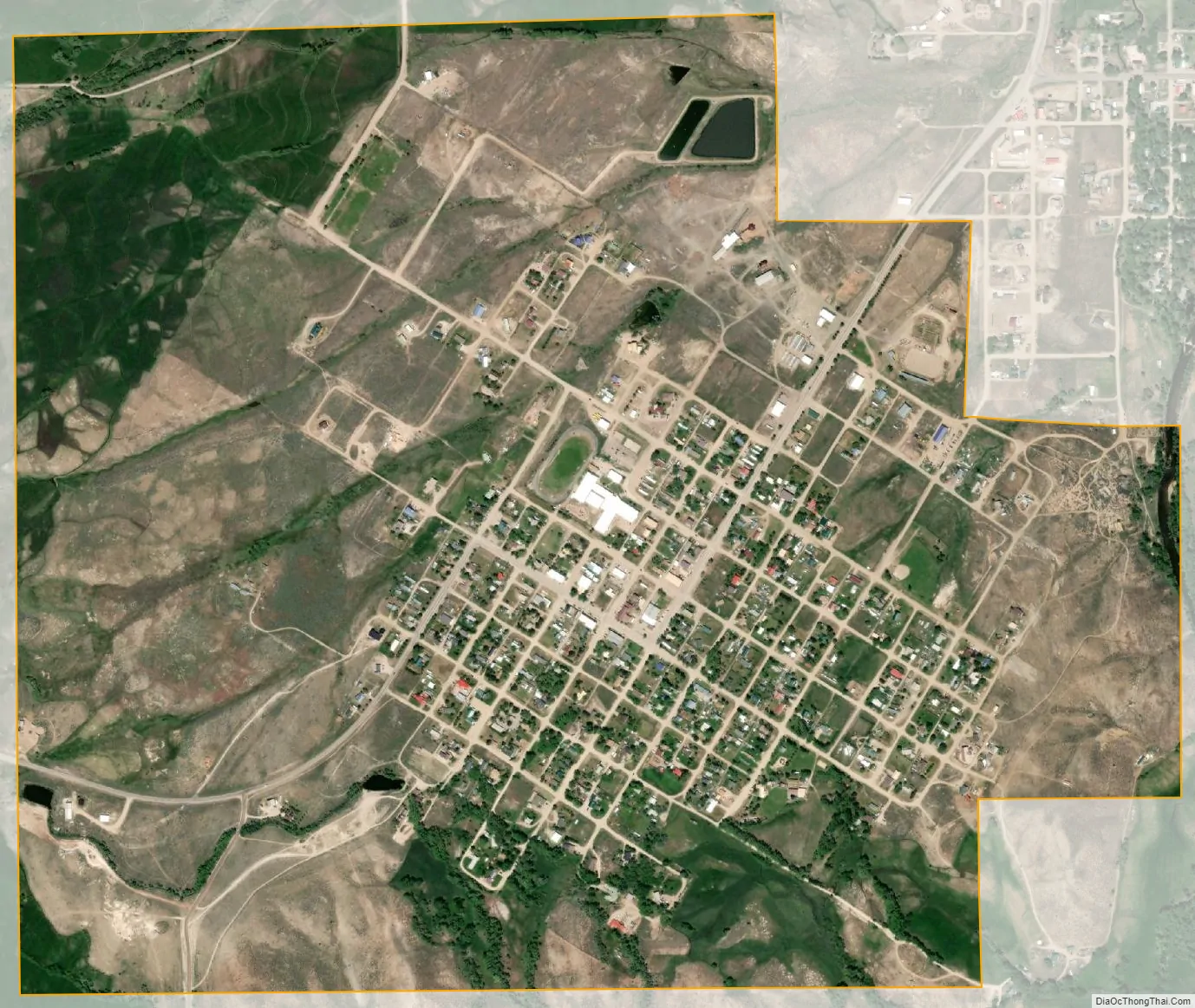
Encampment city Satellite Map
Geography
Encampment is located at 41°12′30″N 106°47′28″W / 41.20833°N 106.79111°W / 41.20833; -106.79111 (41.208216, -106.791215).
According to the United States Census Bureau, the town has a total area of 1.60 square miles (4.14 km), all land.
See also
Map of Wyoming State and its subdivision: Map of other states:- Alabama
- Alaska
- Arizona
- Arkansas
- California
- Colorado
- Connecticut
- Delaware
- District of Columbia
- Florida
- Georgia
- Hawaii
- Idaho
- Illinois
- Indiana
- Iowa
- Kansas
- Kentucky
- Louisiana
- Maine
- Maryland
- Massachusetts
- Michigan
- Minnesota
- Mississippi
- Missouri
- Montana
- Nebraska
- Nevada
- New Hampshire
- New Jersey
- New Mexico
- New York
- North Carolina
- North Dakota
- Ohio
- Oklahoma
- Oregon
- Pennsylvania
- Rhode Island
- South Carolina
- South Dakota
- Tennessee
- Texas
- Utah
- Vermont
- Virginia
- Washington
- West Virginia
- Wisconsin
- Wyoming