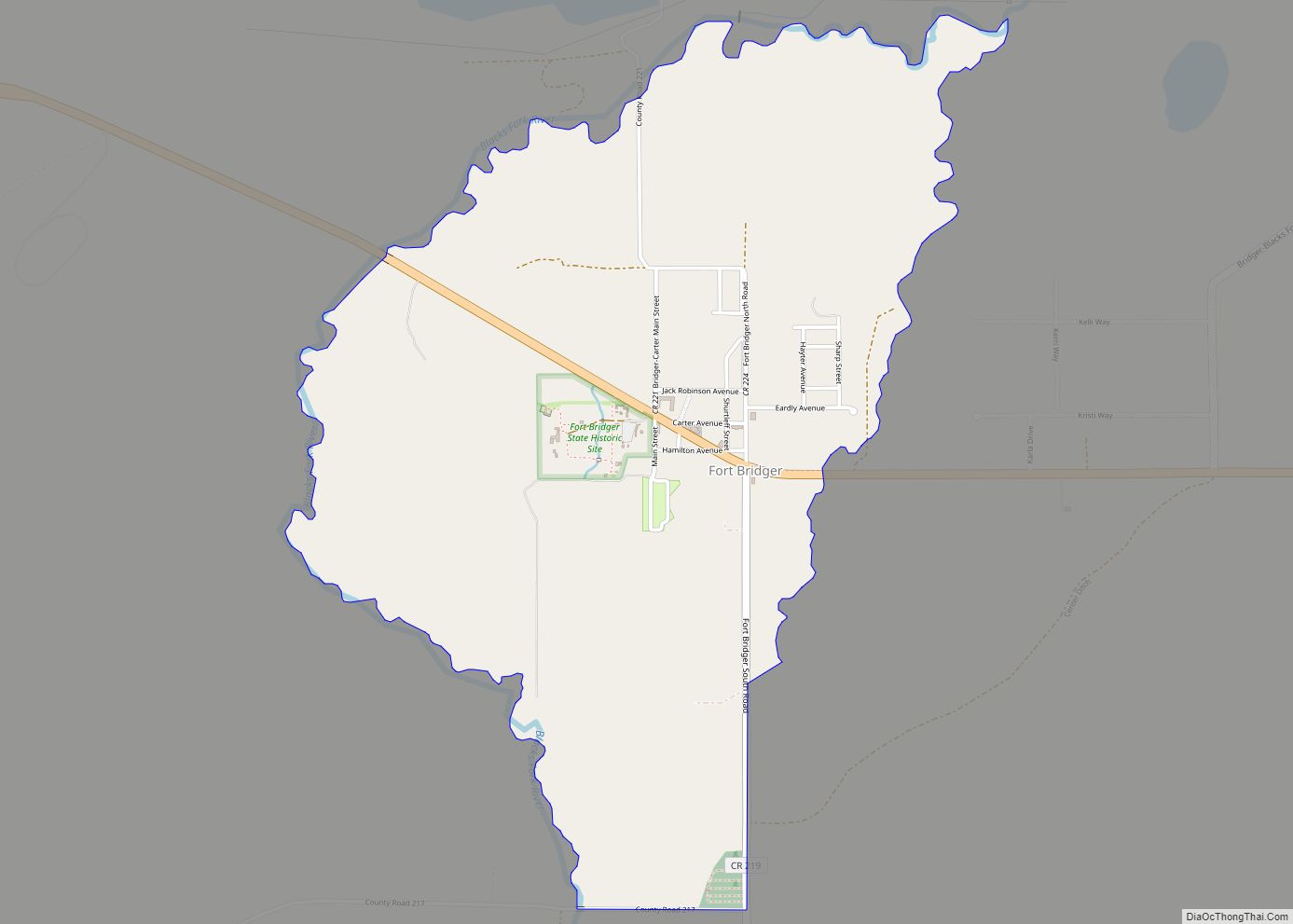
Fort Bridger is a census-designated place (CDP) in eastern Uinta County, Wyoming, United States. The population was 345 at the 2010 census. The community takes its name from the eponymous Fort Bridger, established in 1842, which is located within the boundaries of the CDP.
| Name: | Fort Bridger CDP |
|---|---|
| LSAD Code: | 57 |
| LSAD Description: | CDP (suffix) |
| State: | Wyoming |
| County: | Uinta County |
| Elevation: | 6,674 ft (2,034 m) |
| Total Area: | 2.0 sq mi (5.2 km²) |
| Land Area: | 2.0 sq mi (5.2 km²) |
| Water Area: | 0.0 sq mi (0.0 km²) |
| Total Population: | 345 |
| Population Density: | 170/sq mi (66/km²) |
| ZIP code: | 82933 |
| Area code: | 307 |
| FIPS code: | 5627940 |
| GNISfeature ID: | 1588631 |
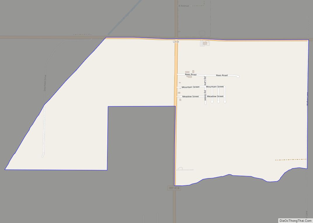
Online Interactive Map
Click on ![]() to view map in "full screen" mode.
to view map in "full screen" mode.
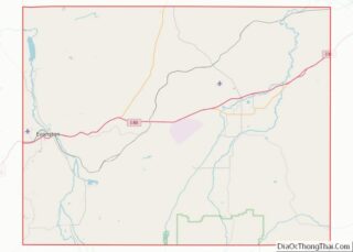
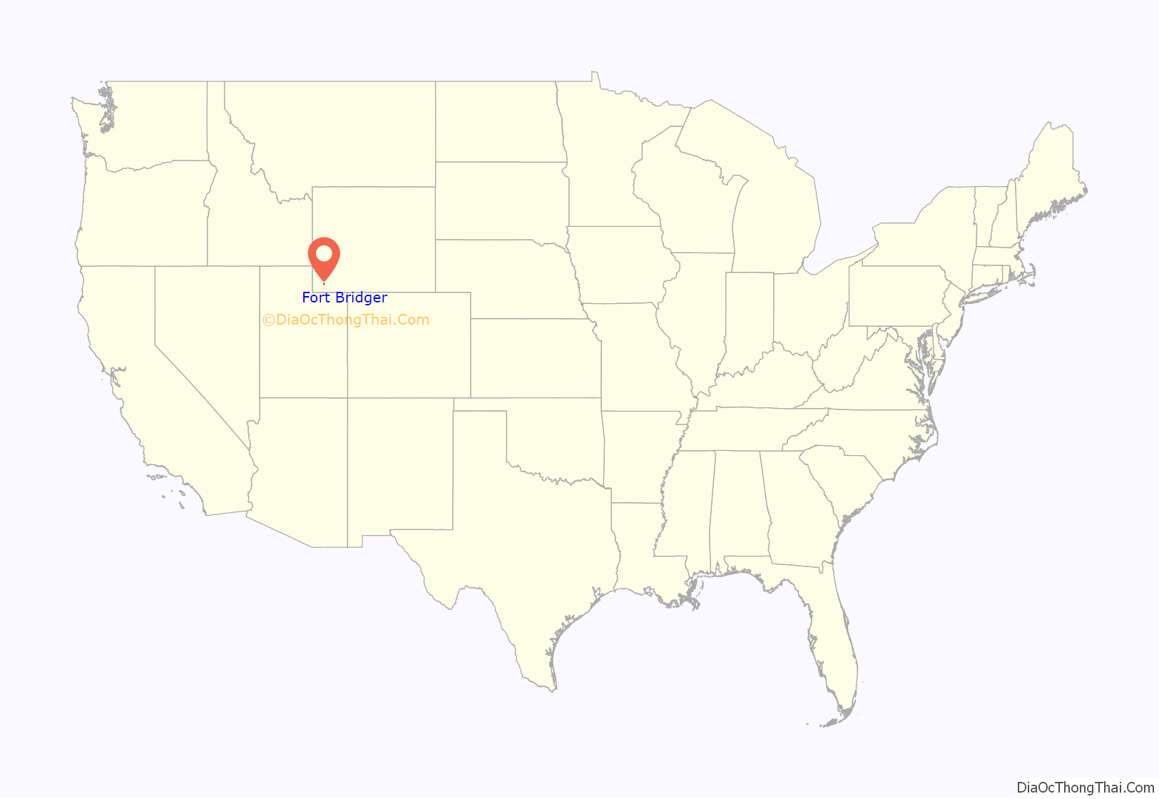
Fort Bridger location map. Where is Fort Bridger CDP?

History
Fort Bridger was established in 1843 by Jim Bridger and Louis Vasquez. It served as a trading post for those who were traveling westward along the Oregon Trail, as well as LDS Pioneers, the Pony Express, the Lincoln Highway, and the transcontinental railroad. The fort was also commonly used to trade with the local Native Americans.
The fort was not very glamorous, it was even a disappointment to most travelers. It was simply two log cabins about 40 feet (12 m) in length connected by a fence to hold horses. Most visitors complained about insufficient supplies and it being over priced. They did, however, have a blacksmith’s shop that many travelers took advantage of.
By 1858, Fort Bridger became a military outpost. Today, Fort Bridger is a historic site. Jim Bridger’s trading post is reconstructed, along with other historic buildings from the military. There is also a museum with gift shops available for visitors.
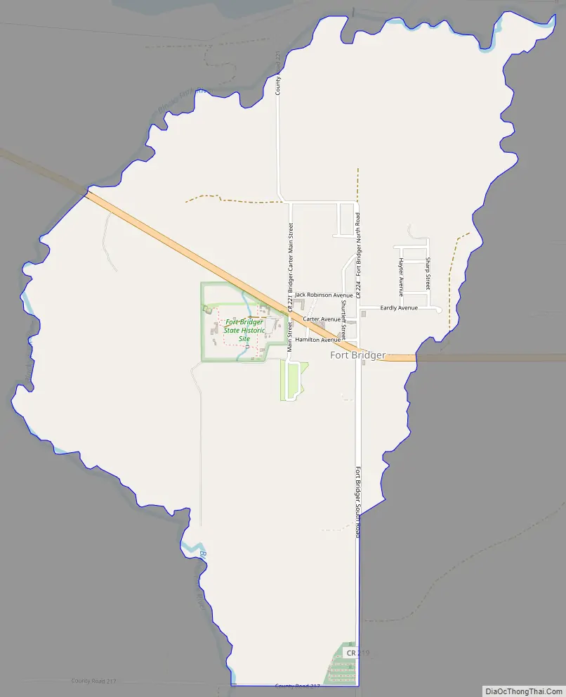
Fort Bridger Road Map
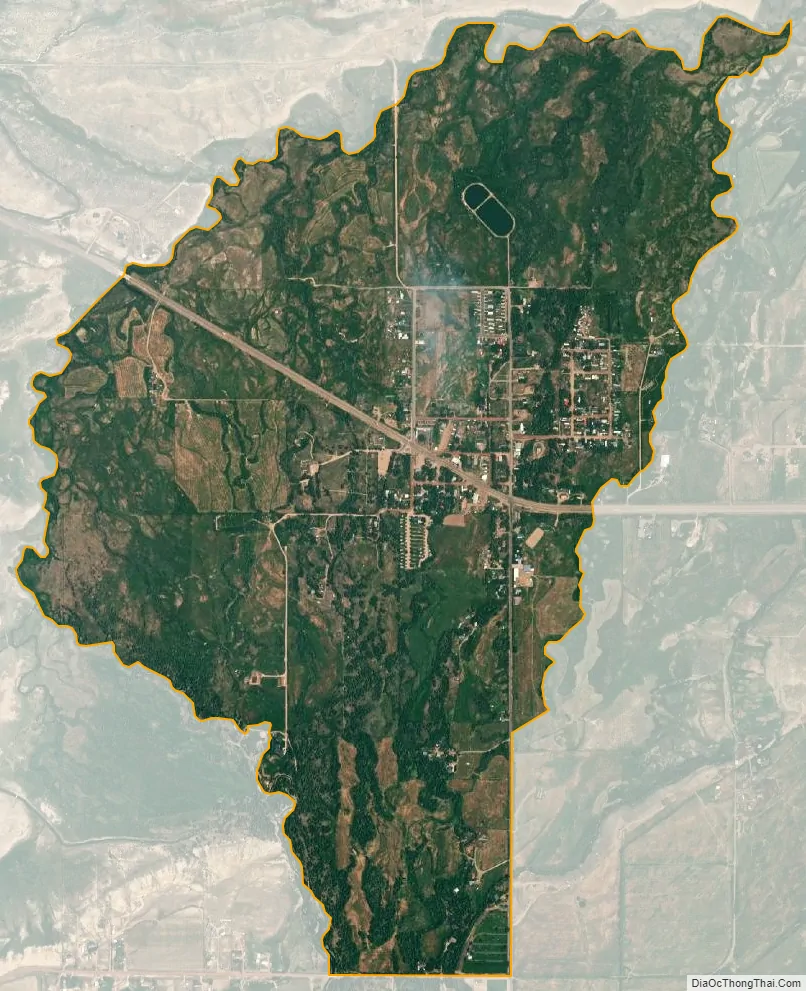
Fort Bridger city Satellite Map
Geography
Fort Bridger is located at 41°19′7″N 110°23′11″W / 41.31861°N 110.38639°W / 41.31861; -110.38639 (41.318716, -110.386418).
According to the United States Census Bureau, the CDP has a total area of 2.0 square miles (5.2 km), all land.
See also
Map of Wyoming State and its subdivision: Map of other states:- Alabama
- Alaska
- Arizona
- Arkansas
- California
- Colorado
- Connecticut
- Delaware
- District of Columbia
- Florida
- Georgia
- Hawaii
- Idaho
- Illinois
- Indiana
- Iowa
- Kansas
- Kentucky
- Louisiana
- Maine
- Maryland
- Massachusetts
- Michigan
- Minnesota
- Mississippi
- Missouri
- Montana
- Nebraska
- Nevada
- New Hampshire
- New Jersey
- New Mexico
- New York
- North Carolina
- North Dakota
- Ohio
- Oklahoma
- Oregon
- Pennsylvania
- Rhode Island
- South Carolina
- South Dakota
- Tennessee
- Texas
- Utah
- Vermont
- Virginia
- Washington
- West Virginia
- Wisconsin
- Wyoming