Frannie is a town in Big Horn and Park counties in the U.S. state of Wyoming. The population was 157 at the 2010 census.
In 1894, Frannie’s post office opened. Postmaster Morris, the town’s first postmaster, had a daughter named Frannie, and the town was named after her. Until 1954, the legal status of Frannie was that of an unincorporated area taking in parts of Big Horn and Park Counties. In 1954, the town was incorporated. Under Wyoming law (WS 15-3-101), Frannie now has the status of an incorporated town having less than 4,000 people.
The town has a mayor-council form of government in which the governing body comprises the mayor and the council, together. The governing body has authority over the budget, other fiscal matters, and other major issues affecting the town. The current mayor is Steven Richardson, whose current term expires in 2026.
Frannie receives natural gas service from Frannie-Deaver Utilities, a privately held company in Frannie. Since 1955 the town has provided municipal (potable) water service. In 2000 the town installed a sanitary sewer system. The town contracts for its trash collection and fire-fighting services. Fire protection is provided by the Big Horn County Fire District #5 in Deaver, Wyoming. Police coverage is provided primarily by the Big Horn County Sheriff’s Office.
| Name: | Frannie town |
|---|---|
| LSAD Code: | 43 |
| LSAD Description: | town (suffix) |
| State: | Wyoming |
| County: | Big Horn County, Park County |
| Elevation: | 4,216 ft (1,285 m) |
| Total Area: | 0.44 sq mi (1.15 km²) |
| Land Area: | 0.44 sq mi (1.15 km²) |
| Water Area: | 0.00 sq mi (0.00 km²) |
| Total Population: | 157 |
| Population Density: | 358.92/sq mi (138.65/km²) |
| ZIP code: | 82423 |
| Area code: | 307 |
| FIPS code: | 5629825 |
| GNISfeature ID: | 1588719 |
| Website: | franniewy.govoffice2.com |
Online Interactive Map
Click on ![]() to view map in "full screen" mode.
to view map in "full screen" mode.
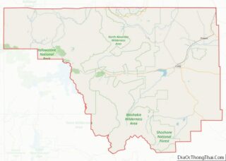
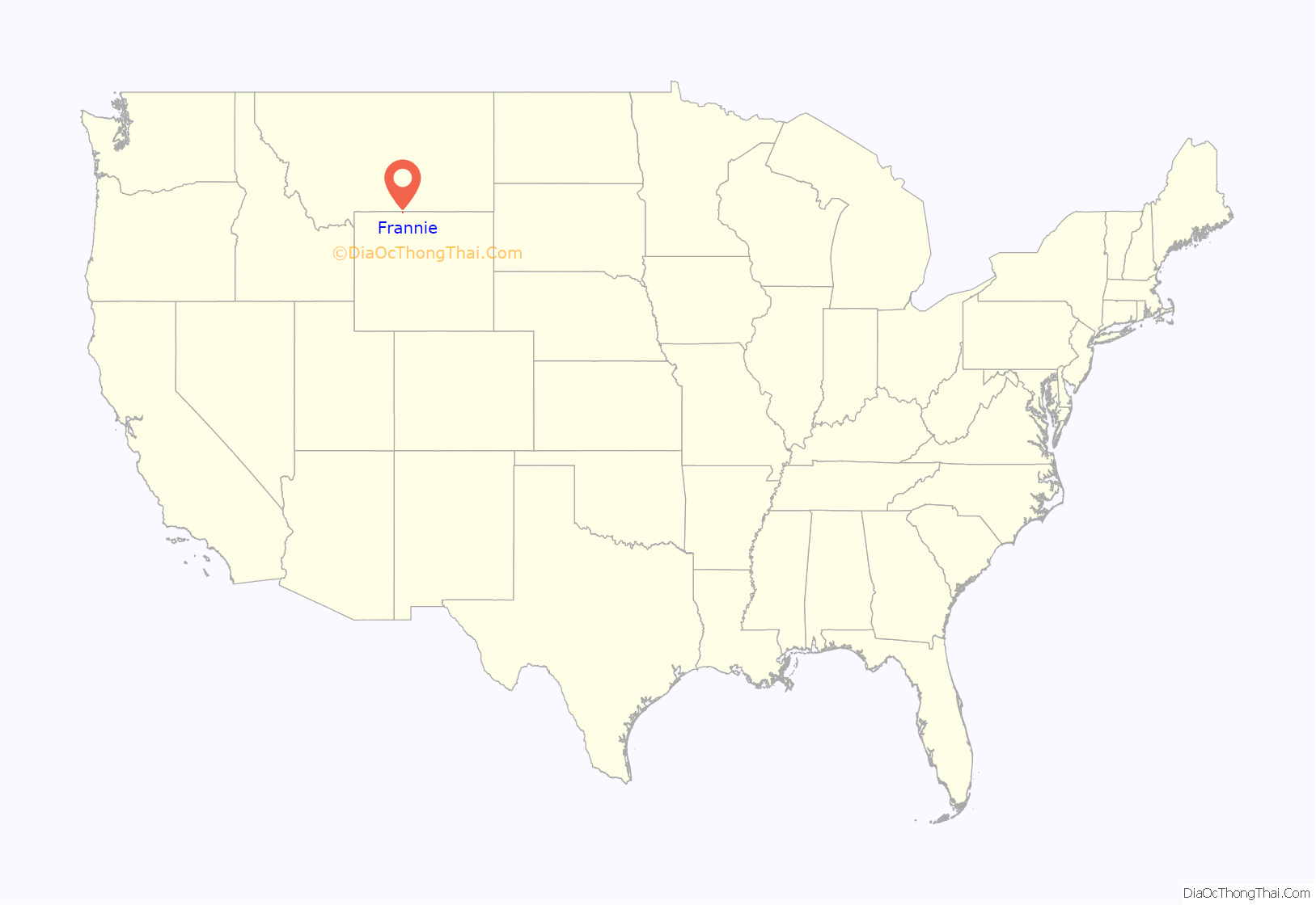
Frannie location map. Where is Frannie town?
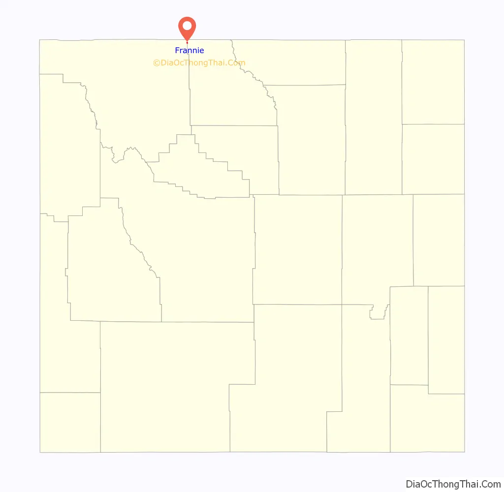
Frannie Road Map
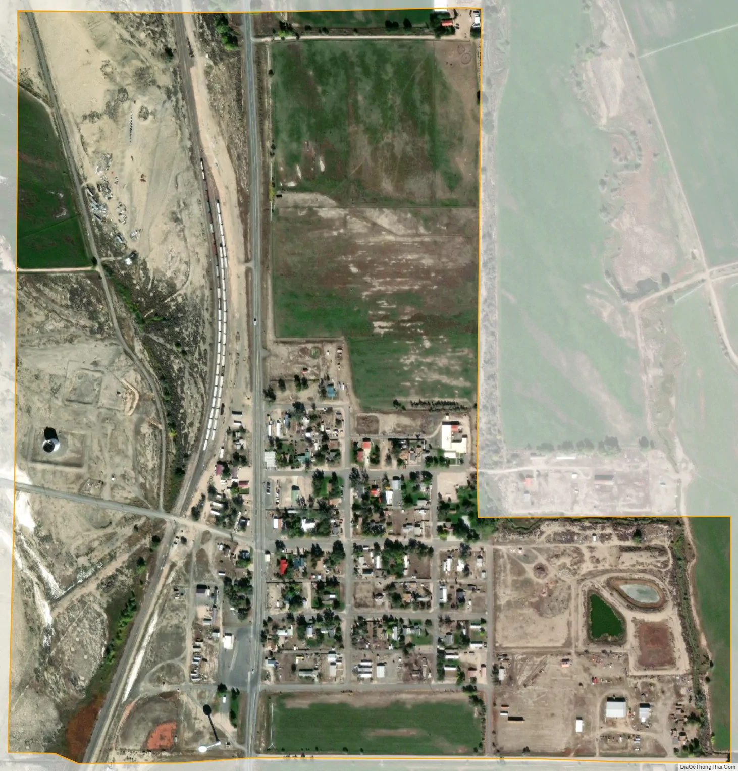
Frannie city Satellite Map
Geography
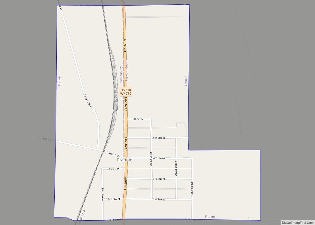
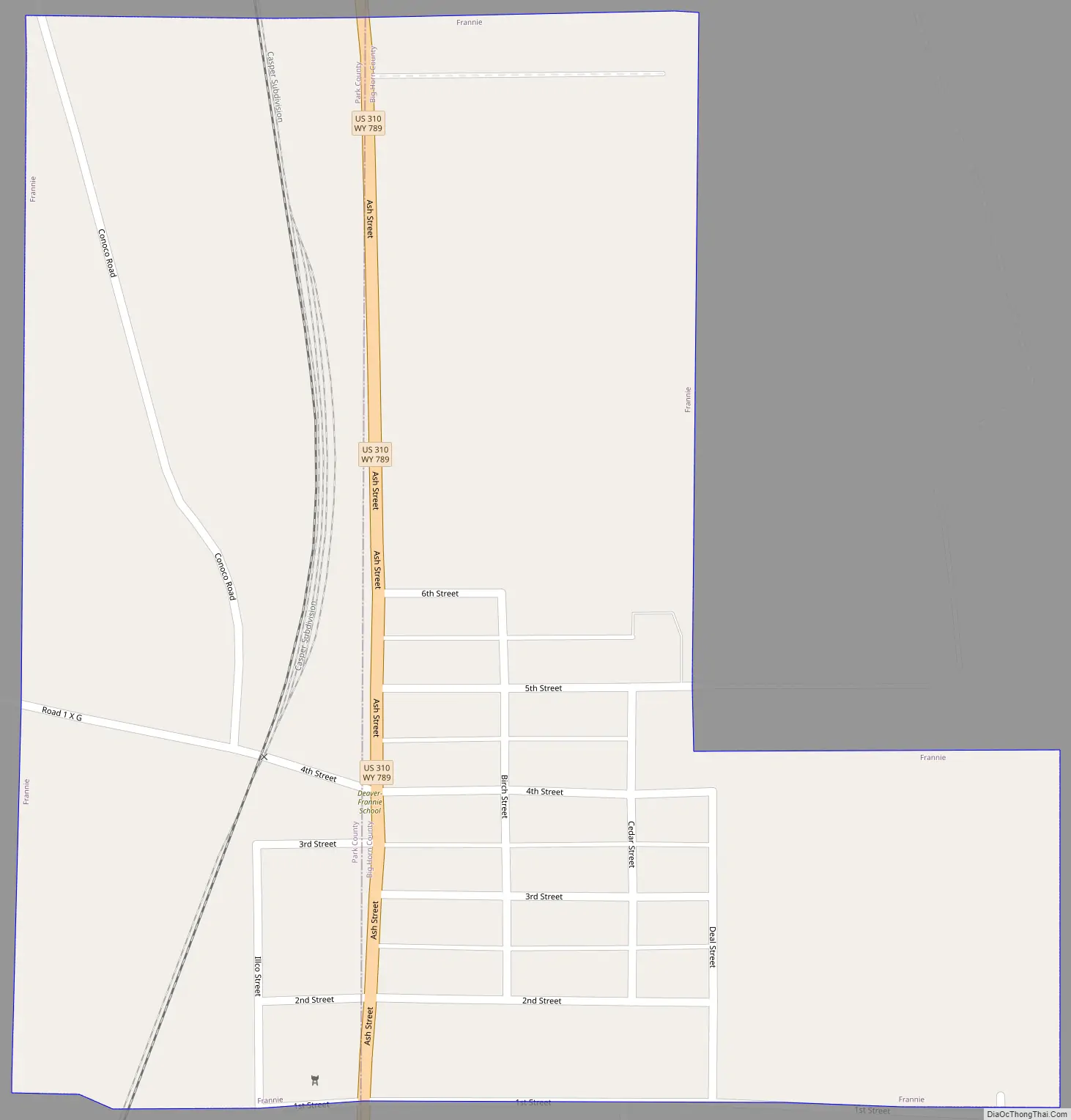
Frannie is located at 44°58′11″N 108°37′13″W / 44.96972°N 108.62028°W / 44.96972; -108.62028 (44.969738, -108.620340). US Highway 310 (locally known as “Ash St.”) is the main road through the town. All but 19 of the town’s population is found east of US 310. The town is also located two miles south of the Montana border and is the northernmost town in Wyoming’s Bighorn Basin—a mountain desert region which relies on a network of canals and pipelines to provide irrigation and potable water for the population, farming, and ranching activities.
According to the United States Census Bureau, the town has a total area of 0.44 square miles (1.14 km), all land. The Town boundaries, at its eastern end, follow the Sage/Frannie Creek.
Among Wyoming towns Frannie has a unique geographic characteristic: it is the only town having boundaries which include parts of two counties—Big Horn (pop. 138) and Park (pop. 19.) Accordingly, visitors to Frannie are greeted with a welcoming sign which includes the phrase “Biggest Little Town In Wyoming.” Locals say this designation is because “it took two counties to hold our town!” Included in the Park County portion of Frannie is the post office and two of the town’s three businesses. The Town Hall is located within the Big Horn County portion.
See also
Map of Wyoming State and its subdivision: Map of other states:- Alabama
- Alaska
- Arizona
- Arkansas
- California
- Colorado
- Connecticut
- Delaware
- District of Columbia
- Florida
- Georgia
- Hawaii
- Idaho
- Illinois
- Indiana
- Iowa
- Kansas
- Kentucky
- Louisiana
- Maine
- Maryland
- Massachusetts
- Michigan
- Minnesota
- Mississippi
- Missouri
- Montana
- Nebraska
- Nevada
- New Hampshire
- New Jersey
- New Mexico
- New York
- North Carolina
- North Dakota
- Ohio
- Oklahoma
- Oregon
- Pennsylvania
- Rhode Island
- South Carolina
- South Dakota
- Tennessee
- Texas
- Utah
- Vermont
- Virginia
- Washington
- West Virginia
- Wisconsin
- Wyoming