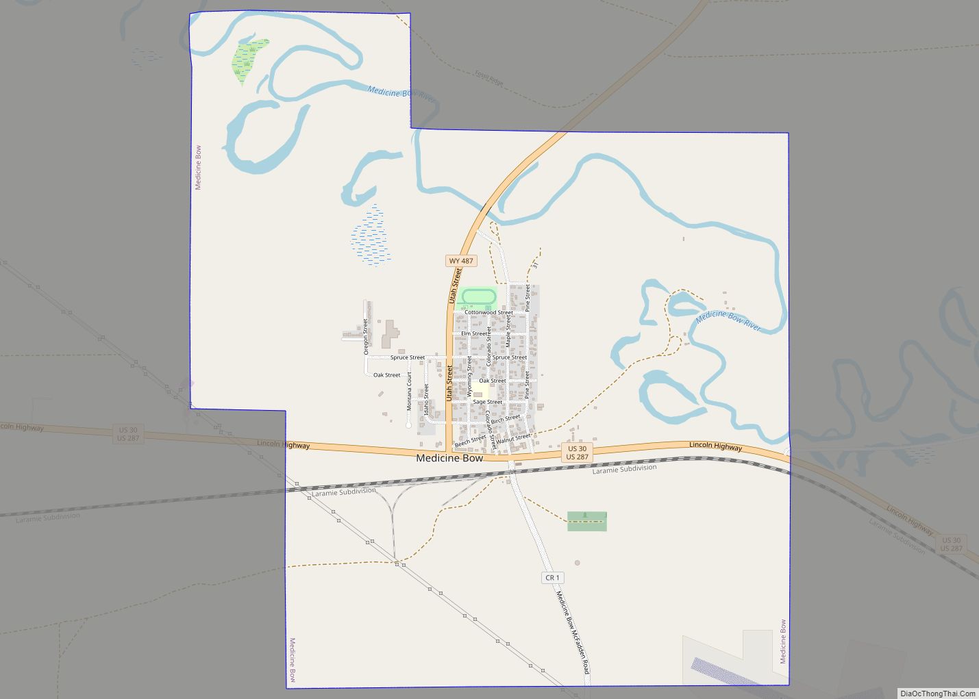
Medicine Bow is a town in Carbon County, Wyoming, United States. Its population was 284 at the 2010 census.
| Name: | Medicine Bow town |
|---|---|
| LSAD Code: | 43 |
| LSAD Description: | town (suffix) |
| State: | Wyoming |
| County: | Carbon County |
| Elevation: | 6,565 ft (2,001 m) |
| Total Area: | 3.46 sq mi (8.96 km²) |
| Land Area: | 3.46 sq mi (8.96 km²) |
| Water Area: | 0.00 sq mi (0.00 km²) |
| Total Population: | 284 |
| Population Density: | 74.90/sq mi (28.92/km²) |
| ZIP code: | 82329 |
| Area code: | 307 |
| FIPS code: | 5651575 |
| GNISfeature ID: | 1591446 |
| Website: | www.medicinebow.org |
Online Interactive Map
Click on ![]() to view map in "full screen" mode.
to view map in "full screen" mode.
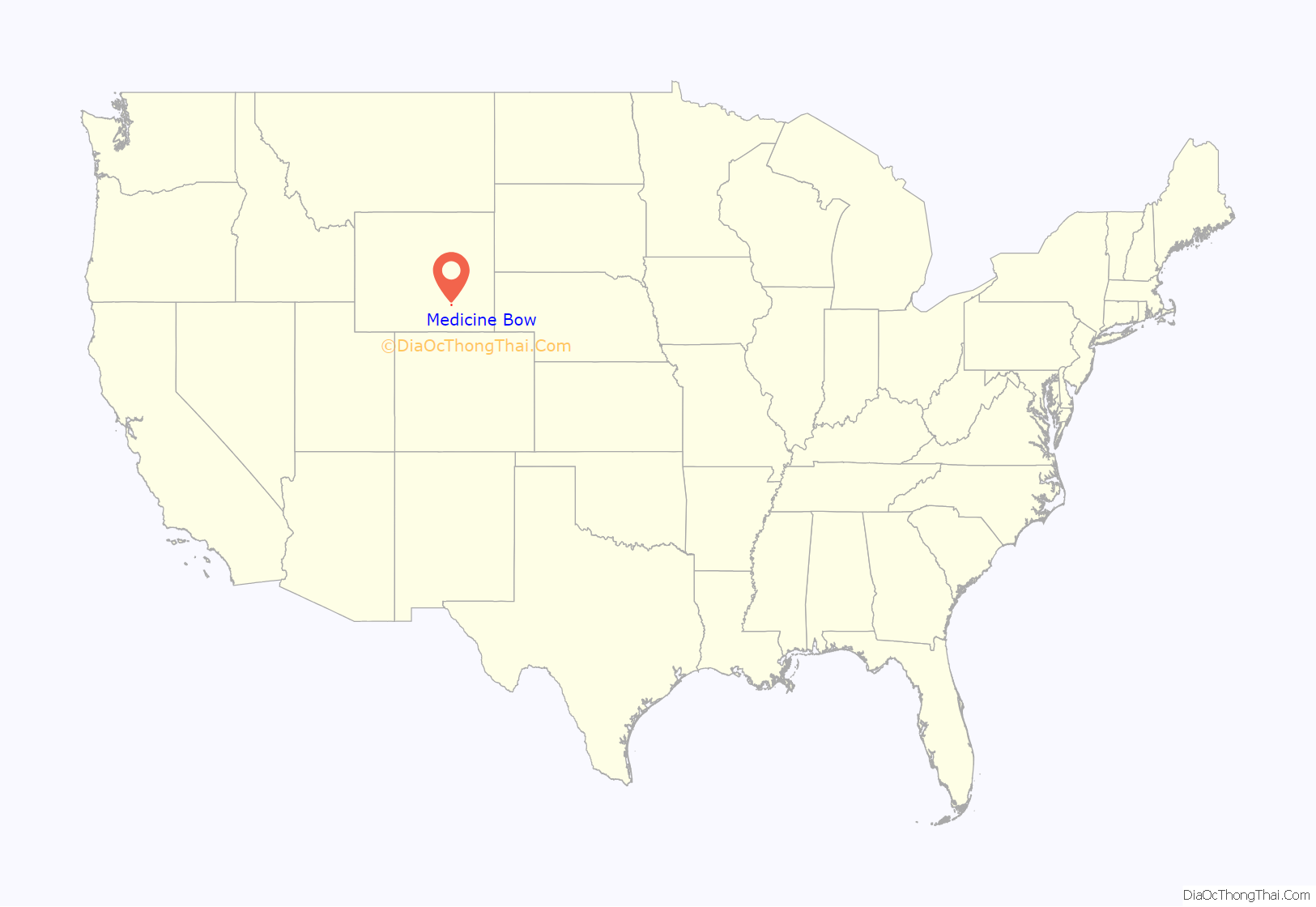
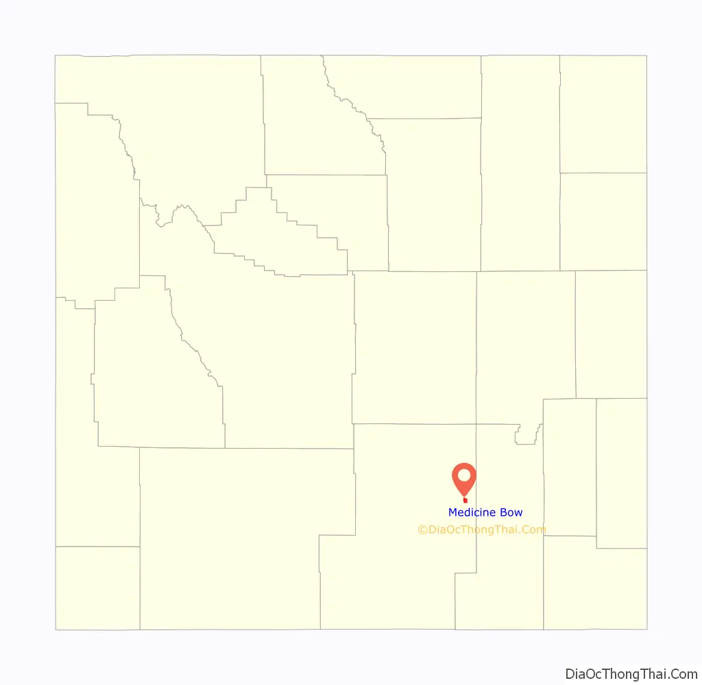
Medicine Bow location map. Where is Medicine Bow town?
History
The community largely owes its existence to the first transcontinental railroad, built through the area in 1868. A post office called Medicine Bow has been in operation since 1869. The community was named after the Medicine Bow River.
Dippy, a well-known dinosaur skeleton, was found in a quarry nearby around 1898. In 1899, fossil hunters for the American Museum of Natural History and the Field Museum stayed in or near the town during their search for large dinosaur skeletons. The town had a railroad and was near the fossilferous sedimentary hills from the Jurassic Morrison Formation, making it an important stopping location for paleontologists, with fossils of Diplodocus and Brontosaurus found nearby at Como Bluff by the two institutions during the late 19th and early 20th centuries.
The town was noted to be plagued by crime, with famous bandits such as Butch Cassidy and his Wild Bunch enacting the Wilcox Train Robbery only a few miles away from the AMNH’s fossil localities and Medicine Bow itself.
The Virginian Hotel is a historic hotel located in Medicine Bow. It was built in 1911 by August Grimm. The hotel was added to the National Register of Historic Places in 1978.
In the 1910s, part of the Lincoln Highway was routed through Medicine Bow until Interstate 80 replaced it in 1970.
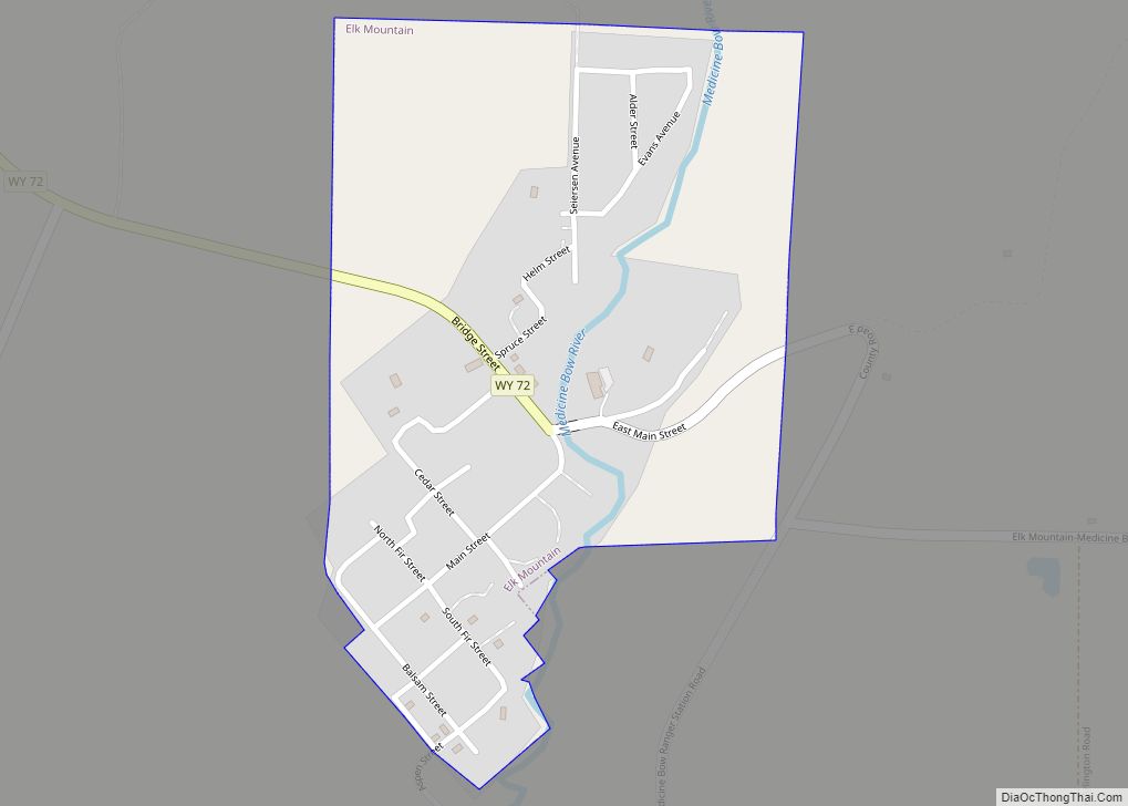
Medicine Bow Road Map
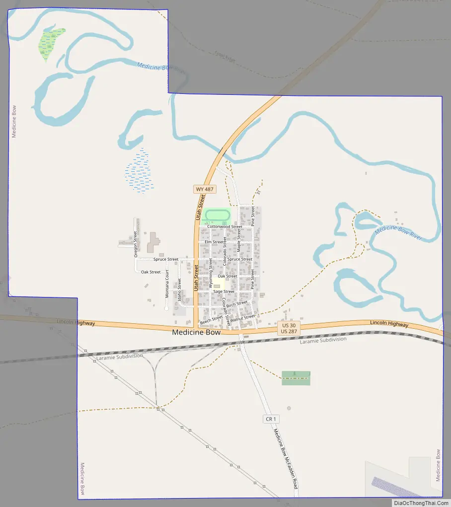
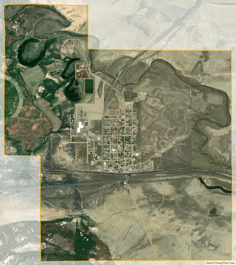
Medicine Bow city Satellite Map
Geography
Medicine Bow is located at 41°53′52″N 106°12′10″W / 41.89778°N 106.20278°W / 41.89778; -106.20278 (41.897668, -106.202796).
According to the United States Census Bureau, the town has a total area of 3.46 square miles (8.96 km), all land.
Climate
See also
Map of Wyoming State and its subdivision: Map of other states:- Alabama
- Alaska
- Arizona
- Arkansas
- California
- Colorado
- Connecticut
- Delaware
- District of Columbia
- Florida
- Georgia
- Hawaii
- Idaho
- Illinois
- Indiana
- Iowa
- Kansas
- Kentucky
- Louisiana
- Maine
- Maryland
- Massachusetts
- Michigan
- Minnesota
- Mississippi
- Missouri
- Montana
- Nebraska
- Nevada
- New Hampshire
- New Jersey
- New Mexico
- New York
- North Carolina
- North Dakota
- Ohio
- Oklahoma
- Oregon
- Pennsylvania
- Rhode Island
- South Carolina
- South Dakota
- Tennessee
- Texas
- Utah
- Vermont
- Virginia
- Washington
- West Virginia
- Wisconsin
- Wyoming