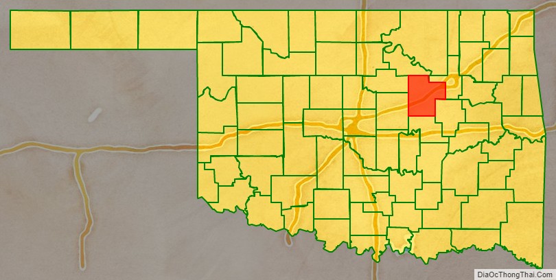
Creek County is a county located in the U.S. state of Oklahoma. As of the 2010 census, the population was 69,967. Its county seat is Sapulpa.
Creek County is part of the Tulsa, OK Metropolitan Statistical Area.
| Name: | Creek County |
|---|---|
| FIPS code: | 40-037 |
| State: | Oklahoma |
| Founded: | 1907 |
| Named for: | Creek Nation |
| Seat: | Sapulpa |
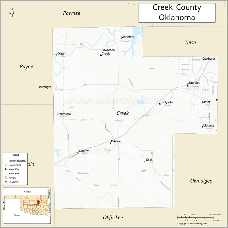
| Largest city: | Sapulpa |
| Total Area: | 970 sq mi (2,500 km²) |
| Land Area: | 950 sq mi (2,500 km²) |
| Total Population: | 69,967 |
| Population Density: | 74/sq mi (29/km²) |
| Time zone: | UTC−6 (Central) |
| Summer Time Zone (DST): | UTC−5 (CDT) |
| Website: | www.creekcountyonline.com |
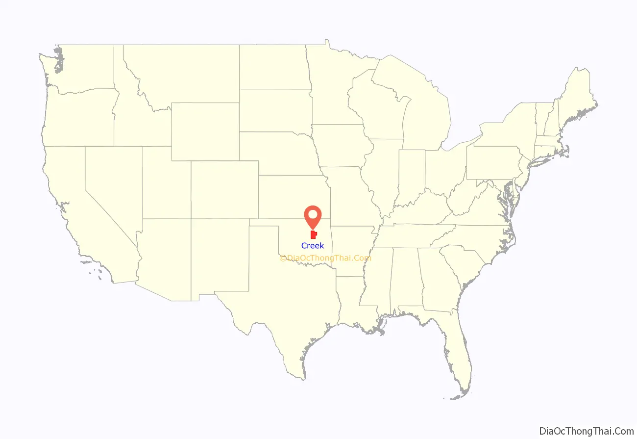
Creek County location map. Where is Creek County?
History
European explorers traveled through this area early in the 19th Century, after the Louisiana Purchase. In 1825, the Osage Nation ceded the territory where the Federal Government planned to resettle the Creek Nation and other tribes after their expulsion from the Southeastern part of the United States. The Creeks began migrating into this area, where they and their black slaves settled to begin farming and raising cattle. In 1835, Federal soldiers under Captain J. L. Dawson built the Dawson Road, following an old Osage hunting trail.
Railroads gave an important boost to the local economy. In 1886, the Atlantic and Pacific Railroad built a line from Red Fork to Sapulpa. In 1898, the St. Louis and Oklahoma City Railway Company (later the St. Louis–San Francisco Railway), connected Sapulpa and Oklahoma City.
The present Creek County was established at the time of statehood, with a population of 18,365. The town of Sapulpa was initially designated as the county seat. This decision was challenged by supporters of the town of Bristow. An election held August 12, 1908 to choose a permanent seat was won by Sapulpa, but the dispute did not end there. After a series of court cases, the Oklahoma Supreme Court ruled in favor of Sapulpa on August 1, 1913.
After oil was discovered at Glenn Pool in adjacent Tulsa County in 1905, other strikes occurred in Creek County. The Cushing-Drumright Oil Field opened in 1912, creating boom towns Drumright, Kiefer and Oilton. By 1920, the county population had increased to 62,480.
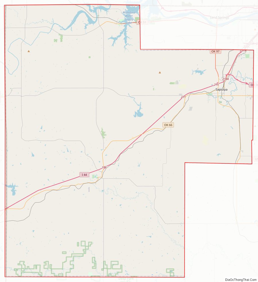
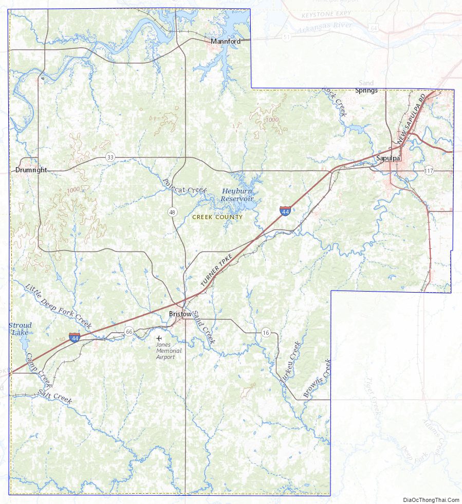
Creek County Road Map
Geography
According to the U.S. Census Bureau, the county has a total area of 970 square miles (2,500 km), of which 950 square miles (2,500 km) is land and 20 square miles (52 km) (2.0%) is water. It is drained by the Cimarron River, and the Deep Fork and Little Deep Fork of the North Canadian River. Heyburn Lake is contained within the county. Keystone Lake is partially within Creek County.
Major highways
- Interstate 44
- US Highway 75 ALT
- State Highway 16
- State Highway 33
- State Highway 48
- State Highway 51
- State Highway 66
- State Highway 99
- State Highway 117
Adjacent counties
- Pawnee County (north)
- Tulsa County (east)
- Okmulgee County (southeast)
- Okfuskee County (south)
- Lincoln County (west)
- Payne County (northwest)
Creek County Topographic Map
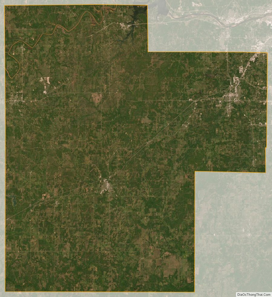
Creek County Satellite Map
Creek County Outline Map

See also
Map of Oklahoma State and its subdivision:- Adair
- Alfalfa
- Atoka
- Beaver
- Beckham
- Blaine
- Bryan
- Caddo
- Canadian
- Carter
- Cherokee
- Choctaw
- Cimarron
- Cleveland
- Coal
- Comanche
- Cotton
- Craig
- Creek
- Custer
- Delaware
- Dewey
- Ellis
- Garfield
- Garvin
- Grady
- Grant
- Greer
- Harmon
- Harper
- Haskell
- Hughes
- Jackson
- Jefferson
- Johnston
- Kay
- Kingfisher
- Kiowa
- Latimer
- Le Flore
- Lincoln
- Logan
- Love
- Major
- Marshall
- Mayes
- McClain
- McCurtain
- McIntosh
- Murray
- Muskogee
- Noble
- Nowata
- Okfuskee
- Oklahoma
- Okmulgee
- Osage
- Ottawa
- Pawnee
- Payne
- Pittsburg
- Pontotoc
- Pottawatomie
- Pushmataha
- Roger Mills
- Rogers
- Seminole
- Sequoyah
- Stephens
- Texas
- Tillman
- Tulsa
- Wagoner
- Washington
- Washita
- Woods
- Woodward
- Alabama
- Alaska
- Arizona
- Arkansas
- California
- Colorado
- Connecticut
- Delaware
- District of Columbia
- Florida
- Georgia
- Hawaii
- Idaho
- Illinois
- Indiana
- Iowa
- Kansas
- Kentucky
- Louisiana
- Maine
- Maryland
- Massachusetts
- Michigan
- Minnesota
- Mississippi
- Missouri
- Montana
- Nebraska
- Nevada
- New Hampshire
- New Jersey
- New Mexico
- New York
- North Carolina
- North Dakota
- Ohio
- Oklahoma
- Oregon
- Pennsylvania
- Rhode Island
- South Carolina
- South Dakota
- Tennessee
- Texas
- Utah
- Vermont
- Virginia
- Washington
- West Virginia
- Wisconsin
- Wyoming