Tulsa (/ˈtʌlsə/) is the second-largest city in the state of Oklahoma and 47th-most populous city in the United States. The population was 413,066 as of the 2020 census. It is the principal municipality of the Tulsa metropolitan area, a region with 1,023,988 residents. The city serves as the county seat of Tulsa County, the most densely populated county in Oklahoma, with urban development extending into Osage, Rogers and Wagoner counties.
Tulsa was settled between 1828 and 1836 by the Lochapoka Band of Creek Native American tribe and most of Tulsa is still part of the territory of the Muscogee (Creek) Nation.
Historically, a robust energy sector fueled Tulsa’s economy; however, today the city has diversified and leading sectors include finance, aviation, telecommunications and technology. Two institutions of higher education within the city have sports teams at the NCAA Division I level: Oral Roberts University and the University of Tulsa. As well, the University of Oklahoma has a secondary campus at the Tulsa Schusterman Center, and Oklahoma State University has a secondary campus located in downtown Tulsa. For most of the 20th century, the city held the nickname “Oil Capital of the World” and played a major role as one of the most important hubs for the American oil industry.
It is situated on the Arkansas River between the Osage Hills and the foothills of the Ozark Mountains in northeast Oklahoma, a region of the state known as “Green Country”. Considered the cultural and arts center of Oklahoma, Tulsa houses two art museums, full-time professional opera and ballet companies, and one of the nation’s largest concentrations of art deco architecture.
| Name: | Tulsa city |
|---|---|
| LSAD Code: | 25 |
| LSAD Description: | city (suffix) |
| State: | Oklahoma |
| County: | Osage County, Rogers County, Tulsa County, Wagoner County |
| Elevation: | 722 ft (194 m) |
| Land Area: | 197.76 sq mi (512.21 km²) |
| Water Area: | 4.09 sq mi (10.58 km²) |
| Population Density: | 2,088.67/sq mi (806.44/km²) |
| Area code: | 539/918 |
| FIPS code: | 4075000 |
| GNISfeature ID: | 1100962 |
| Website: | www.cityoftulsa.org |
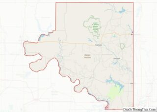
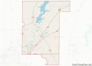
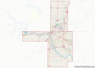
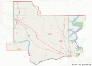
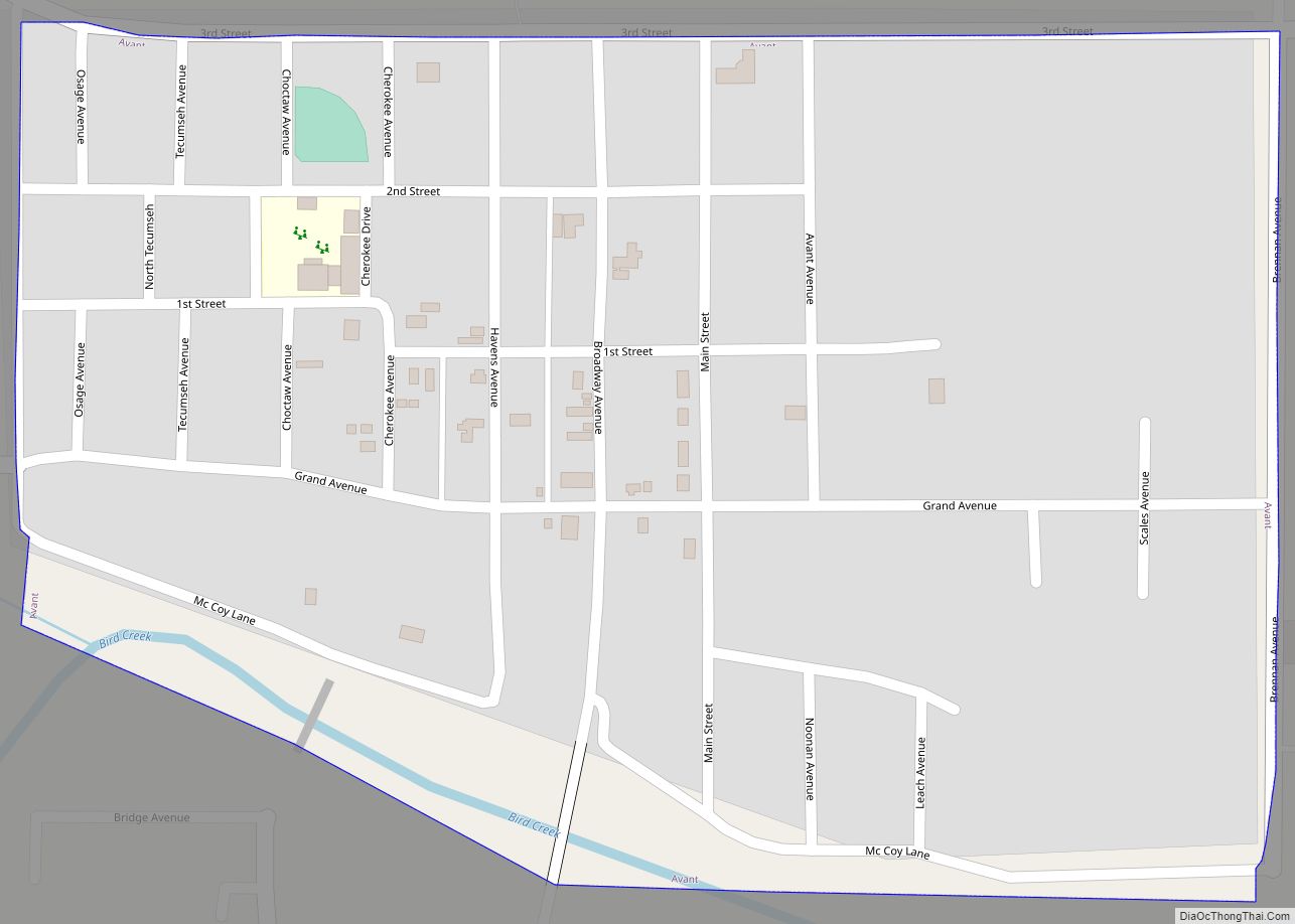
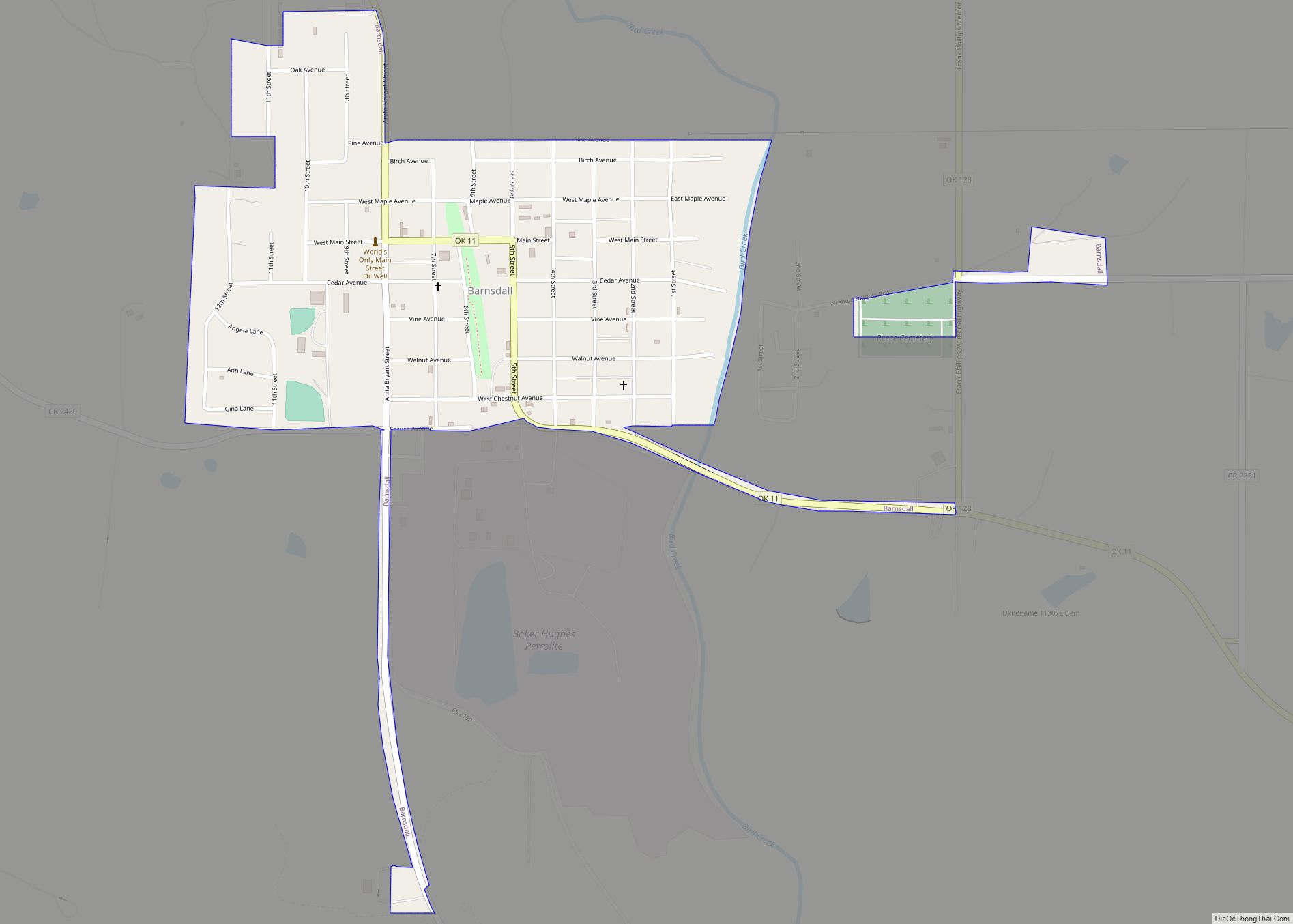
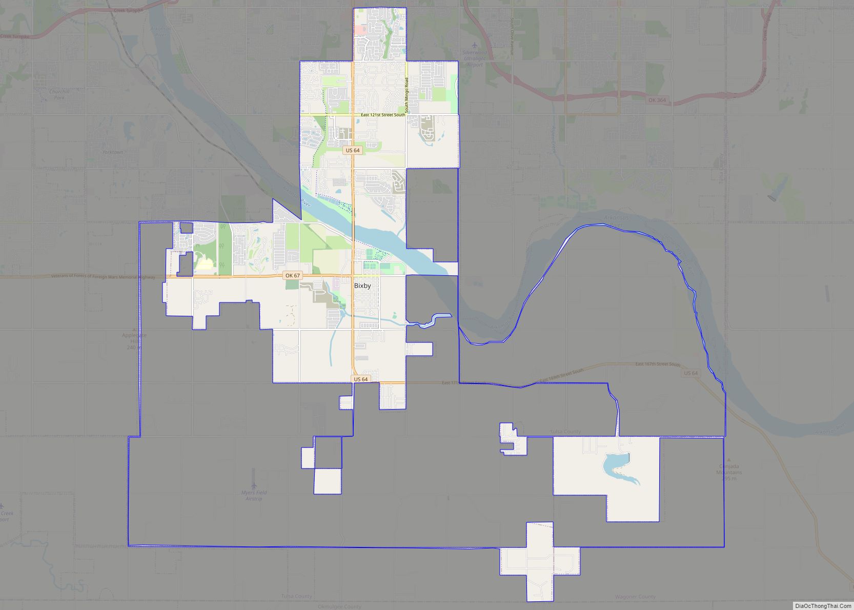
Explore Tulsa with this interactive map collection. This collection includes a road map, things to do, a reference map, and an interactive map of the surrounding area. It is an excellent resource to help you navigate the city and make the most of your visit.
The road map of Tulsa can help you find your way around the city. It includes major roads and highways, as well as street names and landmarks. You can also find points of interest, such as parks, restaurants, and shopping centers.
The things to do map will help you plan your trip. It shows you all the great attractions in the city, as well as museums, galleries, and other popular destinations. You can also find nearby hotels, restaurants, and other amenities.
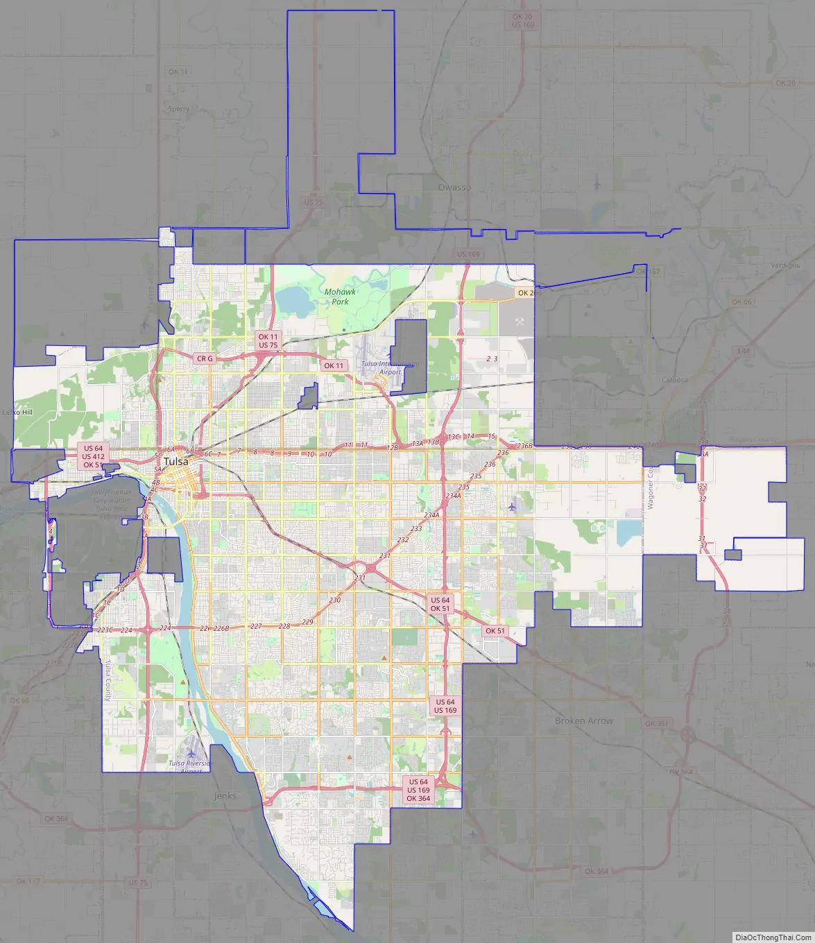
The reference map is great for those who are just starting to explore the city. It includes the city limits, major streets, and other important landmarks. It also includes information about the city’s public transportation system.
The interactive map of the surrounding area is great for those who are looking to explore the region. It includes nearby cities, towns, parks, and other attractions. You can also find information about transportation, such as airports, bus routes, and train stations.
The Tulsa map collection is an excellent resource for anyone looking to explore the city. Use it to help you navigate the city and make the most of your visit. With this collection, you can easily find your way around Tulsa and all its wonderful attractions.
Online Interactive Map
Click on ![]() to view map in "full screen" mode.
to view map in "full screen" mode.
Tulsa Oklahoma is a great place to visit and explore. It’s the second-most populous city after Oklahoma City. The Arkansas River meanders through Tulsa, where several parks have been established along the river banks. Lake Yahola is the largest reservoir within the city. This map will help you find your way around the city and discover all of the hidden treasures. This interactive map includes the best landmarks, restaurants, hotels, activities, and attractions in Tulsa, Oklahoma. Tour the city by zooming and panning around to find your favorite spots.
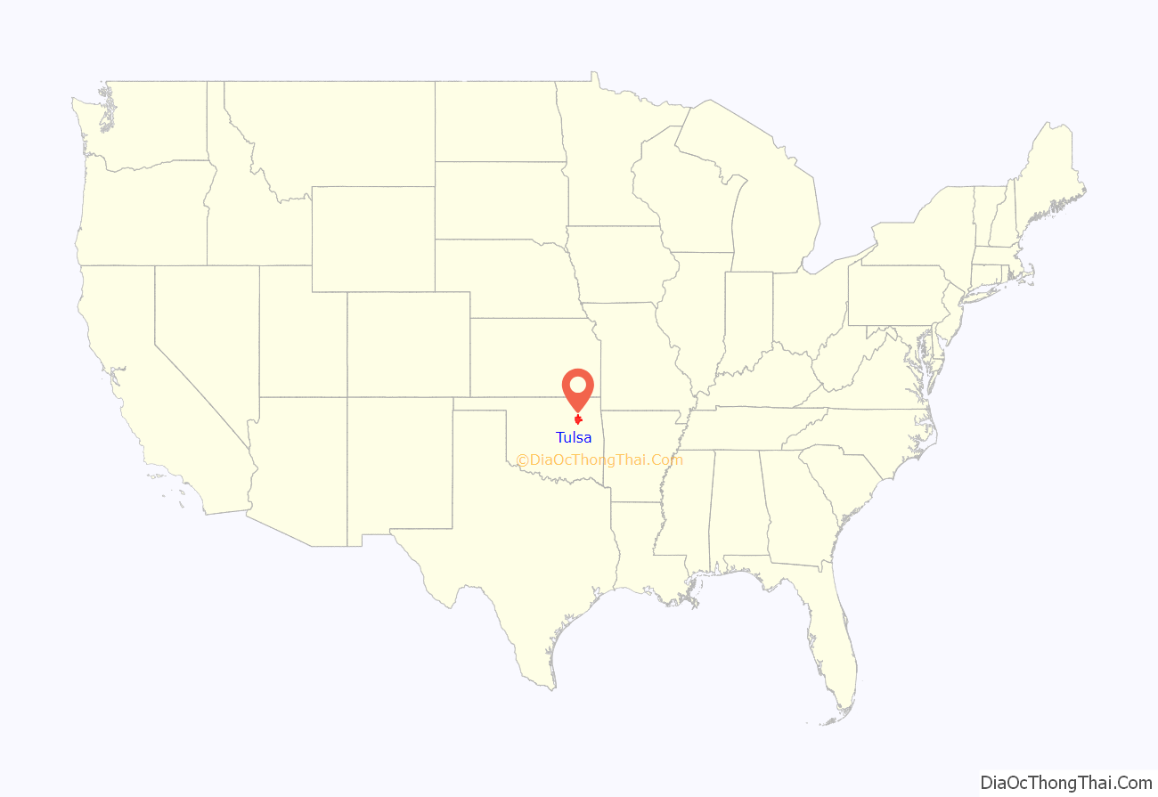
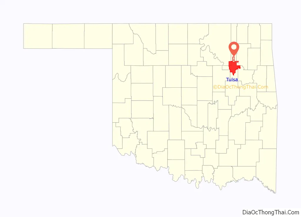
Tulsa location map. Where is Tulsa city?
History
The area where Tulsa now exists is considered Indian Territory, on the land of the Kiikaapoi (Kickapoo), Wahzhazhe Ma zha (Osage), Muscogee (Creek), and Caddo tribes, among others, before it was first formally settled by the Lochapoka and Creek tribes in 1836. They established a small settlement under the Creek Council Oak Tree at the present-day intersection of Cheyenne Avenue and 18th Street. This area and this tree reminded Chief Tukabahchi and his small group of the Trail of Tears survivors of the bend in the river and their previous Creek Council Oak Tree back in the Tallassee, Alabama area. They named their new settlement Tallasi, meaning “old town” in Creek, which later became “Tulsa”. The area around Tulsa was also settled by members of the other so-called “Five Civilized Tribes” who had been relocated to Oklahoma from the Southern United States. Most of modern Tulsa is located in the Creek Nation, with parts located in the Cherokee and Osage Nations.
Although Oklahoma was not yet a state during the Civil War, the Tulsa area saw its share of fighting. The Battle of Chusto-Talasah took place on the north side of Tulsa and several battles and skirmishes took place in nearby counties. After the War, the tribes signed Reconstruction treaties with the federal government that in some cases required substantial land concessions. In the years after the Civil War and around the turn of the century, the area along the Arkansas River that is now Tulsa was periodically home to or visited by a series of colorful outlaws, including the legendary Wild Bunch, the Dalton Gang, and Little Britches.
In 2020, the Supreme Court ruled that much of eastern Oklahoma, including much of Tulsa, falls in the category of Indian Country, reshaping much of the legal jurisdiction in the region. The Muscogee (Creek), Cherokee, Chickasaw, Choctaw, and Seminole tribal communities welcomed the decision as a long-fought for victory.
Incorporation and “Oil Capital” prosperity
Around August 1, 1882, the town was almost centered at a location just north of the current Whittier Square, when a construction crew laying out the line of the St. Louis-San Francisco Railroad chose that spot for a sidetrack. However, an area merchant persuaded them to move the site further west into the Muscogee Nation, which had friendlier laws for white business owners. On January 18, 1898, Tulsa was officially incorporated and elected Edward Calkins as the city’s first mayor.
Tulsa was still a micro town near the banks of the Arkansas River in 1901 when its first oil well, named Sue Bland No. 1, was established. Much of the oil was discovered on land whose mineral rights were owned by members of the Osage Nation under a system of headrights. By 1905, the discovery of the grand Glenn Pool Oil Reserve (located approximately 15 miles south of downtown Tulsa and site of the present-day town of Glenpool) prompted a rush of entrepreneurs to the area’s growing number of oil fields; Tulsa’s population swelled to over 140,000 between 1901 and 1930. Unlike the early settlers of Northeastern Oklahoma, who most frequently migrated from the South and Texas, many of these new oil-driven settlers came to Tulsa from the commercial centers of the East Coast and lower Midwest. This migration distinguished the city’s demographics from neighboring communities (Tulsa has larger and more prominent Catholic and Jewish populations than most Oklahoma cities) and is reflected in the designs of early Tulsa’s upscale neighborhoods.
Known as the “Oil Capital of the World” for most of the 20th century, the city’s success in the energy industry prompted construction booms in the popular Art Deco style of the time. Profits from the oil industry continued through the Great Depression, helping the city’s economy fare better than most in the United States during the 1930s.
In 1923, Harwelden was built by oil baron E. P. Harwell and his wife Mary, and is an example of prosperity in Tulsa, Oklahoma in the 1920s.
1921 Race Massacre
In the early 20th century, Tulsa was home to the “Black Wall Street”, one of the most prosperous Black communities in the United States at the time. Located in the Greenwood neighborhood, it was the site of the Tulsa Race Massacre, said to be “the single worst incident of racial violence in American history”, in which mobs of White Tulsans killed Black Tulsans, looted and robbed the Black community, and burned down homes and businesses. Sixteen hours of massacring on May 31 and June 1, 1921, ended only when National Guardsmen were brought in by the governor. An official report later claimed that 23 Black and 16 White citizens were killed, but other estimates suggest as many as 300 people died, most of them Black. Over 800 people were admitted to local hospitals with injuries, and an estimated 1,000 Black people were left homeless as 35 city blocks, composed of 1,256 residences, were destroyed by fire. Property damage was estimated at $1.8 million. Efforts to obtain reparations for survivors of the violence have been unsuccessful, but the events were re-examined by the city and state in the early 21st century, acknowledging the terrible actions that had taken place.
20th century
In 1925, Tulsa businessman Cyrus Avery, known as the “Father of Route 66,” began his campaign to create a road linking Chicago to Los Angeles by establishing the U.S. Highway 66 Association in Tulsa, earning the city the nickname the “Birthplace of Route 66”. Once completed, U.S. Route 66 took an important role in Tulsa’s development as the city served as a popular rest stop for travelers, who were greeted by Route 66 icons such as the Meadow Gold Sign and the Blue Whale of Catoosa. During this period, Bob Wills and his group, The Texas Playboys, began their long performing stint at a small ballroom in downtown Tulsa. In 1935, Cain’s Ballroom became the base for the group, which is largely credited for creating Western Swing music. The venue continued to attract famous musicians through its history, and is still in operation today.
For the rest of the mid-20th century, the city had a master plan to construct parks, churches, museums, rose gardens, improved infrastructure, and increased national advertising. The Spavinaw Dam, built during this era to accommodate the city’s water needs, was considered one of the largest public works projects of the era.
A national recession greatly affected the city’s economy in 1982, as areas of Texas and Oklahoma heavily dependent on oil suffered the freefall in gas prices due to a glut, and a mass exodus of oil industries. Tulsa, heavily dependent on the oil industry, was one of the hardest-hit cities by the fall of oil prices. By 1992, the state’s economy had fully recovered, but leaders worked to expand into sectors unrelated to oil and energy.
21st century
In 2003, the “Vision 2025” program was approved by voters, to enhance and revitalize Tulsa’s infrastructure and tourism industry. The keystone project of the initiative, the BOK Center, was designed to be a home for the city’s minor league hockey and arena football teams, as well as a venue for major concerts and conventions. The multi-purpose arena, designed by famed architect Cesar Pelli, broke ground in 2005 and was opened on August 30, 2008.
In July 2020 the Supreme Court ruled in McGirt v. Oklahoma that as it pertains to criminal law much of eastern Oklahoma, including Tulsa, remains as Native American lands. Specifically, prosecution of crimes by Native Americans on these lands falls into the jurisdiction of the tribal courts and federal judiciary under the Major Crimes Act, rather than Oklahoma’s courts.
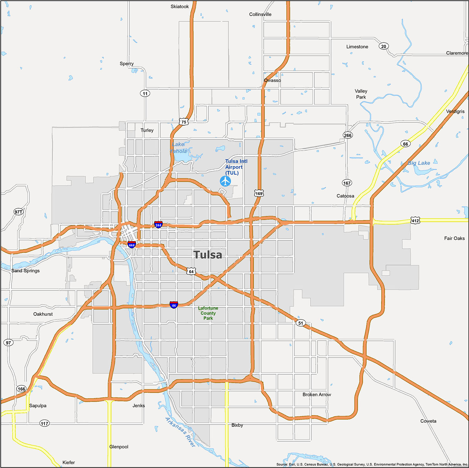
Tulsa Road Map
Discover Tulsa with the help of this comprehensive Tulsa road map. This map will provide you with the information you need to explore the city without getting lost. It features interstates, highways and major roads, making it the perfect companion for any traveler. Whether you’re in Tulsa or traveling outside the city, you’ll have all the highway information you need to get around.
Interstate Highways: I-44, I-244, I-444
US Highways: 11, 51, 64, 75, 169, 266, 412, Creek Tpke
Parkways: L.L. Tisdale Pky, Riverside Pky
Major Roads: 13th E Ave, 25th West Ave, 26th St, 36th St, 46th St, 71st St, 75th East Ave, Airport Blvd, Airport Rd, Apache St, Gilcrease Museum Rd, Kenosha St, Memorial Dr, Peoria Ave, Port Rd
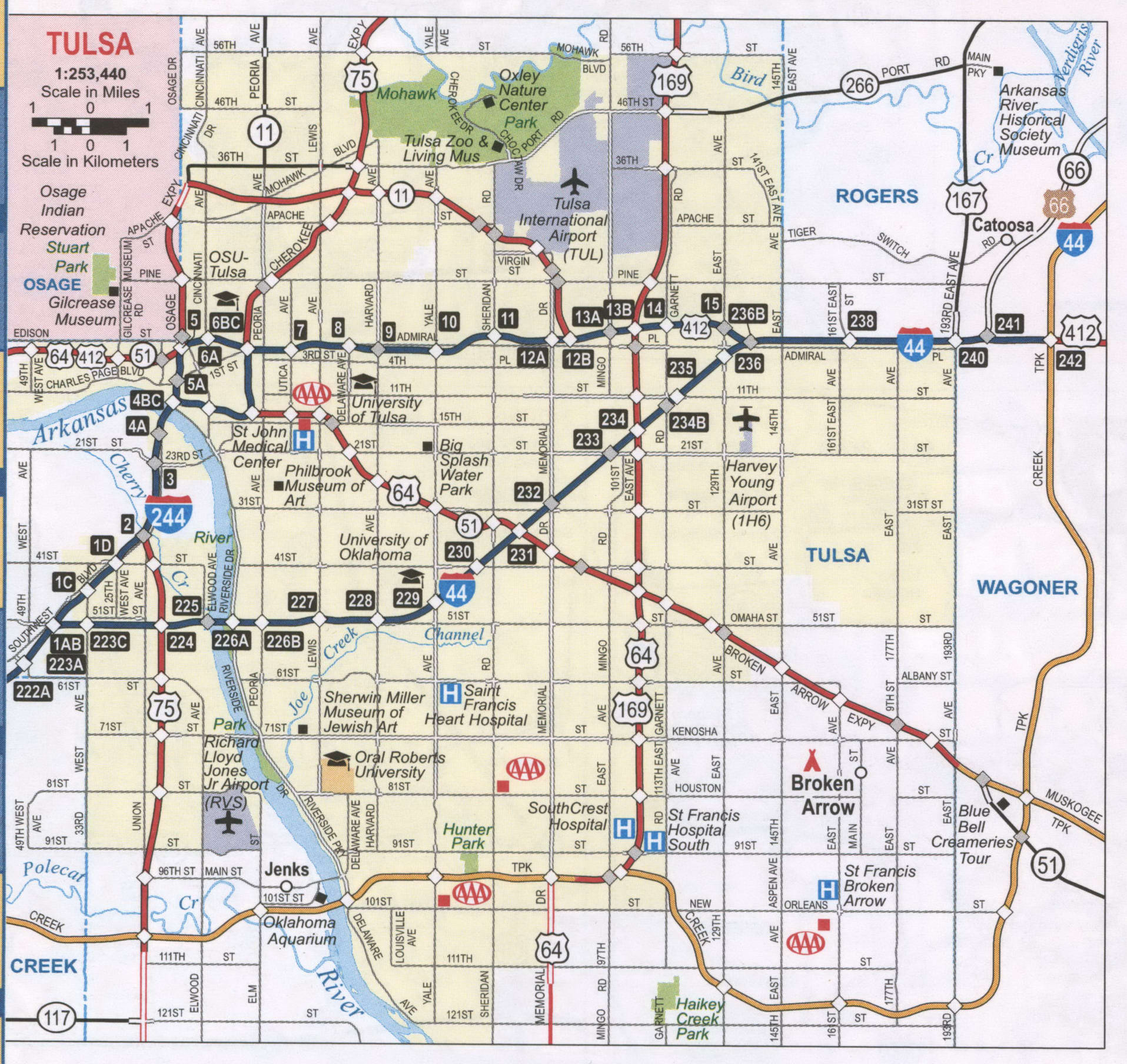
Explore Tulsa, Oklahoma with this comprehensive reference map that provides detailed information about lakes, rivers, and populated areas. The map is a great resource for planning your trip and customizing it to suit your needs, ensuring that you make the most of your time in Tulsa.
Airports: Tulsa International Airport (TUL)
Cities: Bixby, Broken Arrow, Catoosa, Claremore, Collinsville, Coweta, Glenpool, Jenks, Owasso, Sand Springs, Sapulpa, Skiatook, Tulsa
Towns: Fair Oaks, Kiefer, Sperry, Valley Park, Verdigris
Census-designated place (CDP): Limestone, Oakhurst, Turley
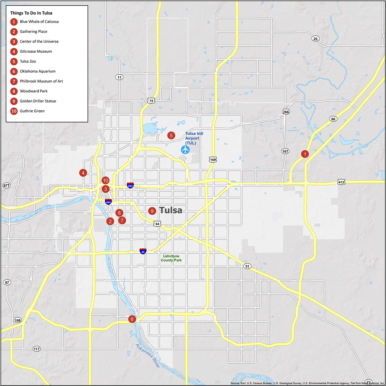
10 things to do in Tulsa city
Tulsa Oklahoma is a great place to visit and explore. It’s the second-most populous city after Oklahoma City. The Arkansas River meanders through Tulsa, where several parks have been established along the river banks. Lake Yahola is the largest reservoir within the city. This map will help you find your way around the city and discover all of the hidden treasures. This interactive map includes the best landmarks, restaurants, hotels, activities, and attractions in Tulsa, Oklahoma. Tour the city by zooming and panning around to find your favorite spots.
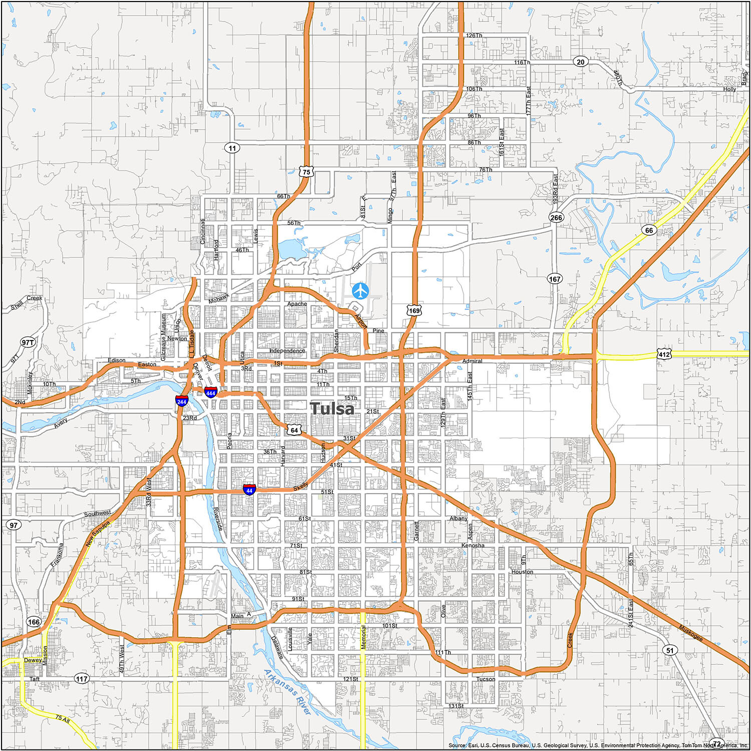
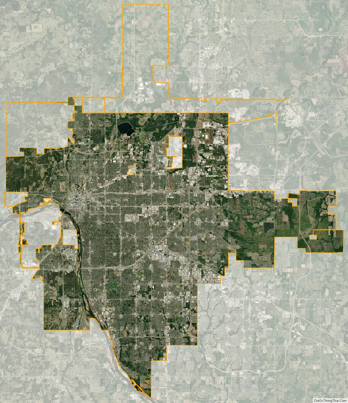
Tulsa city Satellite Map
See also
Map of Oklahoma State and its subdivision:- Adair
- Alfalfa
- Atoka
- Beaver
- Beckham
- Blaine
- Bryan
- Caddo
- Canadian
- Carter
- Cherokee
- Choctaw
- Cimarron
- Cleveland
- Coal
- Comanche
- Cotton
- Craig
- Creek
- Custer
- Delaware
- Dewey
- Ellis
- Garfield
- Garvin
- Grady
- Grant
- Greer
- Harmon
- Harper
- Haskell
- Hughes
- Jackson
- Jefferson
- Johnston
- Kay
- Kingfisher
- Kiowa
- Latimer
- Le Flore
- Lincoln
- Logan
- Love
- Major
- Marshall
- Mayes
- McClain
- McCurtain
- McIntosh
- Murray
- Muskogee
- Noble
- Nowata
- Okfuskee
- Oklahoma
- Okmulgee
- Osage
- Ottawa
- Pawnee
- Payne
- Pittsburg
- Pontotoc
- Pottawatomie
- Pushmataha
- Roger Mills
- Rogers
- Seminole
- Sequoyah
- Stephens
- Texas
- Tillman
- Tulsa
- Wagoner
- Washington
- Washita
- Woods
- Woodward
- Alabama
- Alaska
- Arizona
- Arkansas
- California
- Colorado
- Connecticut
- Delaware
- District of Columbia
- Florida
- Georgia
- Hawaii
- Idaho
- Illinois
- Indiana
- Iowa
- Kansas
- Kentucky
- Louisiana
- Maine
- Maryland
- Massachusetts
- Michigan
- Minnesota
- Mississippi
- Missouri
- Montana
- Nebraska
- Nevada
- New Hampshire
- New Jersey
- New Mexico
- New York
- North Carolina
- North Dakota
- Ohio
- Oklahoma
- Oregon
- Pennsylvania
- Rhode Island
- South Carolina
- South Dakota
- Tennessee
- Texas
- Utah
- Vermont
- Virginia
- Washington
- West Virginia
- Wisconsin
- Wyoming