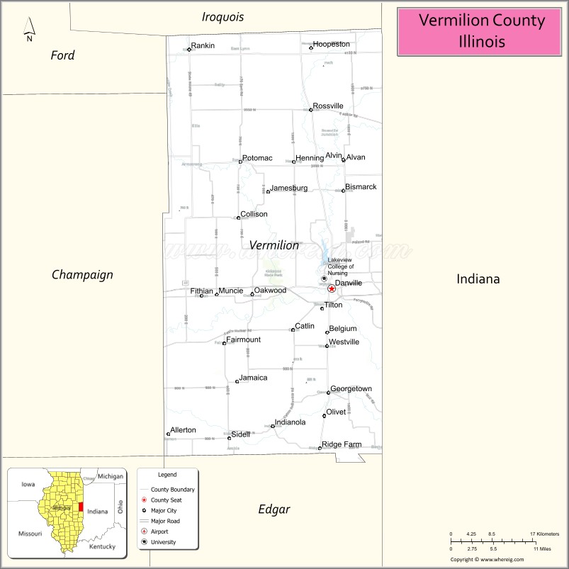
Vermilion County is a county in the eastern part of the U.S. state of Illinois, between the Indiana border and Champaign County. It was established in 1826 and was the 45th of Illinois’ 102 counties. According to the 2010 United States Census, it had a population of 81,625, a decrease of 2.7% in 2000. It contains 21 incorporated settlements; the county seat and largest city is Danville.
Vermilion County is part of the Danville, Illinois, Metropolitan Statistical Area.
| Name: | Vermilion County |
|---|---|
| FIPS code: | 17-183 |
| State: | Illinois |
| Founded: | 1826 |
| Named for: | Vermilion river |
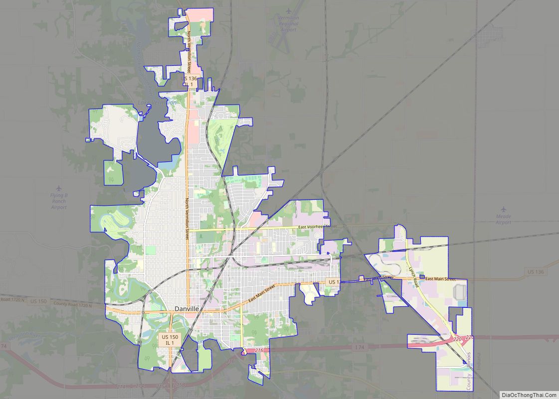
| Seat: | Danville |
| Total Area: | 901.28 sq mi (2,334.3 km²) |
| Land Area: | 898.37 sq mi (2,326.8 km²) |
| Total Population: | 74,188 |
| Population Density: | 82/sq mi (32/km²) |
| Time zone: | UTC−6 (Central) |
| Summer Time Zone (DST): | UTC−5 (Central) |
| Website: | www.vercounty.org |
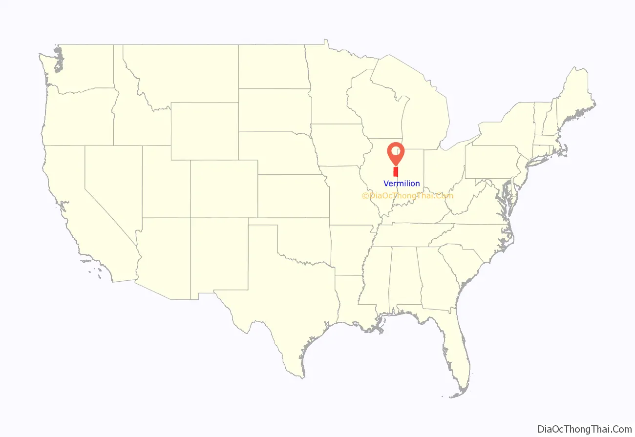
Vermilion County location map. Where is Vermilion County?
History
Vermilion County is named after the Vermilion River, which passes through the county and empties into the Wabash River in Indiana near Cayuga; the river was so named because of the color of the earth along its route.
The area which became Vermilion County was under the flag of France from 1682 to 1763, as part of New France.
It was taken over by Great Britain for fifteen years after the French and Indian War; it then became part of the colonies after the Revolutionary War when the area was ceded to Virginia, titled “the Illinois County of Virginia”. Later it was part of the Indiana Territory, then the Illinois Territory, and finally the state of Illinois. The county was created on 18 January 1826, from a portion of Edgar County. There was an unorganized territory to the north and west which was attached to the county; Champaign and Iroquois counties were formed from part of this territory in 1833. The remainder was used to create Ford County in 1859, the last Illinois county to be formed.
The county’s saline springs were a strong attraction to early explorers; they were mentioned as early as 1801. Joseph Barron, an interpreter fluent in several Native American languages, stated in an affidavit that he was present at the “Vermilion Salines” that year. The production required 100 gallons of water for one bushel of salt and proved to be profitable from the first run (1822–1829), when salt became less expensive and the venture was no longer economical.
The area’s first settlement was made in 1819 near these saline springs, by the Treat, Beckwith, and Whitcomb. James Butler, from Ohio, followed in 1820 and settled in the Catlin area; within a few years, the settlement grew to encompass several families and became known as “Butler’s Point”. In the southern part of the county, Henry Johnson built a cabin west of present-day Georgetown; this area was known as “Johnson’s Point”. The southern portion of the county was soon filled with small settlements. Most settlers in Vermilion County came from the American South, who had left because of their opposition to slavery.
Some of the early settlers were of the Religious Society of Friends, or Quakers. They founded the settlement of Vermilion Grove in the south part of the county, one of the county’s first settlements and the site of the county’s second public school.
The county has strong ties to Abraham Lincoln, who practiced law in Danville from 1841 to 1859 with Ward Hill Lamon; Lamon later served as Lincoln’s bodyguard. Lincoln spoke in Danville during his 1858 campaign for a seat in the US Senate. Lincoln gave the speech in his stocking feet from the balcony of Dr. William Fithian, a prominent local physician. The Fithian home is now listed on the National Register of Historic Places and serves as the Vermilion County Museum; visitors can see Lincoln memorabilia including a bed in which Lincoln slept.
The various stages in the evolution of Vermilion County are shown below.
Vermilion County from the time of its creation to 1831, including a large tract of unorganized territory temporarily attached to it.
Vermilion between 1831 and 1833
The county between 1833 and 1836, after creation of Champaign and Iroquois Counties
Vermilion County between 1836 and 1837
Vermilion County between 1837 and 1853
Vermilion County after 1853, when the unorganized territory was reduced to its current size.
In 1859, the additional territory was split off as Ford County, reducing Vermilion to its current borders.
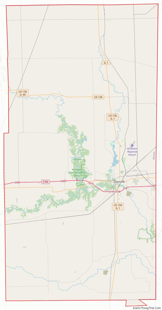
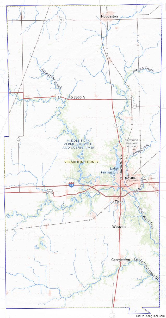
Vermilion County Road Map
Geography
Vermilion County is located along the eastern border of Illinois; its northern border is about 95 miles (153 km) south of Chicago.
Vermilion County in Illinois and Vermillion County in Indiana are two of twenty-two counties or parishes in the United States with the same name to border each other across state lines. According to the 2010 census, the county has a total area of 901.28 square miles (2,334.3 km), of which 898.37 square miles (2,326.8 km) (or 99.68%) is land and 2.91 square miles (7.5 km) (or 0.32%) is water. The land in Vermilion County consists mostly of various forms of silt loam. Lake Vermilion, a man-made 1,000-acre (400 ha) reservoir, is the county’s largest body of water, located northwest of Danville. It provides the city’s culinary water, and also provides recreation opportunities.
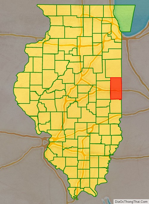
Adjacent counties
- Iroquois County – north
- Benton County, Indiana – northeast
- Warren County, Indiana – east
- Vermillion County, Indiana – southeast
- Edgar County – south
- Douglas County – southwest
- Champaign County – west
- Ford County – northwest
Cities
Villages
- Allerton – at SW corner of county; extends into Champaign County
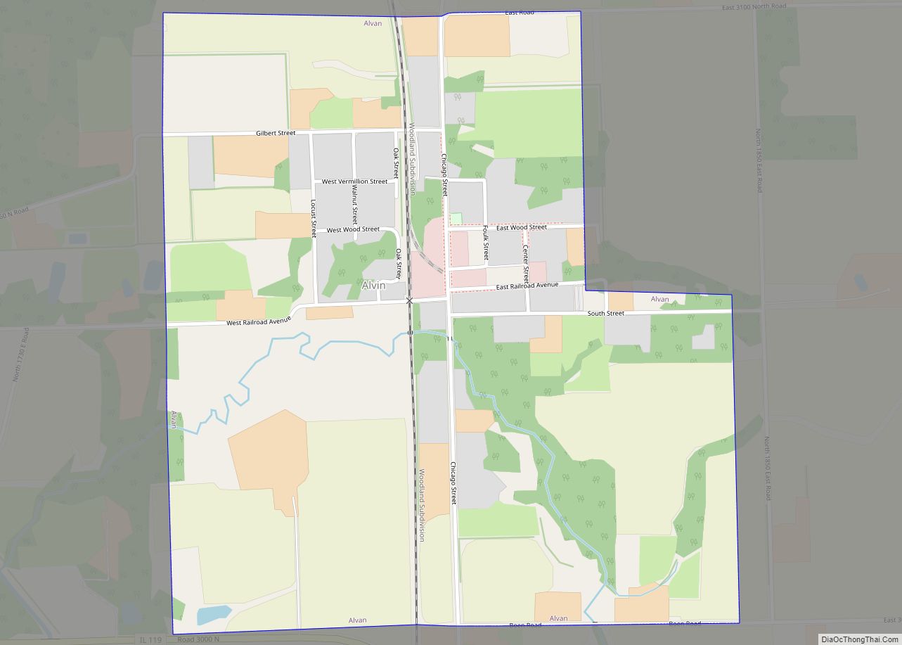
- Alvin – north of Danville
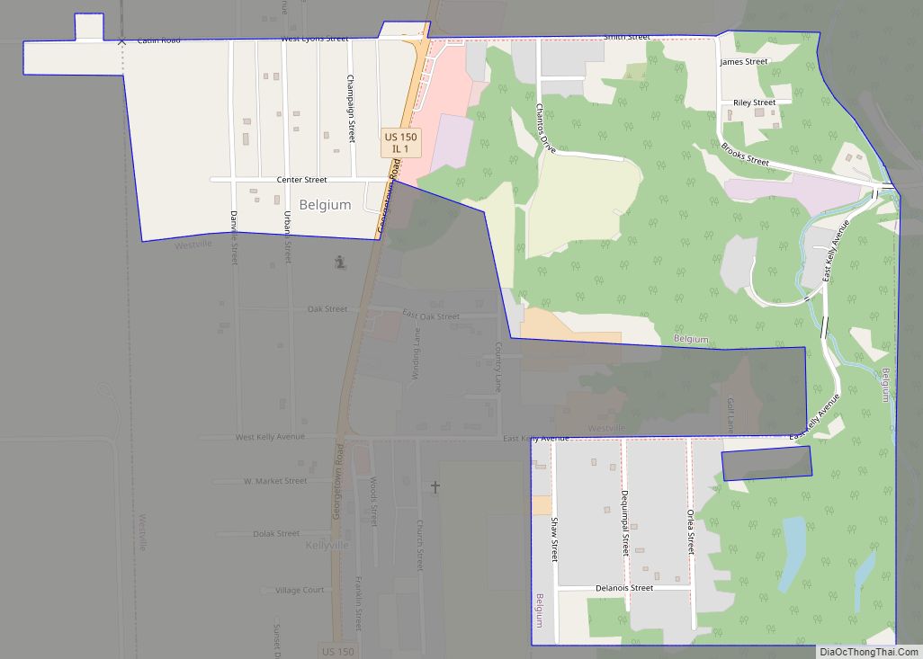
- Belgium – on Route 1
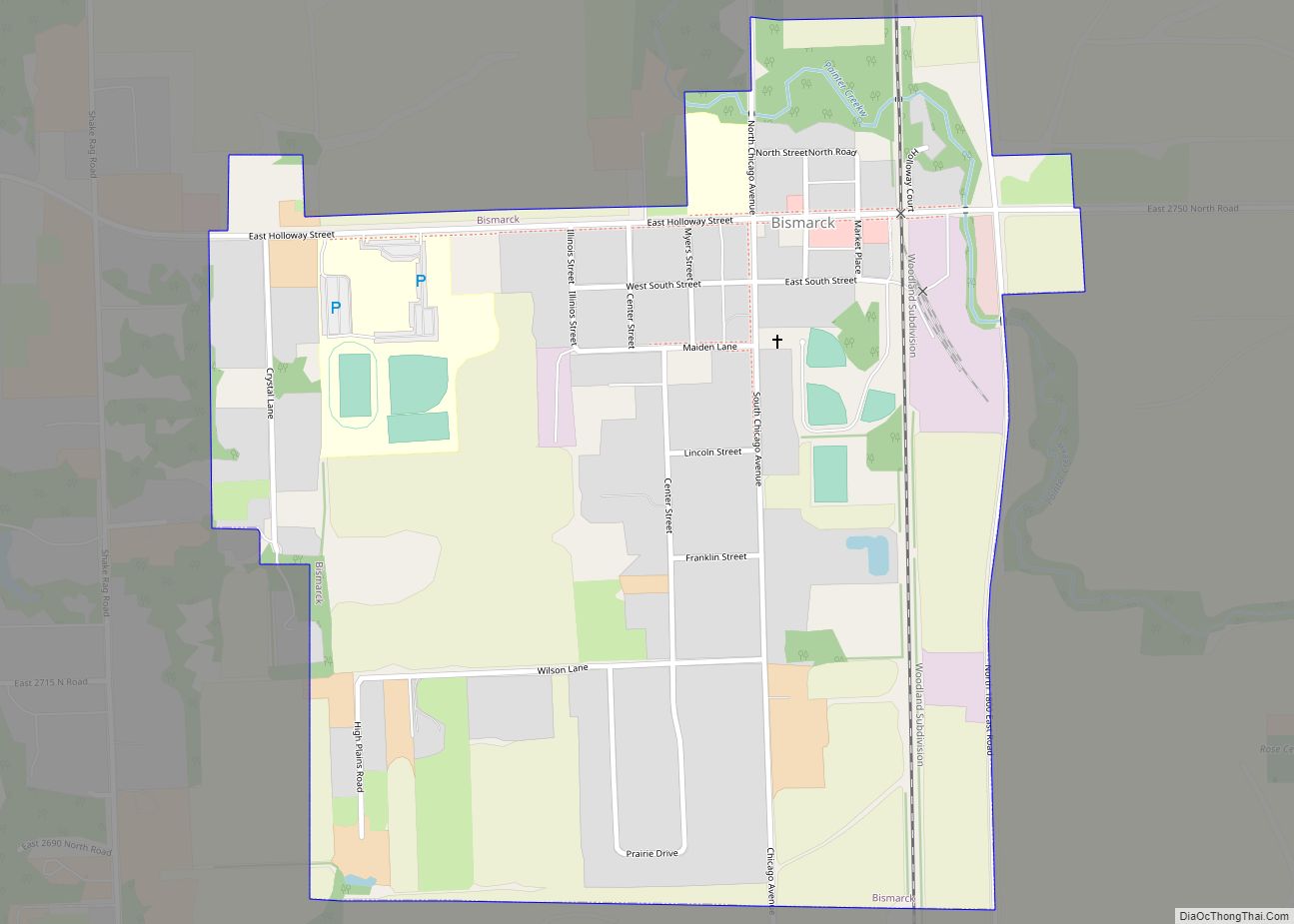
- Bismarck – north of Danville
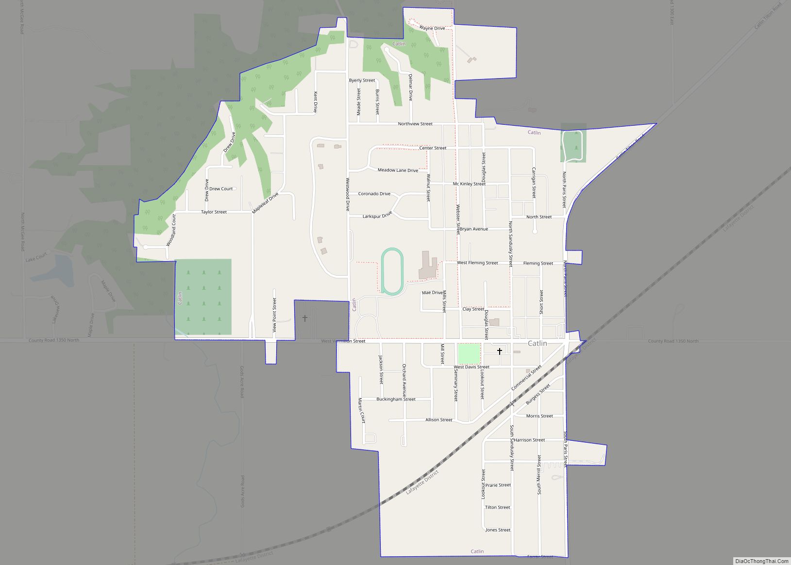
- Catlin – southwest of Danville
- Fairmount – southwest of Danville
- Fithian – west of Danville on US 150
- Henning – north of Danville on US 136
- Indianola – southwest of Danville
- Muncie – west of Danville on US 150
- Oakwood – west of Danville on US 150
- Potomac – on US 136 north of Danville
- Rankin – at NW corner of county
- Ridge Farm
- Rossville – on Route 1, south of Hoopeston
- Sidell – east of Allerton
- Tilton
- Westville
Unincorporated communities
- Armstrong
- Batestown
- Cheneyville
- Collison
- East Lynn
- Hartshorn
- Hegeler
- Hillery
- Hope
- Illiana
- Jamaica
- Jamesburg
- Midway
- Newtown
- Olivet
- Ryan
- Unionville
Previous settlements
Several towns were established in the county which no longer survive. In some cases, the coming of the railroads helped to define the best locations for settlements, and as a result some existing towns were abandoned. When Lake Vermilion was created, the town of Denmark was flooded and now lies at the bottom of the reservoir.
- Archie (south of Sidell)
- Blue Grass City
- Butler’s Point (see Catlin)
- Conkeytown
- Denmark
- Ellis (Middlefork Township)
- Franklin (see Bismarck)
- Geneva
- Gilbert (see Alvin)
- Humrick
- Johnsonville (Blount Township)
- Munroe
- Myersville (see Bismarck)
- Pellsville (see Rankin)
- Prospect City
- Reilly (Butler Township)
- Shepherd’s Town
- Watkins Grove (or Watkins Glen)
- Weaver City (see Ambia, Indiana)
Townships
Township government was adopted in Vermilion County in 1851, and eight townships were created:
- Carroll
- Danville
- Elwood
- Georgetown
- Middlefork
- Newell (first called Richland)
- Pilot
- Ross
Eleven additional townships were created in the following decades:
- Blount
- Butler
- Catlin
- Grant
- Jamaica
- Love
- McKendree
- Oakwood
- Sidell
- South Ross
- Vance
Parks
The Vermilion County Conservation District operates four parks:
- Forest Glen Preserve
- Heron County Park
- Kennekuk Cove County Park
- Lake Vermilion County Park
The Illinois Department of Natural Resources manages three areas in the county:
- Kickapoo State Recreation Area
- Harry “Babe” Woodyard State Natural Area
- Middle Fork State Fish and Wildlife Area
Vermilion County Topographic Map
Vermilion County Satellite Map
Vermilion County Outline Map