Catlin is a village in Vermilion County, Illinois, United States. It is part of the Danville, Illinois Metropolitan Statistical Area. The population was 2,040 at the 2010 census, and 1,952 in 2018. Catlin is the hometown of Illinois State Representative Chad Hays, who represents the 104th Representative District of Illinois.
| Name: | Catlin village |
|---|---|
| LSAD Code: | 47 |
| LSAD Description: | village (suffix) |
| State: | Illinois |
| County: | Vermilion County |
| Founded: | 1866 |
| Elevation: | 656 ft (200 m) |
| Total Area: | 0.85 sq mi (2.21 km²) |
| Land Area: | 0.85 sq mi (2.20 km²) |
| Water Area: | 0.00 sq mi (0.01 km²) 0% |
| Total Population: | 1,983 |
| Population Density: | 2,335.69/sq mi (901.40/km²) |
| ZIP code: | 61817 |
| Area code: | 217 |
| FIPS code: | 1711774 |
| Website: | catlinil.com |
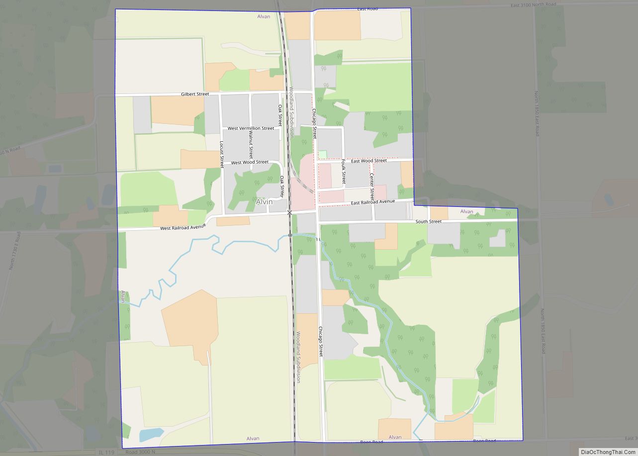
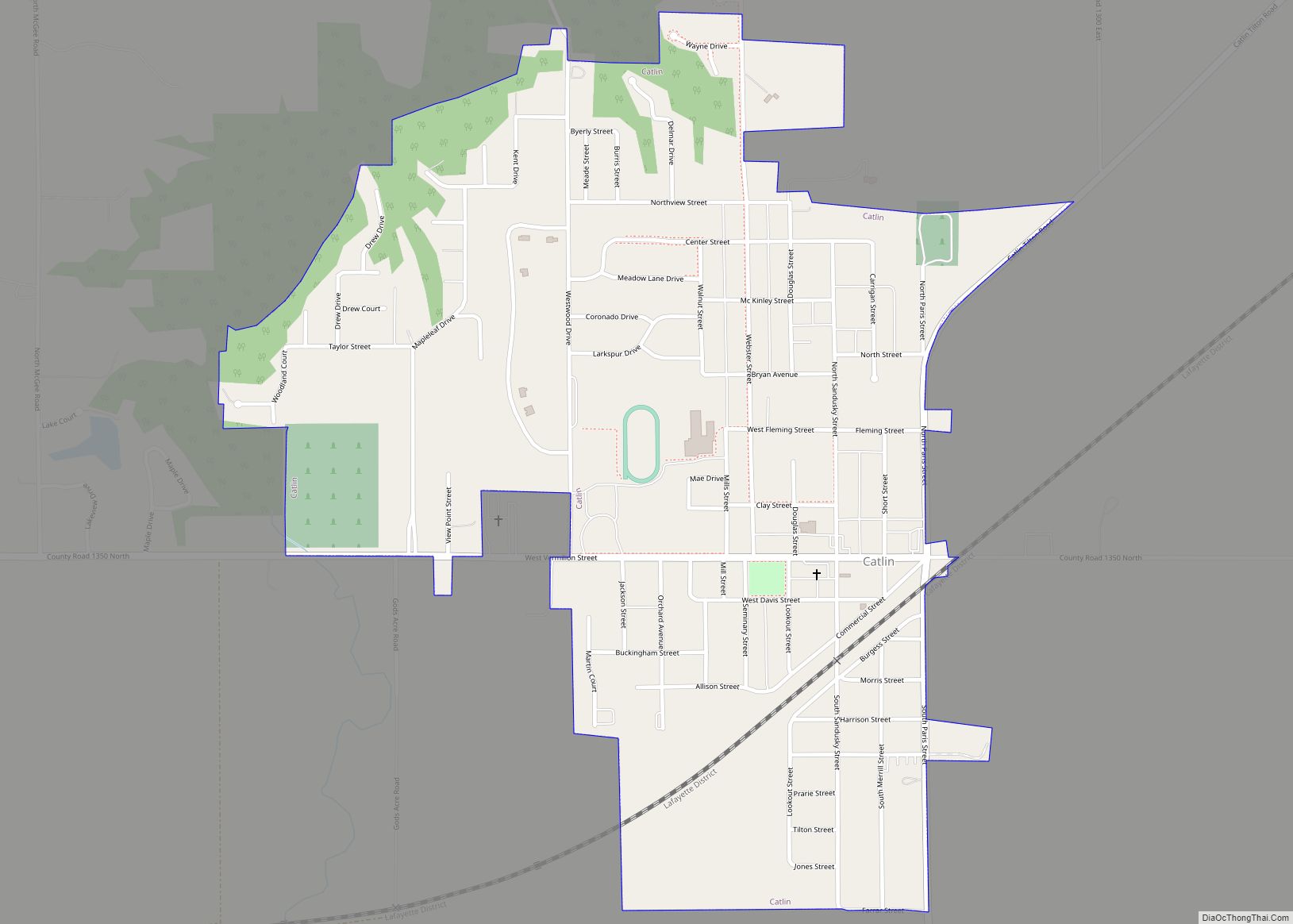
Online Interactive Map
Click on ![]() to view map in "full screen" mode.
to view map in "full screen" mode.
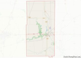
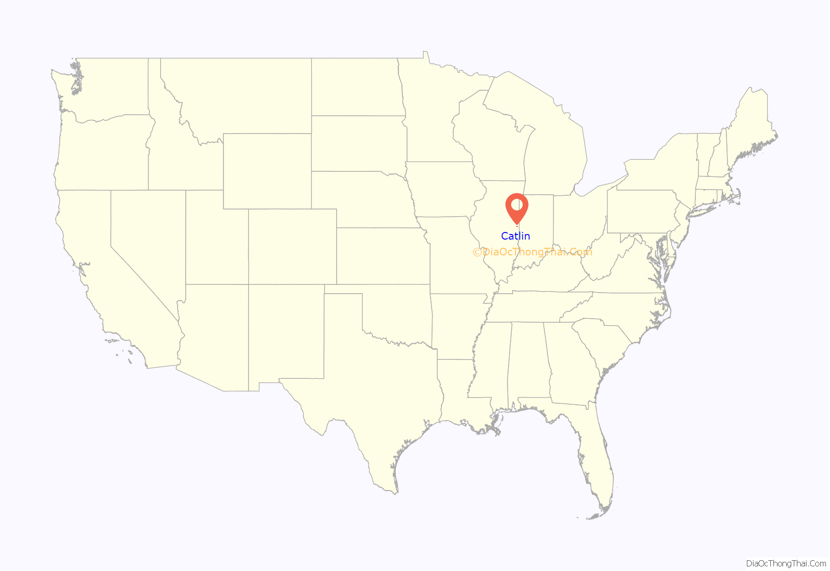
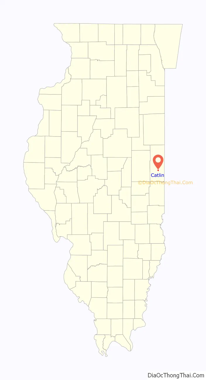
Catlin location map. Where is Catlin village?
History
Early significant events in our village history.
1820 — First permanent settlement of Vermilion County. James Butler first settler. His place was called Butler’s Point.
1822 — God’s Acre Cemetery, the first cemetery in Vermilion County was established. First meeting of county commissioners held at Butler’s home. First Circuit Court held at home of Asa Elliott, friend of James Butler.
1823 — First mill built and used in Vermilion and Champaign Counties, called a “corncracker” by James Butler. Made of a large log and stones, all constructed on a hand-made forge. Its capacity, with a muscular man as motive power, was one bushel of cracked corn in an hour.
1824 — The “salt works” drew in the first settlers of the area. Twenty-four large salt kettles were brought in and each held 100 gallons. It took 100 gallons of water to make a bushel of salt.
1825 — First marriage in the county was a double marriage. Couples were from Butler’s Point. Cyrus Douglas wed Ruby Bloss and Annis Butler wed Marquis Snow.
1827 — Amos Woodin, a cooper by trade, built the house now known as the Catlin Heritage Museum. First school was built and doubled as a church.
1830 — Grandma Guyman arrived in the area and became the Doctor and Midwife to Catlin Township, delivering over 1,000 babies. G. W. Pate and his father Adam Pate come to Butler’s Point. Identified with progress of Methodism in this part of the country.
1834 — Asa Elliott, friend of James Butler and one of the original settlers of Butler’s Point, begins serving in the State Legislature with Abe Lincoln.
1838 — Pottawatomie Trail of Death came through the village. 860 members of this Indian tribe where forcible removed by militia from north central Indiana to reservation land in what is now eastern Kansas.
1849 — Henry Jones of England came to the area and bought the Whitcomb farm and 3,000 acres adjacent. He had 14 head of oxen and considerable cattle and was considered wealthy.
1850 — Second Fair of Vermilion County Agricultural and Mechanical Association were held at the Fairgrounds in Catlin until 1878 when it was transferred to Danville.
1856 — Guy Merrill and Josiah Hunt made first plat of Catlin. The village is officially named Catlin, after the president of the Great Western Railroad.
Catlin Road Map
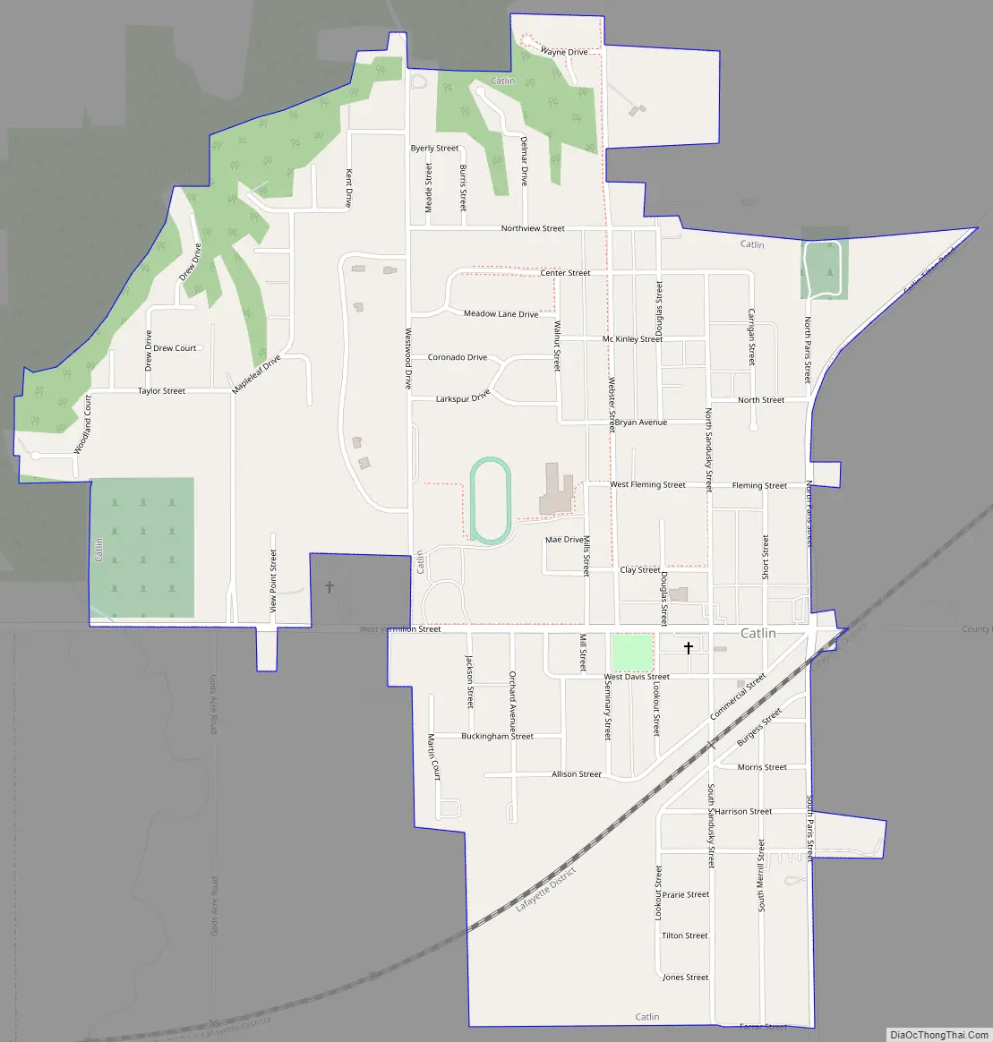
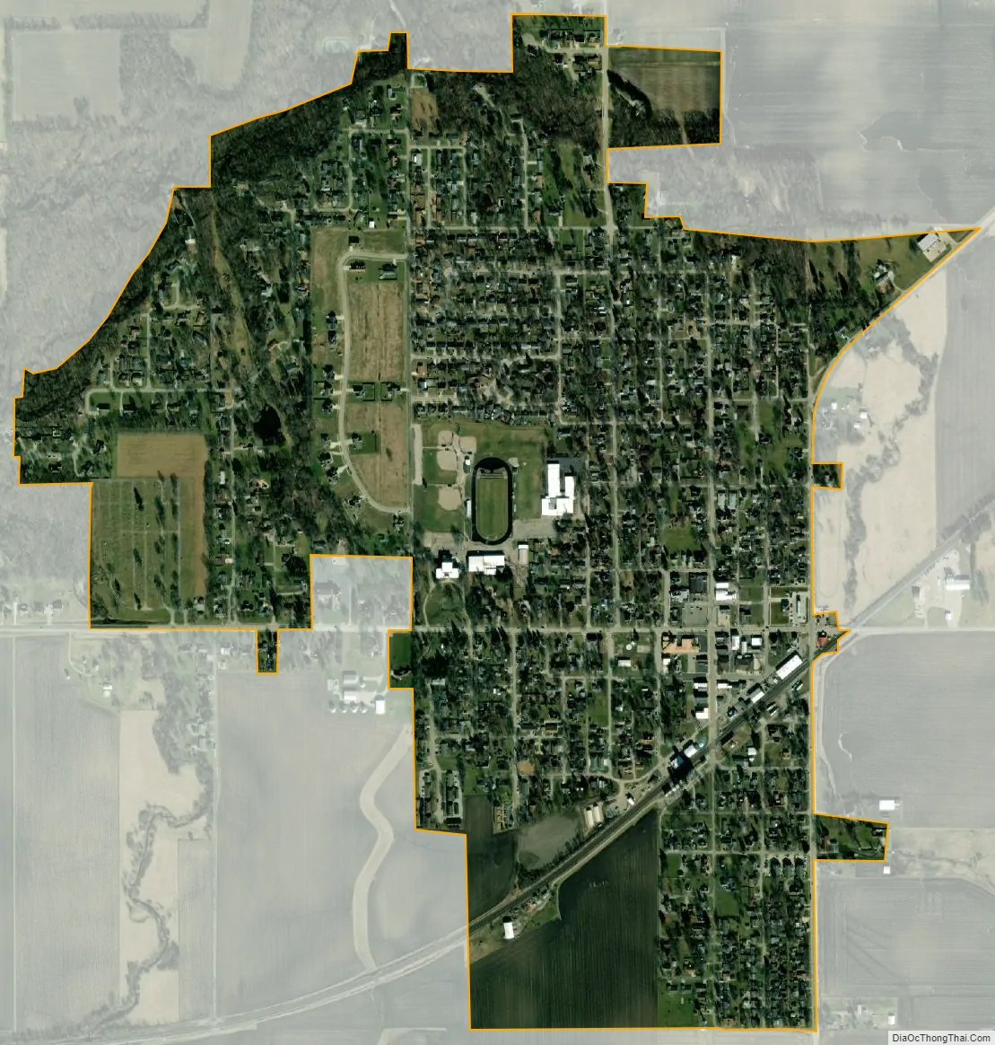
Catlin city Satellite Map
Geography
According to the 2010 census, Catlin has a total area of 0.843 square miles (2.18 km), of which 0.84 square miles (2.18 km) (or 99.64%) is land and 0.003 square miles (0.01 km) (or 0.36%) is water.
See also
Map of Illinois State and its subdivision:- Adams
- Alexander
- Bond
- Boone
- Brown
- Bureau
- Calhoun
- Carroll
- Cass
- Champaign
- Christian
- Clark
- Clay
- Clinton
- Coles
- Cook
- Crawford
- Cumberland
- De Kalb
- De Witt
- Douglas
- Dupage
- Edgar
- Edwards
- Effingham
- Fayette
- Ford
- Franklin
- Fulton
- Gallatin
- Greene
- Grundy
- Hamilton
- Hancock
- Hardin
- Henderson
- Henry
- Iroquois
- Jackson
- Jasper
- Jefferson
- Jersey
- Jo Daviess
- Johnson
- Kane
- Kankakee
- Kendall
- Knox
- La Salle
- Lake
- Lake Michigan
- Lawrence
- Lee
- Livingston
- Logan
- Macon
- Macoupin
- Madison
- Marion
- Marshall
- Mason
- Massac
- McDonough
- McHenry
- McLean
- Menard
- Mercer
- Monroe
- Montgomery
- Morgan
- Moultrie
- Ogle
- Peoria
- Perry
- Piatt
- Pike
- Pope
- Pulaski
- Putnam
- Randolph
- Richland
- Rock Island
- Saint Clair
- Saline
- Sangamon
- Schuyler
- Scott
- Shelby
- Stark
- Stephenson
- Tazewell
- Union
- Vermilion
- Wabash
- Warren
- Washington
- Wayne
- White
- Whiteside
- Will
- Williamson
- Winnebago
- Woodford
- Alabama
- Alaska
- Arizona
- Arkansas
- California
- Colorado
- Connecticut
- Delaware
- District of Columbia
- Florida
- Georgia
- Hawaii
- Idaho
- Illinois
- Indiana
- Iowa
- Kansas
- Kentucky
- Louisiana
- Maine
- Maryland
- Massachusetts
- Michigan
- Minnesota
- Mississippi
- Missouri
- Montana
- Nebraska
- Nevada
- New Hampshire
- New Jersey
- New Mexico
- New York
- North Carolina
- North Dakota
- Ohio
- Oklahoma
- Oregon
- Pennsylvania
- Rhode Island
- South Carolina
- South Dakota
- Tennessee
- Texas
- Utah
- Vermont
- Virginia
- Washington
- West Virginia
- Wisconsin
- Wyoming