Potomac (listen (help·info)) is a village in Vermilion County, Illinois, United States. It is part of the Danville, Illinois Metropolitan Statistical Area. The population was 750 at the 2010 census.
| Name: | Potomac village |
|---|---|
| LSAD Code: | 47 |
| LSAD Description: | village (suffix) |
| State: | Illinois |
| County: | Vermilion County |
| Elevation: | 669 ft (204 m) |
| Total Area: | 0.49 sq mi (1.26 km²) |
| Land Area: | 0.49 sq mi (1.26 km²) |
| Water Area: | 0.00 sq mi (0.00 km²) |
| Total Population: | 689 |
| Population Density: | 1,411.89/sq mi (545.02/km²) |
| ZIP code: | 61865 |
| Area code: | 217 |
| FIPS code: | 1761366 |
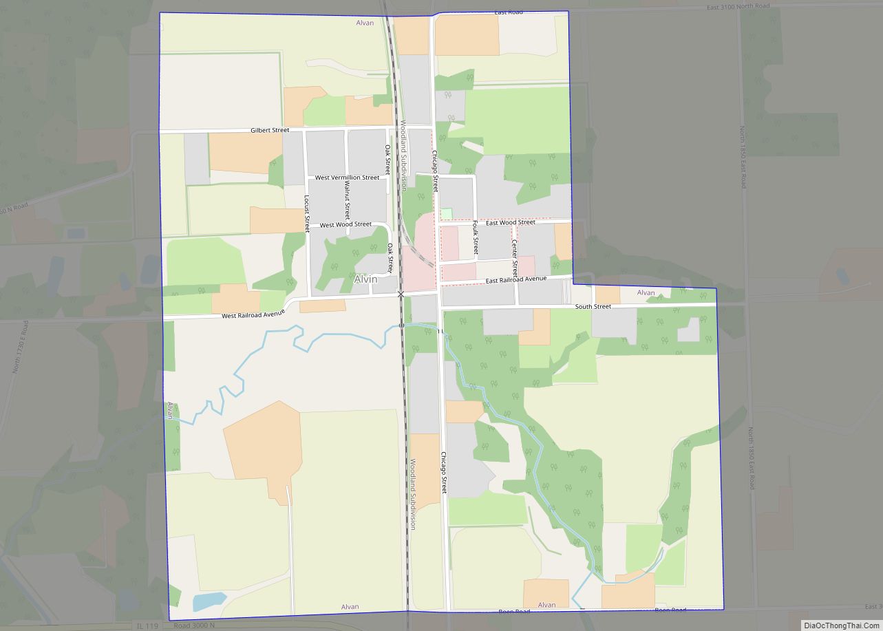
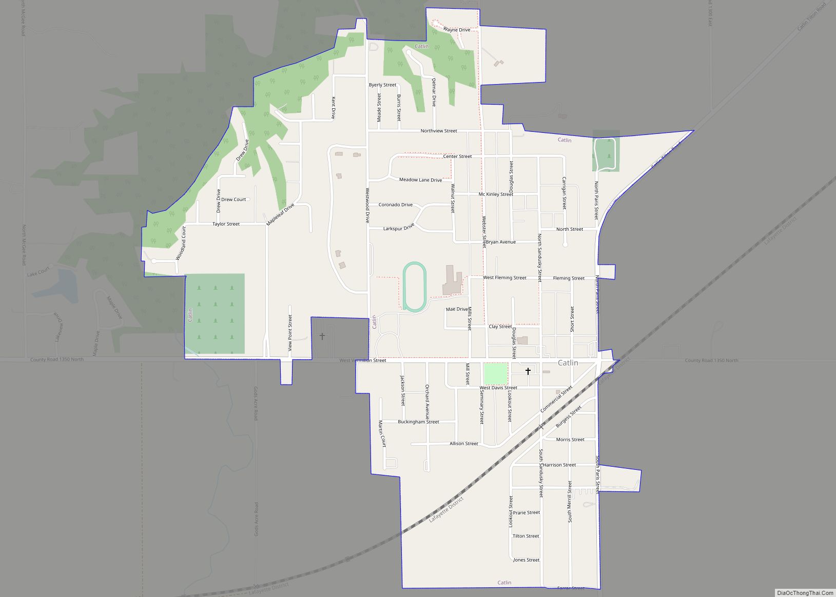
Online Interactive Map
Click on ![]() to view map in "full screen" mode.
to view map in "full screen" mode.
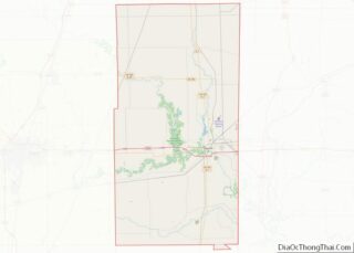
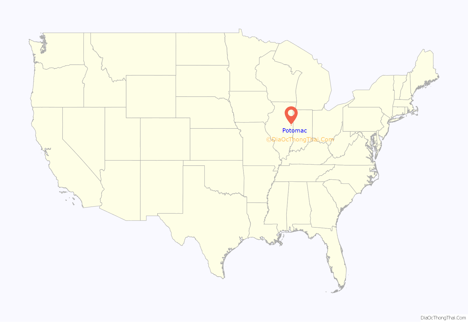
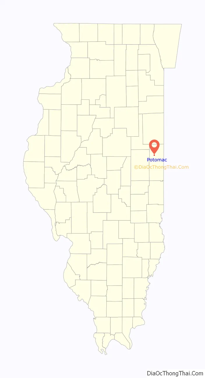
Potomac location map. Where is Potomac village?
History
The town was originally named Marysville after the wives of the two founders, John Smith and Isaac Meneley, who started businesses here circa 1840. On May 13, 1871, a post office was established at the town and was named Potomac, most likely after the Potomac River. The town’s name was later changed to conform to this.
The town was hit by a tornado in April 1953, injuring a dozen people.
Potomac prospered into the late 20th century, with a population peaking at 900 during the 1970 census, due in part to its location along US Route 136, one of the primary East-West highways crossing the state of Illinois. The opening of Interstate 74 reduced the amount of travel through Potomac, leading to a rapid decline in the number of service stations, restaurants and small businesses in the downtown area in the early 1970s. In the early 1990s a fire destroyed several downtown buildings on the north side of Route 136, dramatically altering the appearance of the community.
Potomac is known for its Artesian wells, and its local High School teams were known as the “Potomac Artesians” until area secondary school consolidation in the mid 90’s. One of these wells spouted an eight-inch stream of water 32 feet into the air until the 1930s. Three wells presently operate in open areas, one located in the downtown area, another on the southeast edge of the community, and another in West Side Park, on the west edge of town area where Fourth of July celebrations were once held, locally referred to as “The Jubilee”, in conjunction with an annual Horse Show.
Hugh M. Luckey (1873–1946), farmer and Illinois state legislator, was born near Potomac, on a farm.
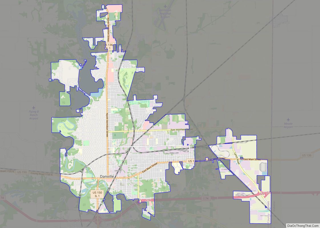
Potomac Road Map
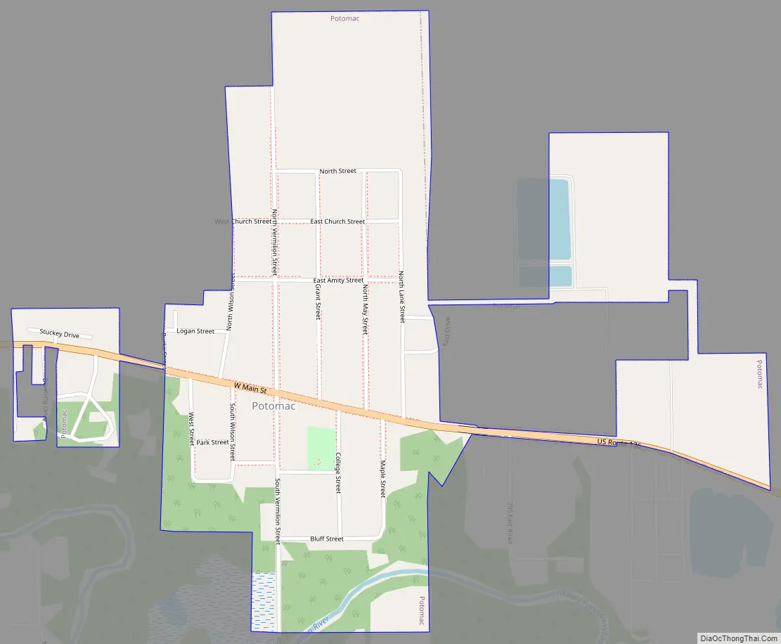
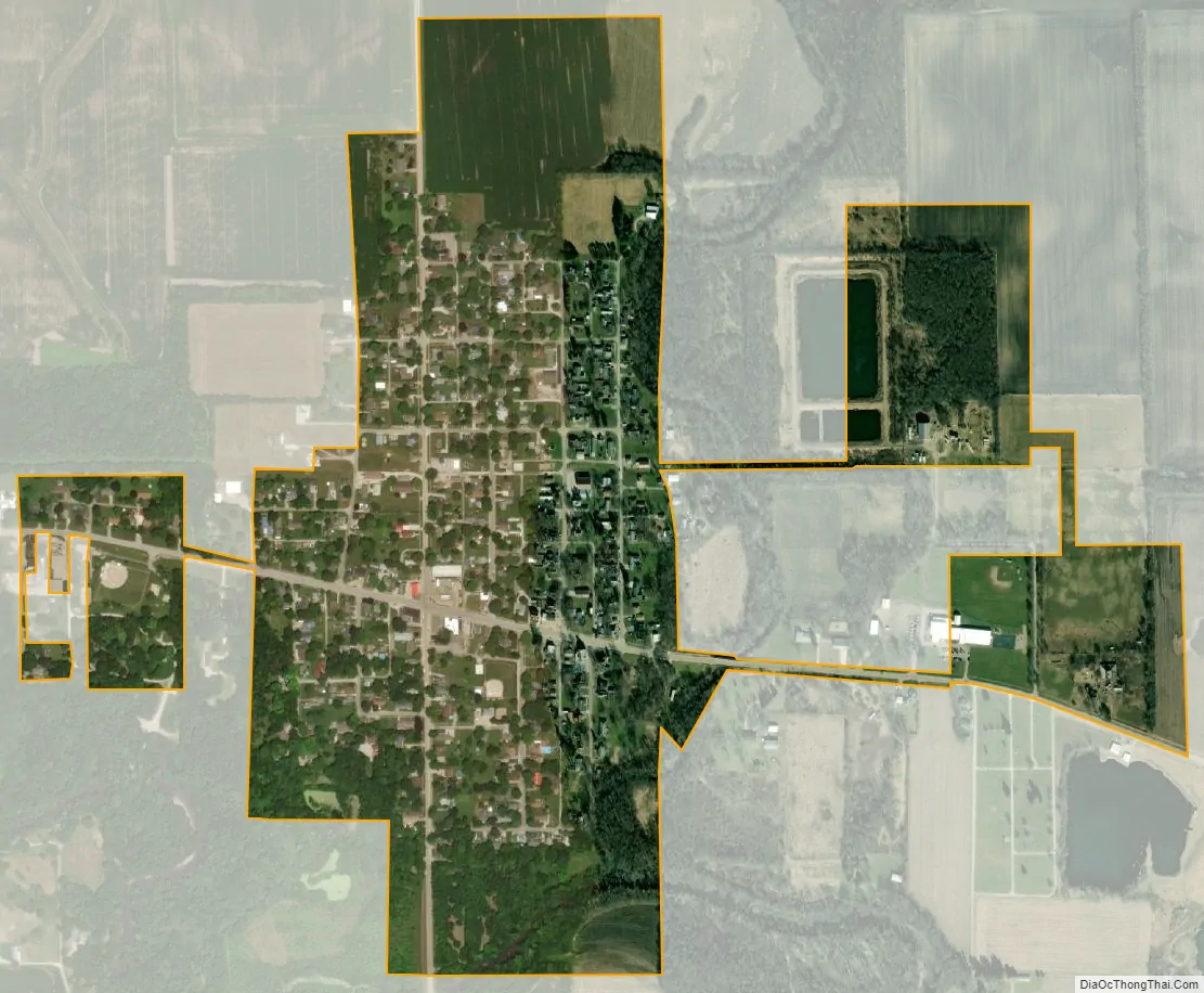
Potomac city Satellite Map
Geography
Potomac is located approximately 18 miles northwest of the county seat of Danville. U.S. Route 136 passes east–west through town. The Middle Fork of the Vermilion River passes just south of the town.
According to the 2010 census, Potomac has a total area of 0.49 square miles (1.27 km), all land.
See also
Map of Illinois State and its subdivision:- Adams
- Alexander
- Bond
- Boone
- Brown
- Bureau
- Calhoun
- Carroll
- Cass
- Champaign
- Christian
- Clark
- Clay
- Clinton
- Coles
- Cook
- Crawford
- Cumberland
- De Kalb
- De Witt
- Douglas
- Dupage
- Edgar
- Edwards
- Effingham
- Fayette
- Ford
- Franklin
- Fulton
- Gallatin
- Greene
- Grundy
- Hamilton
- Hancock
- Hardin
- Henderson
- Henry
- Iroquois
- Jackson
- Jasper
- Jefferson
- Jersey
- Jo Daviess
- Johnson
- Kane
- Kankakee
- Kendall
- Knox
- La Salle
- Lake
- Lake Michigan
- Lawrence
- Lee
- Livingston
- Logan
- Macon
- Macoupin
- Madison
- Marion
- Marshall
- Mason
- Massac
- McDonough
- McHenry
- McLean
- Menard
- Mercer
- Monroe
- Montgomery
- Morgan
- Moultrie
- Ogle
- Peoria
- Perry
- Piatt
- Pike
- Pope
- Pulaski
- Putnam
- Randolph
- Richland
- Rock Island
- Saint Clair
- Saline
- Sangamon
- Schuyler
- Scott
- Shelby
- Stark
- Stephenson
- Tazewell
- Union
- Vermilion
- Wabash
- Warren
- Washington
- Wayne
- White
- Whiteside
- Will
- Williamson
- Winnebago
- Woodford
- Alabama
- Alaska
- Arizona
- Arkansas
- California
- Colorado
- Connecticut
- Delaware
- District of Columbia
- Florida
- Georgia
- Hawaii
- Idaho
- Illinois
- Indiana
- Iowa
- Kansas
- Kentucky
- Louisiana
- Maine
- Maryland
- Massachusetts
- Michigan
- Minnesota
- Mississippi
- Missouri
- Montana
- Nebraska
- Nevada
- New Hampshire
- New Jersey
- New Mexico
- New York
- North Carolina
- North Dakota
- Ohio
- Oklahoma
- Oregon
- Pennsylvania
- Rhode Island
- South Carolina
- South Dakota
- Tennessee
- Texas
- Utah
- Vermont
- Virginia
- Washington
- West Virginia
- Wisconsin
- Wyoming