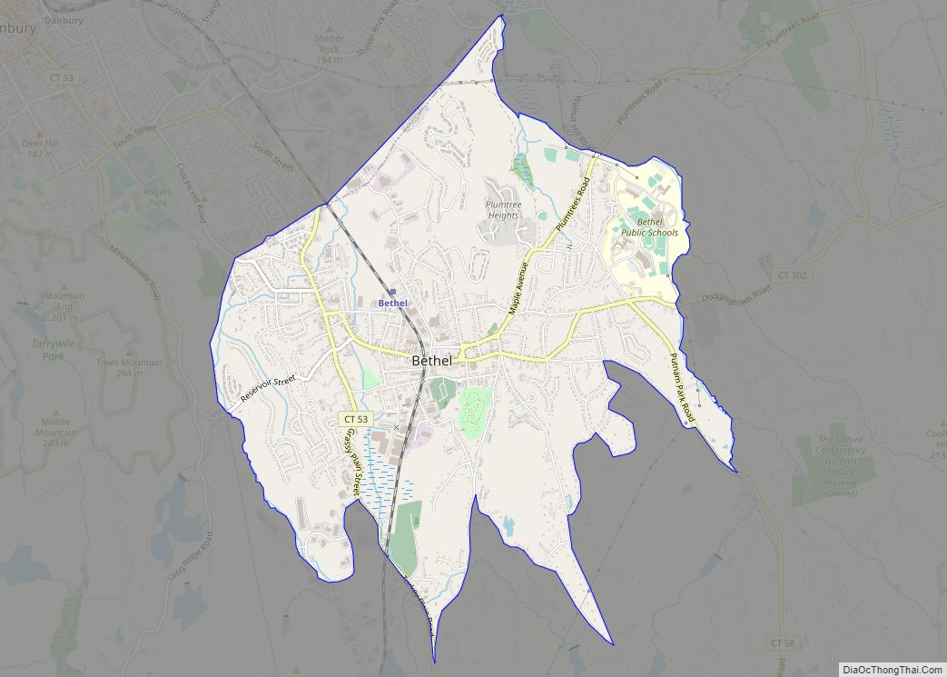
Bethel is a census-designated place (CDP) in Fairfield County, Connecticut, United States. It comprises the primary village and surrounding residential land within the town of Bethel. As of the 2010 census, the population of the CDP was 9,549, out of 18,584 in the entire town.
| Name: | Bethel CDP |
|---|---|
| LSAD Code: | 57 |
| LSAD Description: | CDP (suffix) |
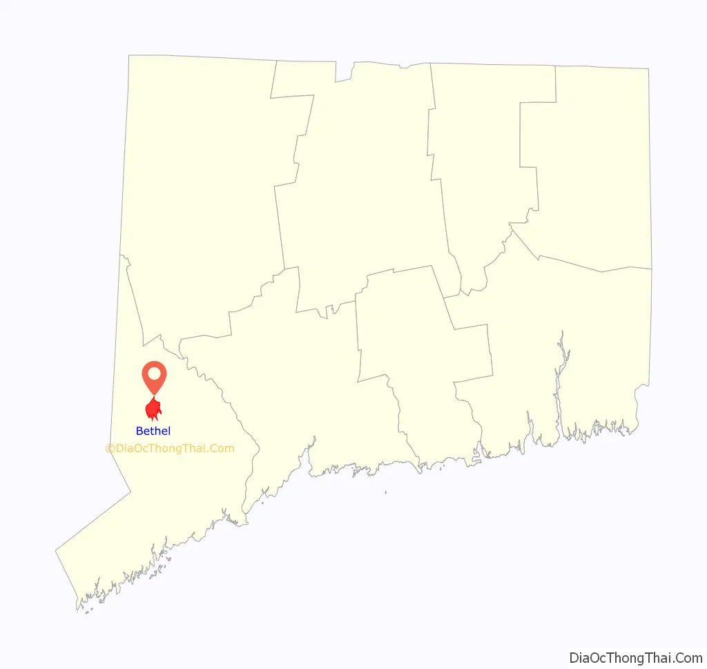
| State: | Connecticut |
| County: | Fairfield County |
| Elevation: | 384 ft (117 m) |
| Total Area: | 4.09 sq mi (10.59 km²) |
| Land Area: | 4.09 sq mi (10.59 km²) |
| Water Area: | 0.0 sq mi (0.0 km²) |
| Total Population: | 9,549 |
| Population Density: | 2,335/sq mi (901.4/km²) |
| ZIP code: | 06801 |
| FIPS code: | 0904790 |
| GNISfeature ID: | 2378335 |
Online Interactive Map
Click on ![]() to view map in "full screen" mode.
to view map in "full screen" mode.
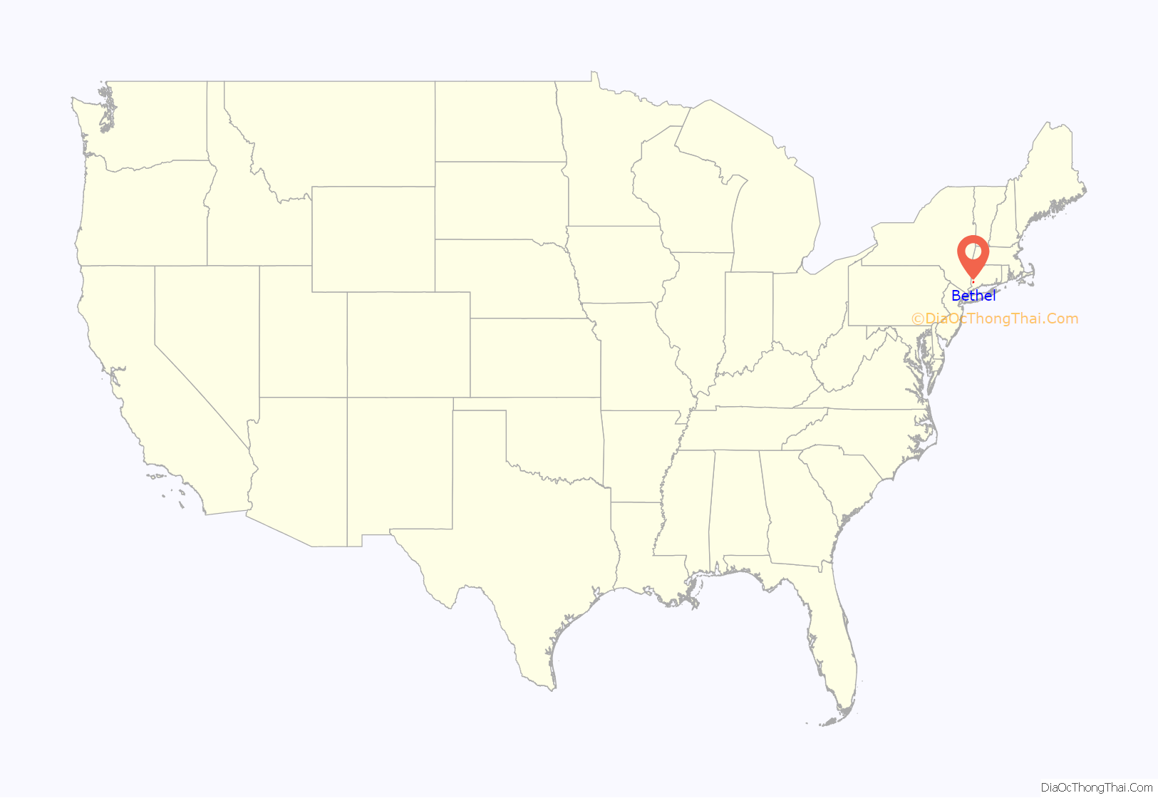
Bethel location map. Where is Bethel CDP?
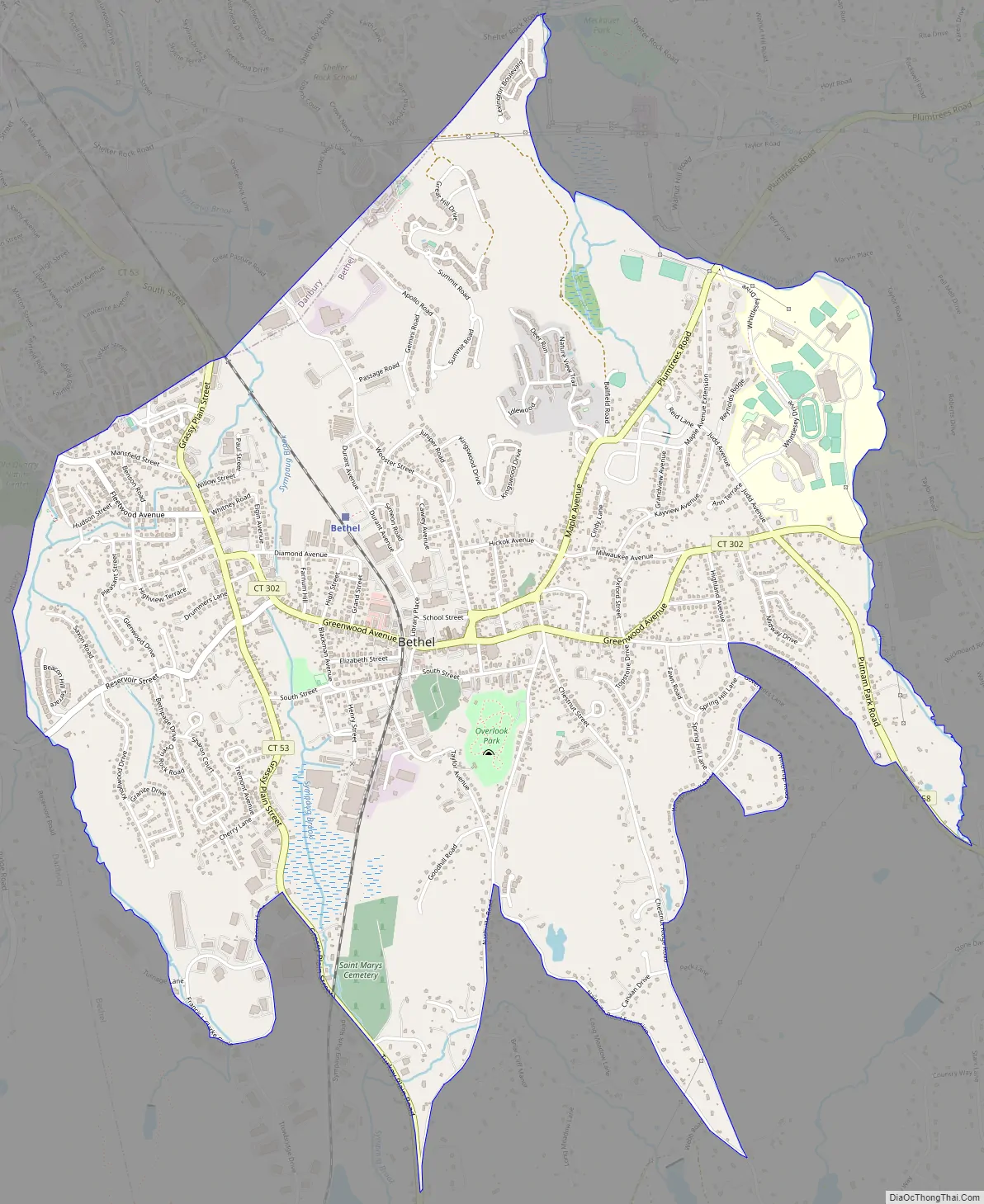
Bethel Road Map
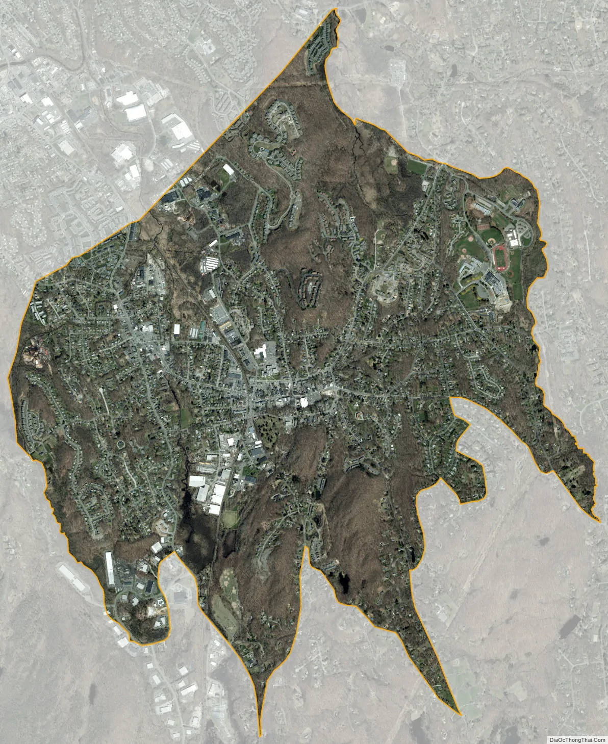
Bethel city Satellite Map
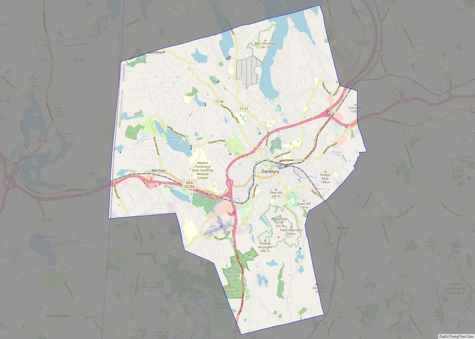
Geography
The Bethel CDP is in the western part of the town of Bethel, and is bordered to the west by the city of Danbury. The CDP extends north to East Swamp Brook and east to Wolf Pit Brook. The southern border of the CDP follows (from east to west) parts of Putnam Park Road, Hoyts Hill, Governors Lane, Whippoorwill Road, Winthrop Road, Spring Hill Lane, Whippoorwill Road again, Chestnut Ridge Road, Nashville Road Exd, Nashville Road, Turkey Plain Road, Grassy Plain Street, 2nd Lane, Francis J Clarke Circle and an unnamed brook back to the Danbury border.
Connecticut Route 53 passes through the west side of the community, leading north into downtown Danbury and south 13 miles (21 km) to Weston. Connecticut Route 302 runs east-west through the center of town, following Greenwood Avenue and part of Milwaukee Avenue. It continues east 6 miles (10 km) to Newtown. Connecticut Route 58 has its northern terminus at Route 302 in the eastern part of the CDP, and leads southeast 18 miles (29 km) to Fairfield at the Bridgeport border.
According to the U.S. Census Bureau, the Bethel CDP has an area of 4.1 square miles (10.6 km), all of it recorded as land. Brooks in the community flow north to the Still River in Danbury, a north-flowing tributary of the Housatonic River.
See also
Map of Connecticut State and its subdivision: Map of other states:- Alabama
- Alaska
- Arizona
- Arkansas
- California
- Colorado
- Connecticut
- Delaware
- District of Columbia
- Florida
- Georgia
- Hawaii
- Idaho
- Illinois
- Indiana
- Iowa
- Kansas
- Kentucky
- Louisiana
- Maine
- Maryland
- Massachusetts
- Michigan
- Minnesota
- Mississippi
- Missouri
- Montana
- Nebraska
- Nevada
- New Hampshire
- New Jersey
- New Mexico
- New York
- North Carolina
- North Dakota
- Ohio
- Oklahoma
- Oregon
- Pennsylvania
- Rhode Island
- South Carolina
- South Dakota
- Tennessee
- Texas
- Utah
- Vermont
- Virginia
- Washington
- West Virginia
- Wisconsin
- Wyoming