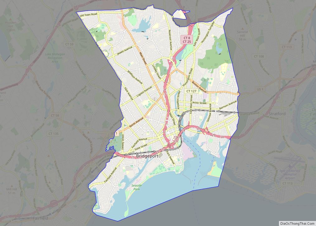
| Name: | Bridgeport city |
|---|---|
| LSAD Code: | 25 |
| LSAD Description: | city (suffix) |
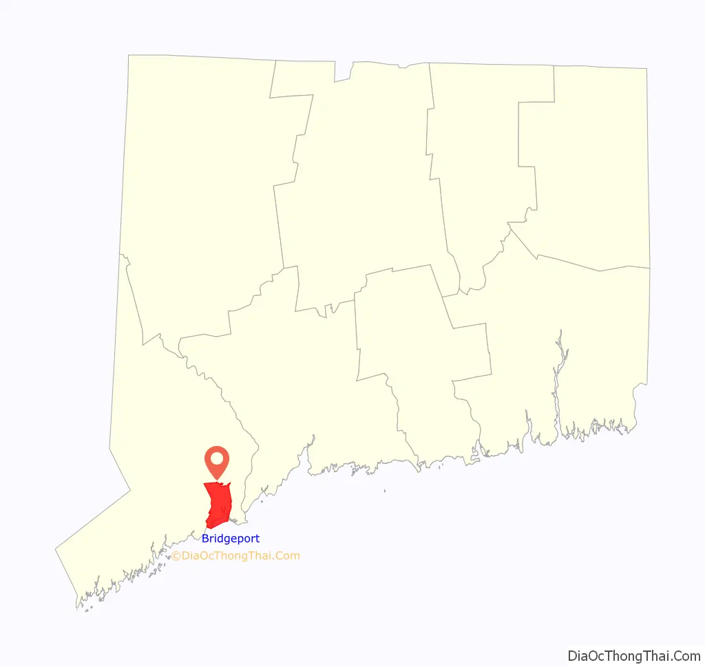
| State: | Connecticut |
| County: | Fairfield County |
| Elevation: | 3 ft (1 m) |
| Land Area: | 16.0 sq mi (41.4 km²) |
| Water Area: | 3.4 sq mi (8.8 km²) |
| Population Density: | 7,700/sq mi (3,000/km²) |
| Area code: | 203/475 |
| FIPS code: | 0908000 |
| GNISfeature ID: | 205720 |
| Website: | bridgeportct.gov |
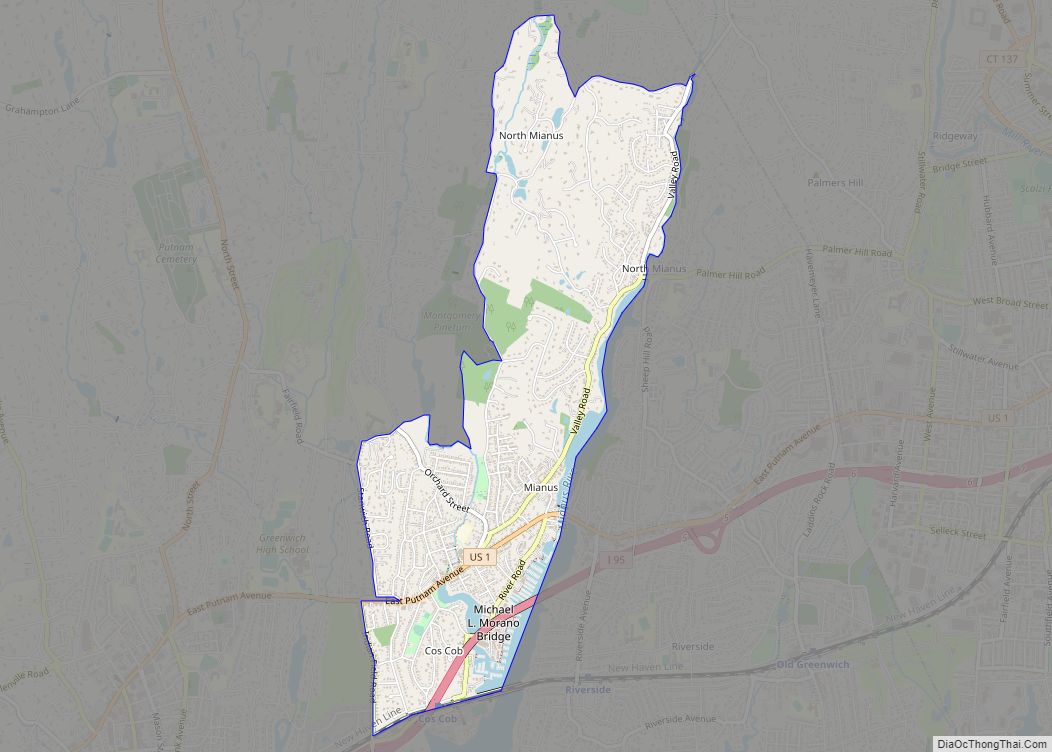
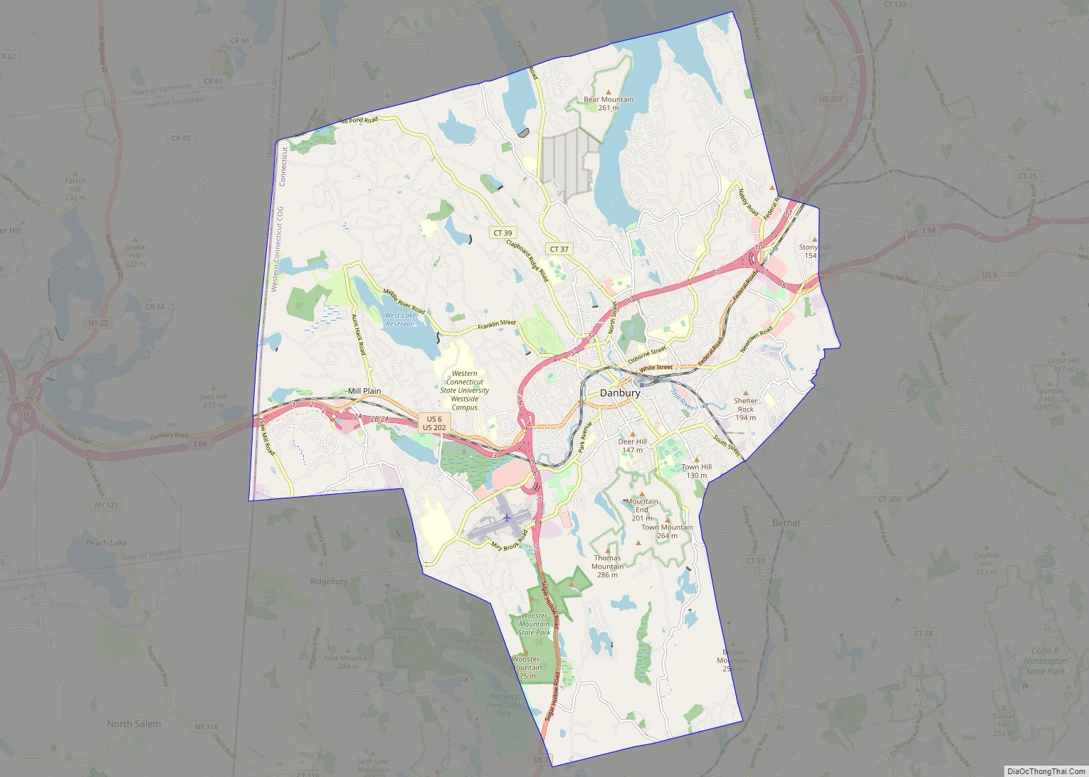
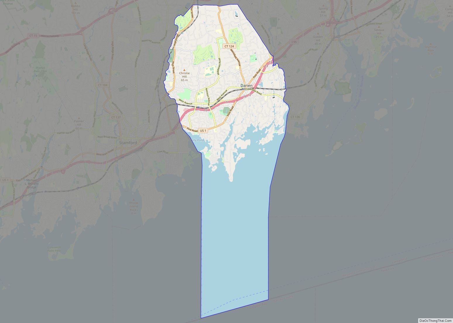
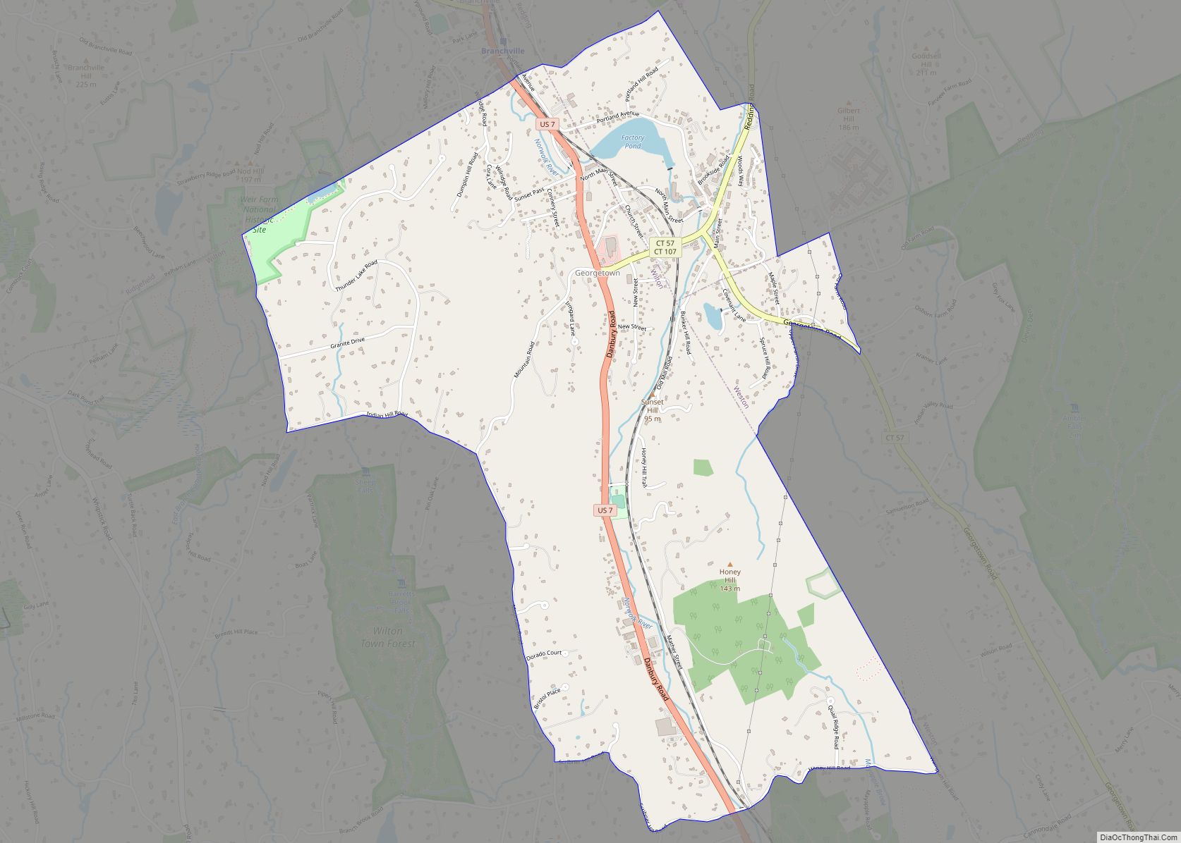
Online Interactive Map
Click on ![]() to view map in "full screen" mode.
to view map in "full screen" mode.
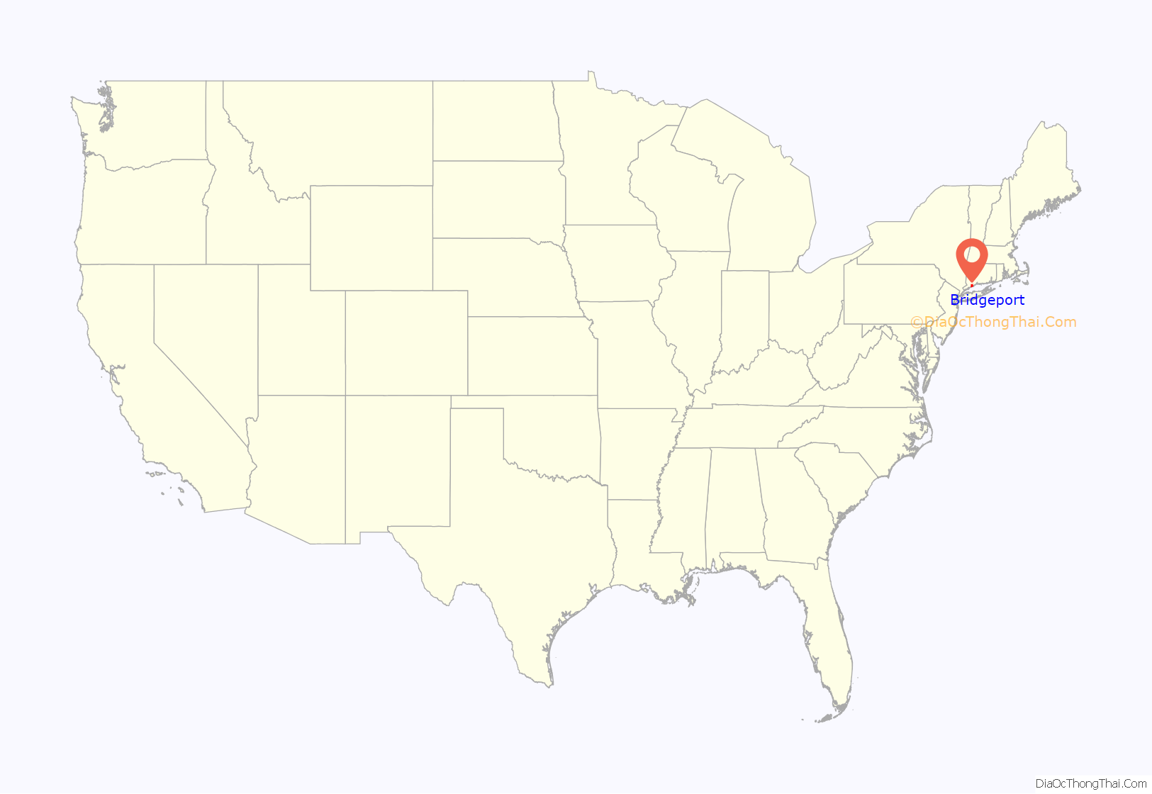
Bridgeport location map. Where is Bridgeport city?
History
Bridgeport was inhabited by the Paugussett native American tribe during the start of European colonization. The earliest European communal settlement was in the historical Stratfield district, along US Route 1; known in colonial times as the King’s Highway. Close by, Mount Grove Cemetery was laid out on what was a native village that extended past the 1650s. It is also an ancient Paugusett burial ground.
The burgeoning farming community grew and became a center of trade, shipbuilding, and whaling. The town was incorporated to subsidize the Housatonic Railroad and rapidly industrialized following the rail line’s connection to the New York and New Haven railroad. The town was given its name because of the need for bridges over the Pequonnock River that provided a navigable port at the mouth of the river. Manufacturing was the mainstay of the local economy until the 1970s.
Colonial history
The first documented European settlement within the present city limits of Bridgeport took place in 1644, centered at Black Rock Harbor and along North Avenue between Park and Briarwood Avenues. The place was called Pequonnock (Quiripi for “Cleared Land”), after a band of the Paugussett, an Algonquian-speaking Native American people who occupied this area. One of their sacred sites was Golden Hill, which overlooked the harbor and was the location of natural springs and their planting fields. (It has since been blasted through for construction of an expressway.) The Golden Hill Indians were granted a reservation here by the Colony of Connecticut in 1639; it lasted until 1802. (One of the tribes acquired land for a small reservation in the late 19th century that was recognized by the state. It is retained in the Town of Trumbull.)
In 1639, Roger Ludlow, deputy governor of the English Connecticut Colony was ordered by the colony’s General Assembly in Hartford to establish two plantations, one at Cupheg the mouth of the Housatonic River (today Stratford), and one at the harbor at the mouth of the Pequonnock River, today’s Bridgeport Harbor. Ludlow disobeyed orders and instead established a settlement in Unconway (today’s Fairfield), probably due to fears of the large Paugussett settlement at Golden Hill, which was a sacred site of theirs, so it is believed that they perhaps instead settled in sparsely populated land surrounding the village. In 1659, the general court in Hartford established the official borders of the Paugussett Reservation.
Bridgeport’s early years were marked by residents’ reliance on fishing and farming. This was similar to the economy of the Paugussett, who had cultivated corn, beans, and squash; and fished and gathered shellfish from both the river and sound. A village called Newfield began to develop around the corner of State and Water streets in the 1760s. The area officially became known as Stratfield in 1695 or 1701, due to its location between the already existing towns of Stratford and Fairfield. During the American Revolution, Newfield Harbor was a center of privateering.
19th century
By the time of the State of Connecticut‘s ratification of the Articles of Confederation in 1781, many of the local farmers held shares in vessels trading at Newfield Harbor or had begun trading in their own name. Newfield initially expanded around the coasting trade with Boston, New York, and Baltimore and the international trade with the West Indies. The commercial activity of the village was clustered around the wharves on the west bank of the Pequonnock, while the churches were erected inland on Broad Street. In 1787, the Fairfield County Court ordered the laying out and widening of what is now State Street and Main Street in downtown Bridgeport, along the Pequannock River then Newfield. It was assumed before the Revolution that this land would grow into a city.
In 1800, the village became the Borough of Bridgeport, the first so incorporated in the state. It was named for the Newfield or Lottery Bridge across the Pequonnock, connecting the wharves on its east and west banks. Bridgeport Bank was established in 1806. In 1821, the township of Bridgeport became independent of Stratford.
In 1821, a small community of remaining Golden Hill Pauguasett Natives, along with free blacks and runaway slaves was established in the South End along Main Street known as Little Liberia, with its own churches, schools and hotels, and served as a stop in the underground railroad. Many remaining Paugusset Indians also lived there.
The West India trade died down around 1840, but by that time the Bridgeport Steamship Company (1824) and Bridgeport Whaling Company (1833) had been incorporated and the Housatonic Railroad chartered (1836). The HRRC ran upstate along the Housatonic Valley, connecting with Massachusetts‘s Berkshire Railroad at the state line. Bridgeport was chartered as Connecticut’s fifth city in 1836 in order to enable the town council to secure funding (ultimately $150,000) to provide to the HRRC and ensure that it would terminate in Bridgeport. The Naugatuck Railroad—connecting Bridgeport to Waterbury and Winsted along the Naugatuck—was chartered in 1845 and began operation four years later. The same year, the New York and New Haven Railroad began operation, connecting Bridgeport to New York and the other towns along the north shore of the Long Island Sound. Now a major junction, the city began to industrialize.
The city’s first immigrants were Irish Catholics who settled in the Sterling Hill section of the Hollow. Having come to the US to escape the famine, they arrived in town during the 1830s to build the railroad. They mostly lived in wooden four to six family tenements, often subdivided homes.
In 1842, showman P.T. Barnum spent a night in Bridgeport, and there met Charles Stratton, a local dwarf. He soon became part of Barnum’s act and a star under the name “General Tom Thumb”. Barnum moved to Bridgeport and built four houses in the city over the course of his life, the first being Iranistan.
In 1852, Barnum began an endeavor with William Noble to develop the land (inherited by Noble) on the other side of the Pequonnock River, across the river from Bridgeport to be known as “East Bridgeport” with Washington Park at the center. The new neighborhood had homes, commerce, and factories, centered around East Main Street. The neighborhood eventually became the East Side of Bridgeport (occasionally spelled “Eastside”).
In 1863, during the Civil War, the Bridgeport Standard ran a series of articles encouraging the creation of a public park in the city. This led wealthy residents P.T. Barnum, William Noble and Nathaniel Wheeler to purchase the land on Long Island Sound and donating the land to the city in 1864. The land on the shore became Seaside Park. A second park was built near East Main Street, when in 1878, James Beardsley donated more than 100 acres (40 ha) to the city along the Pequonnock River under the condition that the land be “kept the same forever as a public park”. Both parks were designed by Frederick Law Olmsted, known for creating Central Park. These two large public parks gave Bridgeport the nickname “The Park City”.
The county’s Roman Catholic seat, St. Augustine Cathedral was finished in 1869, built by the Irish who had arrived 30 year earlier. Saint James Church, predating the archdiocese of Hartford, was the first Roman Catholic congregation in Fairfield County, starting with 250 members in 1842. The congregation gave rise to St Augustine’s in Sterling Hill, the seat of the Diocese of Bridgeport.
Following the Civil War, the town held several iron foundries and factories manufacturing firearms, metallic cartridges, horse harnesses, locks, and blinds. Wheeler & Wilson’s sewing machines were exported throughout the world. Bridgeport absorbed the West End and the village of Black Rock and its busy harbor in 1870. In 1875, P. T. Barnum was elected mayor of the town, which afterwards served as the winter headquarters of Barnum and Bailey’s Circus and Buffalo Bill’s Wild West Show. Barnum also helped establish Fairfield County’s first hospital (Conn.’s 3rd) and the Bridgeport-Port Jefferson ferry, connecting the town to Long Island.
Harvey Hubbell founded Hubbell Incorporated in Bridgeport in 1888. The Holmes & Edwards Silver Co. was founded in 1882, its wares sold nationally, and the company became part of the International Silver Company in 1898. (The H&E brand continued well into the 1950s and was advertised in national magazines such as LIFE and Ladies’ Home Journal.) Hungarian immigrants began to arrive, which led to the Ráckόczi Hungarian Aid Association in Bridgeport in 1887 and the American Hungarian Immigrant Aid Society in 1892. They established themselves in the West End. In 1894, Bridgeport’s Slavic immigrants played a major role in the development of the Orthodox Christian faith in America when they met with Fr Alexis Toth (now Saint Alexis) and founded Holy Ghost Russian Orthodox Church in the city’s Eastside. This parish became the mother church of all Orthodox Churches in New England.
20th century
From 1870 to 1910, Bridgeport became the largest industrial center in Connecticut; its population rose from around 25,000 to over 100,000, including thousands of Irish, Slovaks, Hungarians, Germans, English, and Italian immigrants. Jewish migration to the city began in the 1881, with an influx of Polish, Russian, and especially Hungarian Jews calling Bridgeport home. Bridgeport Jew Edwin Land grew up to invent the Polaroid.
In 1905, Bridgeport was already “the largest industrial center in the state, $49,381,348 was invested in manufacturing and the products being valued at $44,586,519.” The city was a port of entry with its imports being valued at around $656,271 in 1908.
The Singer factory joined Wheeler & Wilson in producing sewing machines and the Locomobile Company of America was a prominent early automobile manufacturer, producing a prototype of the Stanley Steamer and various luxury cars.
The town was also the center of America’s corset production, responsible for 19.9% of the national total, and became the headquarters of Remington Arms following its 1912 merger with the Union Metallic Cartridge Co. Around the time of the First World War, Bridgeport was also producing steam-fitting and heating apparatuses, brass goods, phonographs, typewriters, milling machines, brassieres, and saddles.
Brideport’s Italian immigrants settled in the “Central End”, today’s Little Italy, and the city was the 3rd most Italian in the state by 1910. Their newspapers were the weekly La Tribuna de Connecticut (1906-1908) and later La Sentinella (1920-1948) The West End along Wordin Avenue, known as “Hunktown”, grew into one of the largest Hungarian communities in the US. It was visited by Hungarian republicans trying to take down the Austro-Hungarian monarchy, in order to garner support. The West Side nearby was home to Slovenians, French-Canadians and Swedish immigrants. By 1910 Bridgeport had grown into second largest city in Connecticut at 102,052, behind New Haven.
Between 1910 and 1920, during World War I, the city’s population exploded from 102,054 to 143,555, due to the city’s role in the First World War. Bridgeport had the largest factory in the world at the time, the new Remington Arms plant on Boston Avenue (on the East Side). Built in 1915, it had 13 separate buildings, each of them 5 stories, connected by a long corridor half a mile long. The purpose of the building was to fulfil a company order from the Russian tzar for a million rifles and 100 million round of ammunition. The construction site was protected by the National Guard to prevent Bolshevik arson. The factory by 1916 employed 16,000 people and led to the construction of “Remington City” in the Mill Hill neighborhood, and “Remington Village” in the East End, by Remington Arms.
In the summer of 1915, a series of strikes imposed the eight-hour day on the town’s factories; rather than moving business elsewhere, the success spread the eight-hour day throughout the Northeast. Due to housing shortages in many US cities during World War I, the federal government created the US Housing Corporation. This resulted in 7 USHC housing developments being built in Bridgeport, notably Seaside Village in the South End and Black Rock Gardens in Black Rock. By this point, Remington Arms was producing 50% of America’s cartridges during the war, with 17,000 employees, and homes for new workers were needed. The factory became a General Electric plant after the war. The First World War had continued the city’s expansion so that, on the eve of the Great Depression, there were more than 500 factories in Bridgeport, including Columbia Records’ primary pressing plant, a Singer Sewing Machine factory, etc. .
The 1920s saw the city’s population stabilize at 143,555 after the war. The Roaring Twenties brought more leisure and entertainment. In 1919, the city of Bridgeport bought Pleaseure Beach (also known as Steepchase Island) for $220,000. Pleasure beach was an amusement park and beach on an island in the East End next to Stratford. In 1920, the city parks commissioner began the process of creating a zoo in Beardsley Park. Bridgeport a stop became for performances with around 20 theatures. 1922 was the year the elegantly designed Majestic and Poli Palace theatures, were built downtown, along with the Savory Hotel. The Poli Palace theatre (built by Sylvester Poli) was the largest theater in the state of Connecticut, with gilded hand-carved moldings and vaulted ceilings. The Ritz Ballroom was opened in 1923. In 1928, the city bought an 800-acre (320 ha) racetrack and landing field in Lordship to construct Bridgeport Airport. Spanish immigration in 1920 and 1921 brought hundreds of migrants from Spain, particularly from Pedreguer, Valencia, where “practiclly the entire town migrated” to Bridgeport.
During the Great Depression the city elected Socialist party candidate Jasper McLevy as mayor in 1933. McLevy’s election made headlines as a New England city had a socialist mayor. Known for cutting costs, he would serve as mayor for 12 terms, finally losing in 1957.
The Great Migration led southern African-Americans to Bridgeport around the 1930s (thanks to railroads) along with black foreigners (such as Cape Verdean), By 1930, Bridgeport had the third largest percentage of African Americans in New England. The Italian population by 1930 had more than doubled, now the city’s largest ethnic group. The build-up to World War II helped the city’s recovery in the late 1930s.
Suburban development made its expansion into the undeveloped North End neighborhood. On Park Avenue in 1962 the Museam of Art, Science and Industry (MASI) was opened to the public, today’s Discovery Museam and Planetarium. Known for the newly developed approach of hands on-exhibits, the Museam became science oriented later on. Continued development of new suburban housing outside of Bridgeport in the city’s adjacent suburbs such as Fairfield and Milford attracted middle and upper-class residents, leaving the city with a higher proportion of poor. By the 1960s, Puerto Ricans had begun to immigrate to settle to Bridgeport in large numbers, and by about 1970 had made up 10% of the city’s population, or 15,000 people, the largest Puerto Rican population in Connecticut, and they would continue to grow. Groups such as the local Young Lords branch organized themselves on East Main Street, leading to race riots with police over rents and untility supplies on the East Side.
As cities across the country were renovating their central business district after the war, Bridgeport attempted its own urban renewal projects in its old downtown in the early 1960s during the construction of the highways. Hunktown, with a population of 15,000 and the Irish neighborhood in the South End were demolished and replaced with highways and an industrial park. The Trumbull Shopping Park was built just outside Bridgeport city limits in Trumbull in 1965, Connecticut’s first fully enclosed shopping mall. Bridgeport under Mayor Tedesco went under the 52-acre (21 ha) State Street redevelopment project, demolishing 52 acres of State Street, clearing the land for development. Replaced with modern high-rise office buildings, parking, the Route 8/25 expressway towards Waterbury and Newtown, and a shopping mall at its core. Large parts of Main Street were demolished in what was called the Congress Street Renewal project, nothing was built on the land. Constructed with federal funding, on Lafayette Boulevard and Broad Street, the 450,000 acre, 2 story (with basement) Lafayette Shopping Plaza was erected, a downtown shopping mall with a Sears and a Gimbels department store as anchors connected to it.Military contracts during the 1950s and 1960s enabled the Bridgeport-Lycoming division of AVCO, founded 1951, to employ at times more than 12,000 people, building tanks, helicopters, and other military hardware. Decreased demand led to layoffs, and then closure in 1984. Other examples of urban d
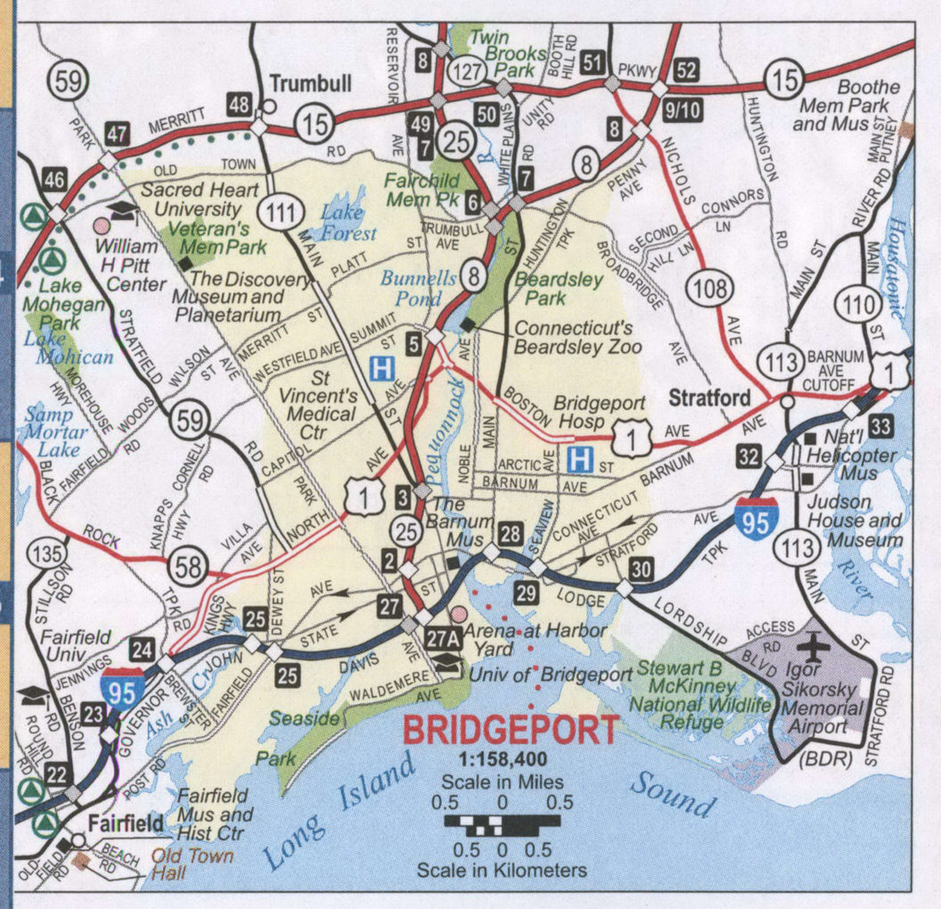
Bridgeport Road Map
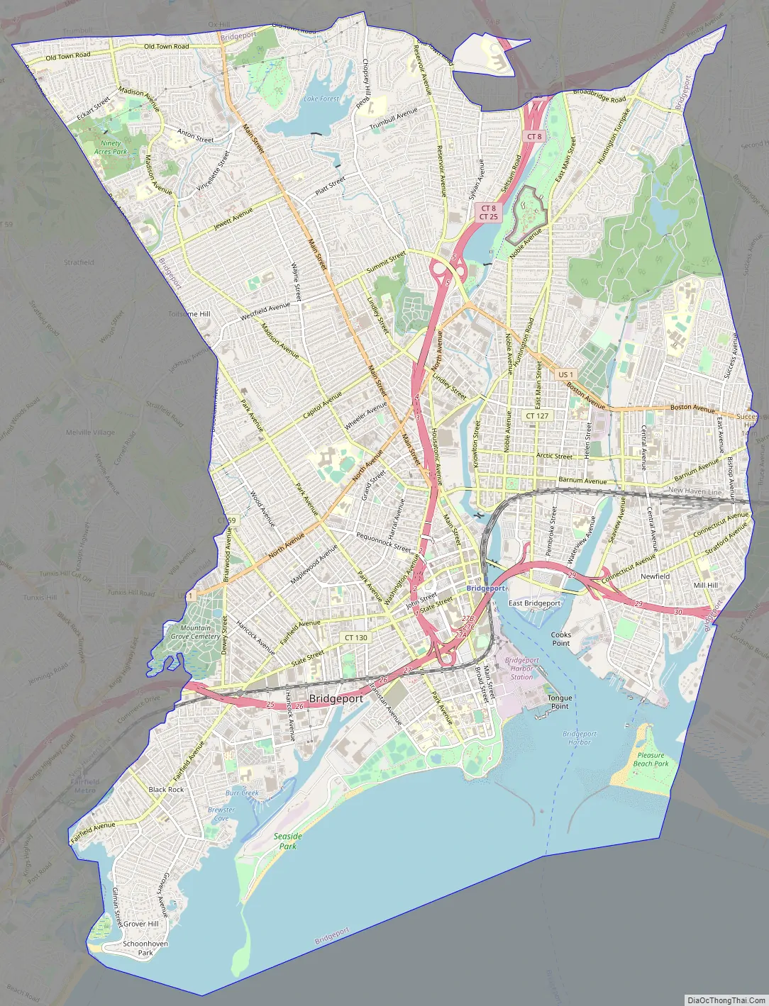
Bridgeport city Satellite Map
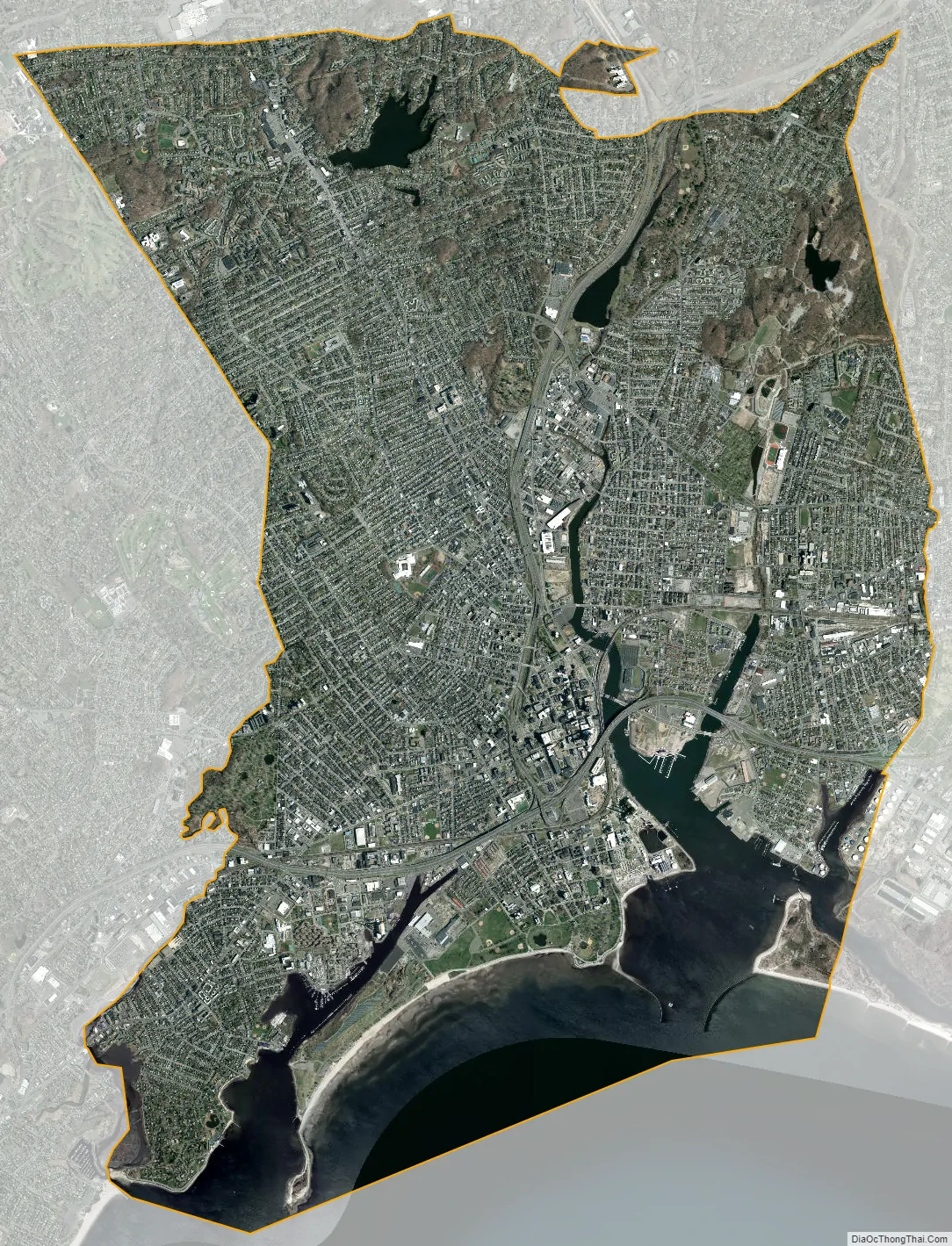
Geography
Bridgeport lies along Long Island Sound at the mouth of the Pequonnock River.
Neighborhoods
Bridgeport has many distinct neighborhoods, divided into five geographic areas: Downtown, the East Side, the North End, the South End, and the West Side.
- Downtown
- McLevy Green
- Downtown South
- Downtown North
- The Hollow
- The Hollow
- Enterprise Zone
- East Side
- Steel Point
- Lower East Side/East Side
- Upper East Side/ North Bridgeport
East End
- Boston Avenue/Mill Hill
- East End
- Newfield
- Pleasure Beach
- North End
- Lake Forest
- Lake Success
- Reservoir/Whiskey Hill
- Old Town Road
- Brooklawn/St. Vincent
- Central End/Little Italy
- Brooklawn
- South End
- Seaside Park
- Soundgate
- West Side
- Black Rock
- West Side
- West End
- Black Rock
- St. Mary’s by the Sea
Climate
Under the Köppen climate classification, Bridgeport straddles the humid subtropical climate (Cfa) and humid continental climate (Dfa) zones with long, hot summers, and cool to cold winters, with precipitation spread fairly evenly throughout the year. Bridgeport, like the rest of coastal Connecticut, lies in the broad transition zone between the colder continental climates of the northern United States and southern Canada to the north, and the warmer temperate and subtropical climates of the middle and south Atlantic states to the south.
The warm/hot season in Bridgeport is from mid-April through early November. Late day thundershowers are common in the hottest months (June, July, August, September), despite the mostly sunny skies. The cool/cold season is from late November though mid March. Winter weather is far more variable than summer weather along the Connecticut coast, ranging from sunny days with higher temperatures to cold and blustery conditions with occasional snow. Like much of the Connecticut coast and nearby Long Island, NY, most of the winter precipitation is rain or a mix and rain and wet snow in Bridgeport. Bridgeport averages about 29 inches (75 cm) of snow annually, compared to inland areas like Hartford and Albany which average 45–60 inches (110–150 cm) of snow annually.
Although infrequent, tropical cyclones (hurricanes/tropical storms) have struck Connecticut and the Bridgeport metropolitan area. Hurricane landfalls have occurred along the Connecticut coast in 1903, 1938, 1944, 1954 (Carol), 1960 (Donna), Hurricane Gloria in 1985, and Hurricane Sandy in 2012.
Bridgeport lies in USDA garden hardiness zone 7a, averaging about 92 days annually with freeze. The coastal location of Bridgeport allows it to be milder than locations well south but inland. For example, the record coldest low temperature at Atlanta is -8 F, while the record coldest at Bridgeport is -7 F. Coastal Connecticut is the broad transition zone where so-called “subtropical indicator” plants such as cold hardy palms and other broadleaf evergreens can successfully be cultivated. As such, Southern Magnolias, Needle Palms, Windmill palm, Loblolly Pines, and Crape Myrtles are grown in private and public gardens. Like much of coastal Connecticut, Long Island, NY, and coastal New Jersey, the growing season is rather long in Bridgeport—averaging 210 days from April 8 to November 5 according to the National Weather Service in Bridgeport.
The average monthly temperature ranges from 31.4 °F (−0.3 °C) in January to 75.7 °F (24.3 °C) in July. The record low is −7 °F (−22 °C), set on January 22, 1984, while the record high is 103 °F (39 °C), set on July 22 in 1957 and 2011.
Precipitation averages 44.9 inches (1,140 mm) annually, and is somewhat evenly distributed throughout the year, with March and April the wettest months. Annual snowfall averages 33.6 inches (85 cm), falling almost entirely from December to March. As is typical of coastal Connecticut, snow cover does not usually last long, with an average of 33 days per winter with snow cover of at least 1 inch (2.5 cm).
See also
Map of Connecticut State and its subdivision: Map of other states:- Alabama
- Alaska
- Arizona
- Arkansas
- California
- Colorado
- Connecticut
- Delaware
- District of Columbia
- Florida
- Georgia
- Hawaii
- Idaho
- Illinois
- Indiana
- Iowa
- Kansas
- Kentucky
- Louisiana
- Maine
- Maryland
- Massachusetts
- Michigan
- Minnesota
- Mississippi
- Missouri
- Montana
- Nebraska
- Nevada
- New Hampshire
- New Jersey
- New Mexico
- New York
- North Carolina
- North Dakota
- Ohio
- Oklahoma
- Oregon
- Pennsylvania
- Rhode Island
- South Carolina
- South Dakota
- Tennessee
- Texas
- Utah
- Vermont
- Virginia
- Washington
- West Virginia
- Wisconsin
- Wyoming