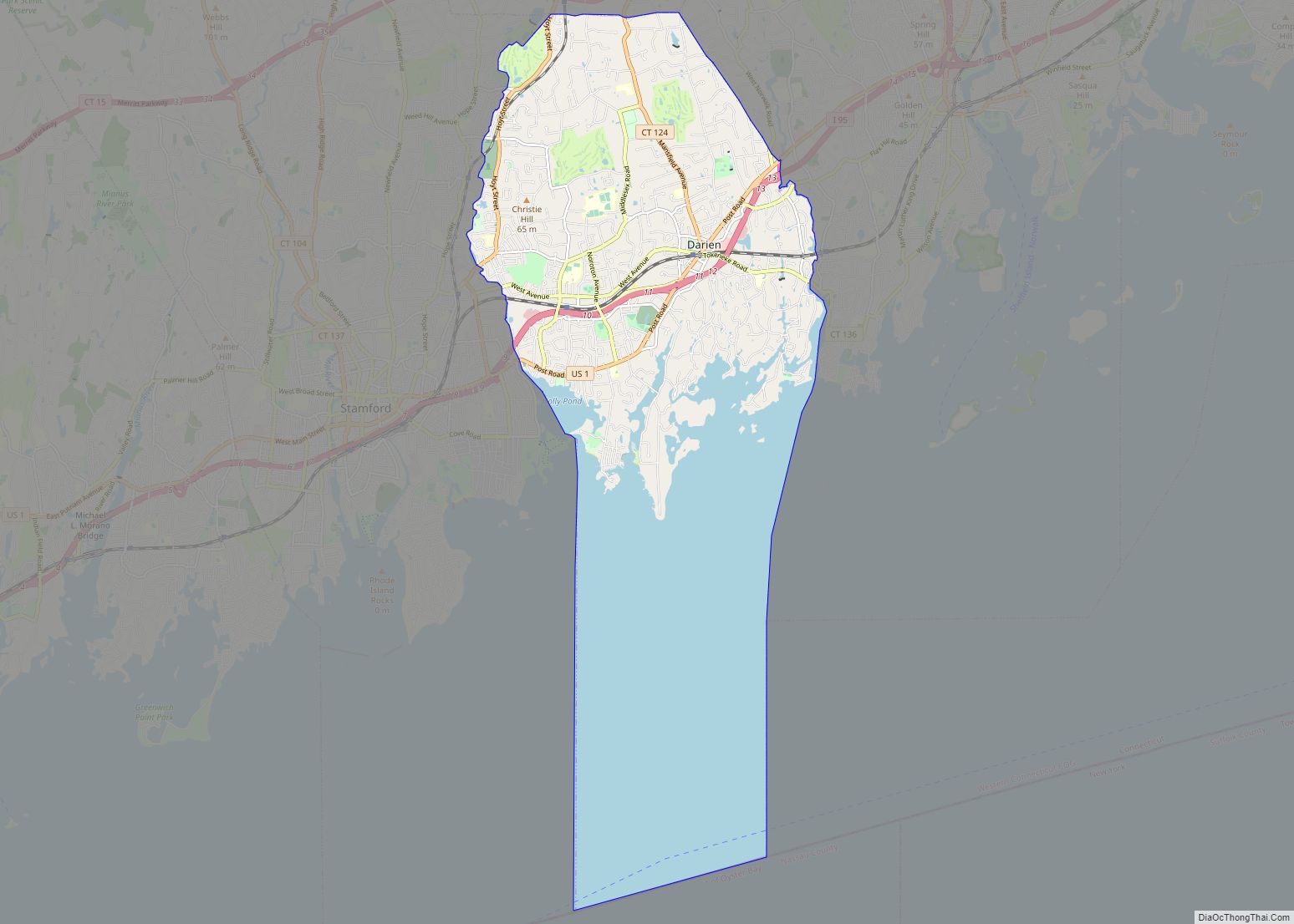
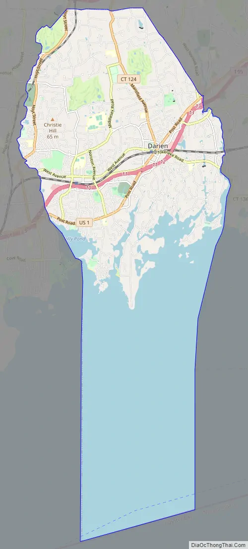
Darien Downtown is a census-designated place (CDP) in the town of Darien, Fairfield County, Connecticut, United States. It represents the built-up center of town around the intersections of U.S. Route 1 (Boston Post Road), Connecticut Route 124 (Mansfield Avenue), and Connecticut Route 136 (Tokeneke Road). Interstate 95 passes through the southern part of the CDP, with access from Exit 11 (Route 1) and Exit 12 (Route 136). It was first listed as a CDP prior to the 2020 census.
| Name: | Darien CDP |
|---|---|
| LSAD Code: | 57 |
| LSAD Description: | CDP (suffix) |
| State: | Connecticut |
| County: | Fairfield County |
| Elevation: | 20 m (60 ft) |
| Total Area: | 2.08 km² (0.80 sq mi) |
| Land Area: | 2.04 km² (0.79 sq mi) |
| Water Area: | 0.04 km² (0.02 sq mi) |
| ZIP code: | 06820 |
| Area code: | 203/475 |
| FIPS code: | 0918920 |
| GNISfeature ID: | 2805053 |
Online Interactive Map
Click on ![]() to view map in "full screen" mode.
to view map in "full screen" mode.
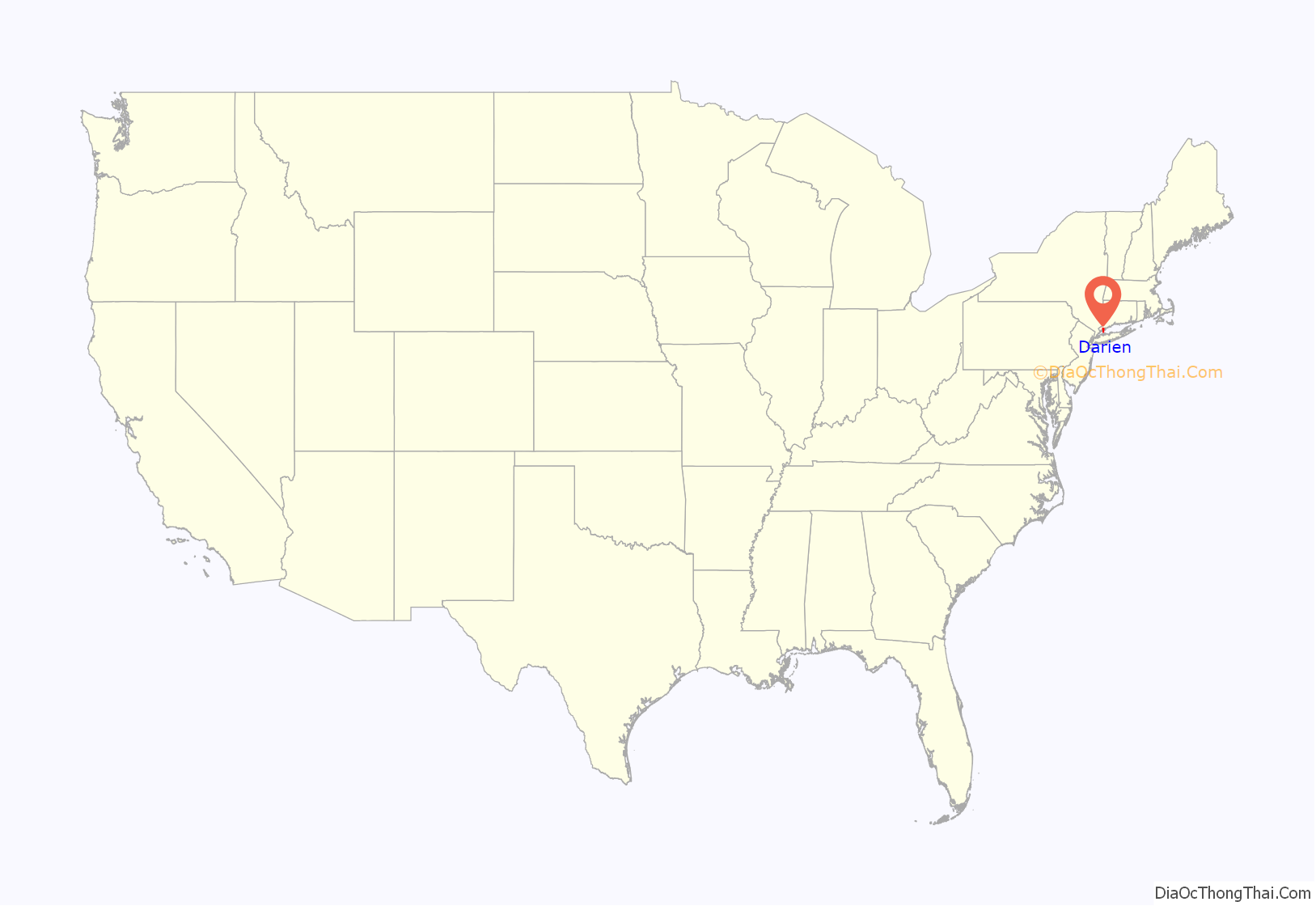
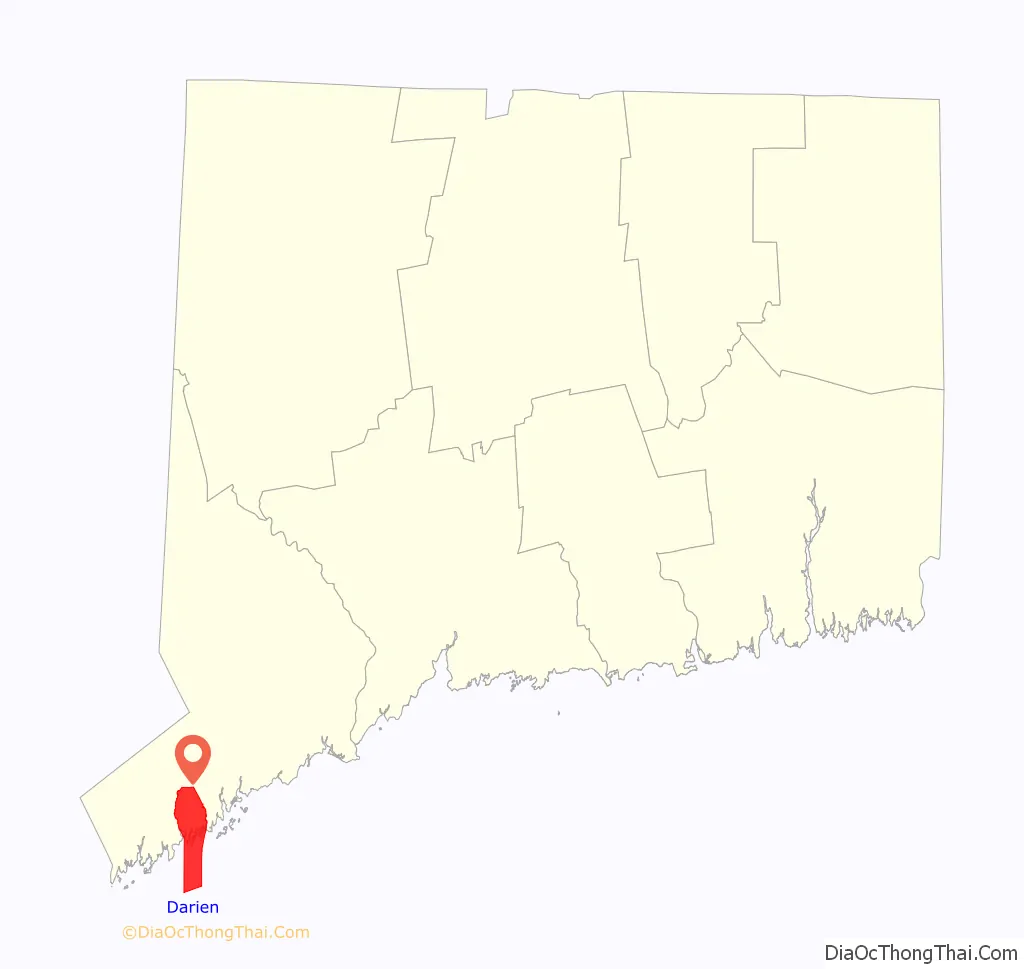
Darien location map. Where is Darien CDP?
Darien Road Map
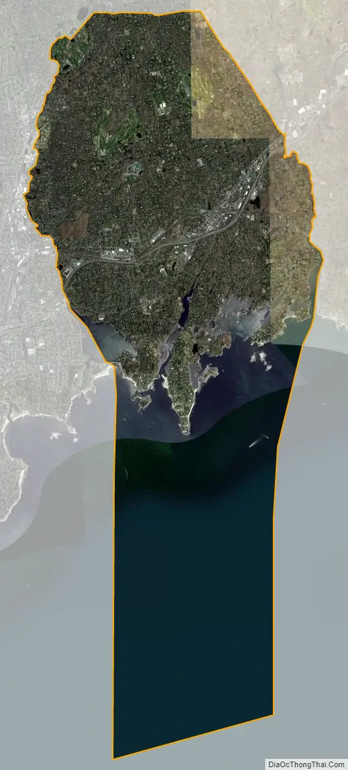
Darien city Satellite Map
See also
Map of Connecticut State and its subdivision: Map of other states:- Alabama
- Alaska
- Arizona
- Arkansas
- California
- Colorado
- Connecticut
- Delaware
- District of Columbia
- Florida
- Georgia
- Hawaii
- Idaho
- Illinois
- Indiana
- Iowa
- Kansas
- Kentucky
- Louisiana
- Maine
- Maryland
- Massachusetts
- Michigan
- Minnesota
- Mississippi
- Missouri
- Montana
- Nebraska
- Nevada
- New Hampshire
- New Jersey
- New Mexico
- New York
- North Carolina
- North Dakota
- Ohio
- Oklahoma
- Oregon
- Pennsylvania
- Rhode Island
- South Carolina
- South Dakota
- Tennessee
- Texas
- Utah
- Vermont
- Virginia
- Washington
- West Virginia
- Wisconsin
- Wyoming