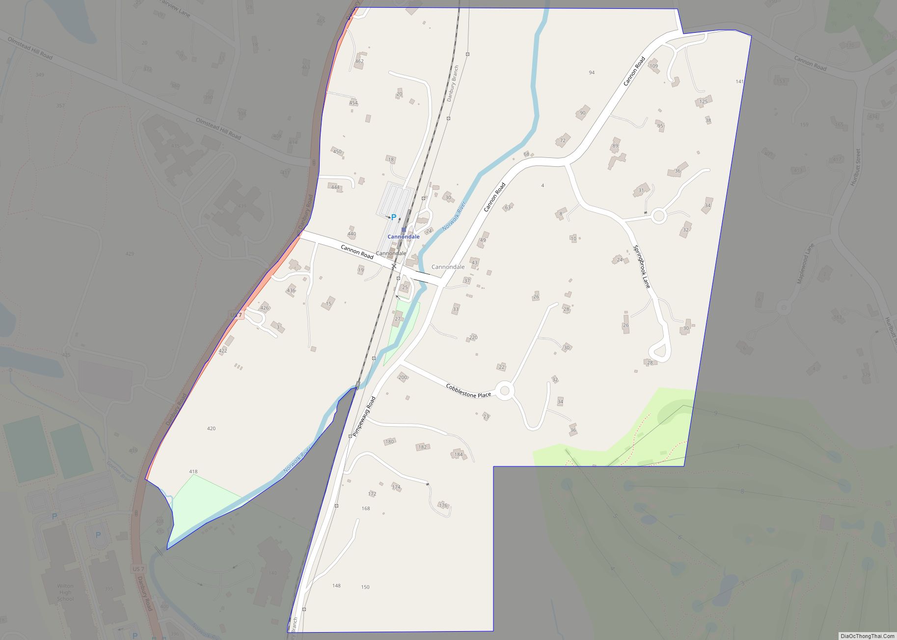
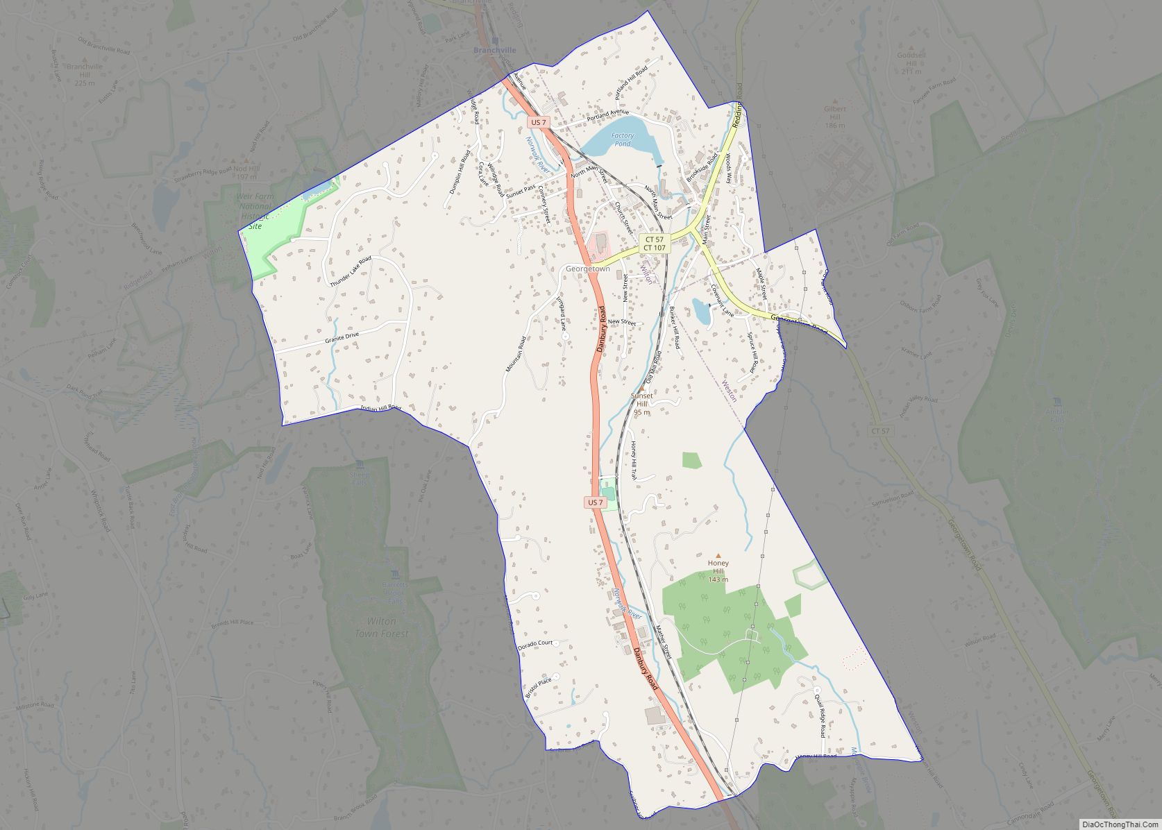
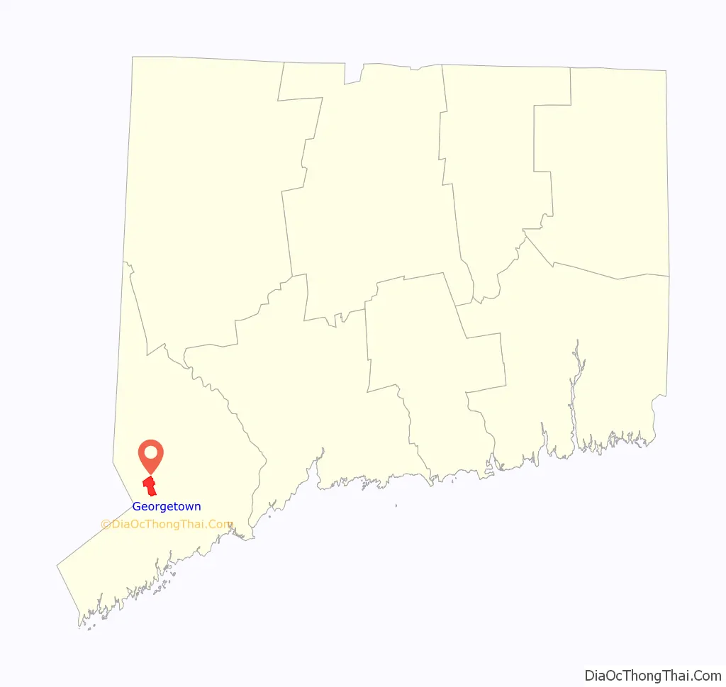
Georgetown is a census-designated place in Fairfield County, Connecticut, United States. It is located in the area where the towns of Wilton, Redding, Weston, and Ridgefield meet.
Georgetown and its surrounding area are also defined as the Georgetown census-designated place (CDP). As of the 2010 census, the population of the CDP was 1,805.
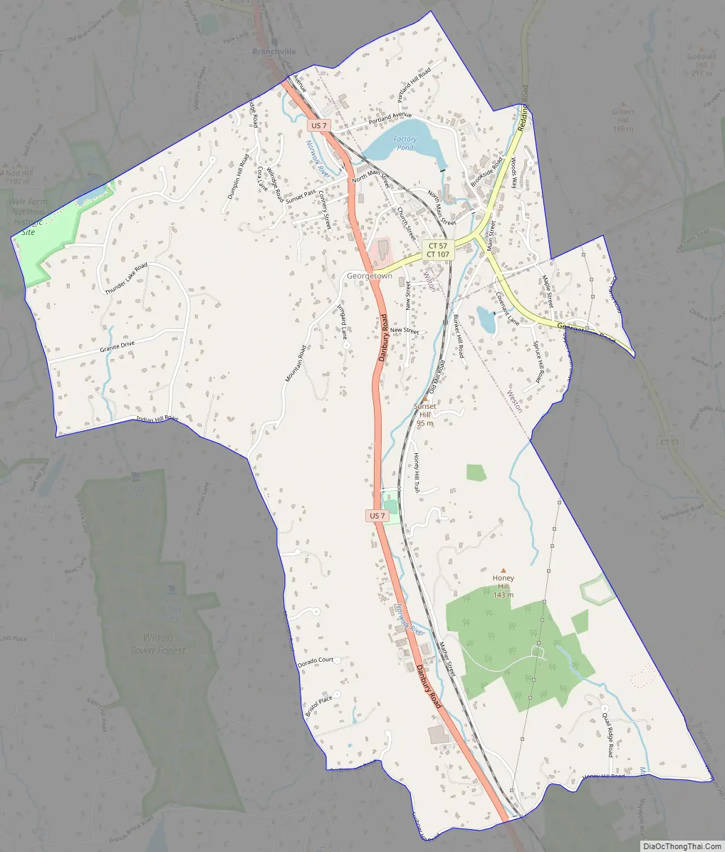
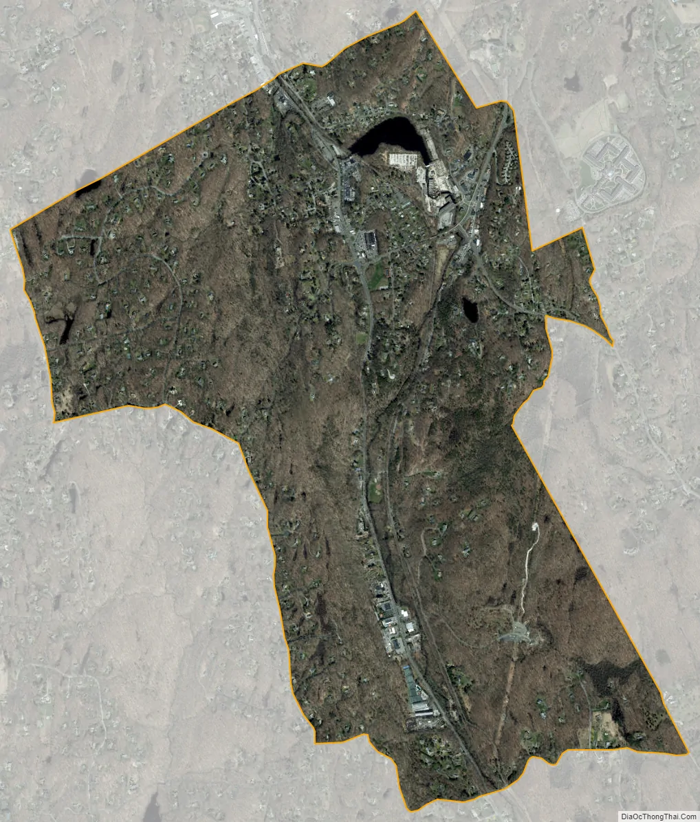
Georgetown is located at the southwest corner of the town of Redding, the northwest corner of the town of Weston, the northeast corner of the town of Wilton, and the southeast corner of Ridgefield. Georgetown residents officially live in and pay local taxes to one of these four towns, but typically identify themselves as living in Georgetown. Georgetown has its own fire district, which also serves the surrounding rural areas not traditionally included in Georgetown, and its own ZIP code (06829).
| Name: | Georgetown CDP |
|---|---|
| LSAD Code: | 57 |
| LSAD Description: | CDP (suffix) |
| State: | Connecticut |
| County: | Fairfield County |
| Elevation: | 354 ft (108 m) |
| Total Area: | 2.9 sq mi (7.4 km²) |
| Land Area: | 2.8 sq mi (7.3 km²) |
| Water Area: | 0.0 sq mi (0.0 km²) |
| Total Population: | 1,805 |
| Population Density: | 620/sq mi (240/km²) |
| ZIP code: | 06829 |
| Area code: | 203 |
| FIPS code: | 0930540 |
| GNISfeature ID: | 0207283 |
Online Interactive Map
Click on ![]() to view map in "full screen" mode.
to view map in "full screen" mode.
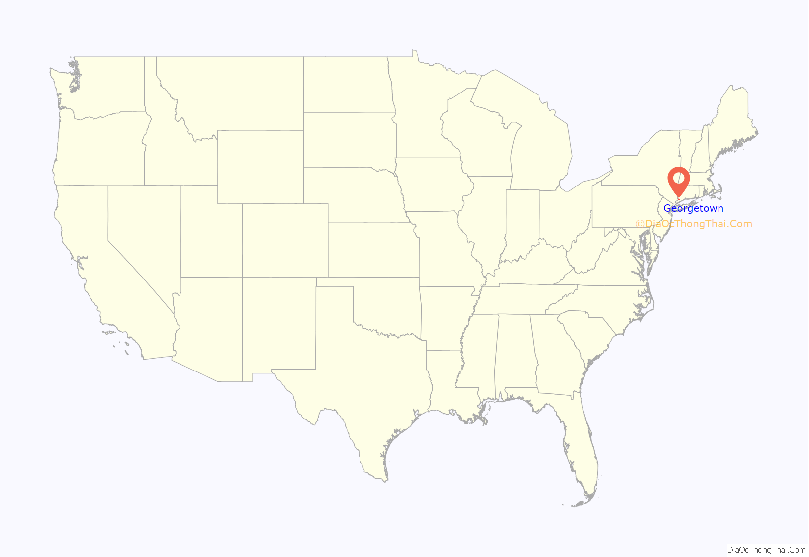
Georgetown location map. Where is Georgetown CDP?
Georgetown Road Map
Georgetown city Satellite Map
Geography
According to the United States Census Bureau, the CDP has a total area of 2.85 square miles (7.4 km), of which 2.84 square miles (7.4 km) is land and 0.02 square miles (0.052 km), or 0.70%, is water. Of the total area of the CDP, 2.36 square miles (6.1 km) are in Wilton, 0.33 square miles (0.85 km) are in Redding, and 0.16 square miles (0.41 km) are in Weston.
See also
Map of Connecticut State and its subdivision: Map of other states:- Alabama
- Alaska
- Arizona
- Arkansas
- California
- Colorado
- Connecticut
- Delaware
- District of Columbia
- Florida
- Georgia
- Hawaii
- Idaho
- Illinois
- Indiana
- Iowa
- Kansas
- Kentucky
- Louisiana
- Maine
- Maryland
- Massachusetts
- Michigan
- Minnesota
- Mississippi
- Missouri
- Montana
- Nebraska
- Nevada
- New Hampshire
- New Jersey
- New Mexico
- New York
- North Carolina
- North Dakota
- Ohio
- Oklahoma
- Oregon
- Pennsylvania
- Rhode Island
- South Carolina
- South Dakota
- Tennessee
- Texas
- Utah
- Vermont
- Virginia
- Washington
- West Virginia
- Wisconsin
- Wyoming