Ridgefield is a census-designated place (CDP) in Fairfield County, Connecticut, United States. It consists of the primary central village in the town of Ridgefield and surrounding residential areas. As of the 2010 census, the population of the CDP was 7,645, out of 24,638 in the entire town.
| Name: | Ridgefield CDP |
|---|---|
| LSAD Code: | 57 |
| LSAD Description: | CDP (suffix) |
| State: | Connecticut |
| County: | Fairfield County |
| Elevation: | 749 ft (228 m) |
| Total Area: | 6.40 sq mi (16.58 km²) |
| Land Area: | 6.40 sq mi (16.57 km²) |
| Water Area: | 0.008 sq mi (0.02 km²) |
| Total Population: | 7,645 |
| Population Density: | 1,195/sq mi (461.5/km²) |
| ZIP code: | 06877 |
| FIPS code: | 0963900 |
| GNISfeature ID: | 2377856 |
Online Interactive Map
Click on ![]() to view map in "full screen" mode.
to view map in "full screen" mode.
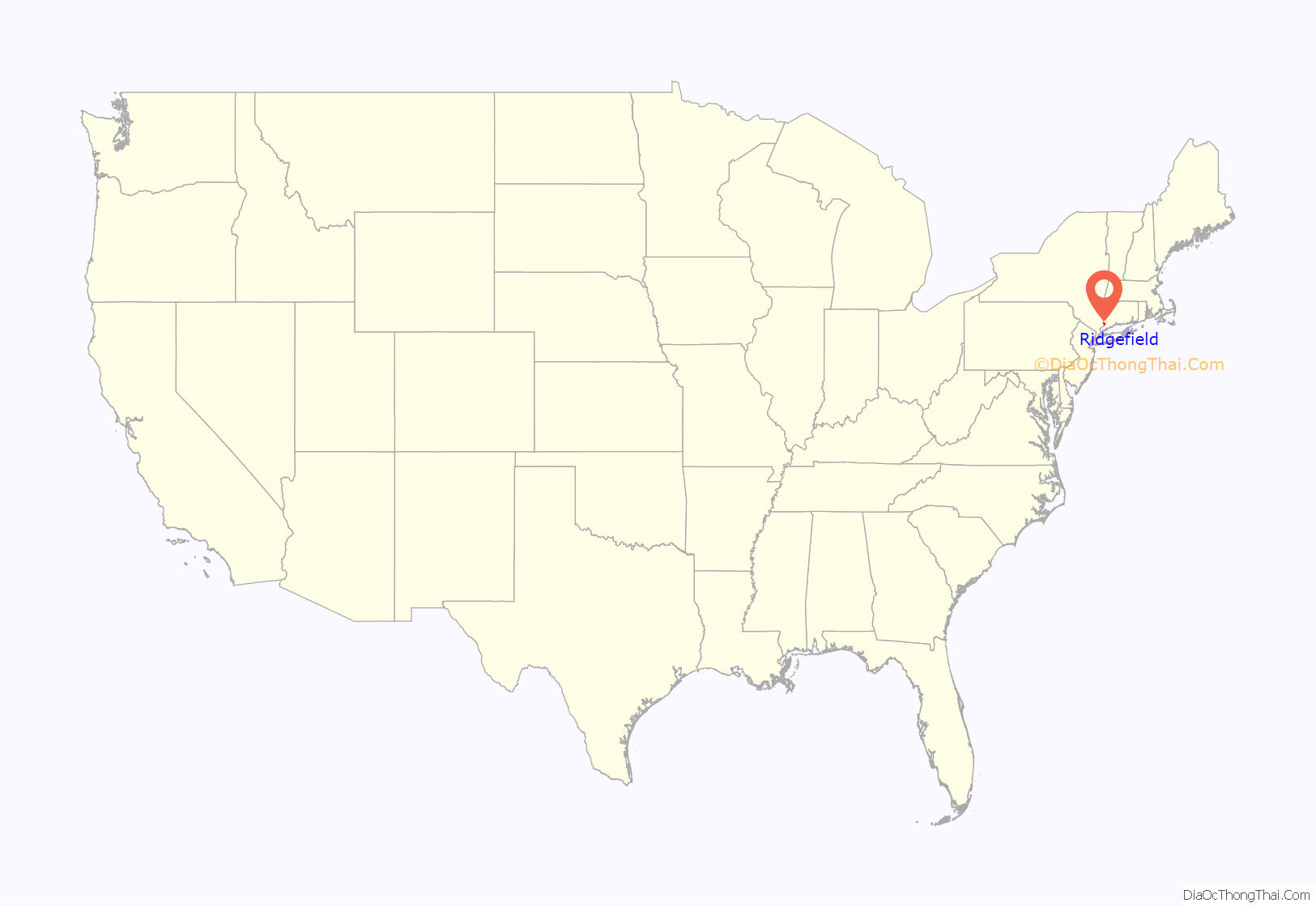
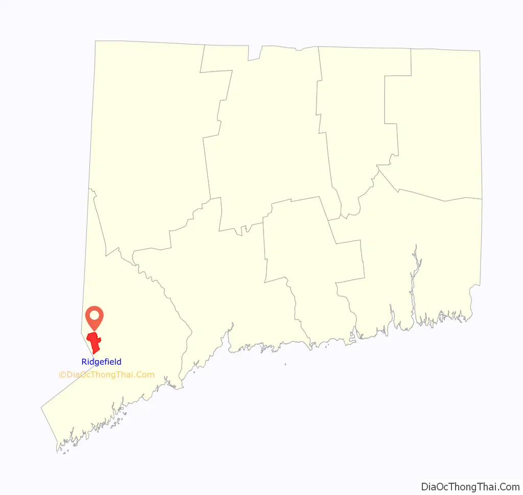
Ridgefield location map. Where is Ridgefield CDP?
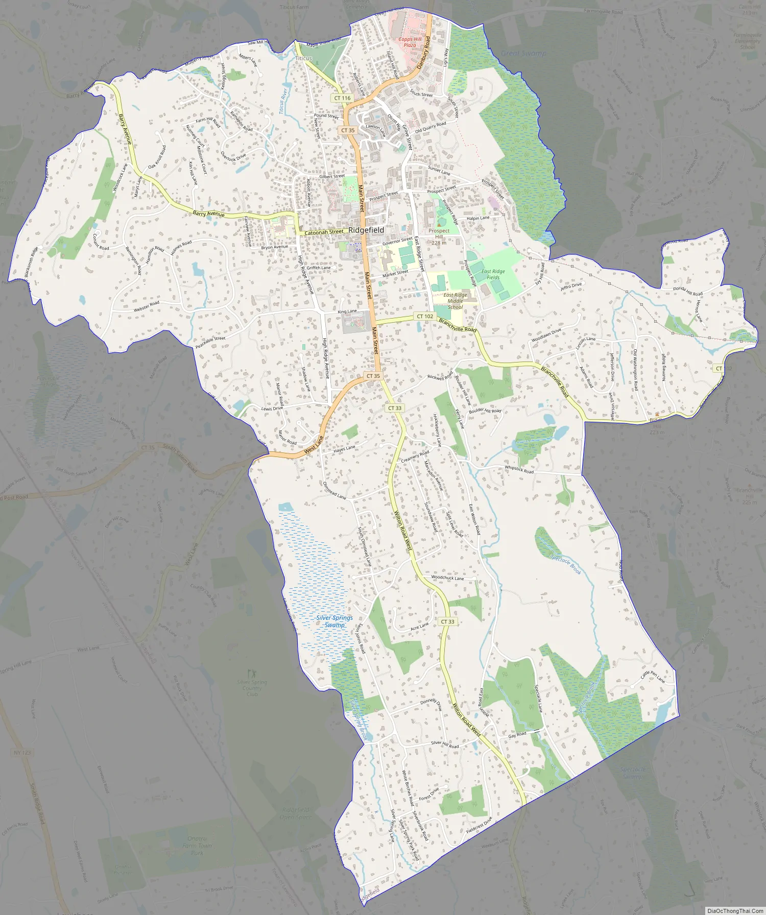
Ridgefield Road Map
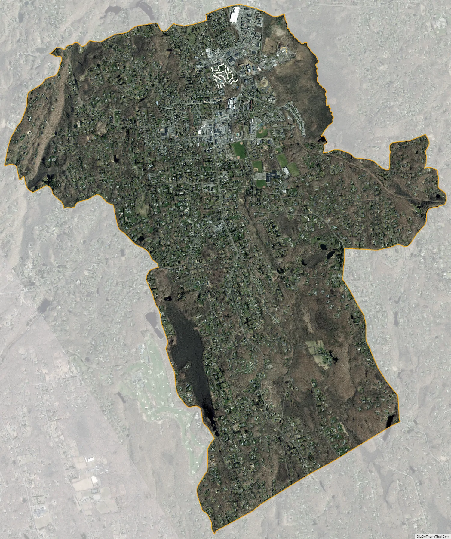
Ridgefield city Satellite Map
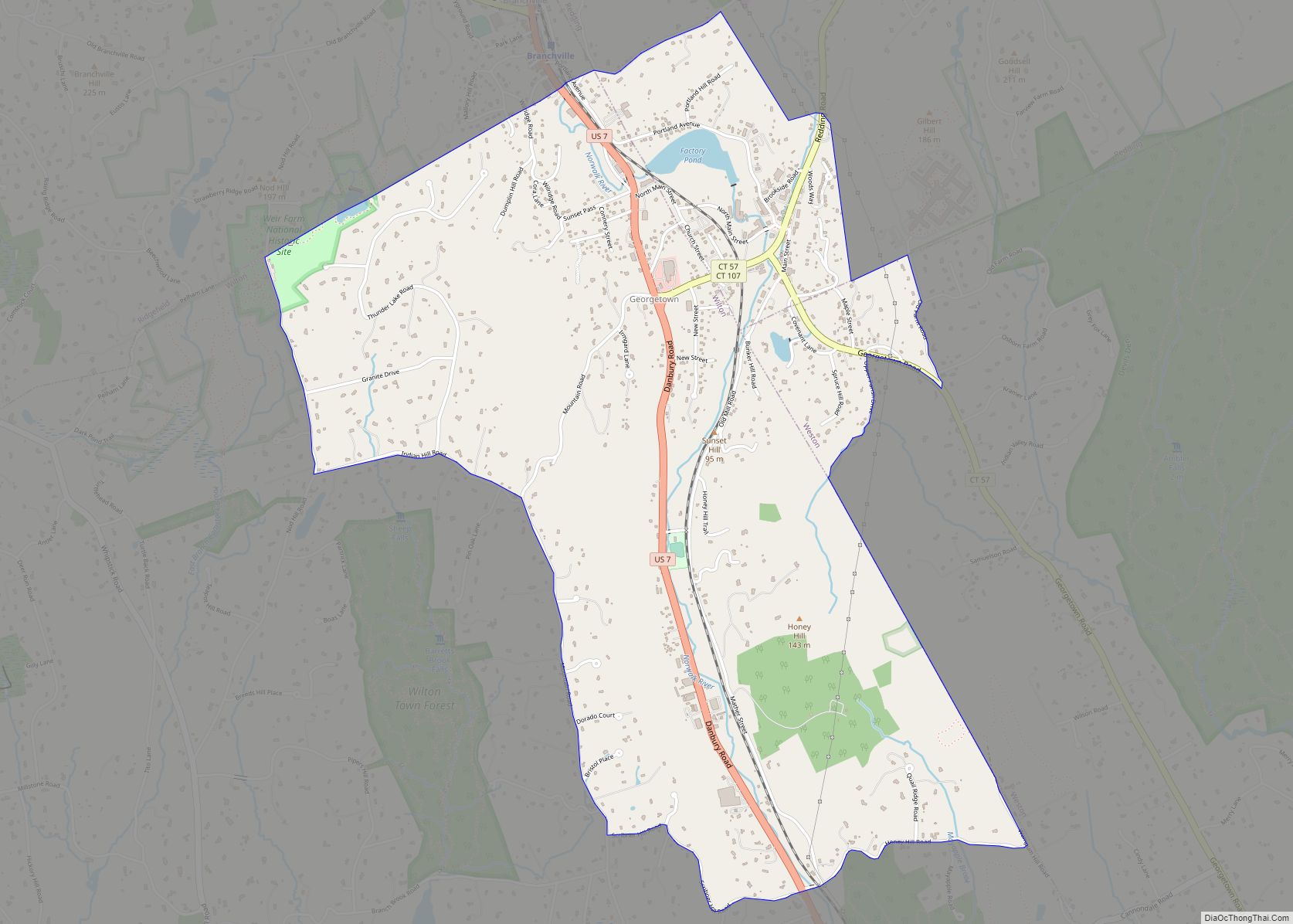
Geography
The CDP is in the southern part of the town of Ridgefield and extends south to the border with the town of Wilton. To the east the CDP border follows Nod Road, Branchville Road, Cooper Hill Road, Harvey Road, Ridgewood Road, Florida Hill Road, and Ridgefield Brook. The northern boundary of the CDP follows Copps Hill Road, Maple Shade Road, Saw Mill Hill Road, Mulberry Street, Ramapoo Road, and a short section of Barry Avenue. To the west the CDP boundary follows Peaceable Ridge Road, Peaceable Hill Road, Peaceable Street, Golf Lane, and Silver Spring Road.
Connecticut Route 33 is Ridgefield’s Main Street and continues south through the CDP as Wilton Road, leading 8 miles (13 km) to Wilton Center and 14 miles (23 km) to Westport. Connecticut Route 35 leads west from the southern part of the town center 1.8 miles (2.9 km) to the New York state border and continues west another 9 miles (14 km) as New York State Route 35 to Katonah, New York. CT 35 also leads north 3 miles (5 km) to U.S. Route 7 near the southern border of Danbury. Connecticut Route 102 (Branchville Road) leads east from Main Street 3.5 miles (5.6 km) to US 7 at Branchville. Connecticut Route 116 (North Salem Road) leads northwest from the north end of Main Street in Ridgefield 4 miles (6 km) to the New York border and continues 1.5 miles (2.4 km) further as NY 116 to the center of North Salem, New York.
According to the U.S. Census Bureau, the Ridgefield CDP has an area of 6.4 square miles (16.6 km), of which 0.01 square miles (0.02 km), or 0.11%, are water.
See also
Map of Connecticut State and its subdivision: Map of other states:- Alabama
- Alaska
- Arizona
- Arkansas
- California
- Colorado
- Connecticut
- Delaware
- District of Columbia
- Florida
- Georgia
- Hawaii
- Idaho
- Illinois
- Indiana
- Iowa
- Kansas
- Kentucky
- Louisiana
- Maine
- Maryland
- Massachusetts
- Michigan
- Minnesota
- Mississippi
- Missouri
- Montana
- Nebraska
- Nevada
- New Hampshire
- New Jersey
- New Mexico
- New York
- North Carolina
- North Dakota
- Ohio
- Oklahoma
- Oregon
- Pennsylvania
- Rhode Island
- South Carolina
- South Dakota
- Tennessee
- Texas
- Utah
- Vermont
- Virginia
- Washington
- West Virginia
- Wisconsin
- Wyoming