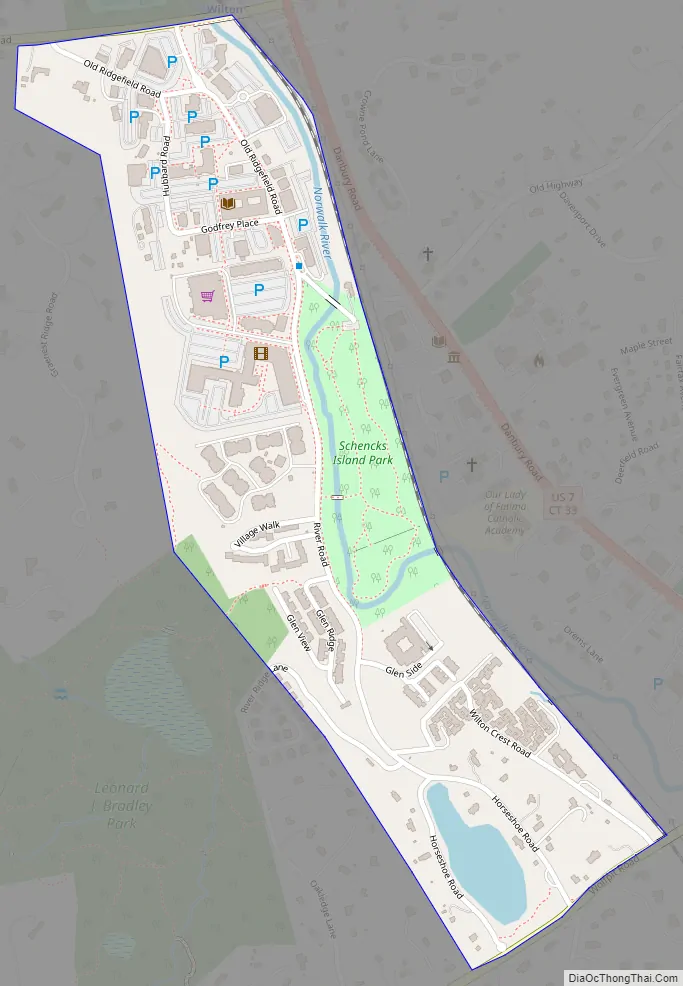
Wilton Center is a neighborhood/section and census-designated place (CDP) in the town of Wilton in Fairfield County, Connecticut, United States. As of the 2010 census it had a population of 732. The CDP partially overlaps the Wilton Center Historic District.
| Name: | Wilton Center CDP |
|---|---|
| LSAD Code: | 57 |
| LSAD Description: | CDP (suffix) |
| State: | Connecticut |
| County: | Fairfield County |
| Total Area: | 0.276 sq mi (0.71 km²) |
| Land Area: | 0.276 sq mi (0.71 km²) |
| Water Area: | 0.000 sq mi (0.00 km²) |
| Total Population: | 732 |
| Population Density: | 2,700/sq mi (1,000/km²) |
| Area code: | 203 |
| FIPS code: | 0986380 |
| GNISfeature ID: | 2631222 |
Online Interactive Map
Click on ![]() to view map in "full screen" mode.
to view map in "full screen" mode.
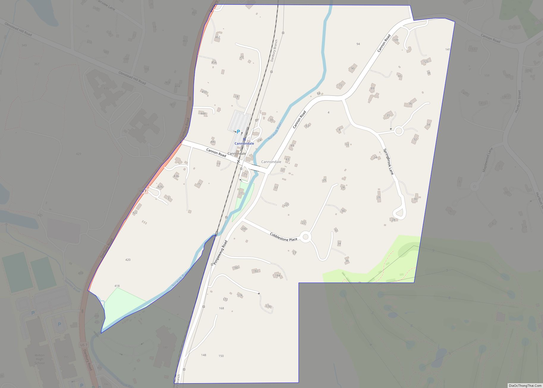
Wilton Center location map. Where is Wilton Center CDP?
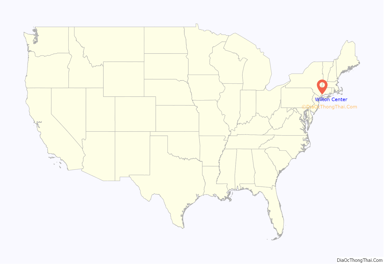
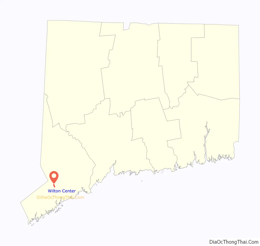
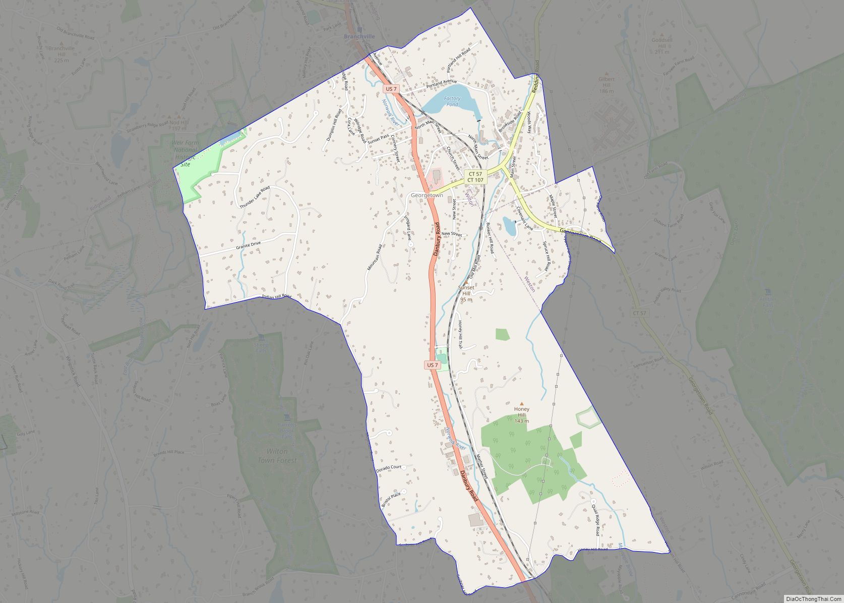
Wilton Center Road Map
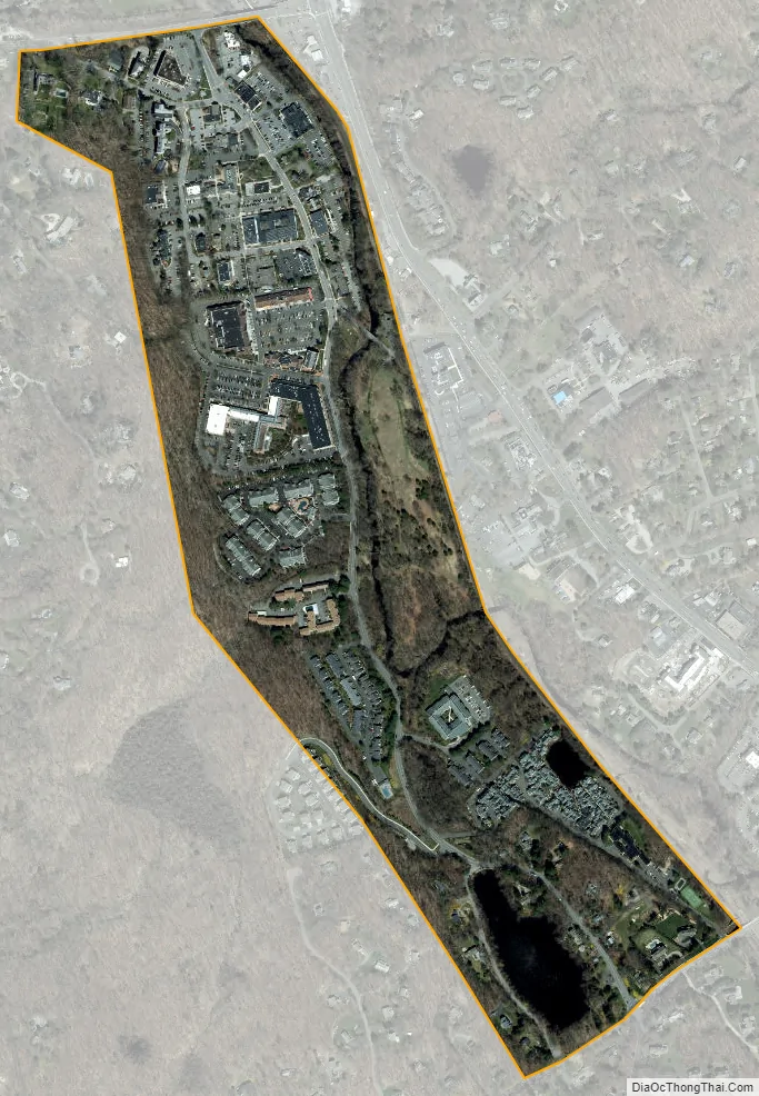
Wilton Center city Satellite Map
Geography
The CDP extends from Ridgefield Road (Connecticut Route 33) in the north to Wolfpit Road Connecticut Route 106 in the south, and is bordered to the east by the Metro-North Railroad Danbury Branch line. The western edge of the CDP is an irregular line about 0.3 miles (0.48 km) west of the Metro-North line. The historic district is largely along Ridgefield Road at the north end of the CDP. The Norwalk River flows from north to south through the eastern side of the CDP.
According to the United States Census Bureau, Wilton Center has a total area of 0.276 square miles (0.71 km), all land.
See also
Map of Connecticut State and its subdivision: Map of other states:- Alabama
- Alaska
- Arizona
- Arkansas
- California
- Colorado
- Connecticut
- Delaware
- District of Columbia
- Florida
- Georgia
- Hawaii
- Idaho
- Illinois
- Indiana
- Iowa
- Kansas
- Kentucky
- Louisiana
- Maine
- Maryland
- Massachusetts
- Michigan
- Minnesota
- Mississippi
- Missouri
- Montana
- Nebraska
- Nevada
- New Hampshire
- New Jersey
- New Mexico
- New York
- North Carolina
- North Dakota
- Ohio
- Oklahoma
- Oregon
- Pennsylvania
- Rhode Island
- South Carolina
- South Dakota
- Tennessee
- Texas
- Utah
- Vermont
- Virginia
- Washington
- West Virginia
- Wisconsin
- Wyoming