Wilmington (Lenape: Paxahakink / Pakehakink) is the largest city in the U.S. state of Delaware. The city was built on the site of Fort Christina, the first Swedish settlement in North America. It lies at the confluence of the Christina River and Brandywine Creek, two waterways near where the Christina flows into the Delaware River. It is the county seat of New Castle County and one of the major cities in the Delaware Valley metropolitan area (synonymous with the Philadelphia metropolitan area). Wilmington was named by Proprietor Thomas Penn after his friend Spencer Compton, Earl of Wilmington, who was prime minister during the reign of George II of Great Britain.
At the 2020 census, the city’s population was 70,898. Wilmington is part of the Delaware Valley metropolitan statistical area (which also includes Philadelphia, Reading, Camden, and other urban areas), which had a 2020 core metropolitan statistical area population of 6,228,601, representing the seventh largest metropolitan region in the nation, and a combined statistical area population of 7.366 million.
| Name: | Wilmington city |
|---|---|
| LSAD Code: | 25 |
| LSAD Description: | city (suffix) |
| State: | Delaware |
| County: | New Castle County |
| Elevation: | 92 ft (28 m) |
| Land Area: | 10.89 sq mi (28.22 km²) |
| Water Area: | 6.29 sq mi (16.30 km²) |
| Population Density: | 6,510.38/sq mi (2,512.48/km²) |
| ZIP code: | 19801-19810, 19850, 19880, 19884-19886, 19890-19899 |
| Area code: | 302 |
| FIPS code: | 1077580 |
| GNISfeature ID: | 214862 |
| Website: | wilmingtonde.gov |
Online Interactive Map
Click on ![]() to view map in "full screen" mode.
to view map in "full screen" mode.
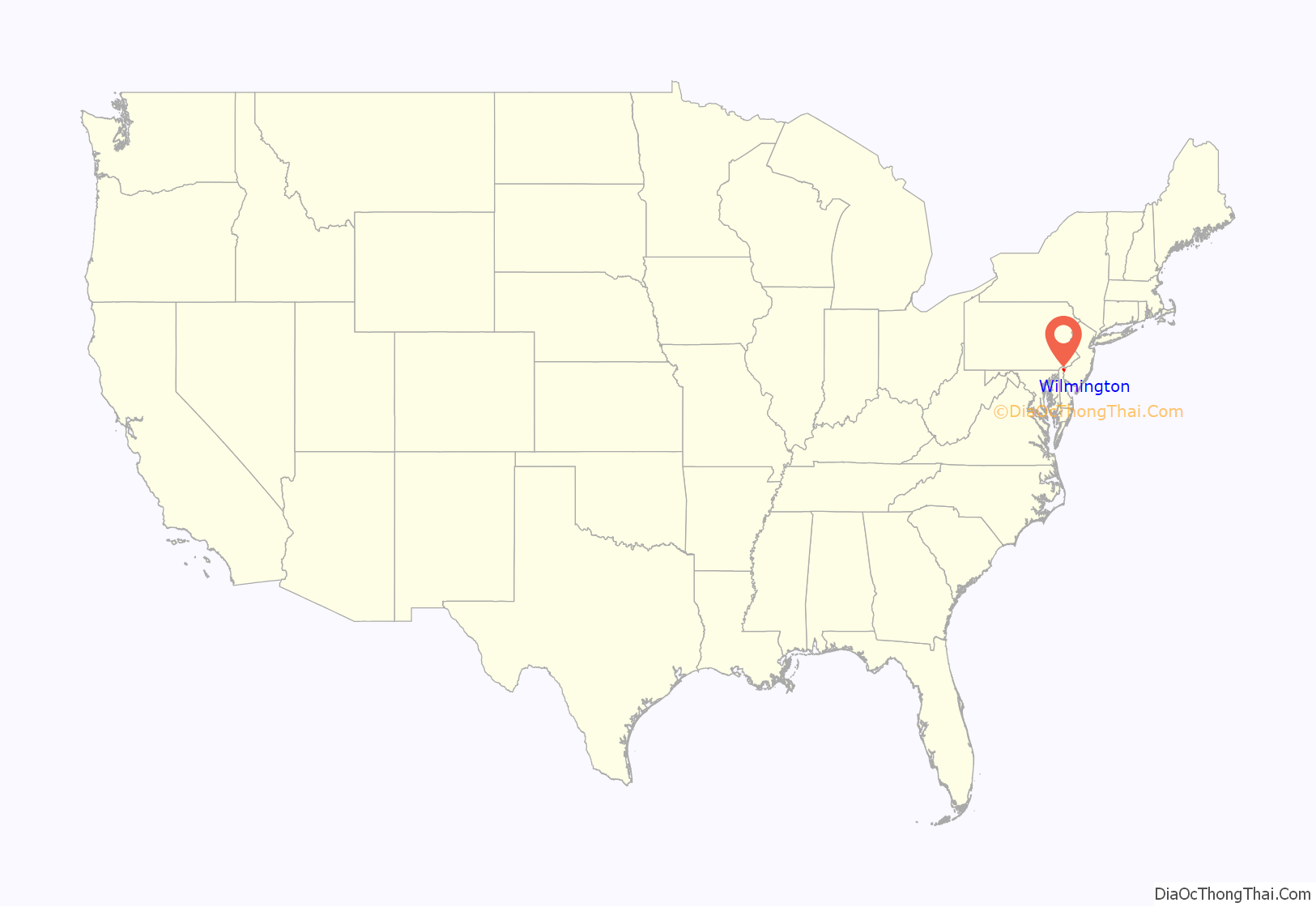
Wilmington location map. Where is Wilmington city?
History
Wilmington is built on the site of Fort Christina and the settlement Kristinehamn, the first Swedish settlement in North America. The modern city also encompasses other Swedish settlements, such as Timmerön / Timber Island (along Brandywine Creek), Sidoland (South Wellington), Strandviken (along the Delaware River near Simonds Garden) and Översidolandet (along the Christina River, near Woodcrest and Ashley Heights).
The area now known as Wilmington was settled by the Lenape (or Delaware Indian) band led by Sachem (Chief) Mattahorn just before Henry Hudson sailed up the Len-api Hanna (“People Like Me River”, present Delaware River) in 1609. The area was called “Maax-waas Unk” or “Bear Place” after the Maax-waas Hanna (Bear River) that flowed by (present Christina River). It was called the Bear River because it flowed west to the “Bear People”, who are now known as the People of Conestoga or the Susquehannocks.
The Dutch heard and spelled the river and the place as Minguannan. When settlers and traders from the Swedish South Company under Peter Minuit arrived in March 1638 on the Fogel Grip and Kalmar Nyckel, they purchased Maax-waas Unk from Chief Mattahorn and built Fort Christina at the mouth of the Maax-waas Hanna (which the Swedes renamed the Christina River after Queen Christina of Sweden). The area was also known as “The Rocks”, and is located near the foot of present-day Seventh Street. Fort Christina served as the headquarters for the colony of New Sweden which consisted of, for the most part, the lower Delaware River region (parts of present-day Delaware, Pennsylvania, and New Jersey), but few colonists settled there. Dr. Timothy Stidham (Swedish:Timen Lulofsson Stiddem) was a prominent citizen and doctor in Wilmington. He was born in 1610, probably in Hammel, Denmark, and raised in Gothenburg, Sweden. He arrived in New Sweden in 1654 and is recorded as the first physician in Delaware.
The most important Swedish governor was Colonel Johan Printz, who ruled the colony under Swedish law from 1643 to 1653. He was succeeded by Johan Rising, who upon his arrival in 1654, seized the Dutch post Fort Casimir, located at the site of the present town of New Castle, which was built by the Dutch in 1651. Rising governed New Sweden until the autumn of 1655, when a Dutch fleet under the command of Peter Stuyvesant subjugated the Swedish forts and established the authority of the Colony of New Netherland throughout the area formerly controlled by the Swedes. This marked the end of Swedish rule in North America.
Beginning in 1664 British colonization began; after a series of wars between the Dutch and English, the area stabilized under British rule, with strong influences from the Quaker communities under the auspices of Proprietor William Penn. A borough charter was granted in 1739 by King George II, which changed the name of the settlement from Willington, after Thomas Willing (the first developer of the land, who organized the area in a grid pattern similar to that of its northern neighbor Philadelphia), to Wilmington, presumably after the British Prime Minister Spencer Compton, Earl of Wilmington, who took his title from Wilmington, East Sussex, in southern England.
Although during the American Revolutionary War only one small battle was fought in Delaware, British troops occupied Wilmington shortly after the nearby Battle of Brandywine on September 11, 1777. The British remained in the town until they vacated Philadelphia in 1778.
In 1800, Eleuthère Irénée du Pont, a French Huguenot, emigrated to the United States. Knowledgeable in the manufacture of gunpowder, by 1802 DuPont had begun making the explosive in a mill on the Brandywine River north of Brandywine Village and just outside the town of Wilmington. The DuPont company became a major supplier to the U.S. military. Located on the banks of the Brandywine River, the village was eventually annexed by Wilmington city.
The greatest growth in the city occurred during the Civil War. Delaware, though officially remaining a member of the Union, was a border state and divided in its support of both the Confederate and the Union causes. The war created enormous demand for goods and materials supplied by Wilmington including ships, railroad cars, gunpowder, shoes, and other war-related goods.
By 1868, Wilmington was producing more iron ships than the rest of the country combined and it rated first in the production of gunpowder and second in carriages and leather. Due to the prosperity Wilmington enjoyed during the war, city merchants and manufacturers expanded Wilmington’s residential boundaries westward in the form of large homes along tree-lined streets. This movement was spurred by the first horsecar line, which was initiated in 1864 along Delaware Avenue.
The late 19th century saw the development of the city’s first comprehensive park system. William Poole Bancroft, a successful Wilmington businessman influenced by the work of Frederick Law Olmsted, led the effort to establish open parkland in Wilmington. Rockford Park and Brandywine Park were created due to Bancroft’s efforts.
Both World Wars stimulated the city’s industries. Industries vital to the war effort – shipyards, steel foundries, machinery, and chemical producers – operated around the clock. Other industries produced such goods as automobiles, leather products, and clothing. In desperate need of workers more and more minorities moved to the north and settled in places like Wilmington. This led to tensions that occasionally boiled over like the Wilmington, Delaware race riot of 1919.
The post-war prosperity again pushed residential development further out of the city. In the 1950s, more people began living in the suburbs of North Wilmington and commuting into the city to work. This was made possible by extensive upgrades to area roads and highways and through the construction of Interstate 95, which cut through several of Wilmington’s neighborhoods and accelerated the city’s population decline. Urban renewal projects in the 1950s and 1960s cleared entire blocks of housing in the Center City and East Side areas.
The Wilmington riot of 1968, a few days after the April 4 assassination of Martin Luther King Jr., became national news. On April 9, Governor Charles L. Terry, Jr. deployed the National Guard and the Delaware State Police to the city at the request of Mayor John Babiarz. Babiarz asked Terry to withdraw the National Guard the following week, but the governor kept them in the city until his term ended in January 1969. This is reportedly the longest occupation of an American city by state forces in the nation’s history.
In the 1980s, job growth and office construction were spurred by the arrival of national banks and financial institutions in the wake of the 1981 Financial Center Development Act, which liberalized the laws governing banks operating within the state, and similar laws in 1986. Today, many national and international banks, including Bank of America, Capital One, Chase, and Barclays, have operations in the city, typically credit card operations.
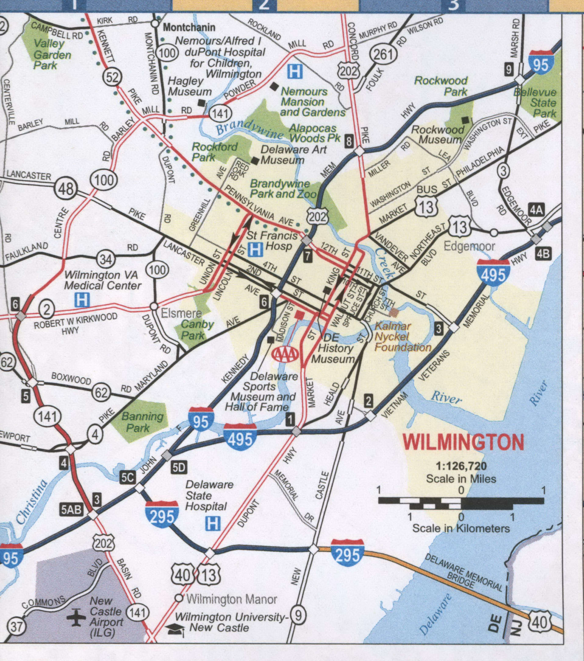
Wilmington Road Map
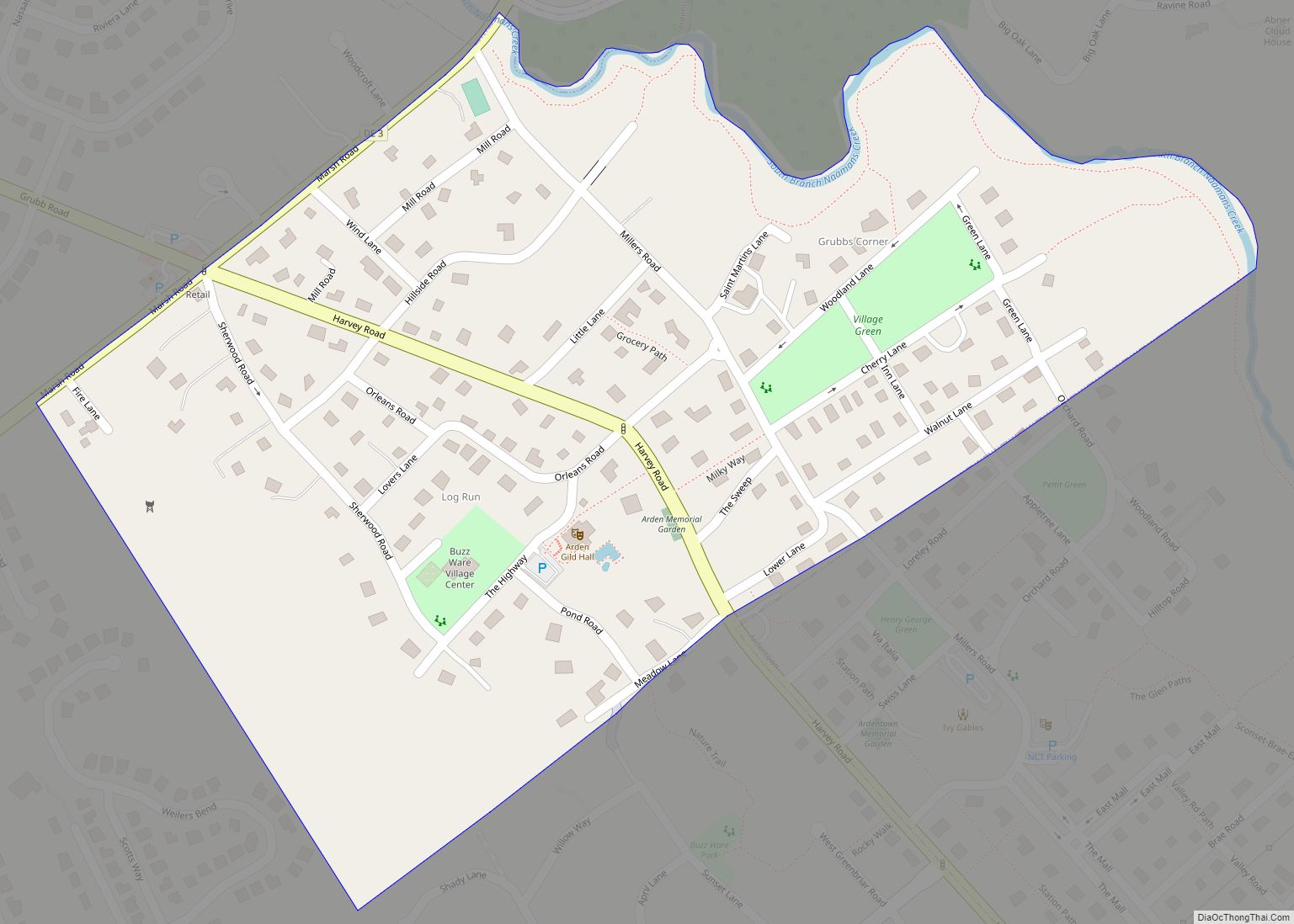
Wilmington city Satellite Map
Geography
According to the United States Census Bureau, the city has a total area of 17.0 square miles (44 km), of which 10.9 square miles (28 km) is land and 6.2 square miles (16 km) is water. The total area is 36.25% water.
The city sits at the confluence of the Christina and Delaware rivers, approximately 33 miles (53 km) southwest of Philadelphia. Wilmington Train Station, one of the southernmost stops on Philadelphia’s SEPTA rail transportation system, is also served by Northeast Corridor Amtrak passenger trains. Wilmington is served by I-95 and I-495 within city limits. In addition, the twin-span Delaware Memorial Bridge, a few miles south of the city, provides direct highway access between Delaware and New Jersey, carrying the I-295 eastern bypass route around Wilmington and Philadelphia, as well as US 40, which continues eastward to Atlantic City, New Jersey.
These transportation links and geographic proximity give Wilmington some of the characteristics of a satellite city to Philadelphia, but Wilmington’s long history as Delaware’s principal city, its urban core, and its independent value as a business destination makes it more properly considered a small but independent city in the Philadelphia metropolitan area.
Wilmington lies along the Fall Line geological transition from the Mid-Atlantic Piedmont Plateau to the Atlantic Coastal Plain. East of Market Street, and along both sides of the Christina River, the Coastal Plain land is flat, low-lying, and in places marshy. The Delaware River here is an estuary at sea level (with twice-daily high and low tides), providing sea-level access for ocean-going ships.
On the western side of Market Street, the Piedmont topography is rocky and hilly, rising to a point that marks the watershed between the Brandywine River and the Christina River. This watershed line runs along Delaware Avenue westward from 10th Street and Market Street.
These contrasting topography and soil conditions affected the industrial and residential development patterns within the city. The hilly west side was more attractive for the original residential areas, offering springs and sites for mills, better air quality, and fewer mosquitoes.
Surrounding municipalities
Climate
Wilmington has a warm temperate climate or humid subtropical climate (Köppen Cfa), with hot and humid summers, cool to cold winters, and precipitation evenly spread throughout the year. In July, the daily average is 76.8 °F (24.9 °C), with an average 21 days of 90 °F (32 °C)+ highs annually. Summer thunderstorms are common in the hottest months. The January daily average is 32.4 °F (0.2 °C), although temperatures may occasionally reach 10 °F (−12 °C) or 55 °F (13 °C) as fronts move toward and past the area. Snowfall is light to moderate, and variable, with some winters bringing very little of it and others witnessing several major snowstorms; the average seasonal total is 20.2 inches (51 cm). Extremes in temperature have ranged from −15 °F (−26 °C) on February 9, 1934, up to 107 °F (42 °C) on August 7, 1918, though both 100 °F (38 °C)+ and 0 °F (−18 °C) readings are uncommon; the last occurrence of each was July 18, 2012 and February 5, 1996, respectively.
See also
Map of Delaware State and its subdivision: Map of other states:- Alabama
- Alaska
- Arizona
- Arkansas
- California
- Colorado
- Connecticut
- Delaware
- District of Columbia
- Florida
- Georgia
- Hawaii
- Idaho
- Illinois
- Indiana
- Iowa
- Kansas
- Kentucky
- Louisiana
- Maine
- Maryland
- Massachusetts
- Michigan
- Minnesota
- Mississippi
- Missouri
- Montana
- Nebraska
- Nevada
- New Hampshire
- New Jersey
- New Mexico
- New York
- North Carolina
- North Dakota
- Ohio
- Oklahoma
- Oregon
- Pennsylvania
- Rhode Island
- South Carolina
- South Dakota
- Tennessee
- Texas
- Utah
- Vermont
- Virginia
- Washington
- West Virginia
- Wisconsin
- Wyoming
