Johnson County is a county in the U.S. state of Kansas, on the border with Missouri. As of the 2020 census, the population was 609,863, making it the most populous county in Kansas. Its county seat is Olathe. Largely suburban, the county contains a number of suburbs of Kansas City, Missouri, including Overland Park, a principal city of and second most populous city in the Kansas City Metropolitan Area.
| Name: | Johnson County |
|---|---|
| FIPS code: | 20-091 |
| State: | Kansas |
| Founded: | August 25, 1855 |
| Named for: | Thomas Johnson |
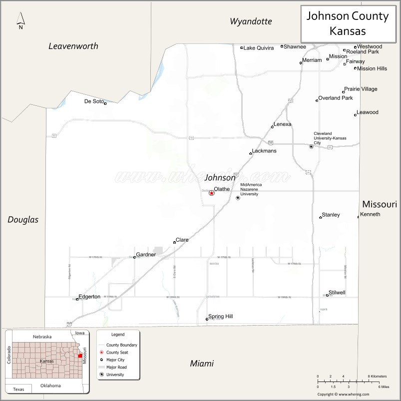
| Seat: | Olathe |
| Largest city: | Overland Park |
| Total Area: | 480 sq mi (1,200 km²) |
| Land Area: | 473 sq mi (1,230 km²) |
| Total Population: | 609,863 |
| Population Density: | 1,289.4/sq mi (497.8/km²) |
| Time zone: | UTC−6 (Central) |
| Summer Time Zone (DST): | UTC−5 (CDT) |
| Website: | jocogov.org |
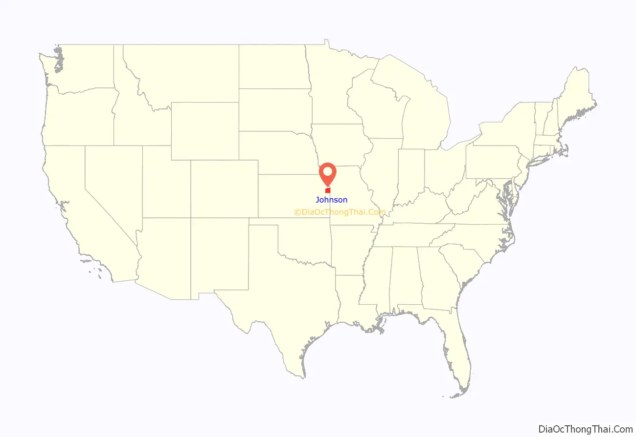
Johnson County location map. Where is Johnson County?
History
This was part of the large territory of the Osage people, who occupied lands up to present-day Saint Louis, Missouri. After the Indian Removal, the United States government reserved much of this area as Indian territory for a reservation for the Shawnee people, who were relocated from east of the Mississippi River in the upper Midwest.
The Santa Fe Trail and Oregon–California Trail, which pass through nearby Independence, Missouri, also passed through the county. Johnson County was established in 1855 as one of the first counties in the newly organized Kansas Territory; it was named for American missionary Thomas Johnson. The renowned gunfighter Wild Bill Hickok settled for a time in the county, becoming constable of Monticello Township in 1858.
Johnson County was the site of many battles between abolitionists and pro-slavery advocates during the period of Bleeding Kansas, prior to the residents voting on whether slavery would be allowed in the territory. In 1862 during the American Civil War, Confederate guerrillas from nearby Missouri, led by William Quantrill, raided the Johnson County communities of Olathe and Spring Hill. They killed half a dozen men and destroyed numerous homes and businesses.
The county was largely rural until the early 20th century, when housing subdivisions were developed in the northeastern portion of the county adjacent to Kansas City, Missouri. Developer J. C. Nichols spurred the boom in 1914 when he built the Mission Hills Country Club to lure upscale residents who previously had been reluctant to move from Missouri to Kansas. Suburban development continued at a steady pace until the close of World War II.
Following the war, the pace of development exploded, triggered by the return of veterans in need of housing, construction of highways that facilitated commuting from suburbs, and the pent-up demand for new housing. The US Supreme Court ruling in Brown v. Board of Education (1954) ruled that segregation of public schools was unconstitutional. Integration of public schools in Kansas City, Missouri, resulted in many white families leaving the inner city, resulting in increased migration to the county for new housing and what were considered higher quality public schools, generally an indicator of higher economic status. From the mid-1980s the pace of growth increased significantly, with the county adding 100,000 residents each decade between the 1990 census and 2010 census.
The 1952 Johnson County Courthouse was closed in 2020, then demolished in 2021. It was replaced by a seven-story courthouse in 2021 after over two years of construction. This new courthouse is the county’s fourth building.
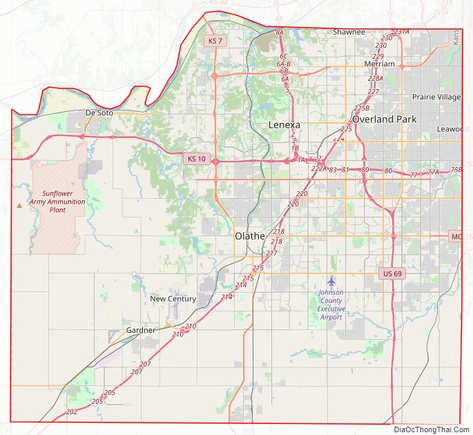
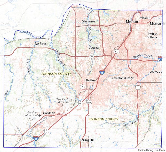
Johnson County Road Map
Geography
According to the United States Census Bureau, the county has a total area of 480 square miles (1,200 km), of which 473 square miles (1,230 km) is land and 6.5 square miles (17 km) (1.4%) is water.
Topography
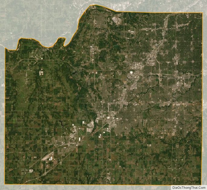
The natural topography of the county consists of gently rolling terrain. The Kansas River forms a portion of the northwest boundary of the county. The elevation generally increases from north to south as the distance from the Kansas and Missouri rivers increases.
Watersheds and streams
The county is drained by the watersheds of the Kansas, Blue, and Marais des Cygnes, all of which are part of the Missouri River watershed. Located in northeastern Kansas, the county receives plentiful rainfall. The county contains numerous small streams, including Kill Creek, Mill Creek, Turkey Creek, Indian Creek, Brush Creek, Tomahawk Creek, the Blue River, Bull Creek and Little Bull Creek.
Kill Creek begins in the southwest portion of the county and flows northward into the Kansas River at De Soto. Mill Creek begins in the central portion of the county in Olathe, flowing northward it empties into the Kansas River at Shawnee. Turkey Creek and Brush Creek each begin in northeast Johnson County. Turkey Creek flows northeastward into Wyandotte County and joins the Kansas River just before its confluence with the Missouri River at Kaw Point. Brush Creek flows east-northeastward through Prairie Village and Mission Hills, entering Kansas City, Missouri, within the median of Ward Parkway and passing the Country Club Plaza before emptying into the Blue River east of the Country Club Plaza and north of Swope Park. Indian Creek begins in the southern portion of Olathe and Tomahawk Creek begins in south Overland Park. Each flows northeastward meeting in Leawood, where the stream retains the name of Indian Creek, just before crossing the state line and entering the Blue River in Kansas City, Missouri. The Blue River begins in rural southern Johnson County and flows north-northeastward through the southeastern portion of the county and crossing the state line just east of the intersection of 151st Street and Kenneth Road in southern Overland Park. The Blue River flows through southern and eastern Kansas City before joining the Missouri River. Bull Creek and Little Bull Creek begin in rural southwestern Johnson County and flow southward where they enter Hillsdale Lake before continuing into Miami County, eventually joining the Marais des Cygnes at Paola.
Flora and fauna
The county consists primarily of prairie grassland with corridors of forested areas along streams and rivers.
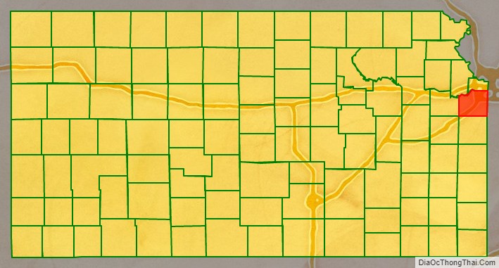
Adjacent counties
- Wyandotte County (north)
- Jackson County, Missouri (east)
- Cass County, Missouri (southeast)
- Miami County (south)
- Franklin County (southwest)
- Douglas County (west)
- Leavenworth County (northwest)
Johnson County Topographic Map
Johnson County Satellite Map
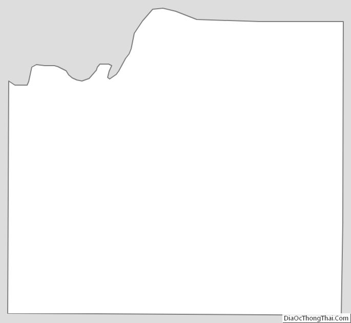
Johnson County Outline Map