De Soto /dəˈsoʊtoʊ/ is a city along the Kansas River, in Johnson and Leavenworth counties in the U.S. state of Kansas, and part of the Kansas City Metropolitan Area. As of the 2020 census, the population of the city was 6,118, and the 2021 estimate is 6,380.
| Name: | De Soto city |
|---|---|
| LSAD Code: | 25 |
| LSAD Description: | city (suffix) |
| State: | Kansas |
| County: | Johnson County |
| Founded: | 1828 |
| Incorporated: | October 1, 1897 |
| Elevation: | 860 ft (260 m) |
| Total Area: | 11.28 sq mi (29.22 km²) |
| Land Area: | 11.15 sq mi (28.89 km²) |
| Water Area: | 0.13 sq mi (0.33 km²) |
| Total Population: | 6,118 |
| Population Density: | 540/sq mi (210/km²) |
| ZIP code: | 66018, 66019, 66025, 66061 |
| Area code: | 913 |
| FIPS code: | 2017850 |
| Website: | desotoks.us |
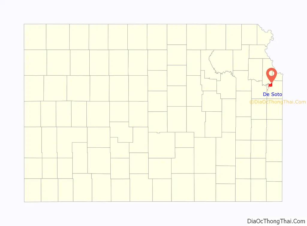
Online Interactive Map
Click on ![]() to view map in "full screen" mode.
to view map in "full screen" mode.
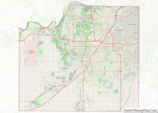
De Soto location map. Where is De Soto city?

History
The land that would become De Soto was part of a large territory extending to present-day St. Louis that was occupied by the Osage people, who were relocated from east of the Mississippi River in the upper Midwest. After the Treaty of St Louis in 1825, the Shawnee were forcibly relocated from Cape Girardeau to southeastern Kansas near the Neosho River. Only the Black Bob band of Shawnee resisted removal, however by 1828 they too migrated west and settled in northeastern Kansas in and around De Soto along the Kansas River. Later in the 19th century, many cultures of Native Americans arrived in the area after being pushed west by European-American pressure following colonial expansion and later the discovery of Gold in 1849. Between 1829 and 1854 almost thirty tribes were assigned reservations in what would become Kansas Territory. The Shawnee Methodist Mission was built in the De Soto area to minister to the tribe. A reserve was established in Kansas and soon other Shawnee from as far east as Ohio would join the reservation. The Agency of the Shawnee Indians, also known as Lexington, was located on the southern edge of the city.
The city of De Soto was platted in the spring of 1857, named for sixteenth-century Spanish explorer Hernando de Soto. In 1858, John Possum, a Shawnee man, and Hattie Possum sold 80 acres (32 ha) to John F. Legate, S. Todd and Stratton and Williams for $1,200. The next sale was 80 acres to the De Soto Town Company in July 1861 for $1,176. Major James B. Abbot is remembered as one of the town’s pioneer landowners and the builder of Abbot Hall. Today, Abbot Hall is one of two town museums. De Soto was incorporated as a city on October 1, 1897.
With the construction of the 9,080-acre (3,670 ha) Sunflower Army Ammunition Plant south of De Soto, the city’s population boomed in the early 1940s during World War II. In May 1943, a Kansas City Star article reported “a town rapidly growing, with a population increase from 400 to 1,000 persons in under a year.” This sudden overflow in population put a great strain on housing and other resources in the city; however, many original residents prospered during this time, buying property and starting new businesses. Production flowed steadily at the Sunflower Army Ammunition Plant until the plant went on standby in March 1948, with small-scale production following shortly after until its closure in 1993.
Clearview
In 1943, nearby Sunflower Village was built to house workers for nearby Sunflower Ordnance Works. The west side “Old Village” had 853 dwellings in 1943, and the east side “New Village” had 580 pre-fab units that was completed by 1945. Housing, a school and traffic were filled and overflowing. Highway 10, the main street, is now 83rd Street. As people came in, it was getting harder to find room and places to room, board, and to dwell in, to a point that people were living in the chicken house and sleeping under quilts on the ground where the current Scout House is sitting on Wea Street. It was so unbearable that rooms that were rented out “by the shift” that other people would bring in trailers and tents. In 1955, the housing units transferred to Sunflower Ordnance Worker (SOW), then sold to private buyers. In 1961, Sunflower was sold to Quick Way Homes and renamed as Clearview City. In 1998, Clearview City was annexed by the city of De Soto, boosting the city’s population by 339 people.
1951 flood
In mid-July 1951, heavy rains led to a great rise of water in the Kansas River and other surrounding areas of the central United States, known as the Great Flood of 1951. De Soto, along the south side of the river, was severely damaged. The river crest at De Soto was 42.3 feet (12.9 m), the highest recorded on the Kansas River during the flood. Most of the downtown area was completely flooded, with over 4 feet (1.2 m) of standing water in some places.
Recent growth
Since the 2008 recession came to an end, growth in De Soto has steadily picked up, with substantial commercial development in the K-10 Business District.
In 2019, the Kansas City Star reported that De Soto was, and is expected to remain the second fastest-growing city in the Kansas City metro area, trailing only Spring Hill.
After the closure of the Sunflower Army Ammunition Plant in 1993, plans for potential development of the 15.5 square-mile lot south of De Soto began to receive attention. After several abandoned proposals for large-scale developments and attractions, a master use plan was adopted by the authorities of Olathe, De Soto, Johnson County, and Sunflower Redevelopment Group.The master plan called for high density housing, major commercial zoning, a “downtown” area for offices, high density commercial and civic uses, and land promised to The University of Kansas, Kansas State University and the City of De Soto, as well as land being reserved for the army reserves, parks and other public spaces. However, slow cleanup and exhausted funding delayed the completion to 2038. In 2019, congressional lawmakers representing Kansas urged the Army to accelerate cleanup efforts of the land. Additional funding allocation and priority from the Army led to the announcement that the portions of the lot closest to De Soto would be ready for development by 2020.
In April 2021, unrelated to the development at the former ammunition plant site, Flint Logistics announced a proposal to construct a $500 million logistics center and high-density residential complex three miles west of De Soto, petitioning annexation of the property adjacent to the Johnson-Douglas County line.
In 2021, following extensive cleanup and decontamination of site, clearance for development was granted by the U.S. Army Corps of Engineers on the northernmost portion of the Sunflower Army Ammunition Plant. De Soto initiated annexation of 10 square miles, doubling the city’s footprint. Shortly thereafter, De Soto established a short-term plan to improve roadway and utility access to the area, as well as establishing a TIF (tax increment financing) district, in an effort to encourage development of the largest remaining undeveloped plot of land in the region. Amidst wide speculation of a large-scale development potential on the site, in July 2022, Panasonic North America announced its intent to construct the company’s first United States-based, and world’s largest electric vehicle battery manufacturing facility. Panasonic’s investment of over $4 billion into the site makes it the largest single private investment in Kansas’ and Kansas City’s history.
In October 2022, Sunflower Redevelopment Group initiated an agreement with De Soto, which included
voluntary annexation of an additional 2,800 acres of the former ammunition plant, completing annexation of the entire 17 square mile property. The agreement was an amendment to the original from 2021, extending the existing TIF district into the most recently annexed portion, excluding a small portion outside of the De Soto USD 232, with most of the original stipulations left intact. The city avoided extending the TIF district into the portion of recently annexed land that lie within Gardner-Edgerton USD 231, fearing that school board would consider veto of the TIF agreement in its entirety, requiring the city to restart the agreement approval process. A part of the amended agreement is that should development not occur within the time frame, the city is not obligated to de-annex the property, as was the contingency with the original agreement. The annexation conflicted with a 1989 boundary agreement with Gardner, however a 2022 ruling by the Kansas Supreme Court on a case between Olathe and Spring Hill set a precedent, rendering the original annexation agreement unenforceable by Gardner.
In November 2022, Sunflower Redevelopment Group renamed the site of the former ammunition plant to Astra Enterprise Park.
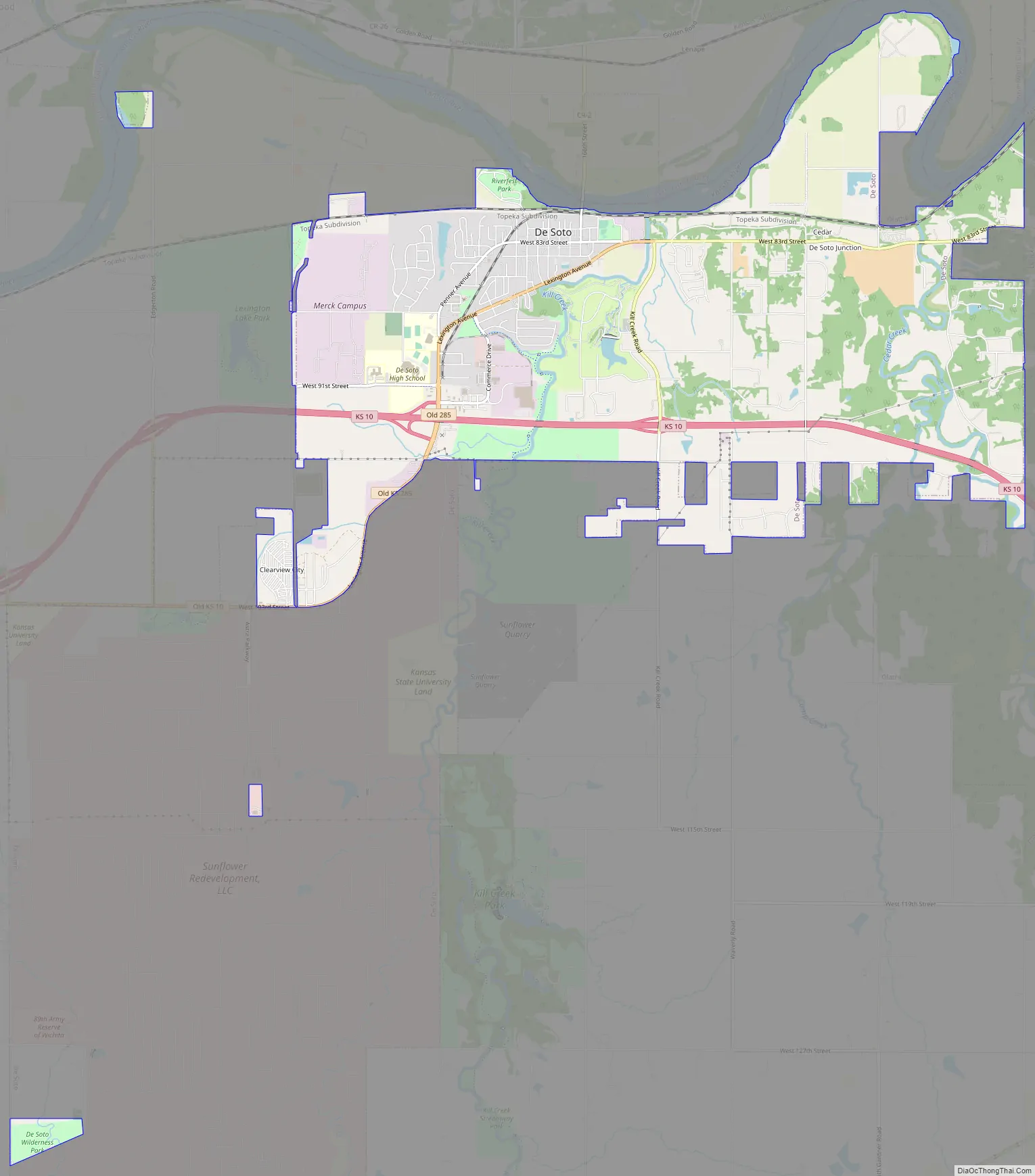
De Soto Road Map
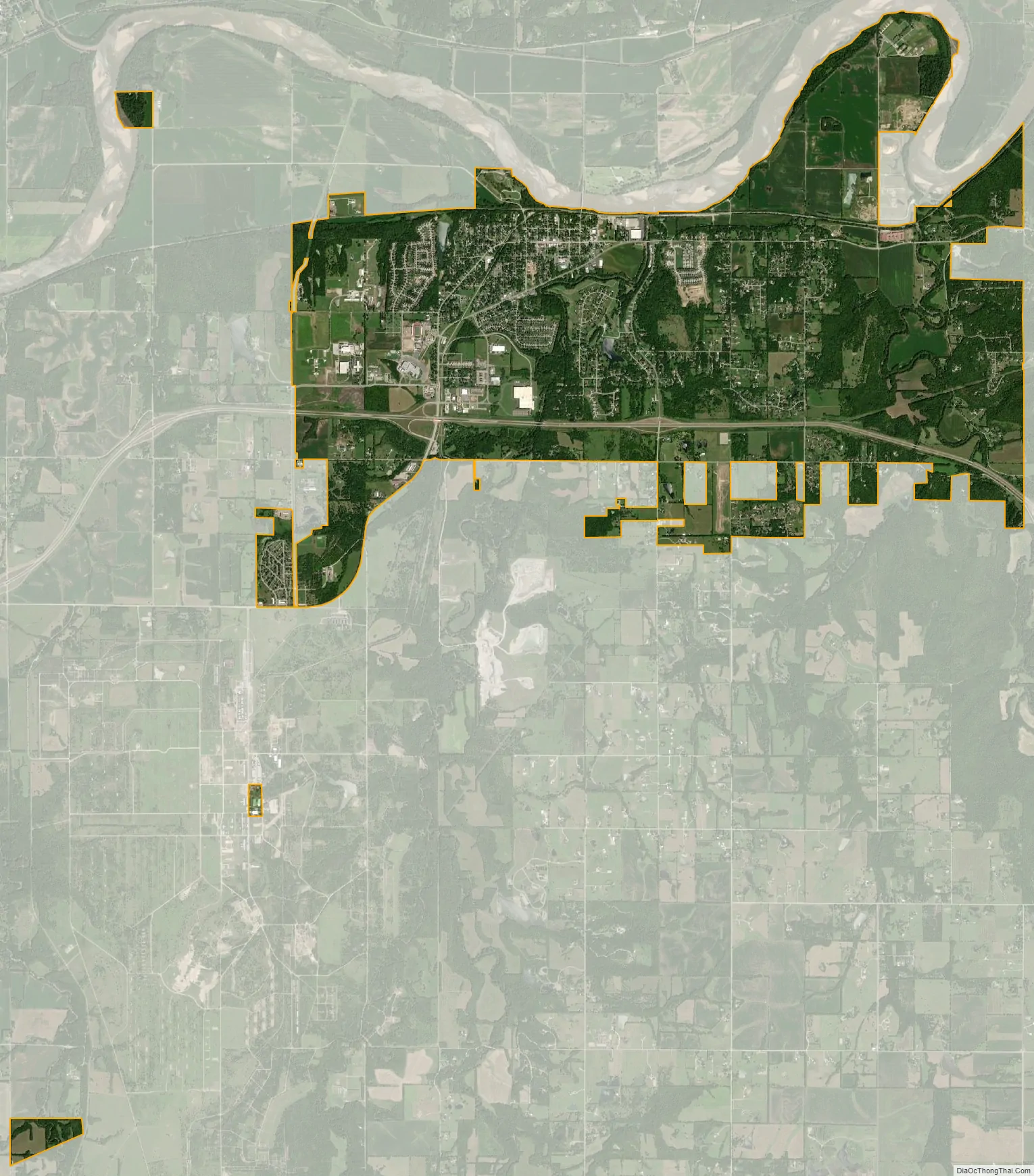
De Soto city Satellite Map
Geography
According to the United States Census Bureau, the city has a total area of 11.20 square miles (29.00 km), of which 11.07 square miles (28.67 km) are land and 0.13 square miles (0.33 km), or 1.15%, are water. While the majority of De Soto is located in northwestern Johnson County at 38°58′45″N 94°58′7″W / 38.97917°N 94.96861°W / 38.97917; -94.96861 (38.9791709, -94.9685783), the golf course north of the Kansas River is located in southern Leavenworth County. De Soto mainly lies south of the Kansas River, the only city in Johnson County originally platted around the river. Four of the river’s tributaries, Captain Creek, Kill Creek, Cedar Creek, Camp Creek end within the city limits.
Considered by many locals to be an exurb, rather than a suburb, De Soto is part of the Kansas City metropolitan area, and it borders other communities on the eastern edges. These include Shawnee to the northeast, Lenexa to the east, and Olathe to the southeast.
De Soto currently has annexation agreements with Olathe and Gardner, guaranteeing De Soto will be able to annex as far south as 127th Street and as far east as meeting Olathe at its western boundary. However, a 2022 Kansas Supreme Court ruling on a disagreement between Spring Hill and Olathe nullified most boundary agreements between Johnson County cities. Subsequently, in October 2022, De Soto initiated annexation of 2,800 acres south of the formerly agreed southernmost boundary with Gardner, at the behest of Sunflower Redevelopment Group, which the city argued took precedence since it was a voluntary annexation request.
See also
Map of Kansas State and its subdivision:- Allen
- Anderson
- Atchison
- Barber
- Barton
- Bourbon
- Brown
- Butler
- Chase
- Chautauqua
- Cherokee
- Cheyenne
- Clark
- Clay
- Cloud
- Coffey
- Comanche
- Cowley
- Crawford
- Decatur
- Dickinson
- Doniphan
- Douglas
- Edwards
- Elk
- Ellis
- Ellsworth
- Finney
- Ford
- Franklin
- Geary
- Gove
- Graham
- Grant
- Gray
- Greeley
- Greenwood
- Hamilton
- Harper
- Harvey
- Haskell
- Hodgeman
- Jackson
- Jefferson
- Jewell
- Johnson
- Kearny
- Kingman
- Kiowa
- Labette
- Lane
- Leavenworth
- Lincoln
- Linn
- Logan
- Lyon
- Marion
- Marshall
- McPherson
- Meade
- Miami
- Mitchell
- Montgomery
- Morris
- Morton
- Nemaha
- Neosho
- Ness
- Norton
- Osage
- Osborne
- Ottawa
- Pawnee
- Phillips
- Pottawatomie
- Pratt
- Rawlins
- Reno
- Republic
- Rice
- Riley
- Rooks
- Rush
- Russell
- Saline
- Scott
- Sedgwick
- Seward
- Shawnee
- Sheridan
- Sherman
- Smith
- Stafford
- Stanton
- Stevens
- Sumner
- Thomas
- Trego
- Wabaunsee
- Wallace
- Washington
- Wichita
- Wilson
- Woodson
- Wyandotte
- Alabama
- Alaska
- Arizona
- Arkansas
- California
- Colorado
- Connecticut
- Delaware
- District of Columbia
- Florida
- Georgia
- Hawaii
- Idaho
- Illinois
- Indiana
- Iowa
- Kansas
- Kentucky
- Louisiana
- Maine
- Maryland
- Massachusetts
- Michigan
- Minnesota
- Mississippi
- Missouri
- Montana
- Nebraska
- Nevada
- New Hampshire
- New Jersey
- New Mexico
- New York
- North Carolina
- North Dakota
- Ohio
- Oklahoma
- Oregon
- Pennsylvania
- Rhode Island
- South Carolina
- South Dakota
- Tennessee
- Texas
- Utah
- Vermont
- Virginia
- Washington
- West Virginia
- Wisconsin
- Wyoming