Greenbelt is a city in Prince George’s County, Maryland, United States, and a suburb of Washington, D.C. At the 2020 census, the population was 24,921.
Greenbelt is the first and the largest of the three experimental and controversial New Deal Greenbelt Towns, the others being Greenhills, Ohio, and Greendale, Wisconsin. Greenbelt was planned and built by the Federal government as an all-white town. The cooperative community was conceived in 1935 by Undersecretary of Agriculture Rexford Guy Tugwell, whose perceived collectivist ideology attracted opposition to the Greenbelt Towns project throughout its short duration. The project came into legal existence on April 8, 1935, when Congress passed the Emergency Relief Appropriation Act of 1935. Under the authority granted to him by this legislation, President Franklin D. Roosevelt issued an executive order, on May 1, 1935, establishing the United States Resettlement Administration (RA/RRA).
First called Maryland Special Project No. 1, the project was officially named Greenbelt when the Division of Suburban Resettlement of the Resettlement Administration began construction, on January 13, 1936, about eight miles north of Washington. The complete Greenbelt plans were reviewed at the White House by President Roosevelt and First Lady Eleanor Roosevelt on April 30, 1936. The first tenants, after selection in a stringent application process, moved in to the town on September 30, 1937. The construction consisted of structures built in the Art Deco, Streamline Moderne, and Bauhaus architectural styles.
Greenbelt is credited as a historic milestone in urban development because it was the initial model for the privately constructed suburban Washington, D.C., planned cities of Reston, Virginia, and Columbia, Maryland.
The original federally built core of the city, known locally as Old Greenbelt, was recognized as the Greenbelt Historic District by the Maryland Historical Trust, and is listed on the National Register of Historic Places as a National Historic Landmark District.
Greenbelt’s population, which includes residents of privately built dwellings dating from after the end of the federal government’s ownership of the city, was recorded as 23,068 at the 2010 U.S. Census and 24,921 at the 2020 census.
| Name: | Greenbelt city |
|---|---|
| LSAD Code: | 25 |
| LSAD Description: | city (suffix) |
| State: | Maryland |
| County: | Prince George’s County |
| Incorporated: | June 1, 1937 (1937-06-01) |
| Elevation: | 157 ft (48 m) |
| Total Area: | 6.29 sq mi (16.29 km²) |
| Land Area: | 6.24 sq mi (16.15 km²) |
| Water Area: | 0.06 sq mi (0.14 km²) 0.99% |
| Total Population: | 24,921 |
| Population Density: | 3,996.95/sq mi (1,543.35/km²) |
| FIPS code: | 2434775 |
| GNISfeature ID: | 2390596 |
| Website: | www.greenbeltmd.gov |
Online Interactive Map
Click on ![]() to view map in "full screen" mode.
to view map in "full screen" mode.
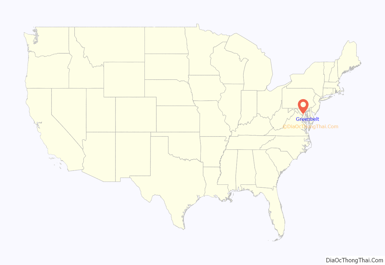
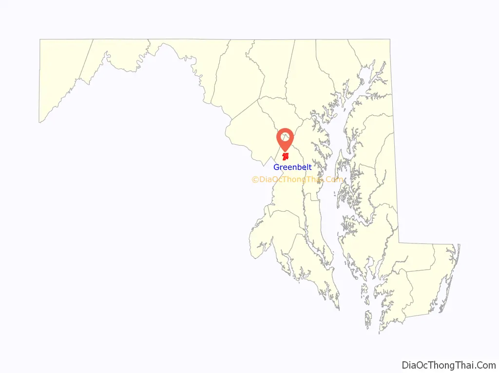
Greenbelt location map. Where is Greenbelt city?
History
Greenbelt was settled on September 30, 1937, as a public cooperative community in the New Deal era. The concept was at the same time both eminently practical and idealistically utopian: the federal government would foster an “ideal” self-sufficient cooperative community that would also ease the pressing housing shortage near the nation’s capital. Construction of the new town would also create jobs and thus help stimulate the national economic recovery following the Great Depression.
Greenbelt, which provided affordable housing for federal government workers, was one of three Greenbelt Towns conceived in 1935, by President Franklin D. Roosevelt’s Brain Trust member Rexford Tugwell, who was serving as the president’s Undersecretary of Agriculture. The project was officially authorized in May 1935. First, on April 8, 1935, the United States Congress passed the Emergency Relief Appropriation Act of 1935. Then under the authority granted to him from this legislation, President Roosevelt issued an executive order, on May 1, 1935, establishing the United States Resettlement Administration (RA / RRA). Rexford Tugwell agreed to serve as the Administrator of the Resettlement Administration, in addition to his Undersecretary of Agriculture position, without receiving any additional salary.
Working alongside Tugwell was Charles W. Yost. The two other Greenbelt Towns are Greendale, Wisconsin (near Milwaukee) and Greenhills, Ohio (near Cincinnati). A fourth town, Roosevelt, New Jersey (originally called Homestead), was planned but was not fully developed on the same large scale as Greenbelt.
Eleanor Roosevelt, wife of President Franklin D. Roosevelt, helped Tugwell lay out the Maryland town on a site that had formerly consisted largely of tobacco fields. She was also heavily involved in the first cooperative community designed by the federal government in the New Deal Era, Arthurdale, West Virginia, which sought to improve the lives of impoverished laborers by enabling them to create a self-sufficient, and relatively prosperous, cooperative community. Cooperatives in Greenbelt include the Greenbelt News Review, Greenbelt Consumers Coop grocery store, the New Deal Cafe, and the cooperative forming the downtown core of original housing, Greenbelt Homes Incorporated (GHI).
The architectural planning of Greenbelt was innovative, as was the social engineering involved in this federal government project. Applicants for residency were interviewed and screened based on income and occupation, and willingness to become involved in community activities. African-Americans were initially excluded, but were later included by the Greenbelt Committee for Fair Housing founded in 1963, and came to account for 41% of residents, according to the 2000 census. The same census data also indicates that African-Americans are isolated in certain parts within the town, and the percentage of African-Americans within the historic area is between 0% and 5% on most blocks. Much of the federal government planned and developed portion of the city is located within the Greenbelt Historic District.
Greenbelt was the subject of the 1939 documentary film The City.
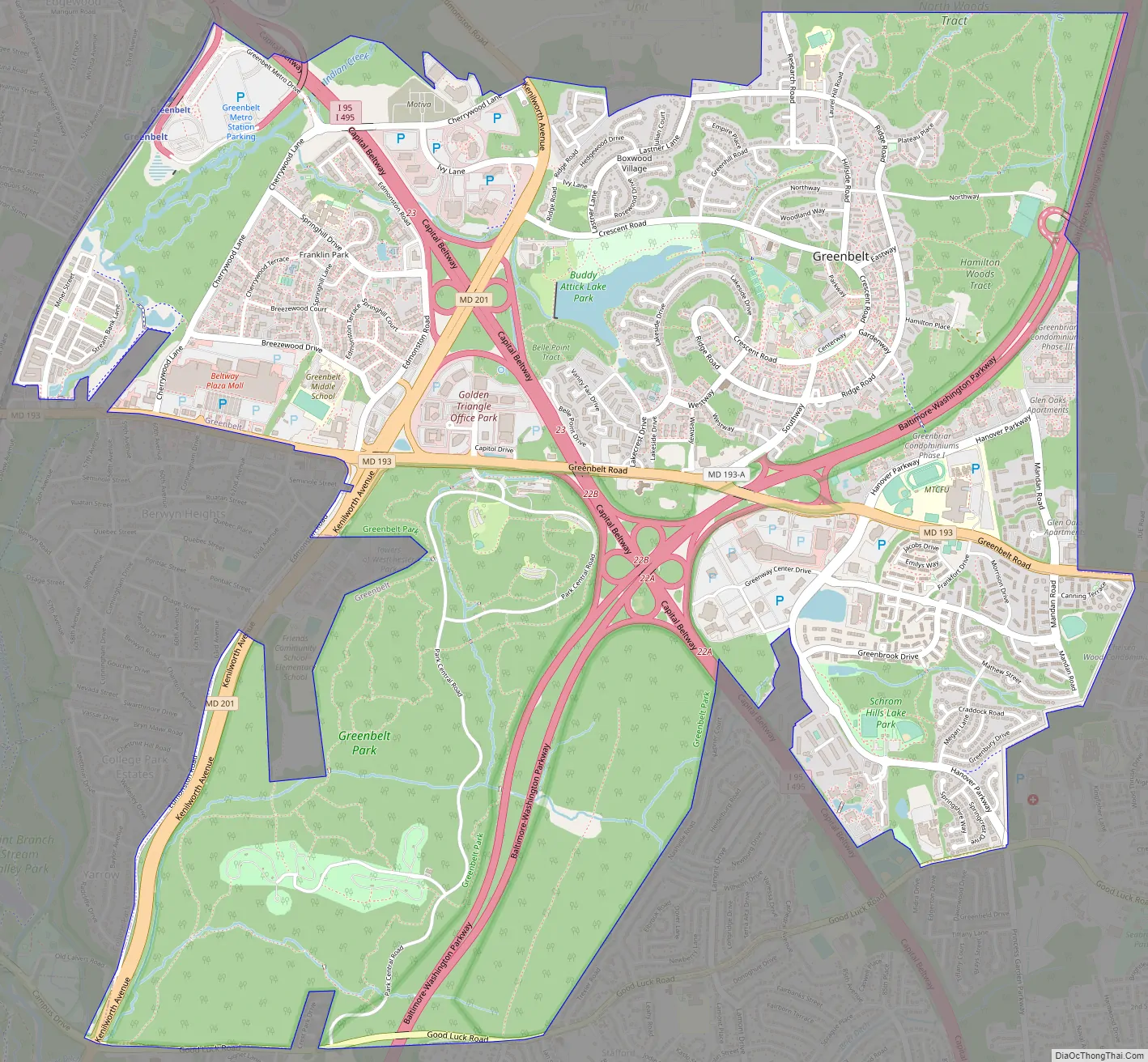
Greenbelt Road Map
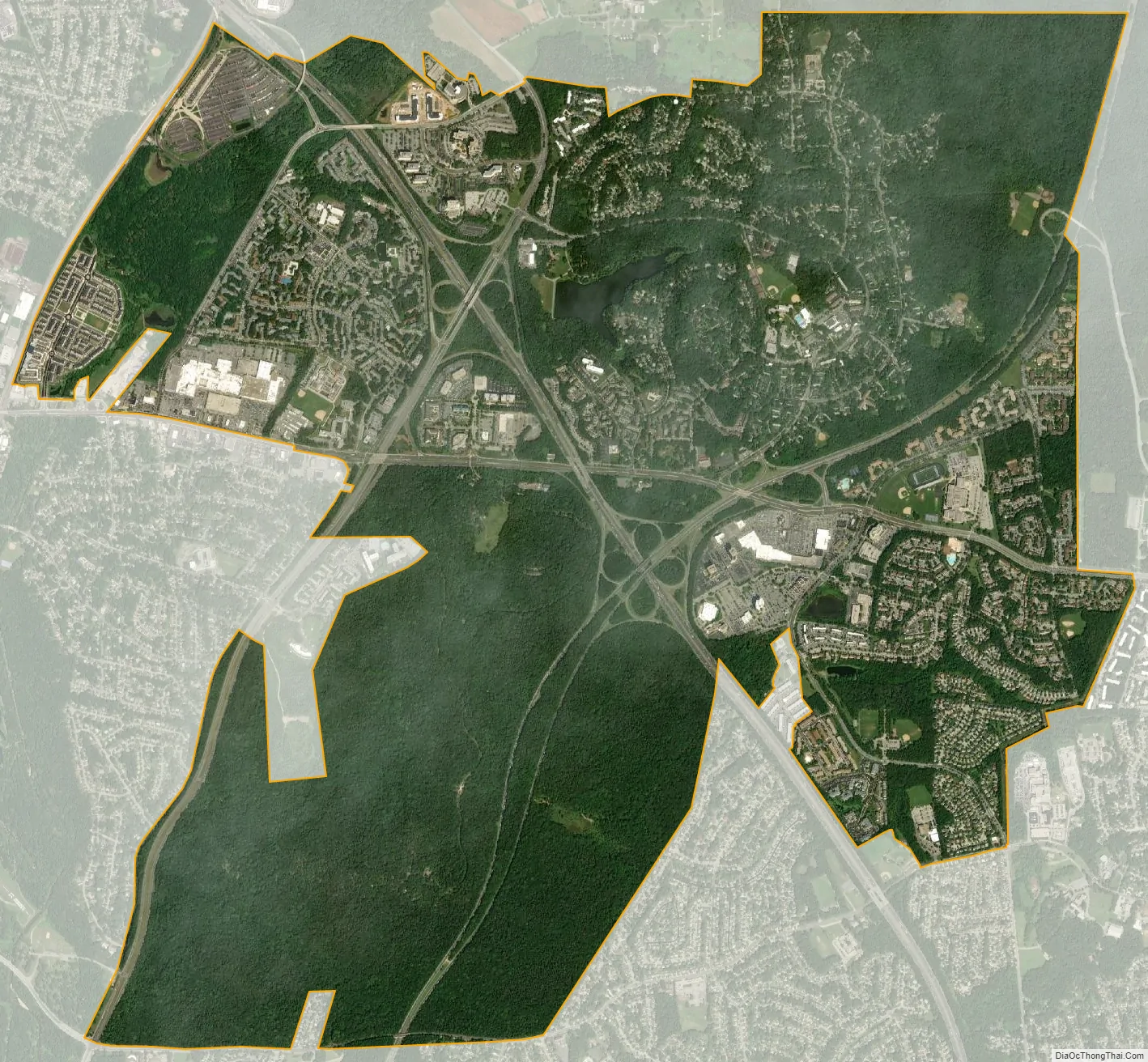
Greenbelt city Satellite Map
Geography
Greenbelt is located at 38°59′41″N 76°53′07″W / 38.99467°N 76.885399°W / 38.99467; -76.885399. According to United States Census Bureau data, as of January 1, 2018, the city has a total area of 6.23 square miles (16,146,235 square meters), of which 6.18 square miles (16,003,389 square meters) is land and 0.06 square miles (142,846 square meters) is water. Greenbelt’s ZIP Codes are 20770, 20771, and 20768. The ZIP Code 20770 contains all residential and business addresses that correspond to actual physical locations inside the geographic boundaries of the City of Greenbelt. The 20768 ZIP Code is assigned exclusively to post-office box (P.O. Box) addresses, while 20771 is the designated ZIP Code for Goddard Space Flight Center, situated on federal government owned land that is contiguous with a portion of Greenbelt’s eastern border.
NASA’s Goddard Space Flight Center, located directly adjacent to Greenbelt’s eastern boundary, utilizes a Greenbelt postal address (Greenbelt, MD 20768), as well. It is partially within the former Goddard census-designated place.
Greenbelt Park, a unit of the National Park System, is located within the City of Greenbelt’s boundaries, at its southernmost portion.
See also
Map of Maryland State and its subdivision: Map of other states:- Alabama
- Alaska
- Arizona
- Arkansas
- California
- Colorado
- Connecticut
- Delaware
- District of Columbia
- Florida
- Georgia
- Hawaii
- Idaho
- Illinois
- Indiana
- Iowa
- Kansas
- Kentucky
- Louisiana
- Maine
- Maryland
- Massachusetts
- Michigan
- Minnesota
- Mississippi
- Missouri
- Montana
- Nebraska
- Nevada
- New Hampshire
- New Jersey
- New Mexico
- New York
- North Carolina
- North Dakota
- Ohio
- Oklahoma
- Oregon
- Pennsylvania
- Rhode Island
- South Carolina
- South Dakota
- Tennessee
- Texas
- Utah
- Vermont
- Virginia
- Washington
- West Virginia
- Wisconsin
- Wyoming


