Roosevelt is a borough in western Monmouth County, in the U.S. state of New Jersey. As of the 2020 United States census, the borough’s population was 808, a decrease of 74 (−8.4%) from the 2010 census count of 882, which in turn reflected a decline of 51 (−5.5%) from the 933 counted at the 2000 census.
Located at the cross-roads between the Delaware Valley region to the south and the Raritan Valley region to the north in the center of the state, the borough was established as Jersey Homesteads by an act of the New Jersey Legislature on May 29, 1937, from portions of Millstone Township. The name was changed to Roosevelt as of November 9, 1945, based on the results of a referendum held three days earlier, in honor of Franklin D. Roosevelt, who had died on April 12, 1945.
New Jersey Monthly magazine ranked Roosevelt as its 12th best place to live in its 2008 rankings of the “Best Places To Live” in New Jersey.
| Name: | Roosevelt borough |
|---|---|
| LSAD Code: | 21 |
| LSAD Description: | borough (suffix) |
| State: | New Jersey |
| County: | Monmouth County |
| Incorporated: | May 29, 1937 as Jersey Homesteads |
| Elevation: | 144 ft (44 m) |
| Total Area: | 1.95 sq mi (5.05 km²) |
| Land Area: | 1.94 sq mi (5.02 km²) |
| Water Area: | 0.01 sq mi (0.02 km²) 0.46% |
| Total Population: | 808 |
| Population Density: | 416.5/sq mi (160.8/km²) |
| ZIP code: | 08555 |
| Area code: | 609 |
| FIPS code: | 3464410 |
| GNISfeature ID: | 0885377 |
| Website: | rooseveltnj.us |
Online Interactive Map
Click on ![]() to view map in "full screen" mode.
to view map in "full screen" mode.
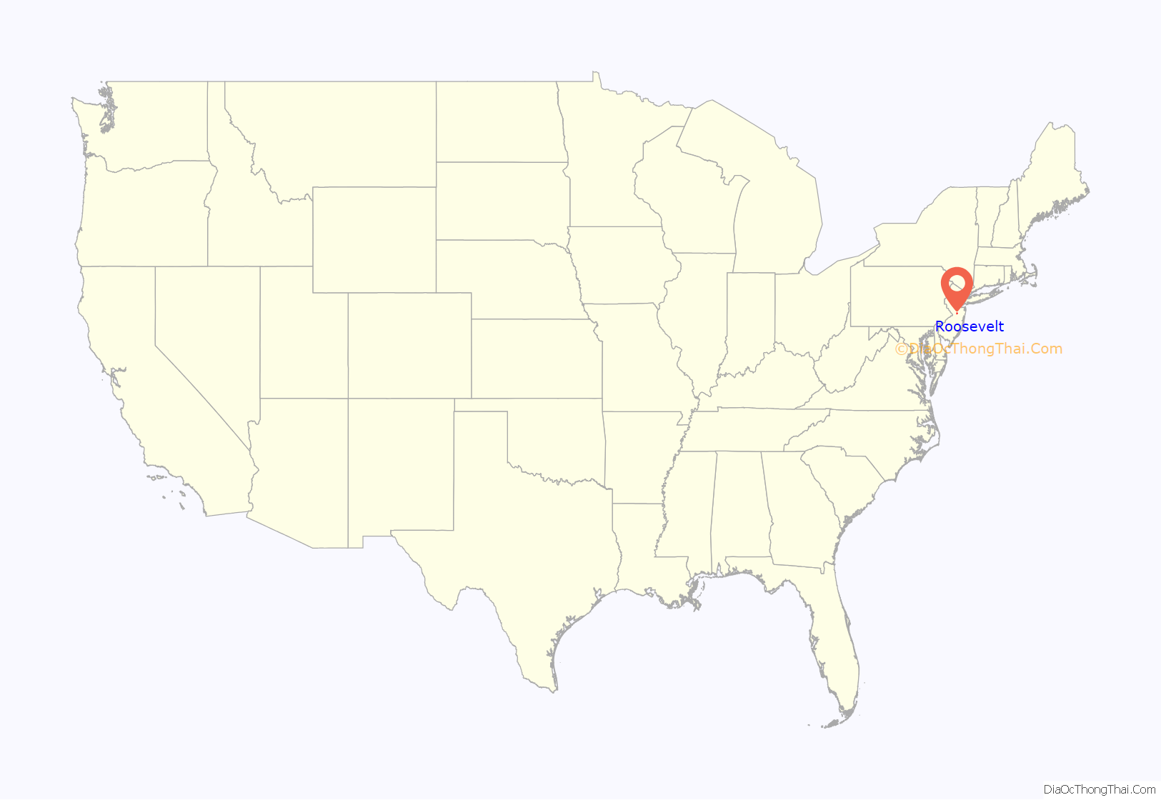
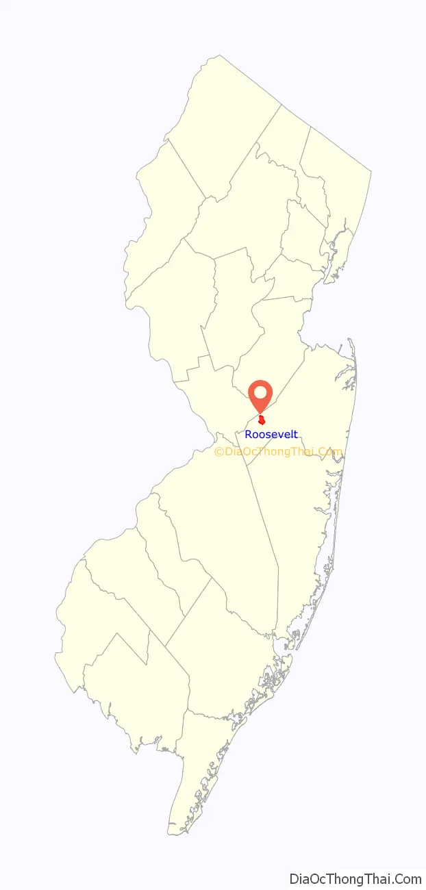
Roosevelt location map. Where is Roosevelt borough?
History
Roosevelt was originally called Jersey Homesteads, and was created during the Great Depression as part of President Roosevelt’s New Deal, its main purpose being to resettle Jewish garment workers. The town was conceived as an integrated cooperative project, with farming, manufacturing, and retail all on a cooperative basis. The project fell under the discretion of the Resettlement Administration, but was conceived and largely planned out by Benjamin Brown.
Farmland in Central Jersey was purchased by Jersey Homesteads, Inc., a corporation owned by the federal government but under control of a board of directors selected by Brown. Construction started around 1936. Soon after there were 200 homes and various public facilities in place. The economy of the town consisted of a garment factory and a farm. Objectives of the community were to help residents escape poverty, to show that cooperative management can work, and as an experiment in government intervention.
Albert Einstein gave the town his political and moral support. Artist Ben Shahn lived in the town and painted a fresco mural viewable in the current Roosevelt Public School. The three panels show the history of the Jersey Homesteads, starting with the eastern European origins of its Jewish residents, their passage through Ellis Island and making plans for the community in Roosevelt.
David Dubinsky and the International Ladies’ Garment Workers’ Union opposed the project, arguing that the factory town would cause unions to lose their power over wages. Political opposition came from those who thought too much money was being spent on the project, as well as those opposed to the New Deal in general.
The Jersey Homesteads cooperative didn’t last through World War II. It failed for a number of reasons. One of the main reasons for its failure is because of delays in housing construction and resulted of shortage in workers in the garment factory. They ended up going on strike against themselves and the Farm Security Administration declared it a failure in 1939 and tried to auction off the assets. By early 1940, having failed to auction the factory fixtures, negotiations with Kartiganer and Co. succeeded and the company began operations at the Jersey Homesteads factory. Proving to be no more economically successful than the factory, the settlement’s agricultural cooperative ceased operations in 1940. Although the clothing store failed with the factory, the borough’s cooperative grocery and meat market endured into the 1940s. According to town expert Michael Hiltzik another reason it failed is “It was very, very expensive, and the agricultural progress that New Dealers thought they’d make, and certainly the industrial gains they thought they would see, never really materialized”
Roosevelt is a historic landmark and is the subject of the 1983 documentary, Roosevelt, New Jersey: Visions of Utopia. The Jersey Homesteads Historic District was added to the New Jersey Register of Historic Places and to the National Register of Historic Places in 1983, including “all that area within the corporate boundaries of the Borough of Roosevelt”.
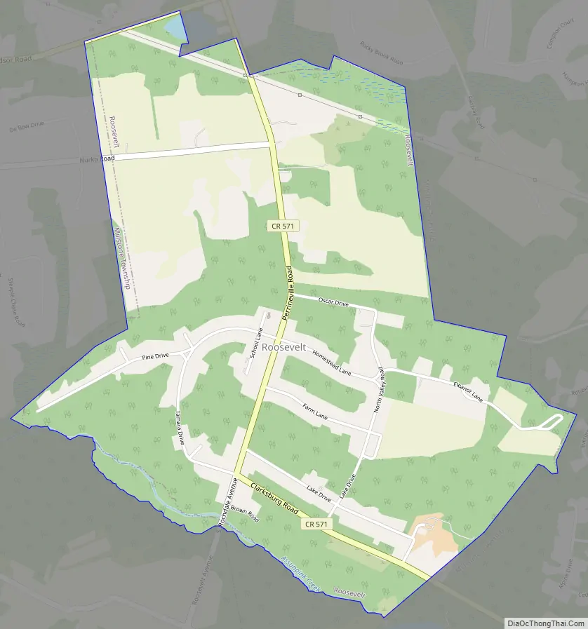
Roosevelt Road Map
Roosevelt city Satellite Map
Geography
According to the United States Census Bureau, the borough had a total area of 1.95 square miles (5.05 km), including 1.94 square miles (5.02 km) of land and 0.01 square miles (0.02 km) of water (0.46%).
The borough borders the Monmouth County municipalities of Millstone Township on the north and east and Upper Freehold Township on the southwest.
See also
Map of New Jersey State and its subdivision: Map of other states:- Alabama
- Alaska
- Arizona
- Arkansas
- California
- Colorado
- Connecticut
- Delaware
- District of Columbia
- Florida
- Georgia
- Hawaii
- Idaho
- Illinois
- Indiana
- Iowa
- Kansas
- Kentucky
- Louisiana
- Maine
- Maryland
- Massachusetts
- Michigan
- Minnesota
- Mississippi
- Missouri
- Montana
- Nebraska
- Nevada
- New Hampshire
- New Jersey
- New Mexico
- New York
- North Carolina
- North Dakota
- Ohio
- Oklahoma
- Oregon
- Pennsylvania
- Rhode Island
- South Carolina
- South Dakota
- Tennessee
- Texas
- Utah
- Vermont
- Virginia
- Washington
- West Virginia
- Wisconsin
- Wyoming


