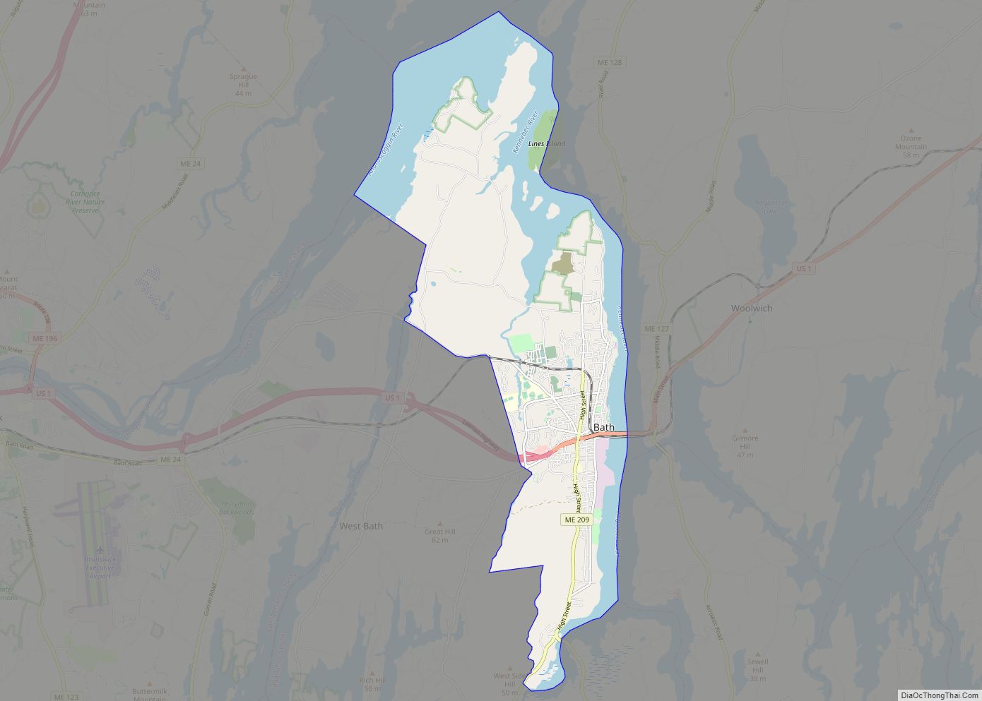
Bath is a city in Sagadahoc County, Maine, in the United States. The population was 8,766 at the 2020 census. It is the county seat of Sagadahoc County, which includes one city and 10 towns. The city is popular with tourists, many drawn by its 19th-century architecture. It is home to the Bath Iron Works and Heritage Days Festival, held annually on the Fourth of July weekend. It is commonly known as “The City of Ships” because of all the sailing ships that were built in the Bath shipyards. Bath is part of the metropolitan statistical area of Greater Portland.
| Name: | Bath city |
|---|---|
| LSAD Code: | 25 |
| LSAD Description: | city (suffix) |
| State: | Maine |
| County: | Sagadahoc County |
| Elevation: | 62 ft (19 m) |
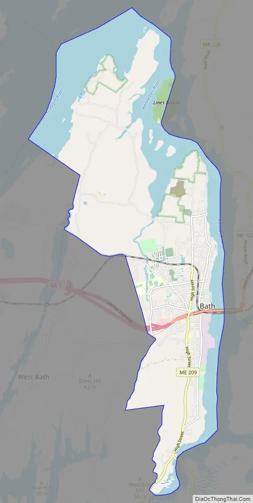
| Total Area: | 13.22 sq mi (34.23 km²) |
| Land Area: | 9.12 sq mi (23.62 km²) |
| Water Area: | 4.10 sq mi (10.61 km²) |
| Total Population: | 8,766 |
| Population Density: | 961.18/sq mi (371.10/km²) |
| ZIP code: | 04530 |
| Area code: | 207 |
| FIPS code: | 2303355 |
| GNISfeature ID: | 0561723 |
| Website: | http://www.cityofbath.com/ |
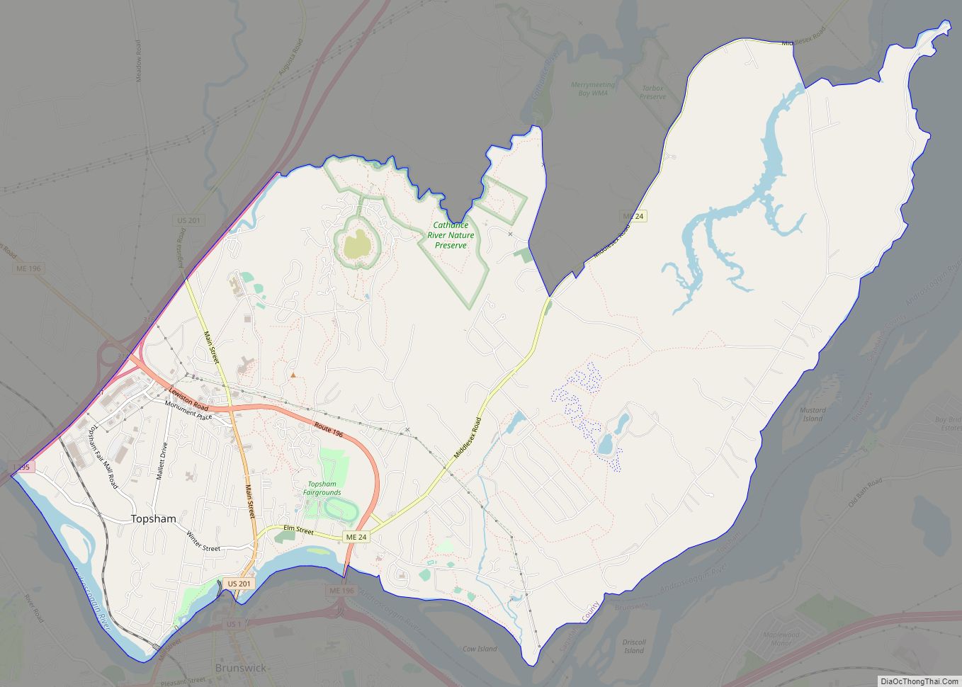
Online Interactive Map
Click on ![]() to view map in "full screen" mode.
to view map in "full screen" mode.
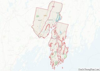
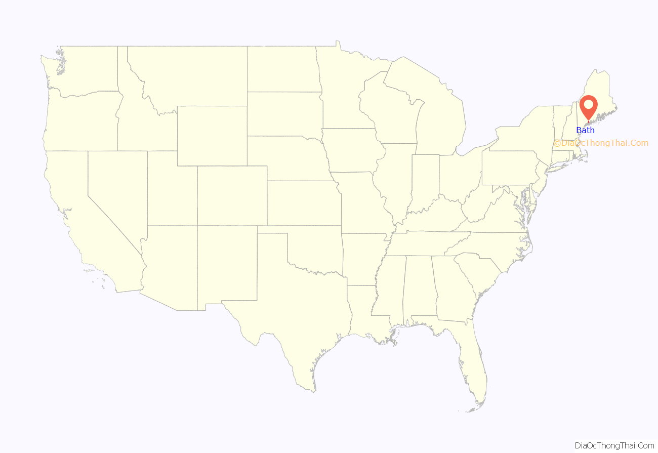
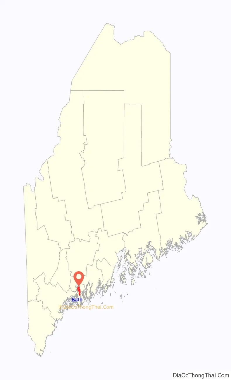
Bath location map. Where is Bath city?
History
Abenaki Indians called the area Sagadahoc, meaning “mouth of big river”. It was a reference to the Kennebec River, which Samuel de Champlain explored in 1605. Popham Colony was established in 1607 downstream, together with Fort St George. The settlement failed due to harsh weather and lack of leadership, but the colonists built the New World’s first oceangoing vessel constructed by English shipwrights, the Virginia of Sagadahoc. It provided passage back to England. Most of Bath, Maine, was settled by travelers from Bath, England.
The next settlement at Sagadahoc was about 1660, when the land was taken from an Indian sagamore known as Robinhood. Incorporated as part of Georgetown in 1753, Bath was set off and incorporated as a town on February 17, 1781. It was named by the postmaster, Dummer Sewall, after Bath in Somerset, England. In 1844, a portion of the town was set off to create West Bath. On June 14, 1847, Bath was incorporated as a city, and in 1854 designated county seat. Land was annexed from West Bath in 1855.
Several industries developed in Bath, including lumber, iron, and brass, with trade in ice and coal. The city and surrounding area is renowned for its shipbuilding and, at one point, was home to more than 200 shipbuilding firms. The industry began in 1743, when Jonathan Philbrook and his sons built two vessels. Since that time, roughly 5,000 vessels have been launched from Bath, which became the nation’s fifth largest seaport by the mid-19th century. The clipper ships built in Bath sailed to ports around the world. The last commercial enterprise to build wooden ships in the city was the Percy & Small Shipyard, which was acquired for preservation in 1971 by the Maine Maritime Museum. The most well-known shipyard is the Bath Iron Works, which was founded in 1884 by Thomas W. Hyde. Hyde became the firm’s general manager in 1888. It has built hundreds of wooden and steel vessels, mostly warships for the U.S. Navy. During World War II, Bath Iron Works launched one new ship approximately every 17 days. The shipyard today is a major regional employer, and currently operates as a division of the General Dynamics Corporation.
In the Bath, Maine, anti-Catholic riot of 1854, an Irish Catholic church was burned.
The city is noted for its Federal, Greek Revival, and Italianate architecture, including the 1858 Custom House and Post Office designed by Ammi B. Young. Bath is a sister city to Shariki (now Tsugaru) in Japan, where the locally built full-rigged ship Cheseborough was wrecked in 1889. Scenes from the movies Message in a Bottle (1999) and The Man Without a Face (1993) were filmed in Bath.
In 1915, Fred Cox, owner of Hallet’s Drug Store on Front Street, purchased the street clock standing at the corner of Front and Centre Streets from Boston, where it was built by Seth Thomas Clock Company four years earlier. It was moved from 70 Front Street to its current location in 1966, having been purchased by Harry Crooker. His family later donated it to the city, with the proviso that it be maintained and kept in a continuously operating condition, else it be returned to the family. The clock was restored in 2000. Crooker established local construction company in 1935. It was sold in 2014, after 79 years of family ownership.
Waterfront in 1907
Front Street c. 1920
Custom House c. 1905
Bath Road Map
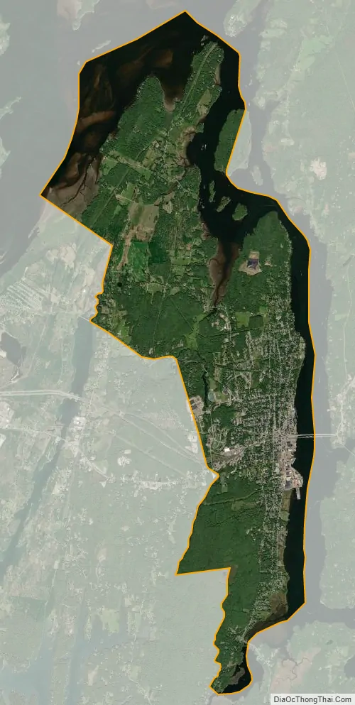
Bath city Satellite Map
Geography
Bath is located at 43°54′59″N 69°49′21″W / 43.91639°N 69.82250°W / 43.91639; -69.82250 (43.916293, −69.822565).
According to the United States Census Bureau, the city has a total area of 13.22 square miles (34.24 km), of which, 9.10 square miles (23.57 km) is land and 4.12 square miles (10.67 km) is water.
See also
Map of Maine State and its subdivision: Map of other states:- Alabama
- Alaska
- Arizona
- Arkansas
- California
- Colorado
- Connecticut
- Delaware
- District of Columbia
- Florida
- Georgia
- Hawaii
- Idaho
- Illinois
- Indiana
- Iowa
- Kansas
- Kentucky
- Louisiana
- Maine
- Maryland
- Massachusetts
- Michigan
- Minnesota
- Mississippi
- Missouri
- Montana
- Nebraska
- Nevada
- New Hampshire
- New Jersey
- New Mexico
- New York
- North Carolina
- North Dakota
- Ohio
- Oklahoma
- Oregon
- Pennsylvania
- Rhode Island
- South Carolina
- South Dakota
- Tennessee
- Texas
- Utah
- Vermont
- Virginia
- Washington
- West Virginia
- Wisconsin
- Wyoming