Waldoboro is a census-designated place (CDP) comprising the central village in the town of Waldoboro in Lincoln County, Maine, United States. The population was 1,233 at the 2010 census, out of 5,075 people in the entire town of Waldoboro.
| Name: | Waldoboro CDP |
|---|---|
| LSAD Code: | 57 |
| LSAD Description: | CDP (suffix) |
| State: | Maine |
| County: | Lincoln County |
| Elevation: | 72 ft (22 m) |
| Total Area: | 5.80 sq mi (15.01 km²) |
| Land Area: | 5.40 sq mi (13.97 km²) |
| Water Area: | 0.40 sq mi (1.04 km²) |
| Total Population: | 1,300 |
| Population Density: | 240.92/sq mi (93.03/km²) |
| ZIP code: | 04572 |
| Area code: | 207 |
| FIPS code: | 2379515 |
| GNISfeature ID: | 0577782 |
Online Interactive Map
Click on ![]() to view map in "full screen" mode.
to view map in "full screen" mode.
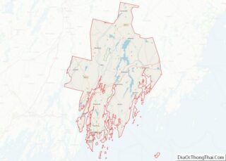
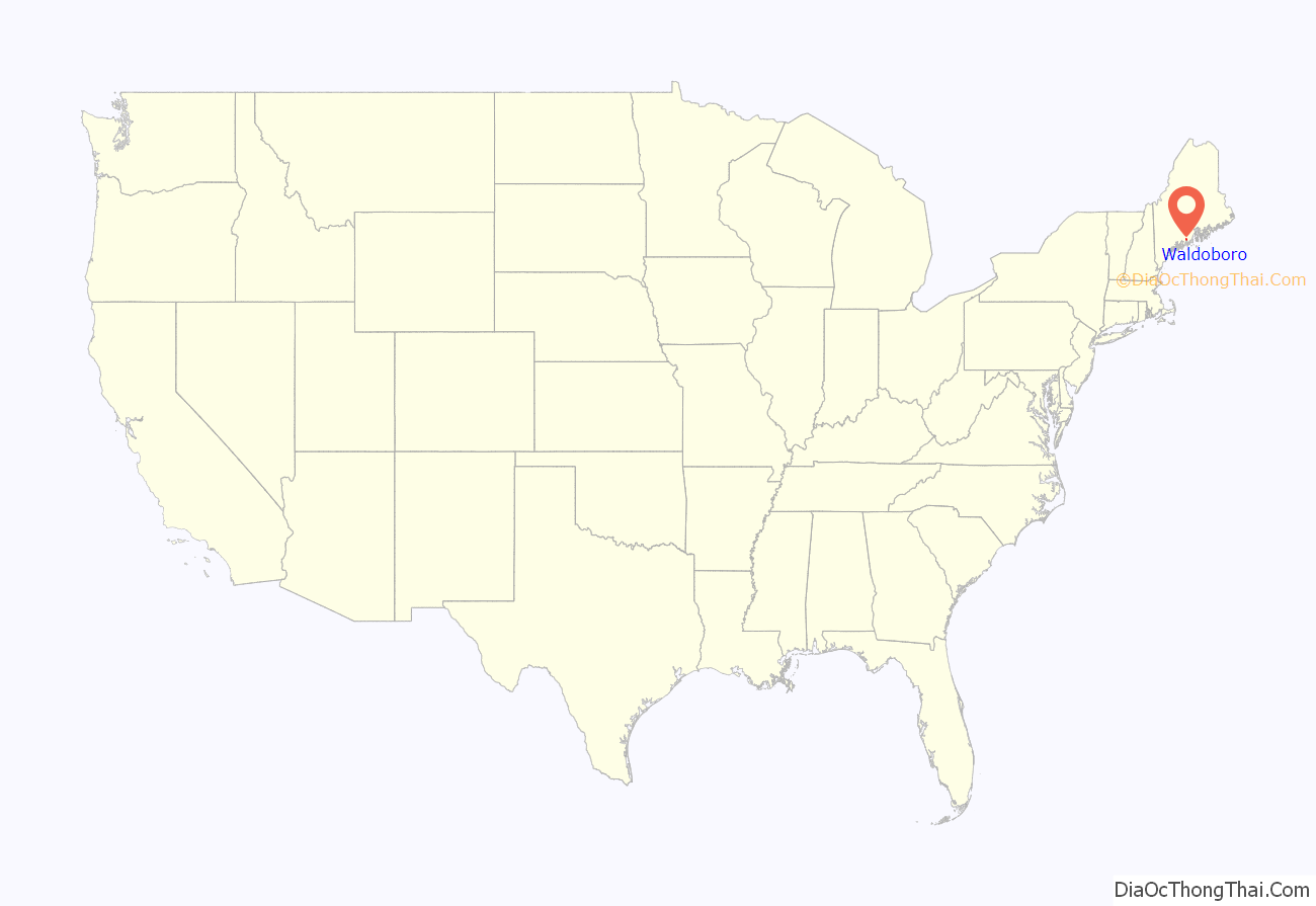
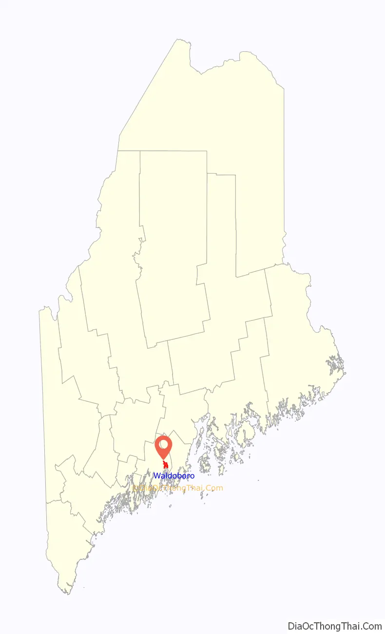
Waldoboro location map. Where is Waldoboro CDP?
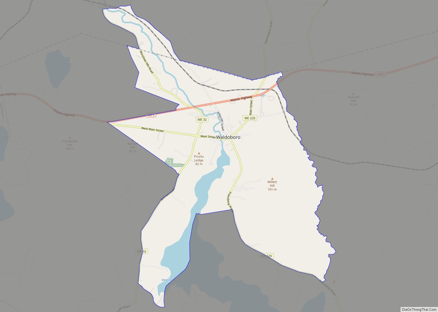
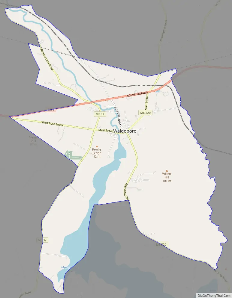
Waldoboro Road Map
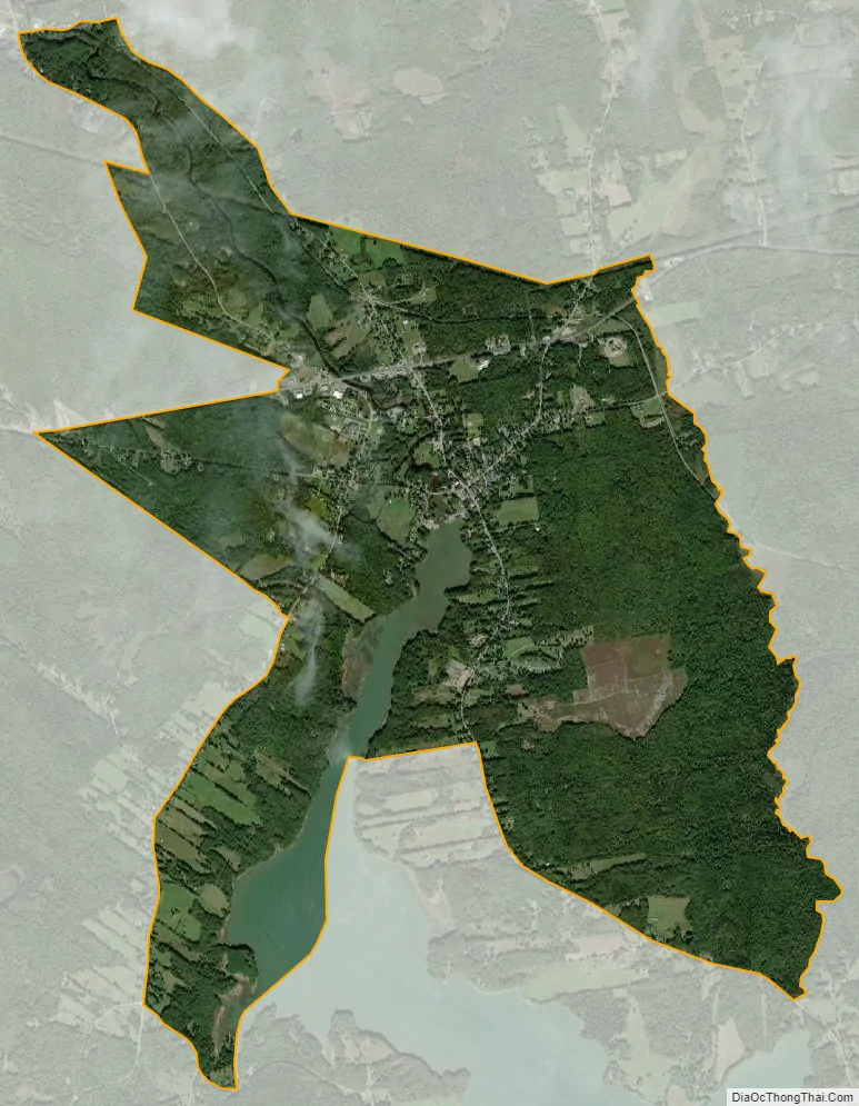
Waldoboro city Satellite Map
Geography
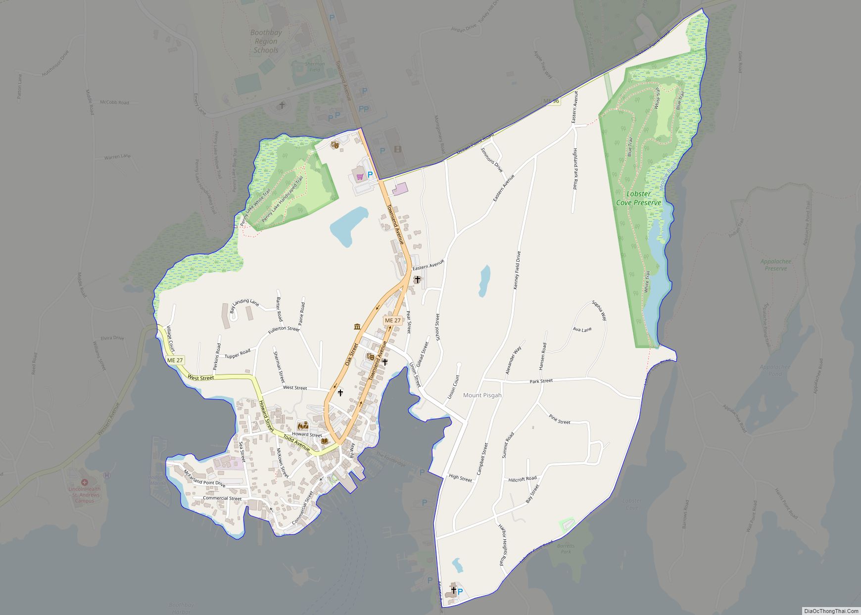
The CDP is located in the south-central part of the town of Waldoboro at 44°5′47″N 69°22′41″W / 44.09639°N 69.37806°W / 44.09639; -69.37806 (44.096562, −69.378102), in eastern Lincoln County. The CDP includes all of the primary village of Waldoboro, on both sides of the Medomak River, as well as part of the village of West Waldoboro. The CDP extends southwest down the Medomak as far as Meetinghouse Cove, from which point the western boundary of the CDP follows Dutch Neck Road and Bremen Road (Maine State Route 32) north to the German Cemetery, then leads northwest to the junction of Main Street and U.S. Route 1. The western boundary continues east along US 1 to ME 32, angles west to include The Hill Road, then returns to ME 32, following it north to Cross Street at Winslows Mills, the northernmost extent of the CDP. The eastern edge of the CDP follows Depot Street southeast from Cross Street, then a powerline east to Maine State Route 220 at Hahn Road. From there, the CDP boundary runs south down Back Brook and Slaigo Brook to Route 220 just north of Sampson Cove on the Medomak River. The border then runs northwest along Route 220 to an unnamed driveway that leads west down to the Medomak.
U.S. Route 1 passes through the northern part of the community, leading east (northbound) 11 miles (18 km) to Thomaston and southwest 10 miles (16 km) to Damariscotta. Maine State Route 220 passes through the center of Waldoboro, leading north 23 miles (37 km) to Liberty and south 9 miles (14 km) to Friendship. Maine State Route 32 runs through the western side of the community, leading north 9 miles (14 km) to Jefferson and southwest 18 miles (29 km) to New Harbor.
According to the United States Census Bureau, the Waldoboro CDP has a total area of 5.8 square miles (15.0 km), of which 5.4 square miles (14.0 km) are land and 0.39 square miles (1.0 km), or 6.90%, is water. The Medomak River runs through the center of the village, where it reaches tidewater and continues south as an arm of Muscongus Bay, part of the Gulf of Maine and the Atlantic Ocean.
The bedrock geology of the area has been mapped by William C. Sidle in 1991. A minute degree of contamination was found due to naturally occurring mercury.
See also
Map of Maine State and its subdivision: Map of other states:- Alabama
- Alaska
- Arizona
- Arkansas
- California
- Colorado
- Connecticut
- Delaware
- District of Columbia
- Florida
- Georgia
- Hawaii
- Idaho
- Illinois
- Indiana
- Iowa
- Kansas
- Kentucky
- Louisiana
- Maine
- Maryland
- Massachusetts
- Michigan
- Minnesota
- Mississippi
- Missouri
- Montana
- Nebraska
- Nevada
- New Hampshire
- New Jersey
- New Mexico
- New York
- North Carolina
- North Dakota
- Ohio
- Oklahoma
- Oregon
- Pennsylvania
- Rhode Island
- South Carolina
- South Dakota
- Tennessee
- Texas
- Utah
- Vermont
- Virginia
- Washington
- West Virginia
- Wisconsin
- Wyoming