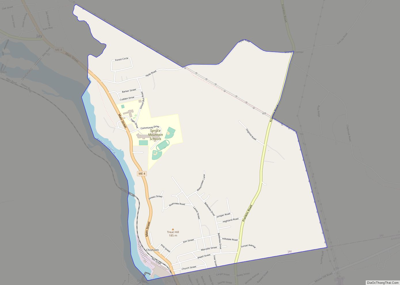
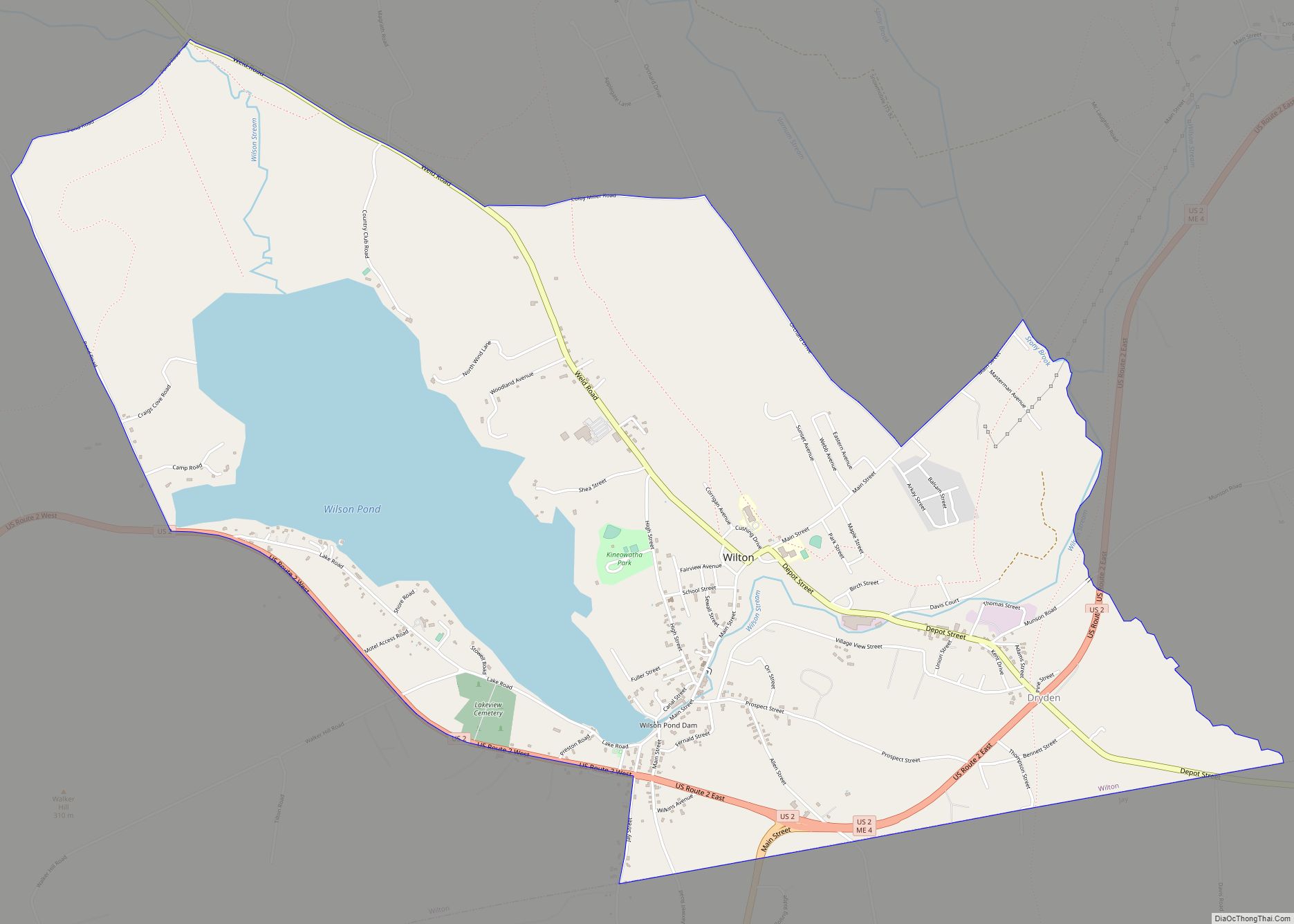
Wilton is a census-designated place (CDP) consisting of the main settlement within the town of Wilton in Franklin County, Maine, United States. The CDP population was 2,198 at the 2010 census, out of a total town population of 4,116.
| Name: | Wilton CDP |
|---|---|
| LSAD Code: | 57 |
| LSAD Description: | CDP (suffix) |
| State: | Maine |
| County: | Franklin County |
| Elevation: | 551 ft (168 m) |
| Total Area: | 4.99 sq mi (12.92 km²) |
| Land Area: | 4.09 sq mi (10.60 km²) |
| Water Area: | 0.90 sq mi (2.33 km²) |
| Total Population: | 2,071 |
| Population Density: | 506.11/sq mi (195.43/km²) |
| ZIP code: | 04294 |
| Area code: | 207 |
| FIPS code: | 2385815 |
| GNISfeature ID: | 0578559 |
Online Interactive Map
Click on ![]() to view map in "full screen" mode.
to view map in "full screen" mode.
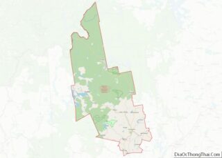
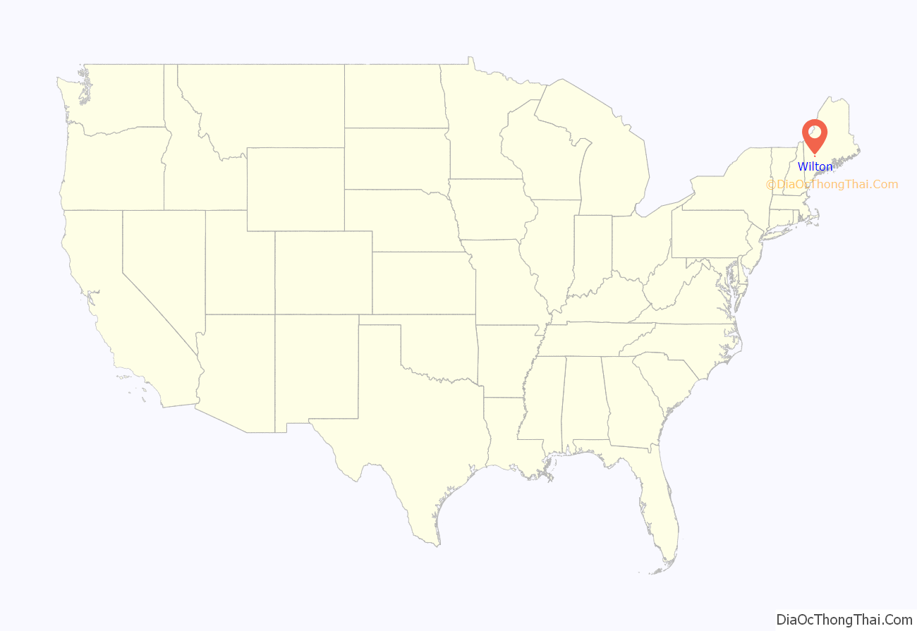
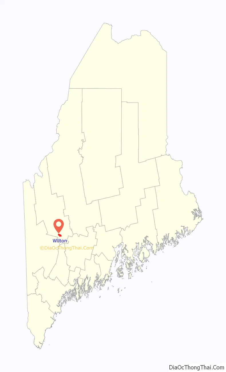
Wilton location map. Where is Wilton CDP?
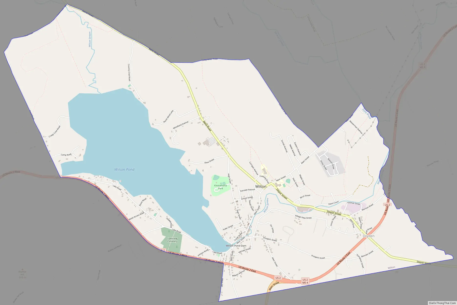
Wilton Road Map
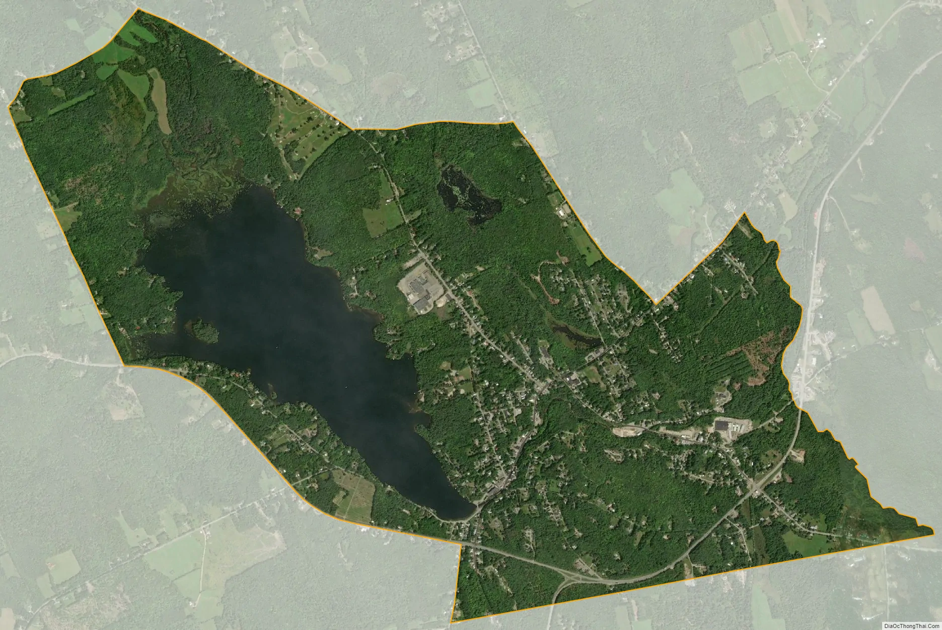
Wilton city Satellite Map
Geography
The Wilton CDP is located in the south-central part of the town of Wilton at 44°35′31″N 70°13′49″W / 44.59194°N 70.23028°W / 44.59194; -70.23028 (44.591961, −70.230456). The CDP extends south to the town line and is bordered by the town of Jay to the south. U.S. Route 2 passes through the southern part of the CDP, bypassing the densely settled town center; US 2 leads northeast 8 miles (13 km) to Farmington and west 22 miles (35 km) to Rumford. Maine State Route 4 runs northeast with US 2 to Farmington but branches off at Wilton, leading south 6 miles (10 km) to the center of Jay. Maine State Route 156 passes through the center of Wilton, leading northwest 13 miles (21 km) to Weld and east 10 miles (16 km) to US 2 beyond Farmington, near the town of New Sharon.
According to the United States Census Bureau, the CDP has a total area of 5.0 square miles (12.9 km), of which 4.1 square miles (10.6 km) is land and 0.89 square miles (2.3 km), or 17.99%, is water. Most of the water area is Wilson Pond, which occupies the western side of the CDP. The pond’s outlet, Wilson Stream, descends 80 feet (24 m) in elevation through the CDP, allowing for the development of a few water-powered factories in the 19th century.
See also
Map of Maine State and its subdivision: Map of other states:- Alabama
- Alaska
- Arizona
- Arkansas
- California
- Colorado
- Connecticut
- Delaware
- District of Columbia
- Florida
- Georgia
- Hawaii
- Idaho
- Illinois
- Indiana
- Iowa
- Kansas
- Kentucky
- Louisiana
- Maine
- Maryland
- Massachusetts
- Michigan
- Minnesota
- Mississippi
- Missouri
- Montana
- Nebraska
- Nevada
- New Hampshire
- New Jersey
- New Mexico
- New York
- North Carolina
- North Dakota
- Ohio
- Oklahoma
- Oregon
- Pennsylvania
- Rhode Island
- South Carolina
- South Dakota
- Tennessee
- Texas
- Utah
- Vermont
- Virginia
- Washington
- West Virginia
- Wisconsin
- Wyoming