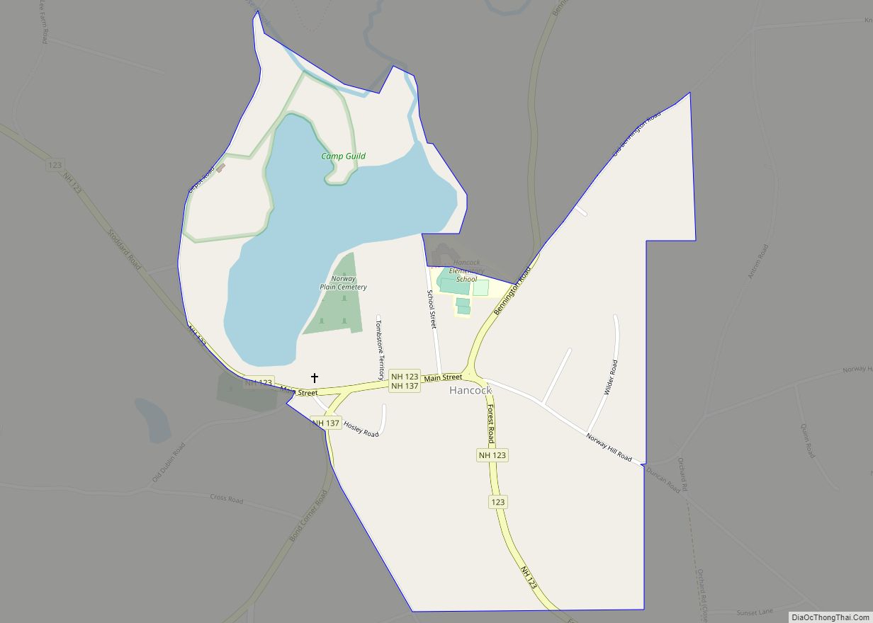
Hancock is a census-designated place (CDP) and the main village in the town of Hancock in Hillsborough County, New Hampshire, United States. The population of the CDP was 213 at the 2020 census, out of 1,731 in the entire town.
| Name: | Hancock CDP |
|---|---|
| LSAD Code: | 57 |
| LSAD Description: | CDP (suffix) |
| State: | New Hampshire |
| County: | Hillsborough County |
| Elevation: | 870 ft (270 m) |
| Total Area: | 0.42 sq mi (1.09 km²) |
| Land Area: | 0.36 sq mi (0.92 km²) |
| Water Area: | 0.06 sq mi (0.17 km²) |
| Total Population: | 213 |
| Population Density: | 598.31/sq mi (230.93/km²) |
| ZIP code: | 03449 |
| Area code: | 603 |
| FIPS code: | 3333620 |
| GNISfeature ID: | 2629724 |
Online Interactive Map
Click on ![]() to view map in "full screen" mode.
to view map in "full screen" mode.
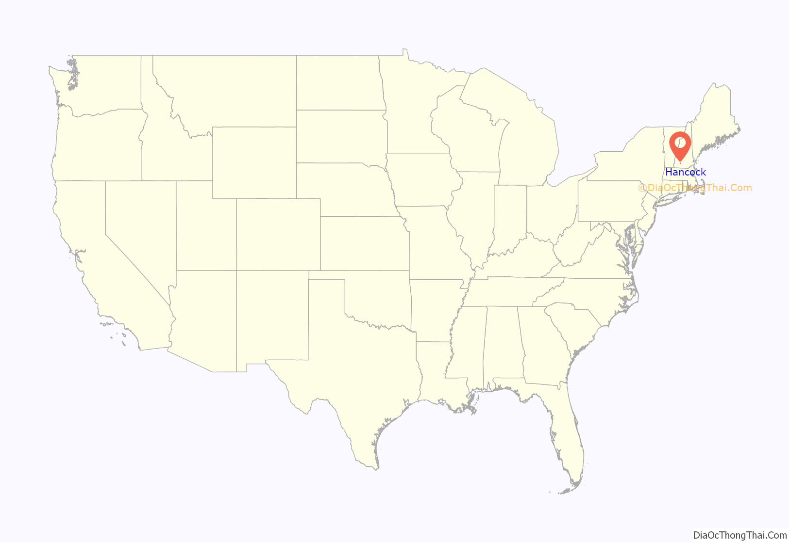
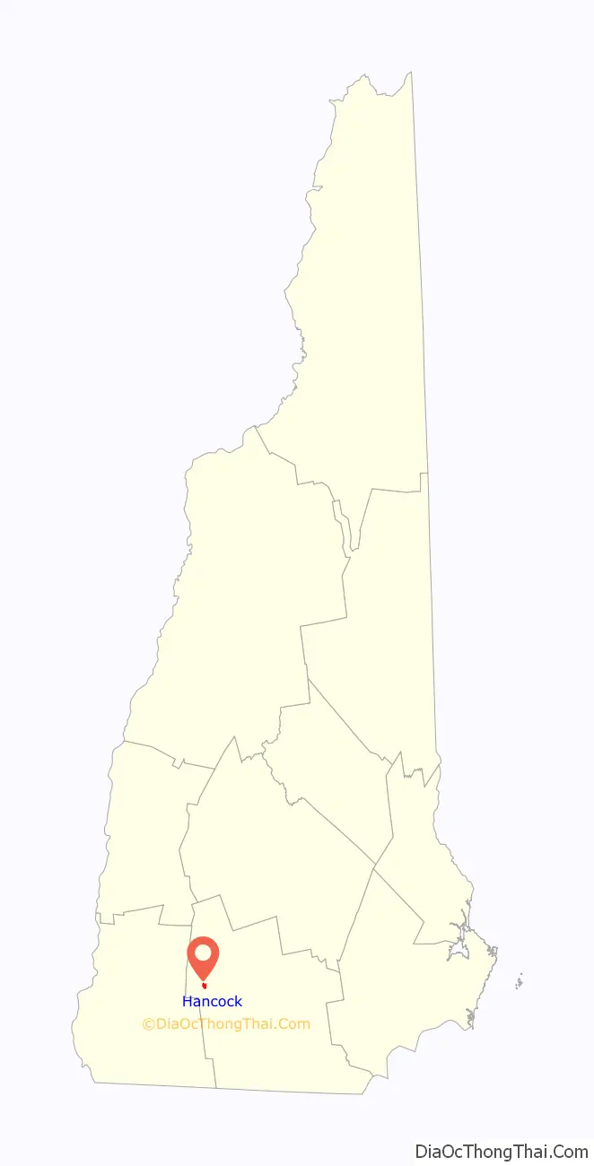
Hancock location map. Where is Hancock CDP?
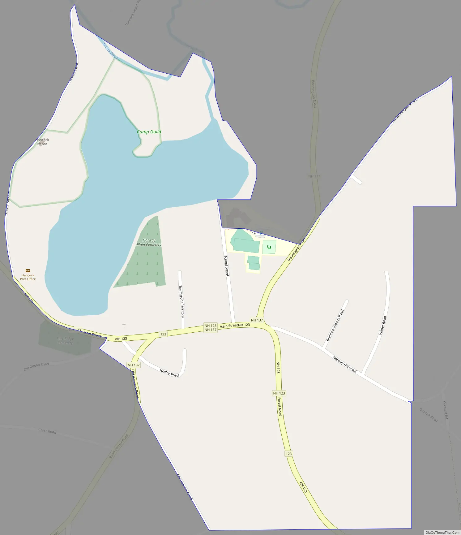
Hancock Road Map
Hancock city Satellite Map

Geography
The CDP is in the center of the town of Hancock and covers the compact village center as well as adjacent Norway Pond. Starting on the west side, the CDP follows Depot Road north past Norway Pond to Moose Brook, runs east along the brook then south to exclude the town recreation field, then heads northeast along Evergreen Hill Road. The east border of the CDP is east of Wilder Road but west of Antrim Road and Stearns Road. The south border of the CDP crosses Forest Road and follows Old Hancock Road and Main Street back to Depot Road.
New Hampshire Routes 123 and 137 combine in the center of the CDP for three blocks of Main Street. Route 123 leads southeast 8 miles (13 km) to Peterborough and northwest 11 miles (18 km) to Stoddard, while Route 137 leads northeast 4 miles (6 km) to Bennington and southwest 13 miles (21 km) to Jaffrey.
According to the U.S. Census Bureau, the Hancock CDP has a total area of 0.42 square miles (1.1 km), of which 0.3 square miles (0.9 km) are land and 0.1 square miles (0.2 km), or 15.20%, are water.
See also
Map of New Hampshire State and its subdivision: Map of other states:- Alabama
- Alaska
- Arizona
- Arkansas
- California
- Colorado
- Connecticut
- Delaware
- District of Columbia
- Florida
- Georgia
- Hawaii
- Idaho
- Illinois
- Indiana
- Iowa
- Kansas
- Kentucky
- Louisiana
- Maine
- Maryland
- Massachusetts
- Michigan
- Minnesota
- Mississippi
- Missouri
- Montana
- Nebraska
- Nevada
- New Hampshire
- New Jersey
- New Mexico
- New York
- North Carolina
- North Dakota
- Ohio
- Oklahoma
- Oregon
- Pennsylvania
- Rhode Island
- South Carolina
- South Dakota
- Tennessee
- Texas
- Utah
- Vermont
- Virginia
- Washington
- West Virginia
- Wisconsin
- Wyoming