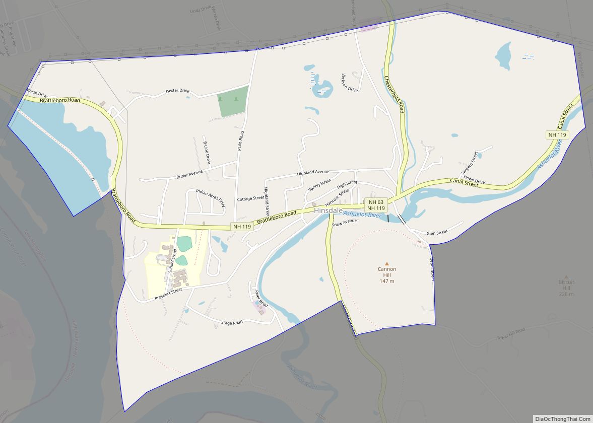
Hinsdale is a census-designated place (CDP) and the main village in the town of Hinsdale in Cheshire County, New Hampshire, United States. The population of the CDP was 1,485 at the 2020 census, out of 3,948 in the entire town of Hinsdale.
| Name: | Hinsdale CDP |
|---|---|
| LSAD Code: | 57 |
| LSAD Description: | CDP (suffix) |
| State: | New Hampshire |
| County: | Cheshire County |
| Elevation: | 250.7 ft (76.4 m) |
| Total Area: | 2.40 sq mi (6.21 km²) |
| Land Area: | 2.32 sq mi (6.02 km²) |
| Water Area: | 0.08 sq mi (0.20 km²) |
| Total Population: | 1,485 |
| Population Density: | 639.26/sq mi (246.87/km²) |
| ZIP code: | 03451 |
| Area code: | 603 |
| FIPS code: | 3336580 |
| GNISfeature ID: | 2378072 |
Online Interactive Map
Click on ![]() to view map in "full screen" mode.
to view map in "full screen" mode.
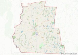
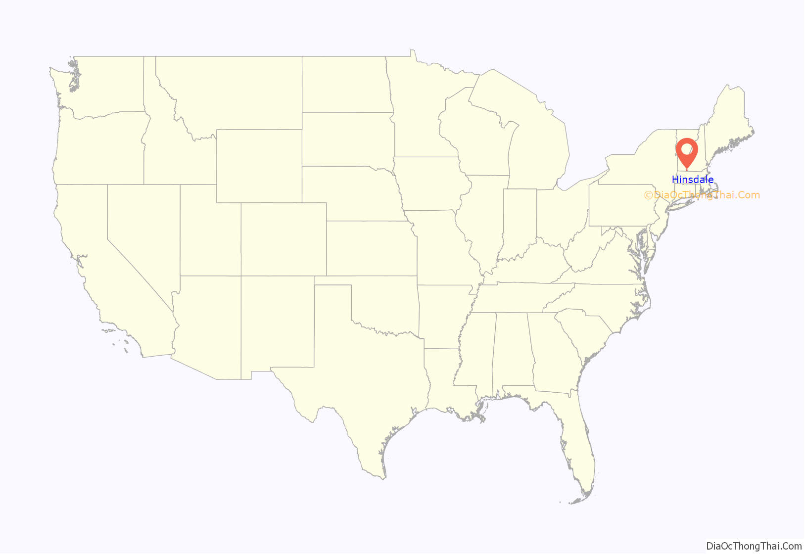
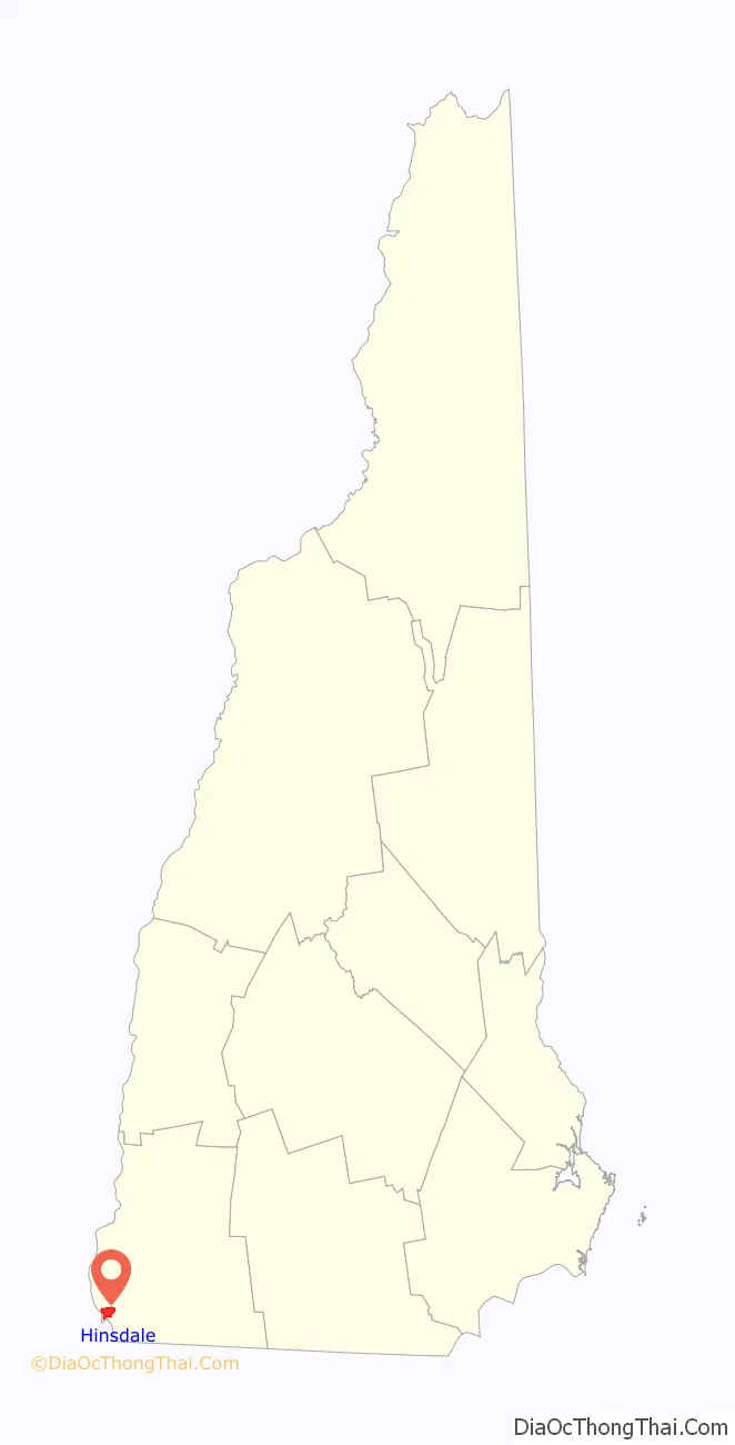
Hinsdale location map. Where is Hinsdale CDP?
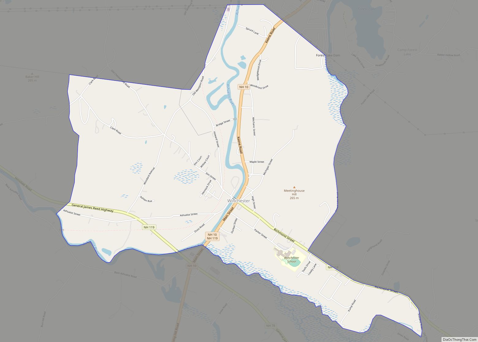
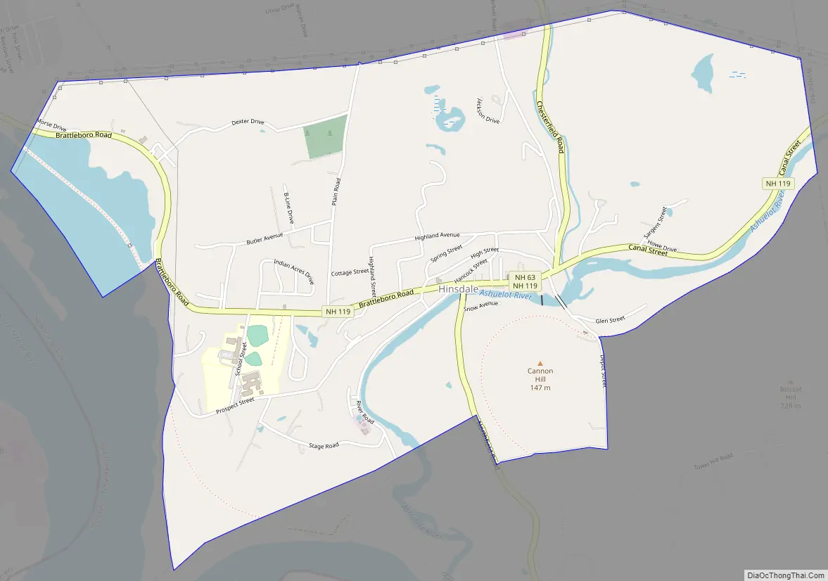
Hinsdale Road Map
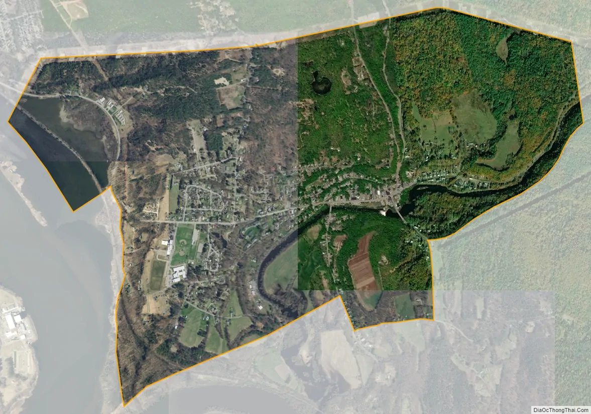
Hinsdale city Satellite Map
Geography
The CDP is in the south-central part of the town of Hinsdale, between the Connecticut River to the west and the Winchester town line to the east. The Ashuelot River, a tributary of the Connecticut, flows through the eastern and southern part of the CDP. New Hampshire Route 119 passes through the center of the village as Brattleboro Road, Main Street, and Canal Street; it leads east 6 miles (10 km) to Winchester and northwest 7 miles (11 km) to Brattleboro, Vermont. New Hampshire Route 63 joins Route 119 along Main Street in the center of Hinsdale, but leads north 8 miles (13 km) to Chesterfield and south 7 miles (11 km) to Northfield, Massachusetts.
According to the U.S. Census Bureau, the Hinsdale CDP has a total area of 2.4 square miles (6.2 km), of which 2.3 square miles (6.0 km) are land and 0.1 square miles (0.2 km), or 3.20%, are water.
See also
Map of New Hampshire State and its subdivision: Map of other states:- Alabama
- Alaska
- Arizona
- Arkansas
- California
- Colorado
- Connecticut
- Delaware
- District of Columbia
- Florida
- Georgia
- Hawaii
- Idaho
- Illinois
- Indiana
- Iowa
- Kansas
- Kentucky
- Louisiana
- Maine
- Maryland
- Massachusetts
- Michigan
- Minnesota
- Mississippi
- Missouri
- Montana
- Nebraska
- Nevada
- New Hampshire
- New Jersey
- New Mexico
- New York
- North Carolina
- North Dakota
- Ohio
- Oklahoma
- Oregon
- Pennsylvania
- Rhode Island
- South Carolina
- South Dakota
- Tennessee
- Texas
- Utah
- Vermont
- Virginia
- Washington
- West Virginia
- Wisconsin
- Wyoming