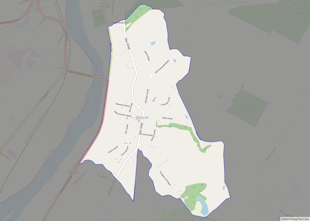
Walpole is a census-designated place (CDP) and the central village in the town of Walpole in Cheshire County, New Hampshire, United States. The population of the CDP was 573 at the 2020 census, compared to 3,633 in the entire town.
| Name: | Walpole CDP |
|---|---|
| LSAD Code: | 57 |
| LSAD Description: | CDP (suffix) |
| State: | New Hampshire |
| County: | Cheshire County |
| Elevation: | 397 ft (121 m) |
| Total Area: | 1.23 sq mi (3.18 km²) |
| Land Area: | 1.22 sq mi (3.15 km²) |
| Water Area: | 0.01 sq mi (0.03 km²) |
| Total Population: | 573 |
| Population Density: | 470.83/sq mi (181.77/km²) |
| ZIP code: | 03608 |
| Area code: | 603 |
| FIPS code: | 3378340 |
| GNISfeature ID: | 2629744 |
Online Interactive Map
Click on ![]() to view map in "full screen" mode.
to view map in "full screen" mode.
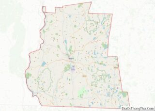
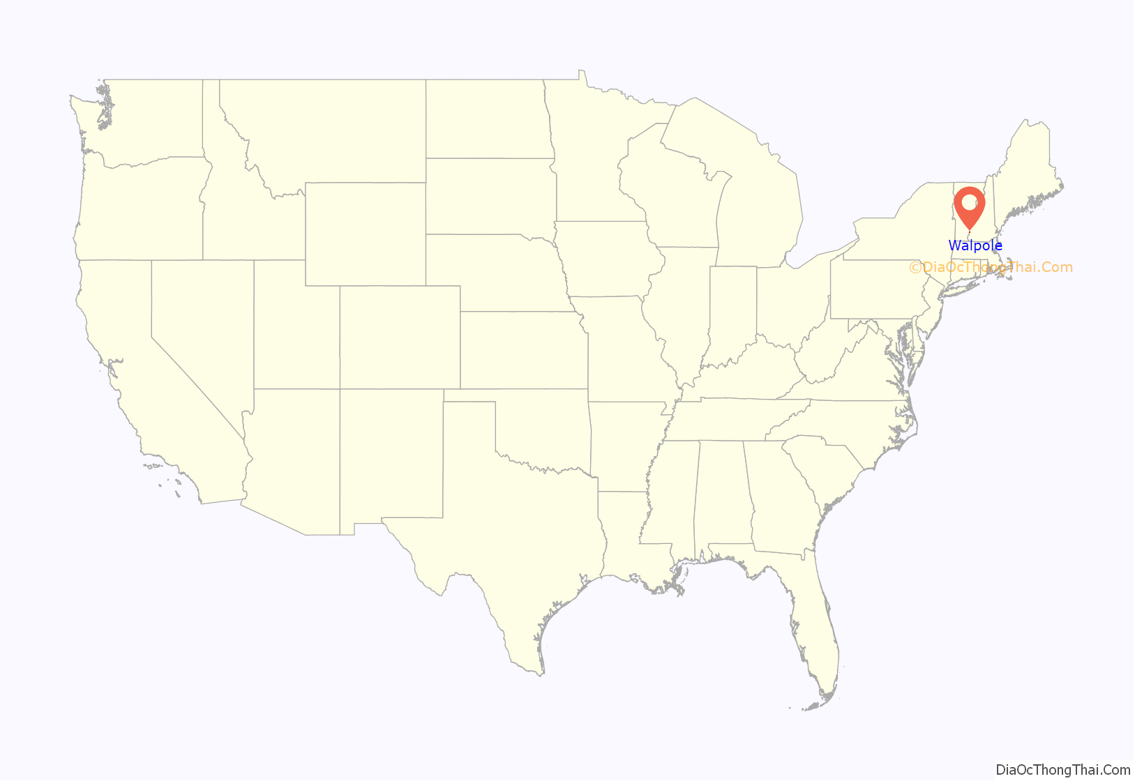
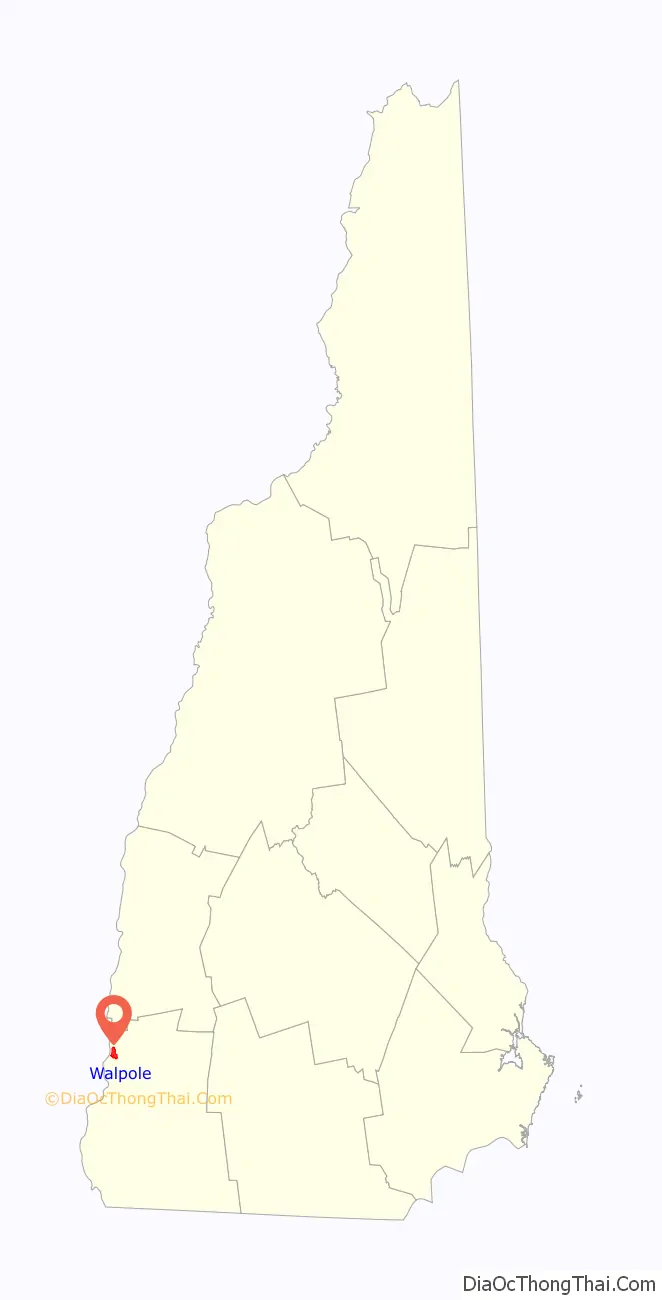
Walpole location map. Where is Walpole CDP?
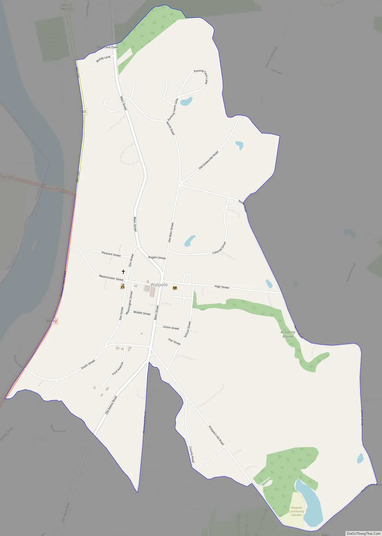
Walpole Road Map
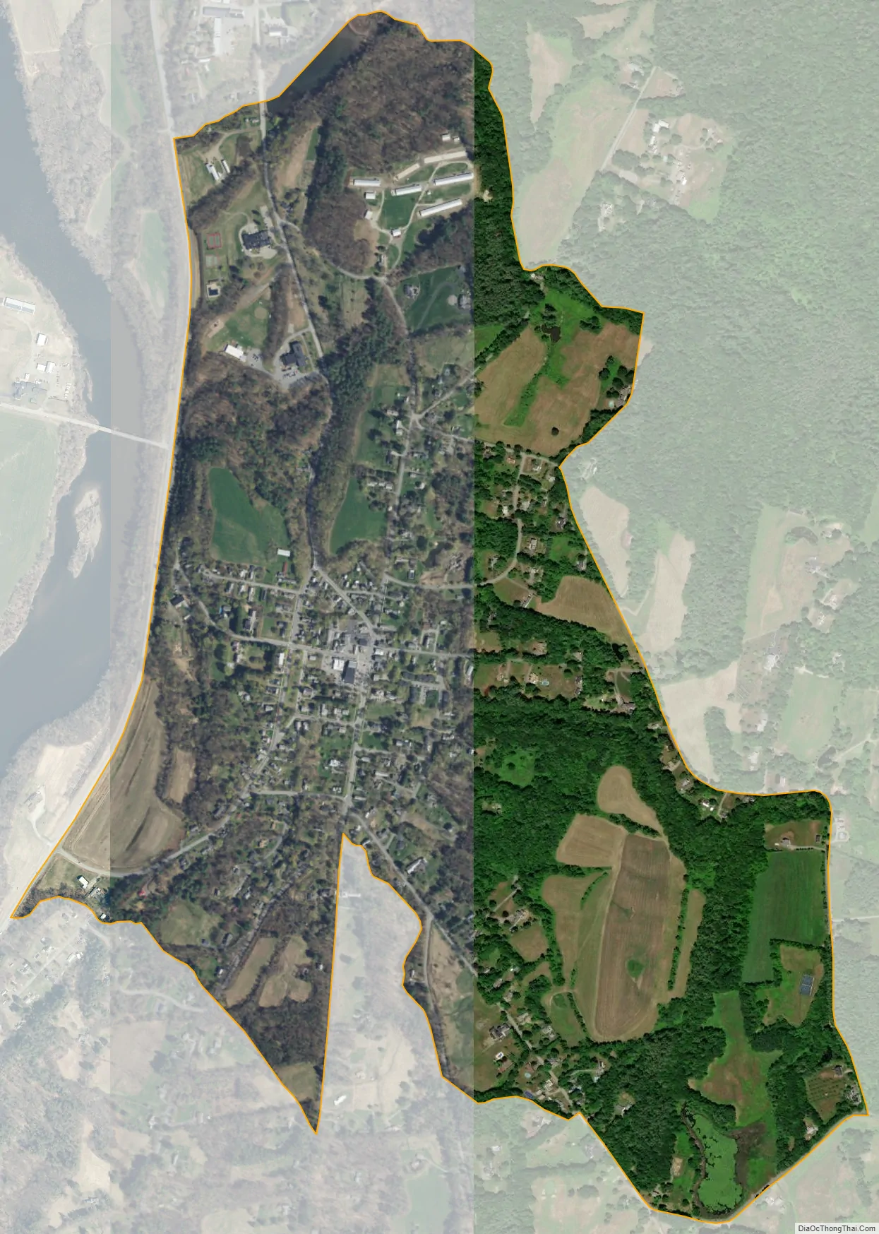
Walpole city Satellite Map
Geography
The CDP is in the west-center part of the town of Walpole, on the east side of the valley of the Connecticut River. The western edge of the CDP follows New Hampshire Route 12, from the outlet of Mill Pond in the north to an unnamed brook south of South Street in the south. The CDP extends southeast to Prospect Hill Road as far as Watkins Hill Road and Maple Grove Road, while the eastern border of the CDP follows North Road and an unnamed brook back to Mill Pond.
Route 12 leads north 4.5 miles (7.2 km) to North Walpole, across the Connecticut River from Bellows Falls, Vermont, and 11 miles (18 km) to Charlestown, while to the south it leads 17 miles (27 km) to Keene. New Hampshire Route 123 leaves Route 12 just west of the town center and leads west across the Connecticut to Westminster, Vermont.
According to the U.S. Census Bureau, the Walpole CDP has a total area of 1.2 square miles (3.2 km), of which 0.01 square miles (0.03 km), or 0.86%, are water.
See also
Map of New Hampshire State and its subdivision: Map of other states:- Alabama
- Alaska
- Arizona
- Arkansas
- California
- Colorado
- Connecticut
- Delaware
- District of Columbia
- Florida
- Georgia
- Hawaii
- Idaho
- Illinois
- Indiana
- Iowa
- Kansas
- Kentucky
- Louisiana
- Maine
- Maryland
- Massachusetts
- Michigan
- Minnesota
- Mississippi
- Missouri
- Montana
- Nebraska
- Nevada
- New Hampshire
- New Jersey
- New Mexico
- New York
- North Carolina
- North Dakota
- Ohio
- Oklahoma
- Oregon
- Pennsylvania
- Rhode Island
- South Carolina
- South Dakota
- Tennessee
- Texas
- Utah
- Vermont
- Virginia
- Washington
- West Virginia
- Wisconsin
- Wyoming