Harrisville is a census-designated place (CDP) and village in the town of Burrillville in Providence County, Rhode Island, United States. The population was 1,605 at the 2010 census. Much of the community composes a historic district listed on the National Register of Historic Places. The village was named after nineteenth century manufacturer Andrew Harris. Previously, the village was named Rhodesville, after Captain William Rhodes, an eighteenth century privateer.
| Name: | Harrisville CDP |
|---|---|
| LSAD Code: | 57 |
| LSAD Description: | CDP (suffix) |
| State: | Rhode Island |
| County: | Providence County |
| Elevation: | 325 ft (99 m) |
| Total Area: | 0.86 sq mi (2.22 km²) |
| Land Area: | 0.81 sq mi (2.10 km²) |
| Water Area: | 0.04 sq mi (0.11 km²) |
| Total Population: | 1,745 |
| Population Density: | 2,149.01/sq mi (829.57/km²) |
| ZIP code: | 02830 |
| Area code: | 401 |
| FIPS code: | 4433400 |
| GNISfeature ID: | 1218783 |
Online Interactive Map
Click on ![]() to view map in "full screen" mode.
to view map in "full screen" mode.
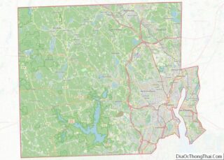
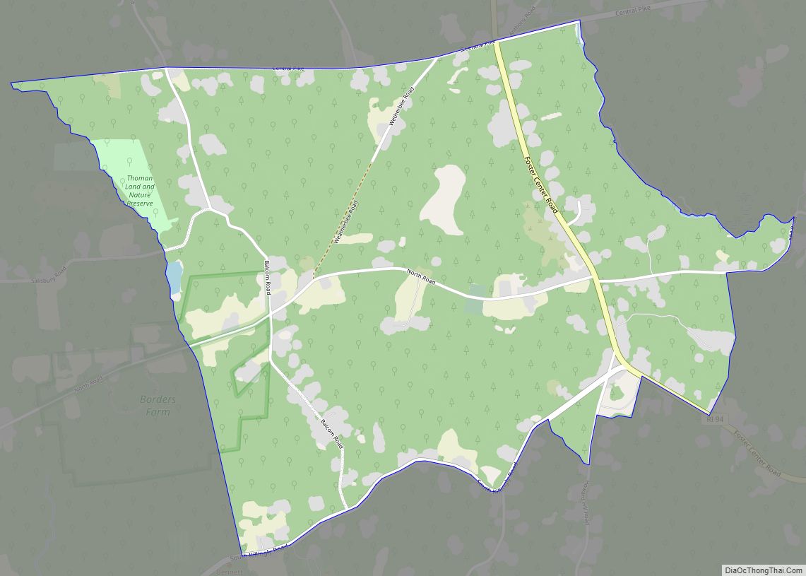
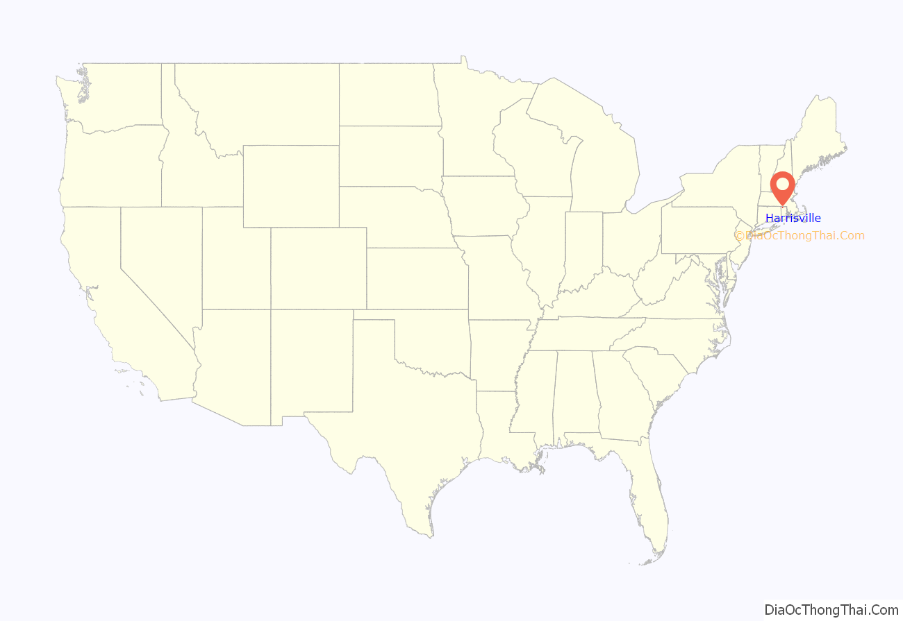
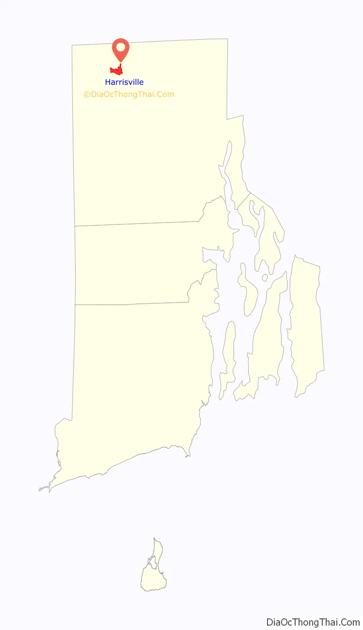
Harrisville location map. Where is Harrisville CDP?
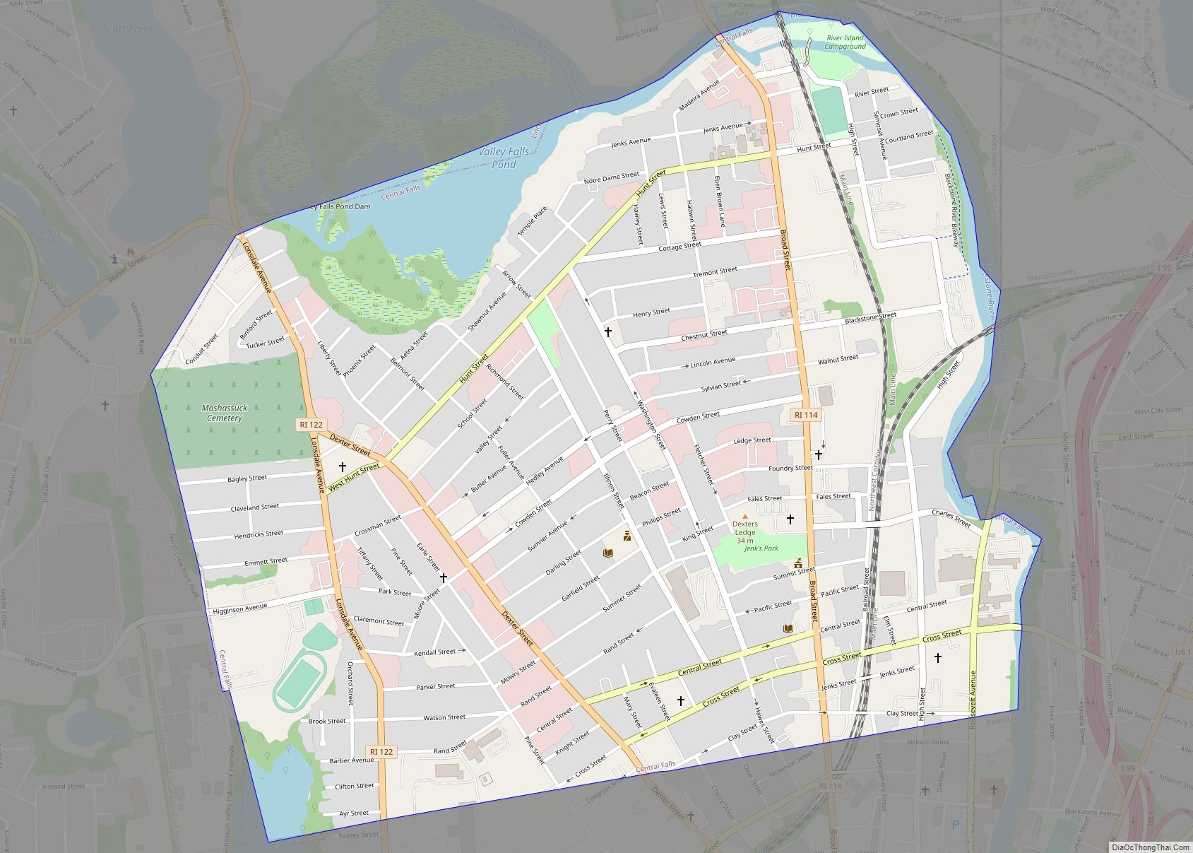
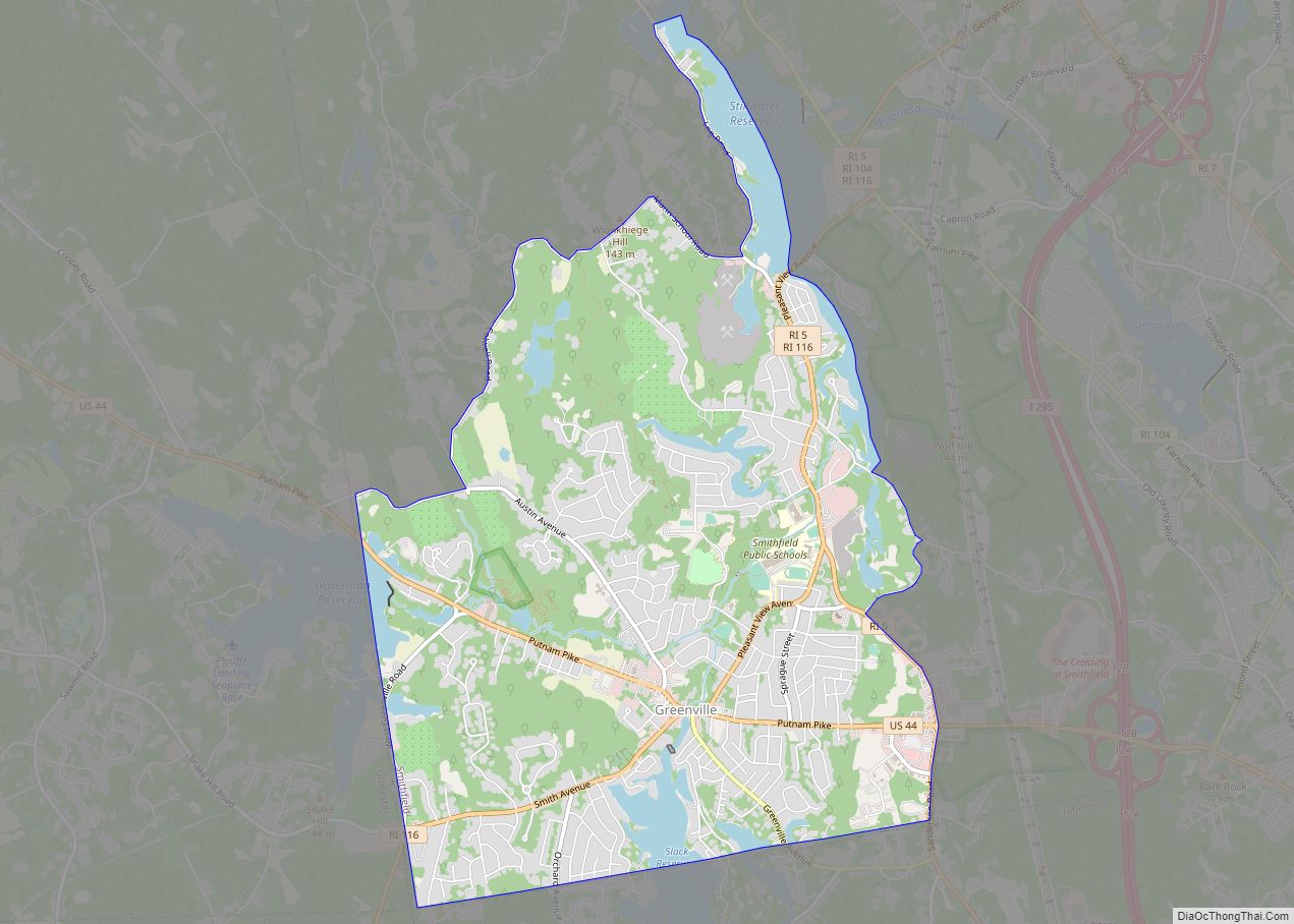
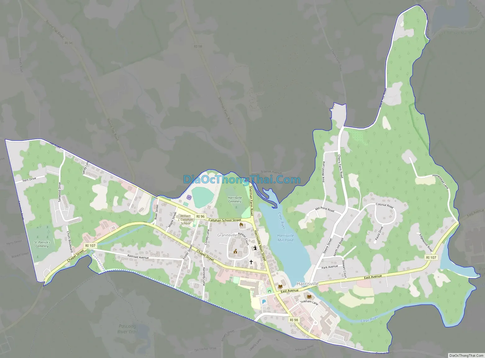
Harrisville Road Map
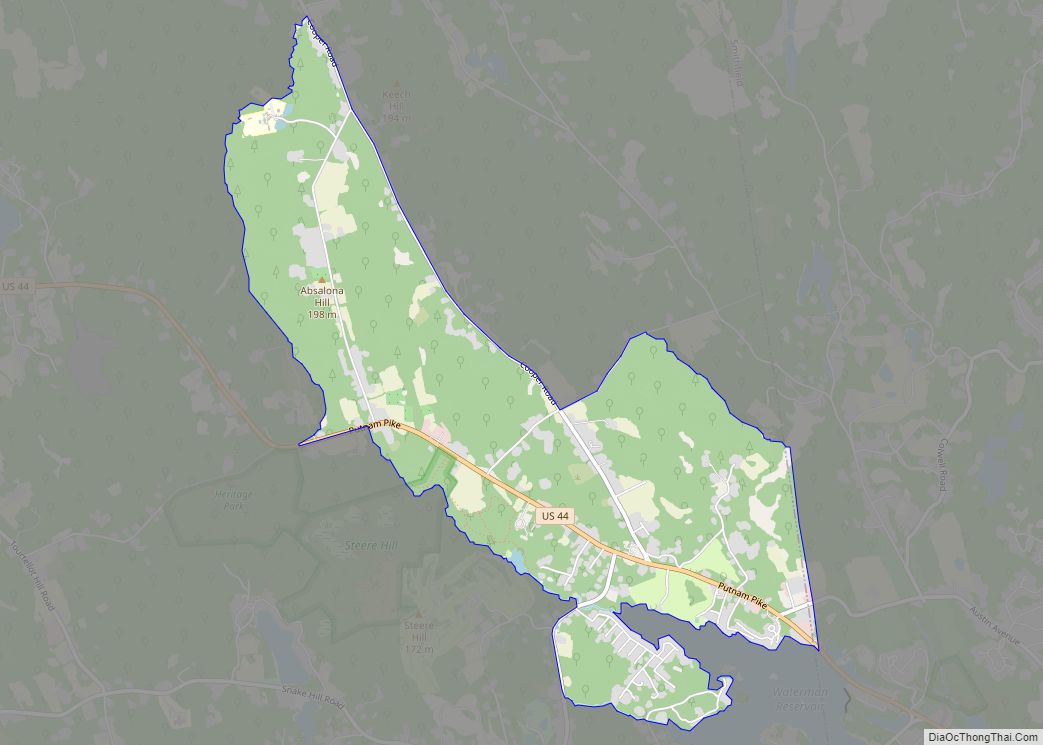
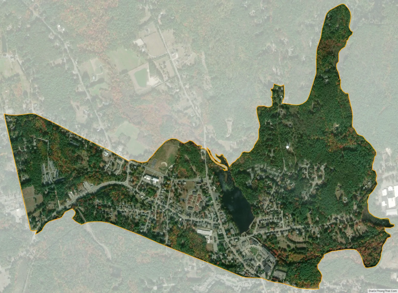
Harrisville city Satellite Map
Geography
Harrisville is located at 41°58′7″N 71°40′48″W / 41.96861°N 71.68000°W / 41.96861; -71.68000 (41.968481, -71.680011).
According to the United States Census Bureau, the CDP has a total area of 2.2 km (0.9 mi). 2.1 km (0.8 mi) of it is land and 0.1 km (0.04 mi) of it (3.53%) is water.
See also
Map of Rhode Island State and its subdivision: Map of other states:- Alabama
- Alaska
- Arizona
- Arkansas
- California
- Colorado
- Connecticut
- Delaware
- District of Columbia
- Florida
- Georgia
- Hawaii
- Idaho
- Illinois
- Indiana
- Iowa
- Kansas
- Kentucky
- Louisiana
- Maine
- Maryland
- Massachusetts
- Michigan
- Minnesota
- Mississippi
- Missouri
- Montana
- Nebraska
- Nevada
- New Hampshire
- New Jersey
- New Mexico
- New York
- North Carolina
- North Dakota
- Ohio
- Oklahoma
- Oregon
- Pennsylvania
- Rhode Island
- South Carolina
- South Dakota
- Tennessee
- Texas
- Utah
- Vermont
- Virginia
- Washington
- West Virginia
- Wisconsin
- Wyoming