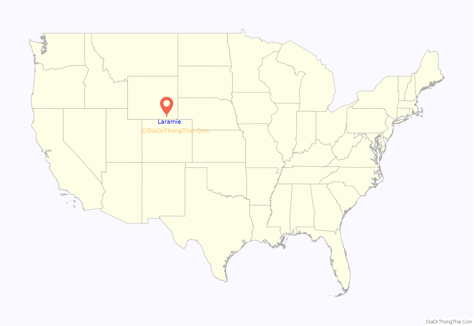
Laramie /ˈlærəmi/ is a city in and the county seat of Albany County, Wyoming, United States. The population was estimated 32,711 in 2019, making it the third-largest city in Wyoming after Cheyenne and Casper. Located on the Laramie River in southeastern Wyoming, the city is north west of Cheyenne, at the junction of Interstate 80 and U.S. Route 287.
Laramie was settled in the mid-19th century along the Union Pacific Railroad line, which crosses the Laramie River at Laramie. It is home to the University of Wyoming, WyoTech, and a branch of Laramie County Community College. Laramie Regional Airport serves Laramie. The ruins of Fort Sanders, an army fort predating Laramie, lie just south of the city along Route 287. Located in the Laramie Valley between the Snowy Range and the Laramie Range, the city draws outdoor enthusiasts with its abundance of outdoor activities.
In 2011, Laramie was named as one of the best cities in which to retire by Money Magazine, which cited its scenic location, low taxes, and educational opportunities.
| Name: | Laramie city |
|---|---|
| LSAD Code: | 25 |
| LSAD Description: | city (suffix) |
| State: | Wyoming |
| County: | Albany County |
| Elevation: | 7,165 ft (2,184 m) |
| Land Area: | 18.36 sq mi (47.55 km²) |
| Water Area: | 0.02 sq mi (0.06 km²) |
| Population Density: | 1,781.74/sq mi (701.16/km²) |
| ZIP code: | 82070-82073 |
| Area code: | 307 |
| FIPS code: | 5645050 |
| GNISfeature ID: | 1590526 |
| Website: | www.cityoflaramie.org |
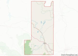
Online Interactive Map
Click on ![]() to view map in "full screen" mode.
to view map in "full screen" mode.
Laramie location map. Where is Laramie city?
History
Laramie was named for Jacques LaRamie, a French or French-Canadian trapper who disappeared in the Laramie Mountains in the early 1820s and was never heard from again. He was one of the first Europeans to visit the area. European-American settlers named a river, mountain range, peak, US Army fort, county, and city for him. More Wyoming landmarks are named for him than for any other trapper but Jim Bridger. Because the name was used so frequently, the town was called Laramie City for decades to distinguish it from other uses.
The city was founded in the mid-1860s as a tent city near the Overland Stage Line route, the Union Pacific portion of the first transcontinental railroad, and just north of Fort Sanders army post. The rails reached Laramie on May 4, 1868 when construction crews worked through town. A few passengers arrived on that same day. The first regular passenger service began on May 10, 1868, by which time entrepreneurs were building more permanent structures. Laramie City (as it was known in early years) soon had stores, houses, a school, and churches. Laramie’s fame as the western terminal of the Union Pacific Railroad, acquired when the 268-mile (431 km) section from North Platte, Nebraska was opened in May, ended in early August 1868 when a 93-mile (150 km) section of track was opened to Benton, 6 miles (9.7 km) east of present-day Sinclair, Wyoming.
The frontier town initially suffered from lawlessness. Its first mayor, M. C. Brown, resigned his office on June 12, 1868 after six turbulent weeks, saying that the other officials elected alongside him on May 2 were guilty of “incapacity and laxity” in dealing with the city’s problems. This was due to the threat to the community from three half-brothers, early Old West gunman “Big” Steve Long, Con Moyer and Ace Moyer. Long was Laramie’s first marshal, and with his brothers owned the saloon Bucket of Blood. The three began harassing settlers, forcing them to sign over the deeds to their property to them. Any who refused were killed, usually goaded into a gunfight by Long. By October 1868, Long had killed 13 men.
The first Albany County sheriff, rancher N. K. Boswell, organized a “Vigilance Committee” in response. On October 28, 1868, Boswell led the committee into the Bucket of Blood, overwhelmed the three brothers, and lynched them at an unfinished cabin down the street. Through a series of other lynchings and other forms of intimidation, the vigilantes reduced the “unruly element” and established a semblance of law and order.
In 1869, Wyoming was organized as Wyoming Territory, the first legislature of which passed a bill granting equal political rights to women in the territory. In March 1870, five Laramie residents became the first women in the world to serve on a jury. As Laramie was the first town in Wyoming to hold a municipal election, on September 6, 1870, Laramie resident Louisa Swain was the first woman in the United States to cast a legal vote in a general election.
Early businesses included rolling mills, a railroad-tie treatment plant, a brick yard, a slaughterhouse, a brewery, a glass manufacturing plant, and a plaster mill, as well as the railroad yards. In 1886, a plant to produce electricity was built. Several regional railroads were based in Laramie, including the Laramie, North Park and Pacific Railroad and Telegraph Company founded in 1880 and the Laramie, North Park and Western Railroad established in 1901.
Governor Francis E. Warren signed a bill that established the University of Wyoming (UW) in 1886, the only public university in the state. Laramie was chosen as its site, and UW opened there in 1887. Under the terms of the Morrill Act, also known as the Land Grant College Act, in 1891 UW added an agricultural college and experiment station to gain benefits as a land grant college.
Late 20th century to present
The city was covered by international media in 1998 after the murder of Matthew Shepard, who was a gay student at the University of Wyoming. His murder generated an international outcry. It became the symbolic focus for a nationwide campaign against gay hate crimes. Federal hate crimes legislation was signed into law in 2009. As of September 2021, Wyoming does not have a hate crimes law, having failed to pass its most recent attempt at a hate crimes law in March 2021. Shepard’s murder was the subject of the award-winning play, later adapted as a movie, The Laramie Project.
In 2004, Laramie became the first city in Wyoming to pass a law to prohibit smoking in enclosed workplaces, including bars, restaurants and private clubs. Opponents of the clean indoor air ordinance, funded in part by the R.J. Reynolds Tobacco Company, immediately petitioned to have the ordinance repealed. However, the voters upheld the ordinance in a citywide referendum which was conducted concurrently with the 2004 general election. The opponents challenged the validity of the election in court, claiming various irregularities. However, the judge ruled that the opponents had failed to meet their burden of showing significant problems with the election, and the ordinance, which had become effective in April 2005, remained in effect. In August 2005, Laramie’s City Council defeated an attempt to amend the ordinance to allow smoking in bars and private clubs.
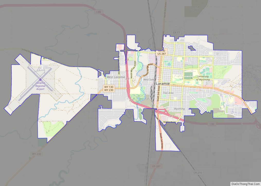
Laramie Road Map
Laramie city Satellite Map
Geography
Laramie is located at 41°18′47″N 105°35′14″W / 41.31306°N 105.58722°W / 41.31306; -105.58722 (41.312927, −105.587251). According to the United States Census Bureau, the city has a total area of 17.76 square miles (46.00 km), of which 17.74 square miles (45.95 km) is land and 0.02 square miles (0.05 km) is water.
Laramie is on a high plain between two mountain ranges, the Snowy Range, about 30 miles (48 km) to the west, and the Laramie Range, 7 miles (11 km) to the east. The city’s elevation above sea level is approximately 7,165 feet (2,184 m). The Laramie River runs through Laramie toward its confluence with the North Platte River east of the Laramie Range.
The city is about 50 miles (80 km) west of Cheyenne, and 130 miles (209 km) north of Denver, Colorado. Laramie lies along U.S. Route 30, Interstate 80, and U.S. Route 287, and it remains an important junction on the Union Pacific Railroad line.
Climate
Laramie’s total precipitation averages about 11 inches (279 mm) a year, and the average number of rainy days per year is about 86. The city experiences a day that is 90 °F (32 °C) or warmer 2.2 times a year. The average temperature in December is 21.1 °F (−6.1 °C), and in July it is 64.0 °F (17.8 °C). Annual snowfall averages 48 inches (122 cm). Because of the high elevation, winters are long, and summers are short and relatively cool. The growing season is short, as the average window for freezing temperatures is September 14 through June 6, while for accumulating (≥0.1 inches (2.5 mm)) it is October 5 through May 12.
Laramie has a semi-arid climate (Köppen climate classification BSk) with long, cold, dry winters and short, warm, somewhat wetter summers.
See also
Map of Wyoming State and its subdivision: Map of other states:- Alabama
- Alaska
- Arizona
- Arkansas
- California
- Colorado
- Connecticut
- Delaware
- District of Columbia
- Florida
- Georgia
- Hawaii
- Idaho
- Illinois
- Indiana
- Iowa
- Kansas
- Kentucky
- Louisiana
- Maine
- Maryland
- Massachusetts
- Michigan
- Minnesota
- Mississippi
- Missouri
- Montana
- Nebraska
- Nevada
- New Hampshire
- New Jersey
- New Mexico
- New York
- North Carolina
- North Dakota
- Ohio
- Oklahoma
- Oregon
- Pennsylvania
- Rhode Island
- South Carolina
- South Dakota
- Tennessee
- Texas
- Utah
- Vermont
- Virginia
- Washington
- West Virginia
- Wisconsin
- Wyoming
