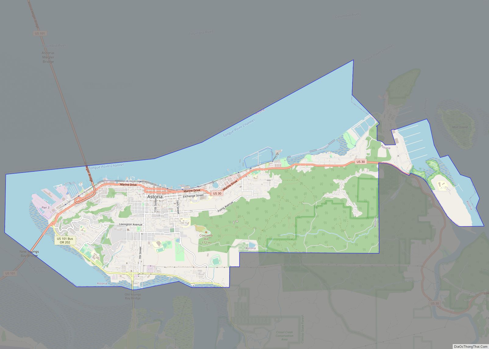
Astoria is a port city and the seat of Clatsop County, Oregon, United States. Founded in 1811, Astoria is the oldest city in the state and was the first permanent American settlement west of the Rocky Mountains. The county is the northwest corner of Oregon, and Astoria is located on the south shore of the Columbia River, where the river flows into the Pacific Ocean. The city is named for John Jacob Astor, an investor and entrepreneur from New York City, whose American Fur Company founded Fort Astoria at the site and established a monopoly in the fur trade in the early 19th century. Astoria was incorporated by the Oregon Legislative Assembly on October 20, 1856.
The city is served by the deepwater Port of Astoria. Transportation includes the Astoria Regional Airport. U.S. Route 30 and U.S. Route 101 are the main highways, and the 4.1-mile (6.6 km) Astoria–Megler Bridge connects to neighboring Washington across the river. The population was 10,181 at the 2020 census.
| Name: | Astoria city |
|---|---|
| LSAD Code: | 25 |
| LSAD Description: | city (suffix) |
| State: | Oregon |
| County: | Clatsop County |
| Founded: | 1811 |
| Incorporated: | 1876 |
| Elevation: | 23 ft (7 m) |
| Total Area: | 9.95 sq mi (25.77 km²) |
| Land Area: | 6.11 sq mi (15.82 km²) |
| Water Area: | 3.84 sq mi (9.95 km²) |
| Total Population: | 10,181 |
| Population Density: | 1,666.56/sq mi (643.42/km²) |
| ZIP code: | 97103 |
| FIPS code: | 4103150 |
| GNISfeature ID: | 1117076 |
| Website: | www.astoria.or.us |
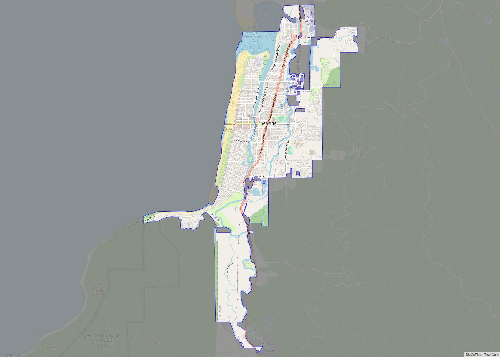
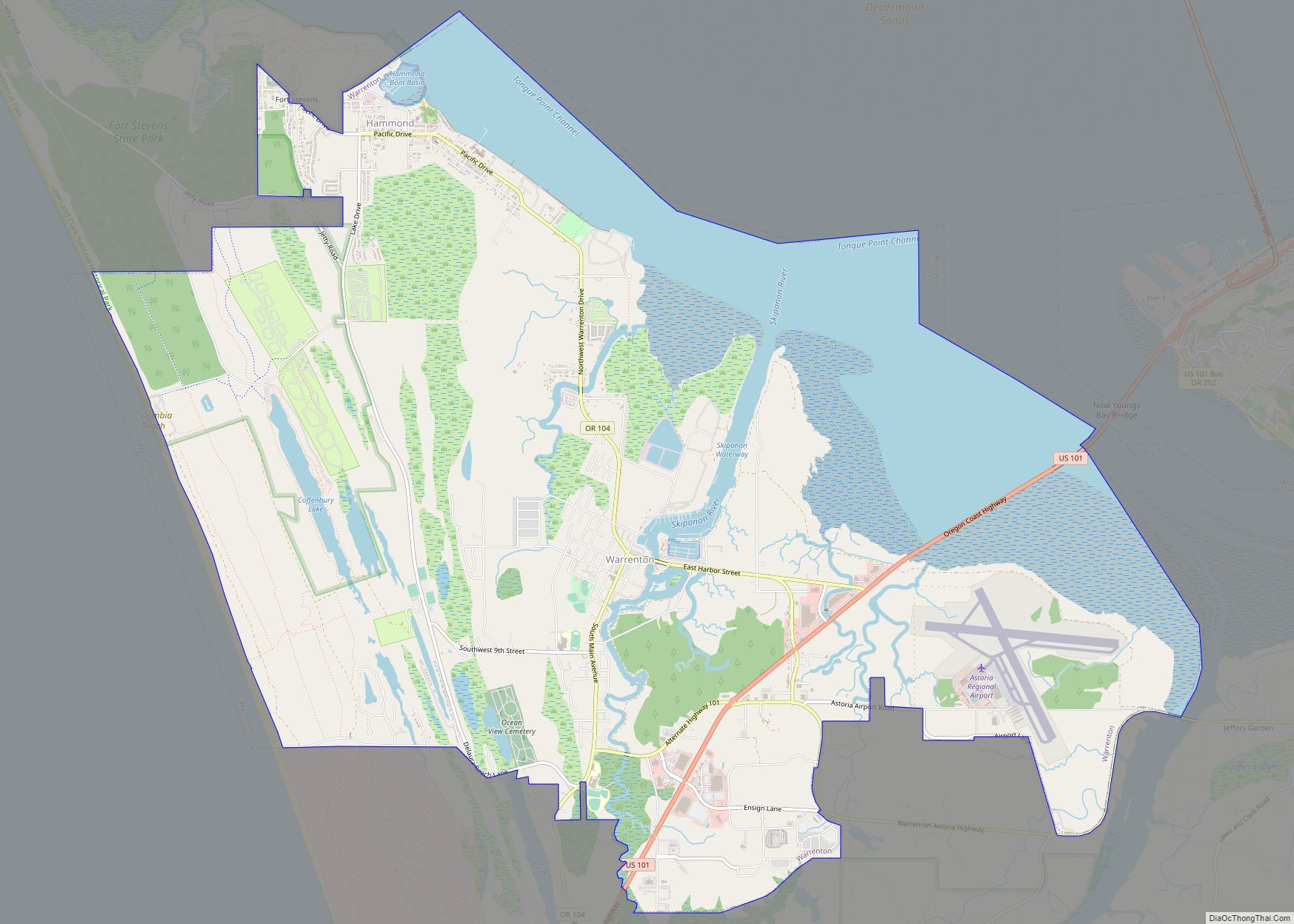
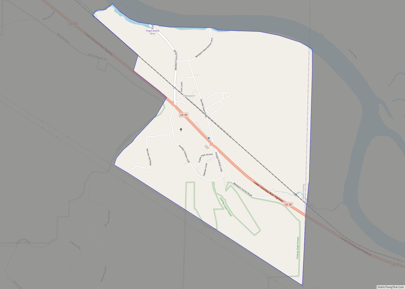
Online Interactive Map
Click on ![]() to view map in "full screen" mode.
to view map in "full screen" mode.
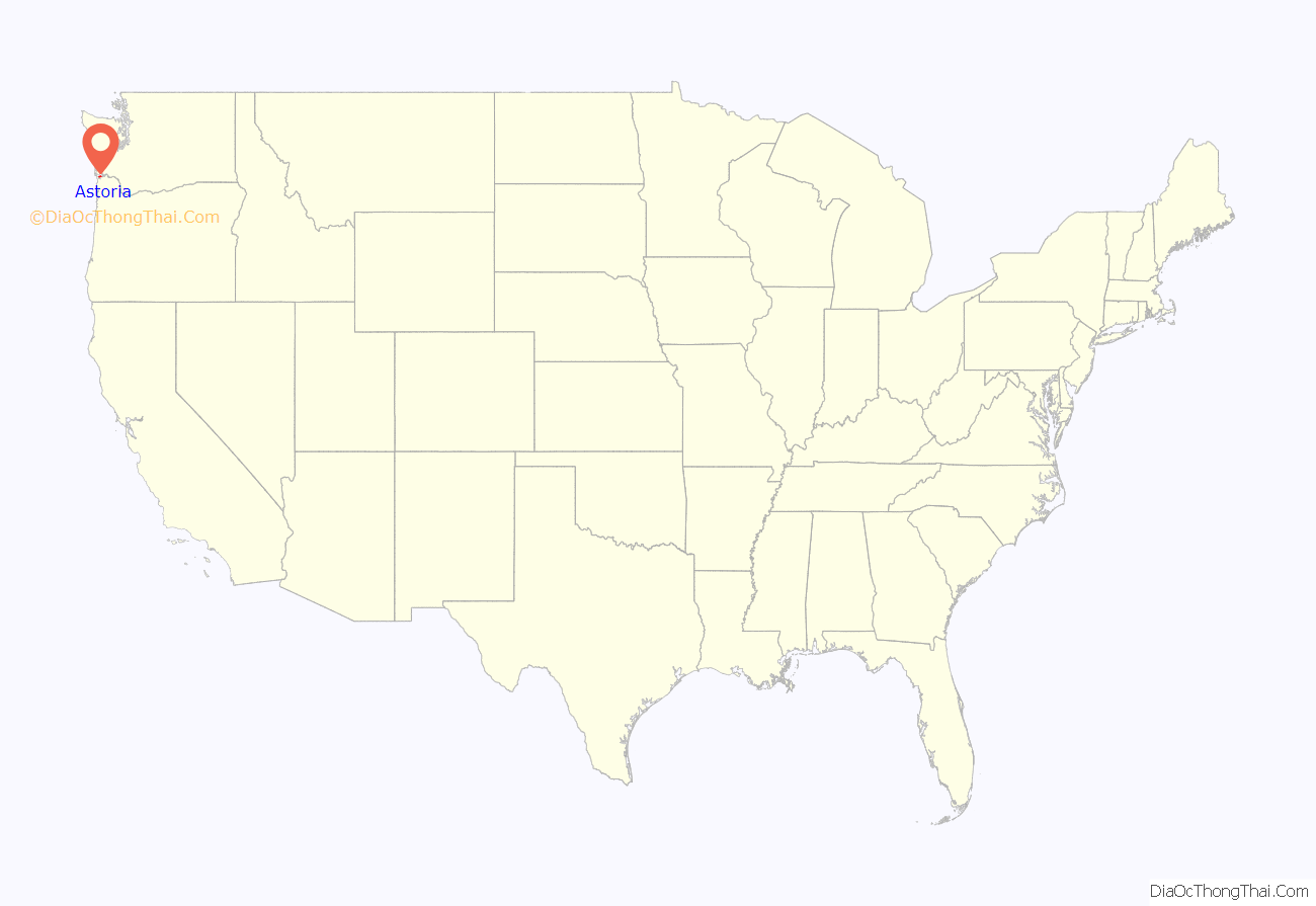
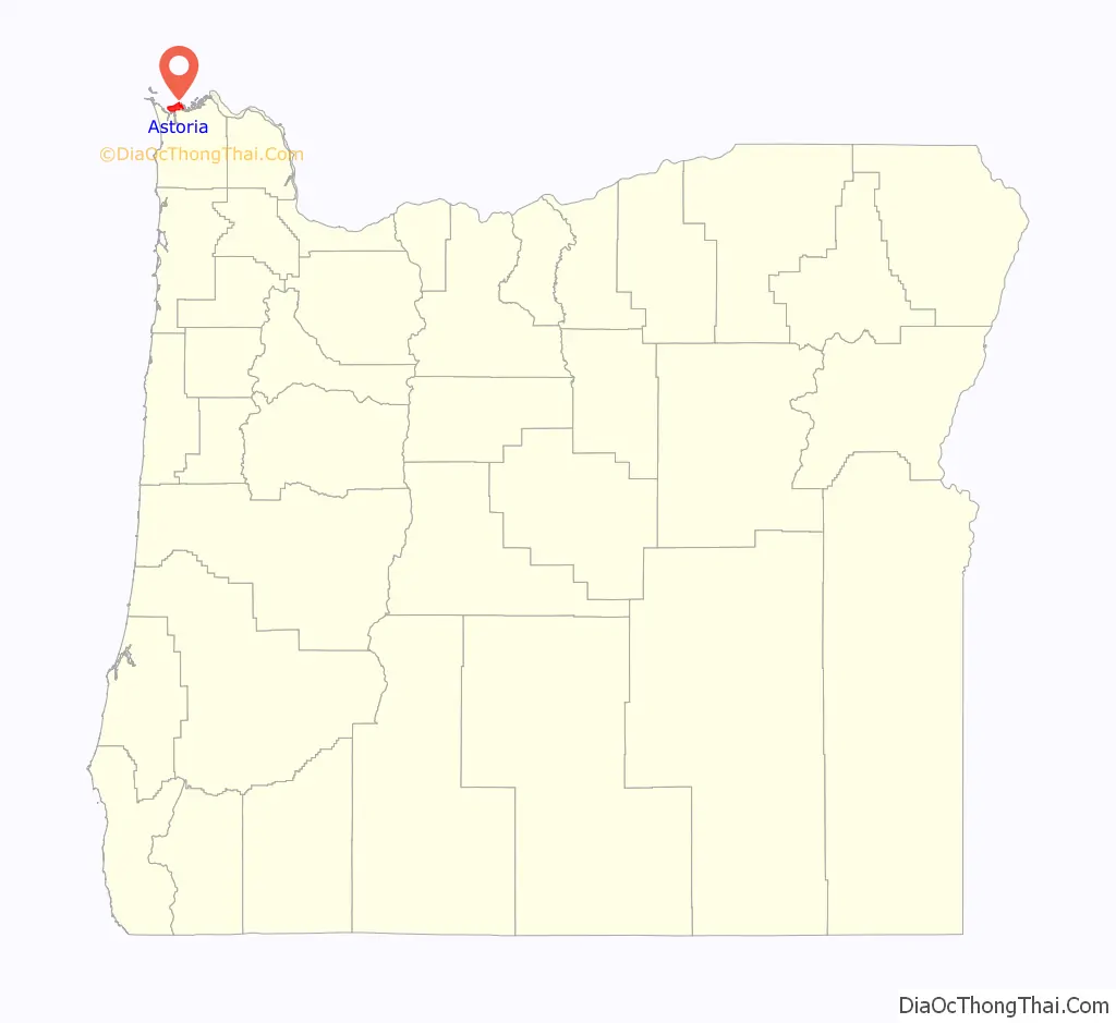
Astoria location map. Where is Astoria city?
History
Prehistoric settlements
During archeological excavations in Astoria and Fort Clatsop in 2012, trading items from American settlers with Native Americans were found, including Austrian glass beads and falconry bells. The present area of Astoria belonged to a large, prehistoric Native American trade system of the Columbia Plateau.
19th century
The Lewis and Clark Expedition spent the winter of 1805–1806 at Fort Clatsop, a small log structure southwest of modern-day Astoria. The expedition had hoped a ship would come by that could take them back east, but instead, they endured a torturous winter of rain and cold. They later returned overland and by internal rivers, the way they had traveled west. Today, the fort has been recreated and is part of Lewis and Clark National Historical Park.
In 1811, British explorer David Thompson, the first person known to have navigated the entire length of the Columbia River, reached the partially constructed Fort Astoria near the mouth of the river. He arrived two months after the Pacific Fur Company’s ship, the Tonquin. The fort constructed by the Tonquin party established Astoria as a U.S., rather than a British, settlement and became a vital post for American exploration of the continent. It was later used as an American claim in the Oregon boundary dispute with European nations.
The Pacific Fur Company, a subsidiary of John Jacob Astor’s American Fur Company, was created to begin fur trading in the Oregon Country. During the War of 1812, in 1813, the company’s officers sold its assets to their Canadian rivals, the North West Company, which renamed the site Fort George. The fur trade remained under British control until U.S. pioneers following the Oregon Trail began filtering into the town in the mid-1840s. The Treaty of 1818 established joint U.S. – British occupancy of the Oregon Country.
Washington Irving, a prominent American writer with a European reputation, was approached by John Jacob Astor to mythologize the three-year reign of his Pacific Fur Company. Astoria (1835), written while Irving was Astor’s guest, promoted the importance of the region in the American psyche. In Irving’s words, the fur traders were “Sinbads of the wilderness”, and their venture was a staging point for the spread of American economic power into both the continental interior and outward in Pacific trade.
In 1846, the Oregon Treaty divided the mainland at the 49th parallel north, making Astoria officially part of the United States. As the Oregon Territory grew and became increasingly more colonized by Americans, Astoria likewise grew as a port city near the mouth of the great river that provided the easiest access to the interior. The first U.S. post office west of the Rocky Mountains was established in Astoria in 1847 and official state incorporation in 1876.
Astoria attracted a host of immigrants beginning in the late 19th century: Nordic settlers, primarily Swedes, Swedish speaking Finns, and Chinese soon became larger parts of the population. The Nordic settlers mostly lived in Uniontown, near the present-day end of the Astoria–Megler Bridge, and took fishing jobs; the Chinese tended to do cannery work, and usually lived either downtown or in bunkhouses near the canneries. By the late 1800s, 22% of Astoria’s population was Chinese. Astoria also had a significant population of Indians, especially Sikhs from Punjab; the Ghadar Party, a political movement among Indians on the West Coast of the U.S. and Canada to overthrow British rule in India, was officially founded on July 15, 1913, in Astoria.
20th and 21st centuries
In 1883, and again in 1922, downtown Astoria was devastated by fire, partly because the buildings were constructed mostly of wood, a readily available material. The buildings were entirely raised off the marshy ground on wooden pilings. Even after the first fire, the same building format was used. In the second fire, flames spread quickly again, and the collapsing streets took out the water system. Frantic citizens resorted to dynamite, blowing up entire buildings to create fire stops.
Astoria has served as a port of entry for over a century and remains the trading center for the lower Columbia basin. In the early 1900s, the Callendar Navigation Company was an important transportation and maritime concern based in the city. It has long since been eclipsed in importance by Portland, Oregon, and Seattle, Washington, as economic hubs on the coast of the Pacific Northwest. Astoria’s economy centered on fishing, fish processing, and lumber. In 1945, about 30 canneries could be found along the Columbia River.
In the early 20th century, the North Pacific Brewing Company contributed substantially to the economic well-being of the town. Before 1902, the company was owned by John Kopp, who sold the firm to a group of five men, one of whom was Charles Robinson, who became the company’s president in 1907. The main plant for the brewery was located on East Exchange Street.
As the Pacific salmon resource diminished, canneries were closed. In 1974, the Bumble Bee Seafoods corporation moved its headquarters out of Astoria and gradually reduced its presence until closing its last Astoria cannery in 1980. The lumber industry likewise declined in the late 20th century. Astoria Plywood Mill, the city’s largest employer, closed in 1989. The Burlington Northern and Santa Fe Railway discontinued service to Astoria in 1996, as it did not provide a large enough market.
From 1921 to 1966, a ferry route across the Columbia River connected Astoria with Pacific County, Washington. In 1966, the Astoria–Megler Bridge was opened. The bridge completed U.S. Route 101 and linked Astoria with Washington on the opposite shore of the Columbia, replacing the ferry service.
Today, tourism, Astoria’s growing art scene, and light manufacturing are the main economic activities of the city. Logging and fishing persist, but at a fraction of their former levels. Since 1982 it has been a port of call for cruise ships, after the city and port authority spent $10 million in pier improvements to accommodate these larger ships.
To avoid Mexican ports of call during the swine flu outbreak of 2009, many cruises were rerouted to include Astoria. The floating residential community MS The World visited Astoria in June 2009.
The town’s seasonal sport fishing tourism has been active for several decades. Visitors attracted by heritage tourism and the historic elements of the city have supplanted fishing in the economy. Since the early 21st century, the microbrewery/brewpub scene and a weekly street market have helped popularize the area as a destination.
In addition to the replicated Fort Clatsop, another point of interest is the Astoria Column, a tower 125 feet (38 m) high, built atop Coxcomb Hill above the town. Its inner circular staircase allows visitors to climb to see a panoramic view of the town, the surrounding lands, and the Columbia flowing into the Pacific. The tower was built in 1926. Financing was provided by the Great Northern Railway, seeking to encourage tourists, and Vincent Astor, a great-grandson of John Jacob Astor, in commemoration of the city’s role in the family’s business history and the region’s early history.
Since 1998, artistically inclined fishermen and women from Alaska and the Pacific Northwest have traveled to Astoria for the Fisher Poets Gathering, where poets and singers tell their tales to honor the fishing industry and lifestyle.
Another popular annual event is the Dark Arts Festival, which features music, art, dance, and demonstrations of craft such as blacksmithing and glassblowing, in combination with offerings of a large array of dark craft brews. Dark Arts Festival began as a small gathering at a community arts space. Now Fort George Brewery hosts the event, which draws hundreds of visitors and tour buses from Seattle.
Astoria is the western terminus of the TransAmerica Bicycle Trail, a 4,250-mile (6,840 km) coast-to-coast bicycle touring route created in 1976 by the Adventure Cycling Association.
Three United States Coast Guard cutters: the Steadfast, Alert, and Elm, are homeported in Astoria.
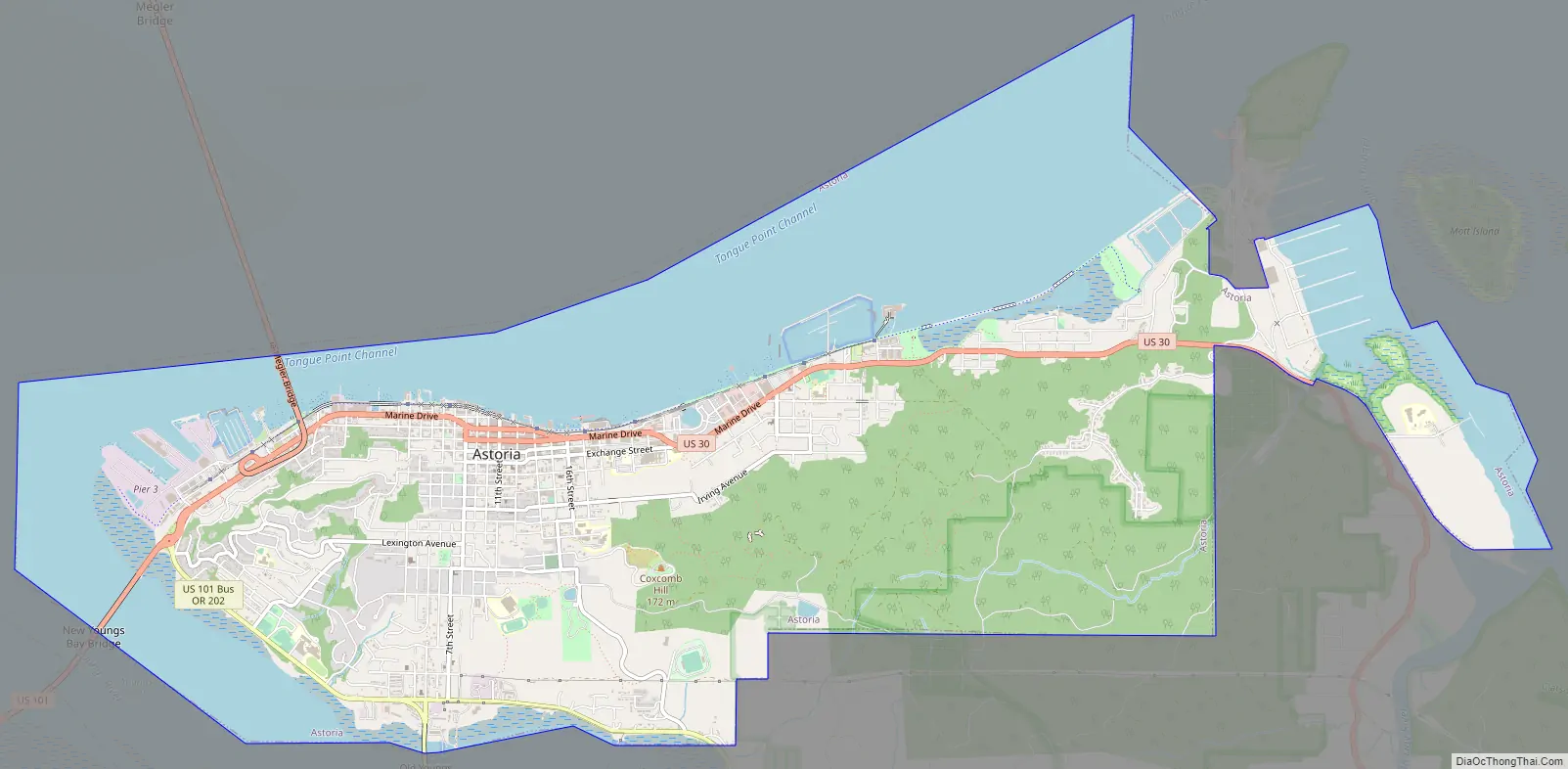
Astoria Road Map
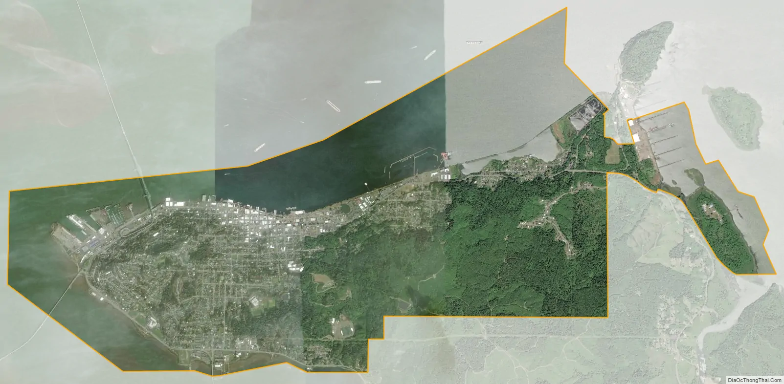
Astoria city Satellite Map
Geography
According to the United States Census Bureau, the city has a total area of 10.11 square miles (26.18 km), of which 3.95 square miles (10.23 km) are covered by water.
Climate
Astoria lies within the Mediterranean climate zone (Köppen Csb), with cool winters and mild summers, although short heat waves can occur. Rainfall is most abundant in late fall and winter and is lightest in July and August, averaging about 67 inches (1,700 mm) of rain each year. Snowfall is relatively rare, averaging under 5 inches (13 cm) a year and frequently having none. Nevertheless, when conditions are ripe, significant snowfalls can occur.
Astoria’s monthly average humidity is always over 80% throughout the year, with average monthly humidity reaching a high of 84% from November to March, with a low of 81% during May. The average relative humidity in Astoria is 89% in the morning and 73% in the afternoon.
Annually, an average of only 4.2 afternoons have temperatures reaching 80 °F (26.7 °C) or higher, and 90 °F or 32.2 °C readings are rare. Normally, only one or two nights per year occur when the temperature remains at or above 60 °F or 15.6 °C. An average of 31 mornings have minimum temperatures at or below the freezing mark. The record high temperature was 101 °F (38.3 °C) on July 1, 1942, and June 27, 2021. The record low temperature was 6 °F (−14.4 °C) on December 8, 1972, and on December 21, 1990. Even with such a cold record low, afternoons usually remain mild in winter. On average. the coldest daytime high is 36 °F (2 °C) whereas the lowest daytime maximum on record is 19 °F (−7 °C). Even during brief heat spikes, nights remain cool. The warmest overnight low is 63 °F (17 °C) set as early in the year as in May during 2008. Nights close to that record are common with the normally warmest night of the year being at 61 °F (16 °C).
On average, 191 days have measurable precipitation. The wettest “water year”, defined as October 1 through September 30 of the next year, was from 1915 to 1916 with 108.04 in (2,744 mm) and the driest from 2000 to 2001 with 44.50 in (1,130 mm). The most rainfall in one month was 36.07 inches (916.2 mm) in December 1933, and the most in 24 hours was 5.56 inches (141.2 mm) on November 25, 1998. The most snowfall in one month was 26.9 in (68 cm) in January 1950, and the most snow in 24 hours was 12.5 in (32 cm) on December 11, 1922.
- ^ Mean monthly maxima and minima (i.e. the highest and lowest temperature readings during an entire month or year) calculated based on data at said location from 1991 to 2020.
See also
Map of Oregon State and its subdivision: Map of other states:- Alabama
- Alaska
- Arizona
- Arkansas
- California
- Colorado
- Connecticut
- Delaware
- District of Columbia
- Florida
- Georgia
- Hawaii
- Idaho
- Illinois
- Indiana
- Iowa
- Kansas
- Kentucky
- Louisiana
- Maine
- Maryland
- Massachusetts
- Michigan
- Minnesota
- Mississippi
- Missouri
- Montana
- Nebraska
- Nevada
- New Hampshire
- New Jersey
- New Mexico
- New York
- North Carolina
- North Dakota
- Ohio
- Oklahoma
- Oregon
- Pennsylvania
- Rhode Island
- South Carolina
- South Dakota
- Tennessee
- Texas
- Utah
- Vermont
- Virginia
- Washington
- West Virginia
- Wisconsin
- Wyoming